The best running trails around Feuillères
4.7
(16)
818
runners
95
runs
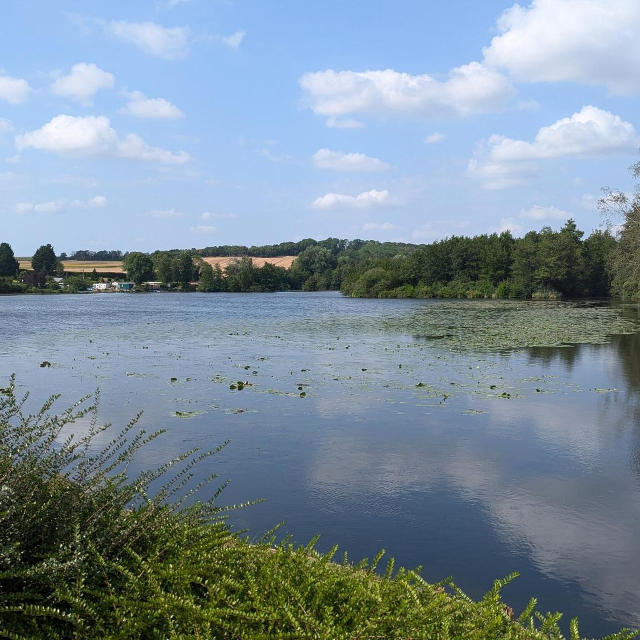
Jogging routes around Feuillères are characterized by the commune's location along the River Somme in northern France. The area features a landscape of ponds, marshes, and winding river meanders, providing varied terrain for runners. The upper Somme valley offers panoramas of these waterscapes, with well-maintained paths suitable for different running preferences. The region's natural setting allows for exploration of local flora and fauna while jogging.
Best jogging routes around Feuillères
- The most popular jogging route is Long run along the…
Last updated: October 26, 2026
31
runners
17.1km
01:46
90m
90m
Hard run. Very good fitness required. Mostly paved surfaces.
30
runners
19.4km
02:13
180m
180m
Hard run. Very good fitness required. Sure-footedness, sturdy shoes and alpine experience required.

5.0
(1)
13
runners
5.35km
00:33
30m
30m
Moderate run. Good fitness required. Mostly paved surfaces.
5.0
(1)
14
runners
10.0km
01:05
40m
40m
Moderate run. Good fitness required. Mostly paved surfaces.
5.0
(1)
15
runners
9.96km
01:02
30m
30m
Moderate run. Good fitness required. Mostly paved surfaces.
Get access to more routes and recommendations from other explorers.
Already have an account?
Our route recommendations are based on thousands of hikes, rides, and runs completed by other people on komoot.
Start today with a free account
Your next adventure awaits.



Tips from the Community

Welcome to Eclusier-Vaux, a municipality in the Somme with 85 inhabitants.
15
0
viewpoint la Montagne de Frise
14
0

There are several small locks with benches to view them well
5
0
A small error in the trail markings (my screenshot of the map) leads us onto private, fenced property. Go down the road to find some stairs on the right.
0
0


The Frize belvedere is accessible by a small path at the foot of the Véloroute. The different views of the Somme Valley are incredible. It's worth leaving your bike for a few moments to better understand the landscape!
0
0

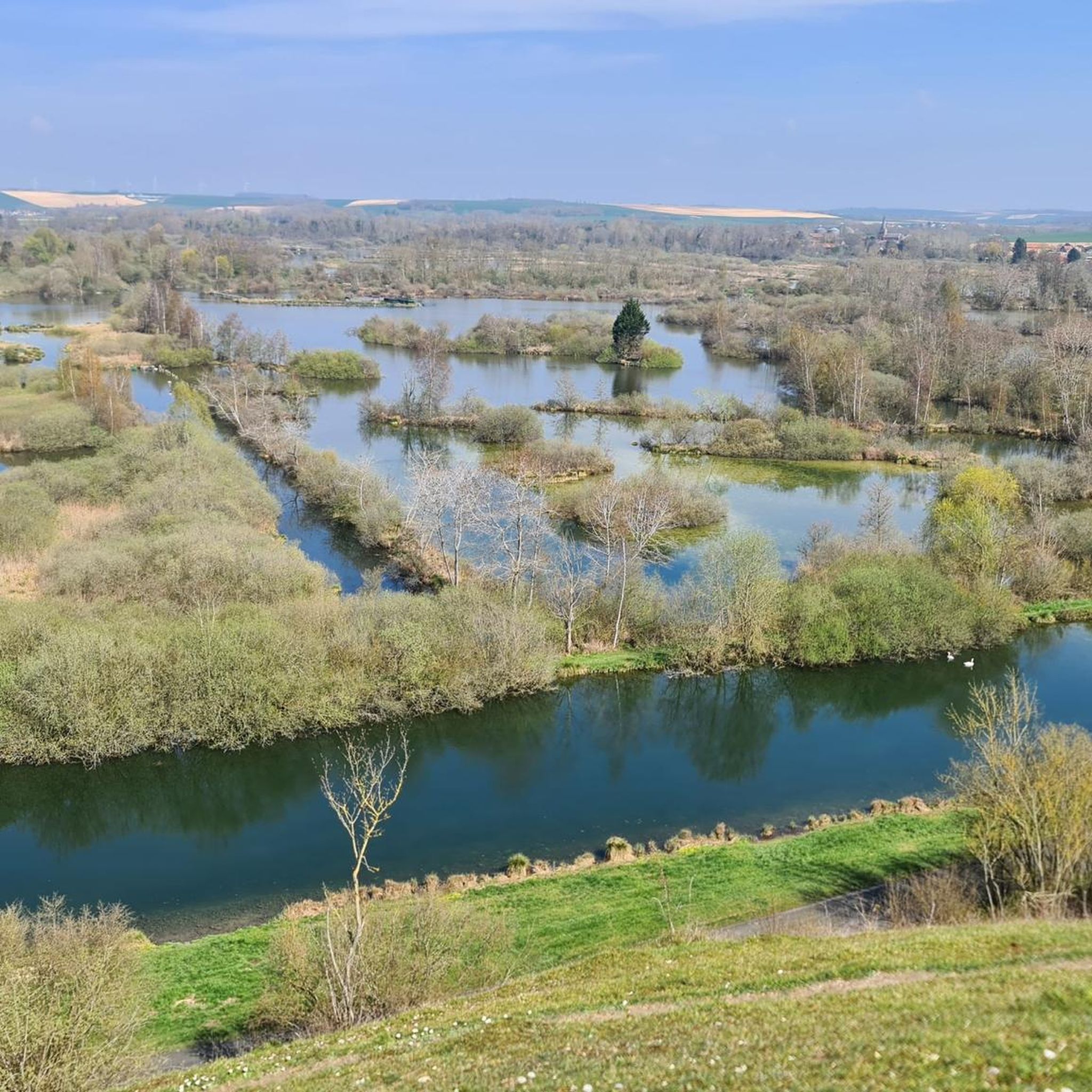
The Frize mountain belvedere reveals a striking view of the meanders of the Somme, in a peaceful setting that contrasts with its past marked by the battles of the First World War. Traces of this history are still visible in the trenches and shell impacts. Mentioned by Blaise Cendrars, this land rich in history today offers visitors an exceptional panorama of a landscape of marshes and ponds.
2
0
Frequently Asked Questions
How many running routes are available in Feuillères?
There are over 85 jogging routes around Feuillères listed on komoot, offering a wide variety of options for runners of all levels.
What kind of terrain can I expect on the jogging trails around Feuillères?
The terrain in Feuillères is largely defined by its location along the River Somme. You can expect picturesque routes along the riverbanks, featuring a rich tapestry of ponds, marshes, and winding river meanders. Many paths are well-maintained, including the Canal de la Somme Cycle Path, which offers a comfortable macadam surface ideal for continuous running.
Are there running routes suitable for beginners in Feuillères?
Yes, Feuillères offers several routes suitable for beginners. There are 5 easy routes available, providing manageable terrain for those new to running or looking for a relaxed jog.
What do other runners say about the trails in Feuillères?
The running routes in Feuillères are highly rated by the komoot community, with an average score of 4.7 stars from more than 10 reviews. Over 700 runners have explored the varied terrain, often praising the tranquil waterscapes and well-maintained paths.
Are there any circular running routes in Feuillères?
Yes, many of the routes in Feuillères are circular, allowing you to start and finish at the same point. For example, the Frise Lock – Trail des anguillères loop from Feuillères is a moderate 3.3-mile (5.3 km) circular path that explores the area around Frise Lock.
Can I find routes with scenic viewpoints in Feuillères?
Absolutely. The region is known for its exceptional panoramas of the upper Somme valley. The Vaux Viewpoint, for instance, provides expansive views over the ponds, marshes, and river bends, offering a rewarding visual experience during your run.
Are the running trails in Feuillères family-friendly?
Many of the trails in and around Feuillères are described as easily-accessible paths suitable for all skill levels, making them generally family-friendly. The flat sections along the Canal de la Somme are particularly good for a relaxed family outing.
Are dogs allowed on the jogging trails in Feuillères?
While specific regulations for dogs on every trail are not provided, generally, dogs are welcome on many outdoor paths in France, especially if kept on a leash. It's always advisable to check local signage or specific route descriptions for any restrictions.
What are some longer running options for experienced runners?
For experienced runners seeking a challenge, Feuillères offers several difficult routes. The Allaines – Long run along the Somme loop from Feuillères is a challenging 15.1-mile (24.4 km) route, while the Long run along the Somme – Péronne loop from Feuillères extends to 22.9 miles (36.9 km), offering significant distances and varied elevation.
What are some points of interest or landmarks I might see while running in Feuillères?
Beyond the natural beauty of the Somme valley, you might encounter historical sites. The nearby town of Péronne, for example, features the Château de Péronne and the Historial of the Great War. The Vaux Viewpoint also offers a notable stop with its panoramic views.
Is there public transport or parking available near the running trails?
Feuillères is a commune in northern France, and while specific public transport details for trailheads are not always available, parking is generally accessible in and around the village. For routes starting directly from Feuillères, you can often find local parking options. For routes further afield, it's best to check the starting point on komoot for specific parking information.
What is the best time of year to go running in Feuillères?
The region's natural beauty can be enjoyed throughout the year. Spring and autumn offer pleasant temperatures and vibrant scenery, making them ideal for running. Summer can be warm but is still suitable, especially during mornings or evenings. Winter runs can be picturesque, though paths might be damp or muddy, so appropriate footwear is recommended.
Are there any routes that follow the Canal de la Somme?
Yes, the Canal de la Somme Cycle Path runs alongside the Somme and has been upgraded to a comfortable macadam surface, making it highly suitable for jogging. This path offers flat and even terrain amidst natural surroundings, perfect for a smooth running experience.
Most popular routes around Feuillères
Most popular attractions around Feuillères

Get inspired with the komoot mobile app


Explore more
Browse the best Running Trails & Routes in other regions.
