The best walks and hikes around Beaugas
4.5
(95)
400
hikers
49
hikes
Hiking around Beaugas offers access to the natural scenery of the Lot-et-Garonne department. The region is characterized by a landscape of rolling hills, forests, and agricultural land, providing a suitable environment for walking paths. While specific prominent natural features within Beaugas itself are not widely documented, the surrounding area provides opportunities for outdoor recreation. The terrain generally includes moderate elevation changes, typical of the Nouvelle-Aquitaine region.
Best hiking trails around Beaugas
- The most popular hiking route is Cancon and Moulinet…
Last updated: June 29, 2026
4.5
(2)
11
hikers
16.0km
04:19
210m
210m
Moderate hike. Good fitness required. Easily-accessible paths. Suitable for all skill levels.
4.7
(15)
35
hikers
13.6km
03:42
200m
200m
Moderate hike. Good fitness required. Easily-accessible paths. Suitable for all skill levels.

Sign up for free
5.0
(1)
20
hikers
6.05km
01:39
90m
90m
Easy hike. Great for any fitness level. Easily-accessible paths. Suitable for all skill levels.
5.0
(1)
7
hikers
4.57km
01:16
80m
80m
Easy hike. Great for any fitness level. Easily-accessible paths. Suitable for all skill levels.
6
hikers
19.3km
05:07
200m
200m
Hard hike. Very good fitness required. Easily-accessible paths. Suitable for all skill levels.
Get access to more routes and recommendations from other explorers.
Sign up for free
Already have an account?
Our route recommendations are based on thousands of hikes, rides, and runs completed by other people on komoot.
Start today with a free account
Your next adventure awaits.
Login or Signup

Tips from the Community

360 view of the village
0
0

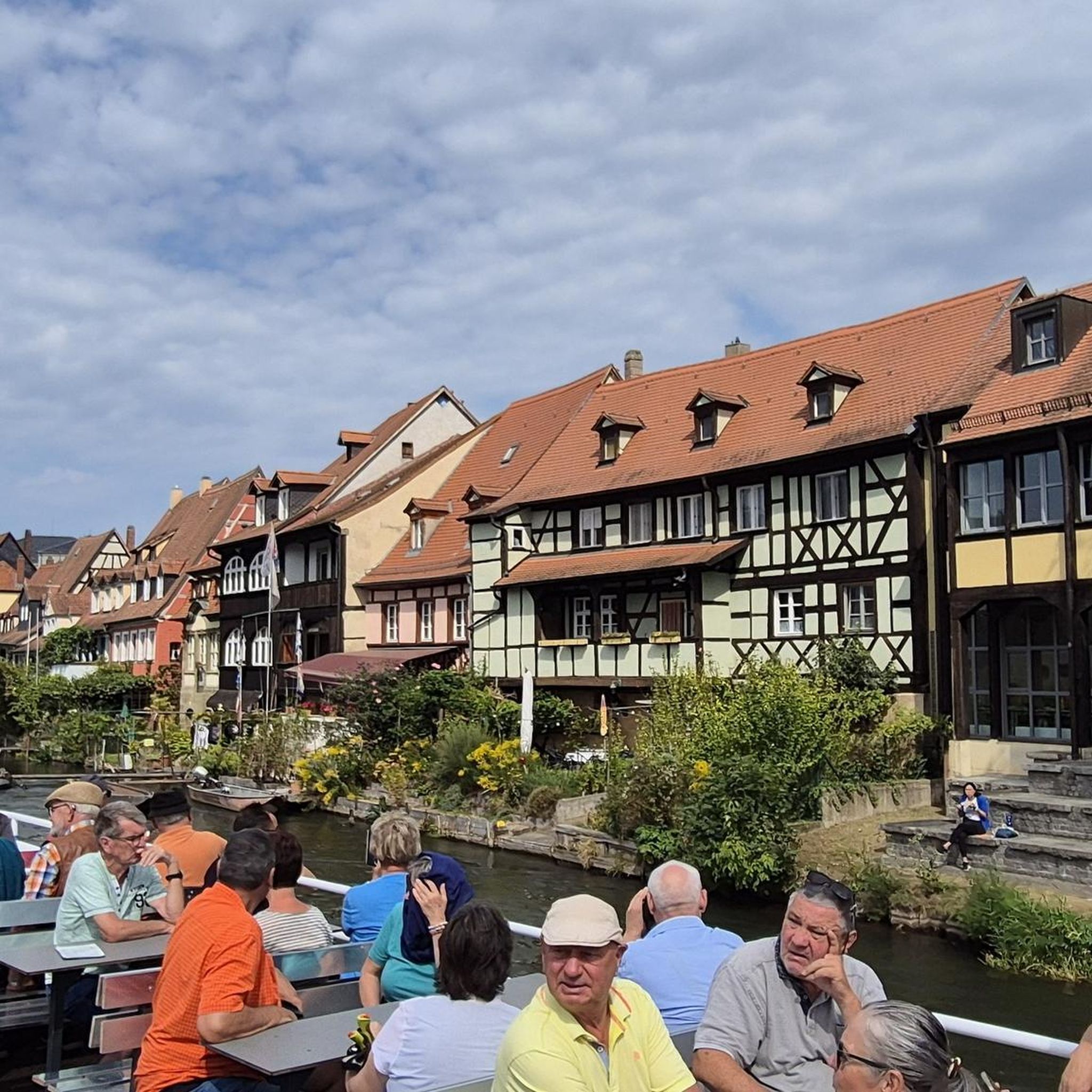
Montflanquin has been listed as one of the "Most Beautiful Villages of France" since 1989. This charming village charms visitors with its central square surrounded by arcades, its Saint-André church, and its medieval streets. From the village, you can enjoy breathtaking views of the surrounding countryside.
1
0

Monflanquin is a commune in the south-west of France, located in the Lot-et-Garonne department, in the Nouvelle-Aquitaine region. Its inhabitants are called Monflanquinois.
1
0

The Place des Arcades hosts a market every Thursday morning since 1256! There is also a farmers market on Thursday evenings in July and August.
4
0
The fortress of Monflanquin, founded in 1256 by Alphonse of Poitiers, Count of Toulouse and brother of Saint Louis, is today listed as one of
4
0
Monflanquin is a French community in the department Lot-et-Garonne, region Aquitaine
3
0

This is the castle chapel and is believed to have been built around the 10th century. From the church you can also enjoy a great panoramic viewpoint.
4
0
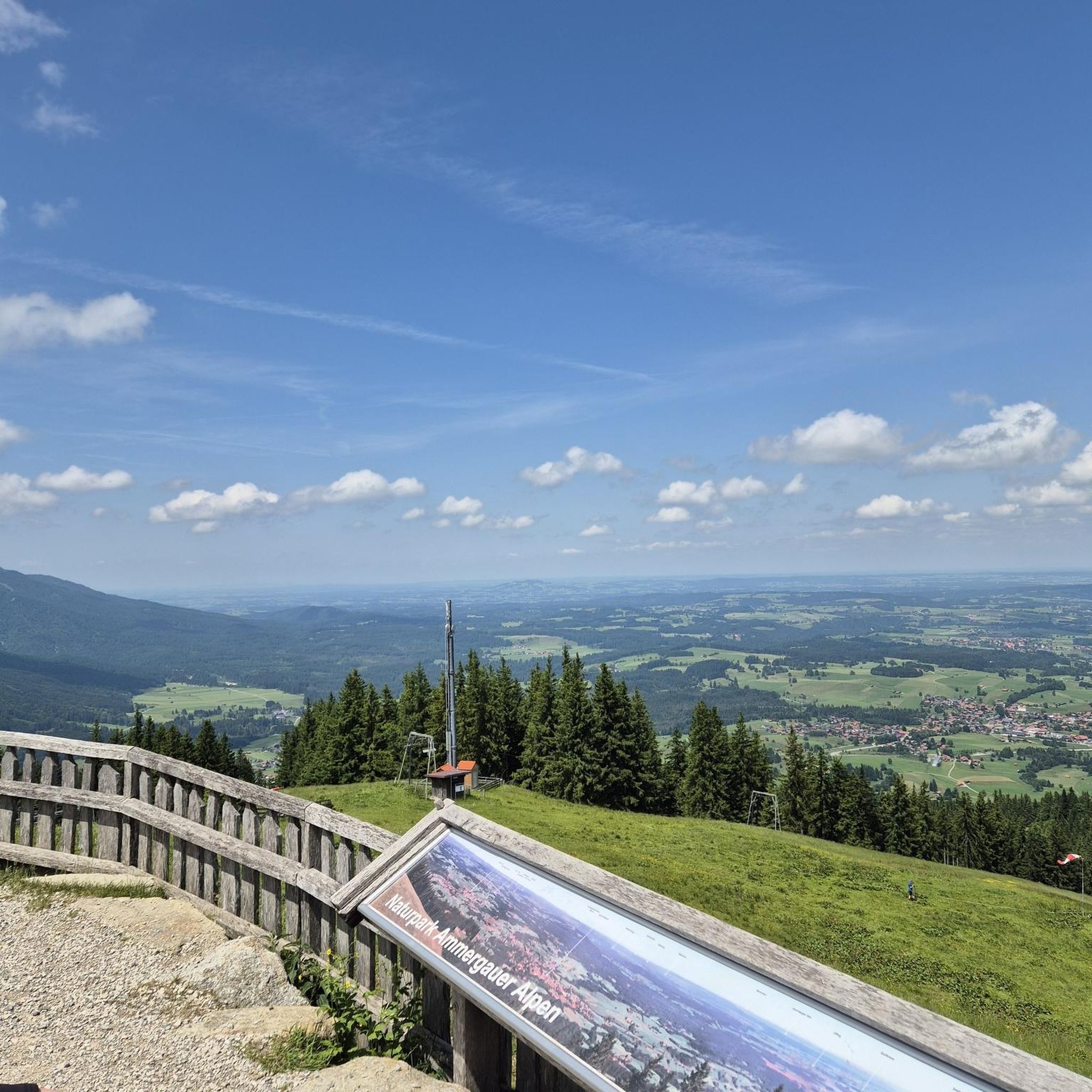
A fantastic panoramic viewpoint with a display board for orientation.
3
0
Frequently Asked Questions
How many hiking trails are available around Beaugas?
There are over 35 hiking trails around Beaugas, offering a variety of options for different skill levels. The komoot community has rated these routes highly, with an average score of 4.5 stars.
What kind of terrain can I expect on hikes near Beaugas?
The terrain around Beaugas is characterized by rolling hills, forests, and agricultural land. You can expect moderate elevation changes, typical of the Nouvelle-Aquitaine region, providing a suitable environment for walking paths through natural scenery.
Are there any family-friendly hiking options in the Beaugas area?
Yes, there are several easy hikes suitable for families. For example, the Château de Saint-Pastour loop from Saint-Pastour is an easy 5.9 km (3.7 miles) trail that takes about 1 hour 39 minutes to complete, offering a pleasant stroll through the local landscape.
Can I bring my dog on the hiking trails around Beaugas?
Most hiking trails in the Beaugas area are generally dog-friendly, especially those through forests and rural paths. However, it's always recommended to keep your dog on a leash, especially near agricultural areas or if there are signs indicating specific restrictions.
Are there circular walks available near Beaugas?
Yes, many routes around Beaugas are designed as circular walks. An example is the Monflanquin – Montflanquin loop from Boulède, an 8.5 miles (13.6 km) trail that allows you to start and end at the same point while exploring varied rural scenery.
What are some notable landmarks or attractions I can see while hiking?
While hiking, you can discover several interesting points. The Beautiful lands with castle – Montflanquin loop from Monflanquin offers views of a castle near Montflanquin. Other nearby attractions include Saint Andrew's Church and the Benedictine priory, Saint-Géraud parish church.
Where can I find parking for hiking trails around Beaugas?
Parking is generally available near the starting points of many trails, especially in or near villages like Monflanquin or Saint-Pastour. As Beaugas is a rural area, roadside parking or small village car parks are common. Specific parking details are often provided on individual route pages on komoot.
What is the best time of year to go hiking in Beaugas?
The best time to hike around Beaugas is typically during spring (April to June) and autumn (September to October). During these seasons, the weather is mild, and the natural scenery is particularly beautiful, with blooming flowers in spring and vibrant foliage in autumn. Summers can be warm, while winters are generally mild but can be damp.
Are there any longer, more challenging hikes for experienced hikers?
Yes, for those seeking a longer experience, the Cancon and Moulinet Terroir Discovery Trail is a moderate 9.9 miles (16.0 km) route that takes approximately 4 hours 19 minutes to complete, exploring the local terroir and countryside.
What do other hikers say about the trails around Beaugas?
The trails around Beaugas are highly rated by the komoot community, with an average score of 4.5 stars from over 80 reviews. Hikers often praise the quiet woodlands, varied rural scenery, and the well-maintained walking paths that make for an enjoyable outdoor experience.
Can I find places to eat or stay near the hiking routes?
Yes, the broader region around Beaugas, including nearby towns and villages like Monflanquin, offers amenities such as cafes, pubs, and accommodation options. These can be found within a short drive from many of the hiking trailheads, providing convenient stops for refreshments or overnight stays.
What kind of wildlife might I encounter on hikes in the area?
The rural and forested landscapes around Beaugas are home to various local wildlife. Hikers might spot common birds, small mammals like rabbits or squirrels, and occasionally deer. The area's natural setting provides a habitat for diverse flora and fauna, especially in quieter sections of the trails.
Most popular attractions around Beaugas

Get inspired with the komoot mobile app


Explore more
Browse the best Hikes in other regions.
