The best walks and hikes around Montgradail
4.7
(99)
301
hikers
63
hikes
Hiking around Montgradail offers a network of trails through varied terrain, characterized by rolling hills and open landscapes that provide expansive views. The region's hiking trails are generally accessible, with moderate elevation changes across most routes. This area provides opportunities for outdoor activity, with paths winding through the local countryside.
Best hiking trails around Montgradail
- The most popular hiking route is Table Orientation – View to the south loop from Le Clot, a 5.0 miles (8.1 km) trail that…
Last updated: July 4, 2026
4.8
(9)
25
hikers
8.10km
02:15
140m
140m
Moderate hike. Good fitness required. Easily-accessible paths. Suitable for all skill levels.
4.8
(10)
26
hikers
8.11km
02:15
150m
140m
Moderate hike. Good fitness required. Easily-accessible paths. Suitable for all skill levels.

Sign up for free
4.3
(3)
7
hikers
11.3km
03:06
180m
180m
Moderate hike. Good fitness required. Easily-accessible paths. Suitable for all skill levels.
4.0
(2)
4
hikers
9.00km
02:29
150m
150m
Moderate hike. Good fitness required. Easily-accessible paths. Suitable for all skill levels.
5.0
(2)
4
hikers
4.65km
01:17
80m
80m
Easy hike. Great for any fitness level. Easily-accessible paths. Suitable for all skill levels.
Get access to more routes and recommendations from other explorers.
Sign up for free
Already have an account?
Our route recommendations are based on thousands of hikes, rides, and runs completed by other people on komoot.
Start today with a free account
Your next adventure awaits.
Login or Signup


Tips from the Community

2 km from Hounoux by a magnificent path, enjoy a breathtaking view of the region
1
0

The Black Virgin is located in an enclave of the wall of the Church of Lignairolle. When in the hand of Sainte Anne it is located in the wall of a building on the right about fifty meters going south after the Church.
2
0
This drinking trough is located on the Chemin de Lignairolles in Seignalens, below the BARRY.
1
0
Route that can be done by most people, of course you need good hiking shoes.
2
0
In the background, on a clear day, you can see the Pyrenees mountain range.
2
0
A view of the Lauragais plain and the Montagne Noire
0
0
Frequently Asked Questions
What kind of landscapes can I expect to see while hiking around Montgradail?
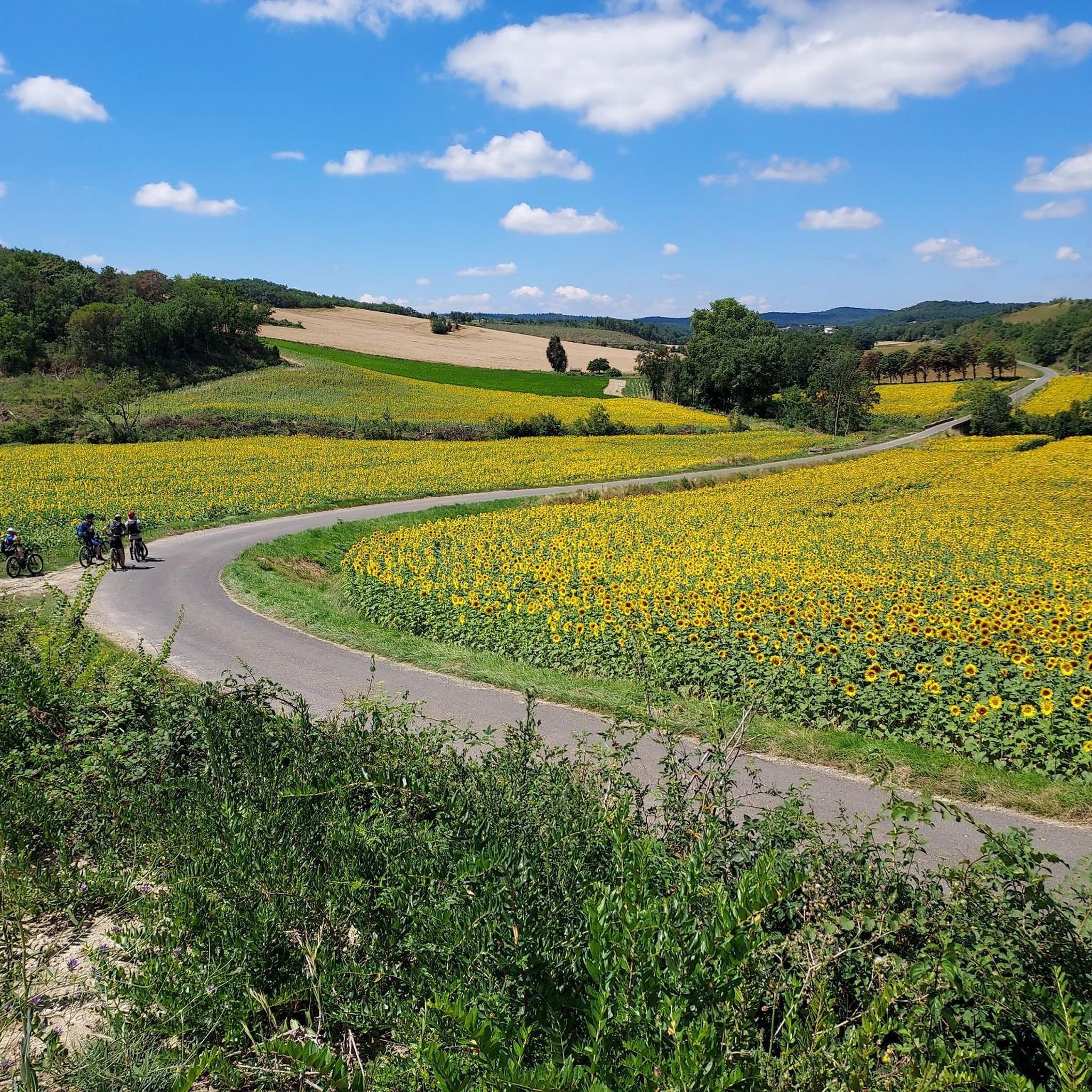
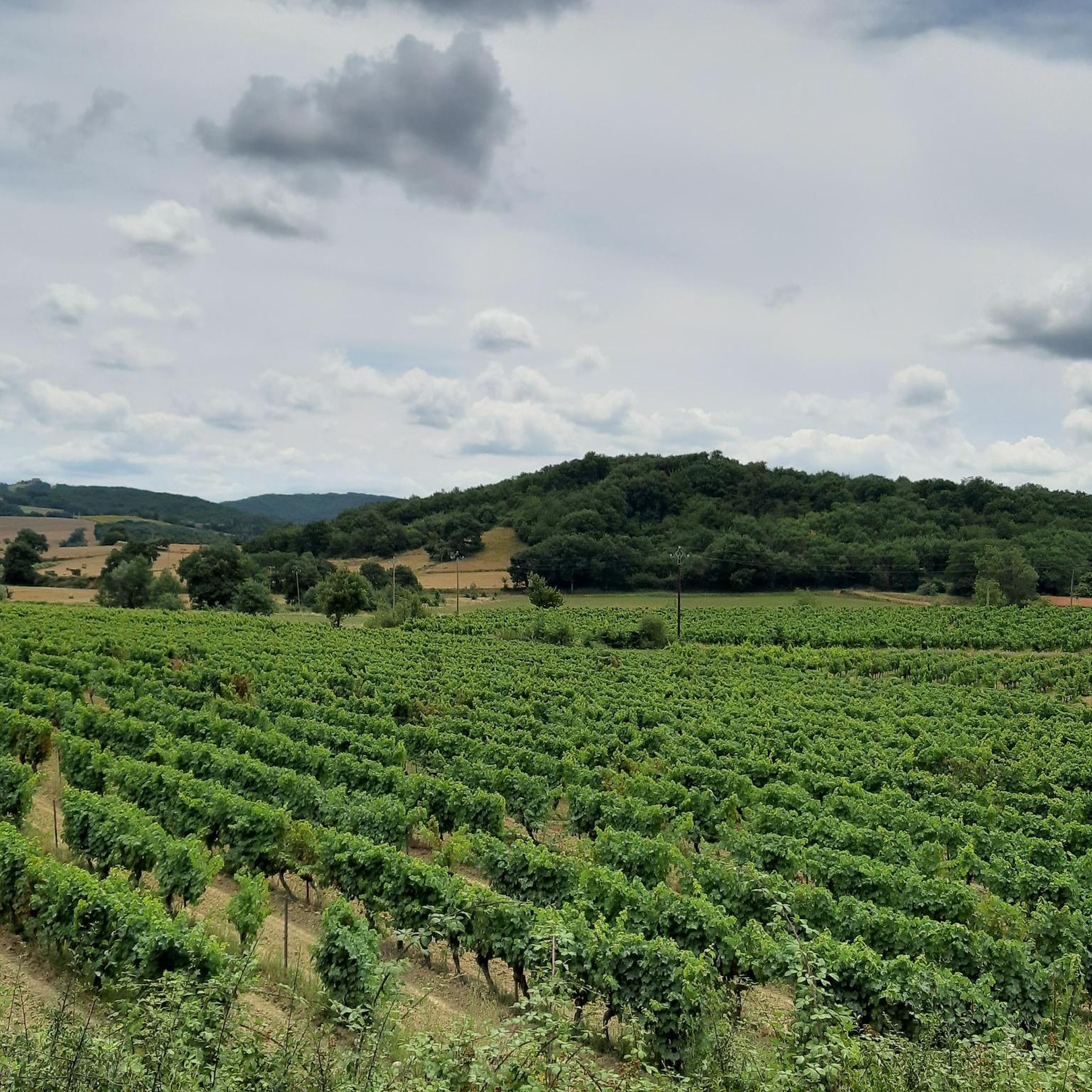
Montgradail offers a diverse and balanced landscape, characterized by vineyards, cereal fields, and forests of oak, maple, and ash. You'll find rolling hills and open countryside, providing magnificent panoramic views across the Razès region, extending to the foothills of the Pyrenees and the Montagne Noire. The area also features the very last vineyards of Languedoc, giving it a distinct Mediterranean feel.
How many hiking trails are available in Montgradail?
There are over 60 hiking trails around Montgradail, catering to various skill levels. This includes 29 easy routes, 28 moderate routes, and 3 more challenging options, ensuring there's something for everyone.
Are there easy hiking trails suitable for beginners or families?
Yes, Montgradail offers many easy hiking trails perfect for beginners or families. Nearly half of the routes, 29 in total, are classified as easy. One excellent option is the View to the south loop from Lignairolles, which is just over 4.5 km long and takes about 1 hour 15 minutes to complete.
What do other hikers enjoy most about hiking in Montgradail?
The hiking trails around Montgradail are highly rated by the komoot community, with an average score of 4.8 out of 5 stars from nearly 100 reviews. Hikers often praise the expansive views, the varied terrain of rolling hills and open landscapes, and the accessible, well-maintained paths that make exploring the local countryside a pleasure.
Are there any circular hiking routes in Montgradail?
Yes, many of the trails in Montgradail are circular, allowing you to start and end at the same point. For example, the popular Table Orientation – View to the south loop from Le Clot is a moderate 8.1 km circular route offering great southern views.
What are some notable viewpoints or panoramic spots in the area?
Montgradail itself is nestled at the foot of the "barre d'Hounoux," offering magnificent panoramic views across the Razès region towards the Pyrenees and Montagne Noire. Many trails, such as the View to the south – Magnificent view. loop from Seignalens, are specifically highlighted for their scenic vistas. The Boucle de la Hille et Mont Carrière à Fanjeaux also features numerous viewpoints, with orientation tables at Mont Carrière to help identify distant landmarks.
Are there any specific trails that showcase the vineyards of the region?
Absolutely. The region is known for its vineyards, particularly the Malepère and the last vineyards of Languedoc. The "Sentier des vignerons à Belvèze-du-Razès" is a loop trail designed to take hikers through the heart of these vineyards, offering stunning views of both the Pyrenees and the Montagne Noire. The "Sentier Paysager de Montgradail" also traverses the vineyards of Malepère.
What attractions or points of interest can I explore near the hiking trails?
Beyond the natural beauty, you can explore several interesting points. The perched village of Fanjeaux offers spectacular panoramic views. You might also encounter the historic Château de Lagarde. For those interested in longer routes, parts of the area are connected to the Greenway from the Canal du Midi to Montségur.
Is there public transport access to the hiking trails in Montgradail?
Public transport options directly to the trailheads in Montgradail can be limited. It is generally recommended to travel by car to access the various starting points for hikes in the region. For detailed local transport information, it's best to consult local tourist information resources.
What is the best time of year to hike in Montgradail?
Montgradail offers pleasant hiking conditions for much of the year. Spring and autumn are particularly ideal, with milder temperatures and vibrant natural colors. Summer can be warm, so early morning or late afternoon hikes are recommended. The diverse landscapes, including forests and open fields, provide varied experiences across the seasons.
Can I bring my dog on the hiking trails?
Many trails in the Montgradail area are dog-friendly, allowing you to enjoy the outdoors with your canine companion. However, it's always advisable to keep your dog on a leash, especially when passing through agricultural areas, near livestock, or in nature reserves, and to check specific trail regulations if available. Always carry water for your dog and clean up after them.
Most popular routes around Montgradail
Most popular attractions around Montgradail

Get inspired with the komoot mobile app


Explore more
Browse the best Hikes in other regions.
