The best MTB trails around Quérigut
4.4
(140)
1,099
riders
36
rides
Mountain bike trails around Quérigut are set within the mountainous Donezan region of the French Pyrenees, characterized by significant elevation changes and varied terrain. The area features extensive forests, providing shaded routes and rich biodiversity, alongside picturesque glacial lakes. Numerous mountain passes, including the Col de Pailhères, offer challenging ascents and technical descents. This diverse landscape provides a network of trails suitable for mountain biking.
Best mountain bike trails around Quérigut
- The most popular mountain bike trail is Cascade du…
Last updated: July 4, 2026
5.0
(2)
14
riders
7.04km
00:36
80m
80m
Easy mountain bike ride. Great for any fitness level. Suitable for all skill levels.
5.0
(2)
14
riders
7.35km
00:37
80m
80m
Easy mountain bike ride. Great for any fitness level. Suitable for all skill levels.

Sign up for free
3.0
(1)
7
riders
34.5km
02:42
850m
850m
Hard mountain bike ride. Good fitness required. Advanced riding skills necessary. Some portions of the route may require you to push your bike.
17
riders
31.2km
03:31
1,060m
1,060m
Hard mountain bike ride. Very good fitness required. Suitable for all skill levels.
5.0
(1)
11
riders
29.4km
02:48
1,150m
1,150m
Hard mountain bike ride. Very good fitness required. Advanced riding skills necessary. Some portions of the route may require you to push your bike.
Get access to more routes and recommendations from other explorers.
Sign up for free
Already have an account?
Our route recommendations are based on thousands of hikes, rides, and runs completed by other people on komoot.
Start today with a free account
Your next adventure awaits.
Login or Signup


Tips from the Community

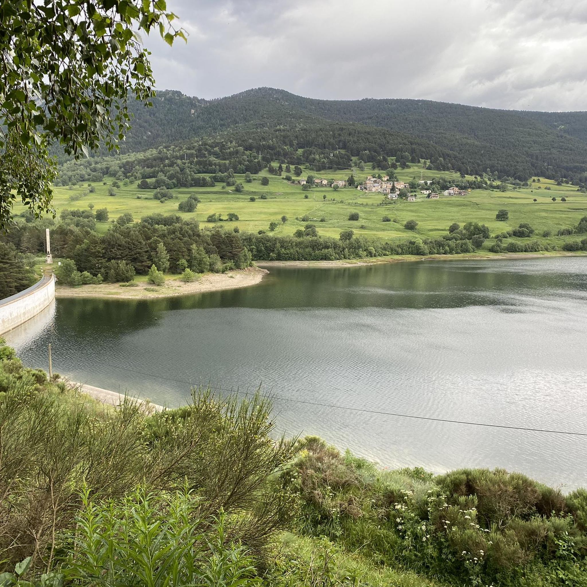
The Puyvalador dam is 160 meters long and 39 meters high. This concrete structure is used to regulate the waters of the Aude river to produce electricity. From the dam, the view is exceptional.
0
0

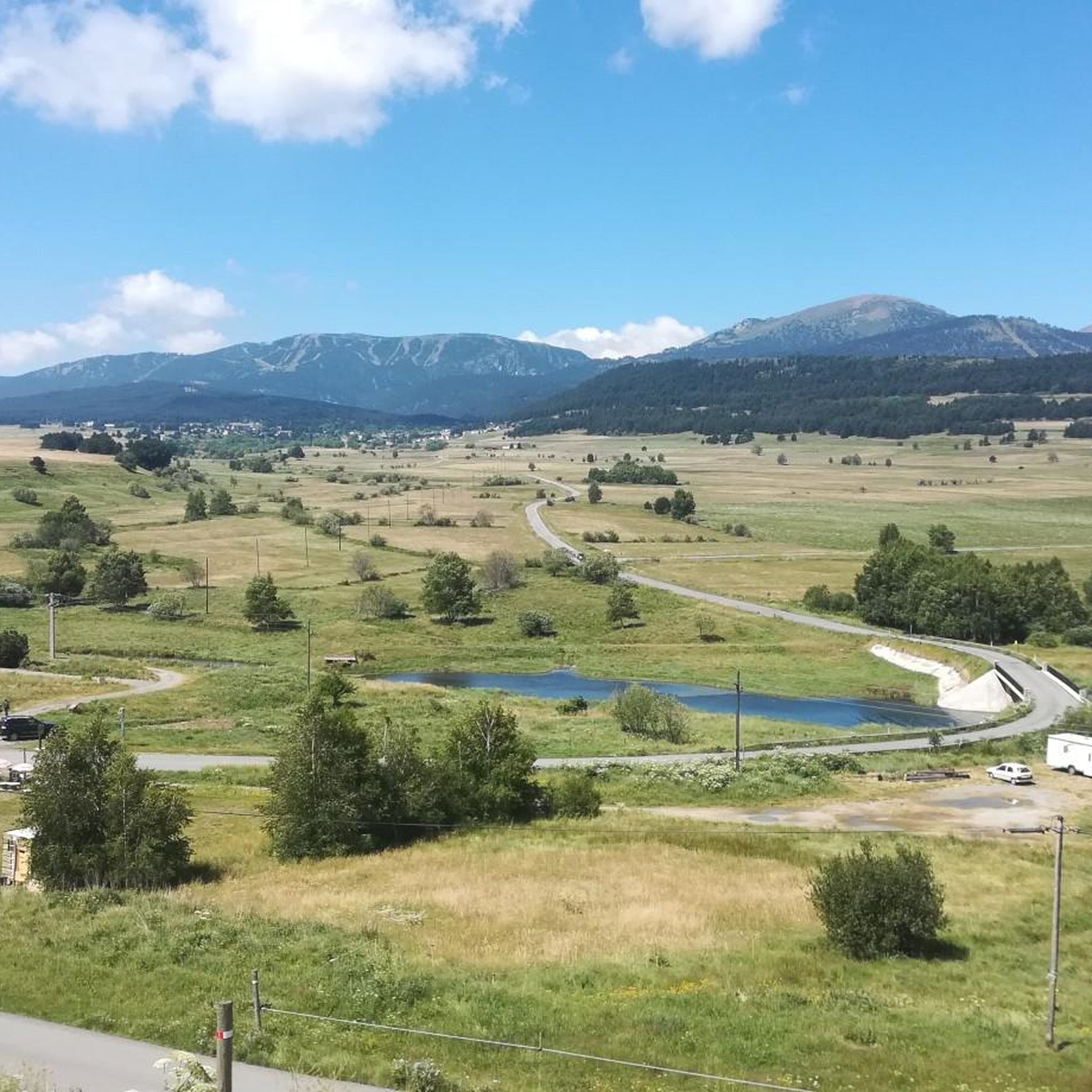
A superb view, only available to the most persistent
1
0

One of the best experiences on my entire tour. I have this picture with the view of the mountains as my screen background. The roads are still closed, the snow is piled up meters high on the sides and at the same time there is not a single car on the road. Simply fantastic
1
0

Rustic and sunny mountain village located on the eastern slope of the Col de Pailhères. There is everything you need for a cycling route, except a repair shop in case of emergency. The panoramic views of the town from its outskirts are beautiful.
0
0

On one side, very close to the path, you can enjoy this beautiful waterfall created by the Galbe River as it descends towards Esposouille.
1
0


Small town on the mountainside on the D25.
3
1

The Col de Pailhères, or Port de Pailhères, is one of the emblematic passes of the Pyrenees and the Tour de France. Culminating at 2,001 meters above sea level, it is one of the few passes in the Pyrenees to exceed the symbolic bar of 2,000 meters. The climb from Mijanès is 10.6 kilometers long with an average of 8.2%, including some passages at more than 10%. It is also possible to climb from Ax-les-Thermes by means of a climb of 18.6 kilometers with an average of 6.9%.
4
0
Frequently Asked Questions
What kind of terrain can I expect on mountain bike trails around Quérigut?
The mountain bike trails around Quérigut feature a diverse and rugged landscape. You'll encounter significant altitude changes, dense forests providing shaded routes, and picturesque glacial lakes. Many routes also include challenging mountain passes like the Col de Pailhères, offering both demanding ascents and technical descents. The terrain often mixes narrow singletracks, fire roads, and some paved sections.
Are there mountain bike trails suitable for beginners or families in Quérigut?
Yes, Quérigut offers several easy mountain bike trails perfect for beginners or families. For example, the Puyvalador Dam loop from Réal is an easy 4.4-mile path that passes by picturesque lakes and natural habitats. Another option is the Puyvalador Dam loop from Puyvalador, a 4.6-mile trail leading through areas with glacial lakes and lush forests.
How many mountain bike trails are available in the Quérigut area?
There are 36 mountain bike trails available in the Quérigut area on komoot, catering to various skill levels. This includes 8 easy routes, 11 moderate routes, and 17 difficult routes, ensuring options for everyone from casual riders to experienced mountain bikers.
What natural features or landmarks can I see along the mountain bike trails?
Many trails incorporate the region's stunning natural features. You can ride past high-altitude lakes such as the Étang de Quérigut, Étang de Laurenti, and the Étangs des Camporells. The Cascade du Galbe – Cascade sur le Galbe loop from Réal offers serene natural beauty through lush forests and past waterfalls. Other notable spots include the View of Étang Bleu and the Laurenti Lake.
Are there any challenging mountain bike routes for experienced riders?
Absolutely. Quérigut offers several difficult routes for experienced mountain bikers seeking a challenge. The Mijanès – Ch de Quérigut loop from Le Pla is a demanding 21.4-mile route with significant elevation gain. Another challenging option is the On the road to Camporells – Serra da Mauri (2,412 m) loop from Puyvalador, which covers 19.4 miles and features over 3,400 feet of climbing.
What is the best time of year for mountain biking in Quérigut?
The best time for mountain biking in Quérigut is generally from late spring through early autumn (May to October). During these months, the weather is more stable, and the high-altitude trails are typically free of snow. Summer offers warmer temperatures, while spring and autumn provide cooler rides and vibrant natural colors.
Are there any circular mountain bike routes in Quérigut?
Yes, many of the mountain bike trails in Quérigut are designed as circular routes, allowing you to start and finish at the same point. Examples include the Cascade du Galbe – Cascade sur le Galbe loop from Réal and both Puyvalador Dam loops from Réal and Puyvalador.
What do other mountain bikers enjoy most about the trails in Quérigut?
The mountain bike trails in Quérigut are highly rated by the komoot community, with an average score of 4.5 stars from over 130 reviews. Riders often praise the stunning mountainous terrain, the extensive forests providing shaded paths, and the beautiful glacial lakes. The variety of routes, from easy loops to challenging climbs, is also frequently highlighted.
Are there places to eat or stay near the mountain bike trails in Quérigut?
Quérigut and the surrounding villages offer various amenities. While specific cafes or pubs directly on trails might be limited, you can find options in the villages. For longer rides, some routes pass by mountain huts or refuges like the En Beys Refuge or Camporells Refuge, which can provide food and accommodation. It's advisable to check their opening times in advance.
Is it possible to spot wildlife while mountain biking in Quérigut?
Yes, Quérigut is part of the Parc Naturel Régional des Pyrénées Ariégeoises, a preserved natural environment. While mountain biking through the dense forests and near high-altitude lakes, you have a good chance of spotting local wildlife. Keep an eye out for various bird species, deer, and other forest inhabitants, especially during quieter times of the day.
What is the typical duration for mountain bike trails in Quérigut?
The duration of mountain bike trails in Quérigut varies significantly based on distance and difficulty. Easy loops like the Puyvalador Dam loop from Réal can be completed in just over 30 minutes, while longer, more difficult routes such as the On the road to Camporells – Serra da Mauri (2,412 m) loop from Puyvalador can take over 3.5 hours to complete.
Most popular routes around Quérigut
Most popular attractions around Quérigut

Get inspired with the komoot mobile app


Explore more
Browse the best MTB trails in other regions.
