The best mountain hikes around Chamoson
3.3
(3)
84
hikers
10
hikes
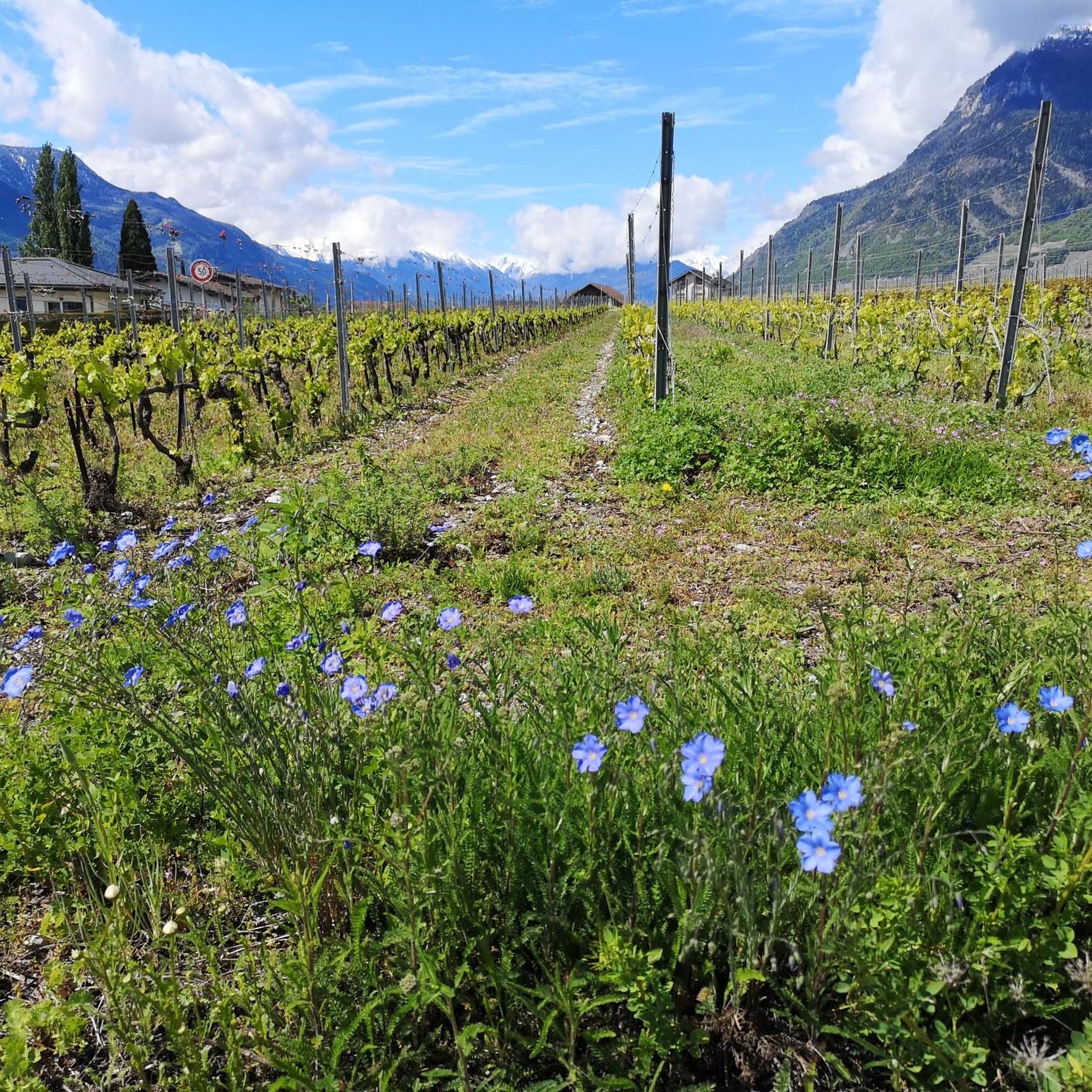
Mountaineering around Chamoson, nestled in Valais, Switzerland, offers diverse terrain stretching from the Rhone River to the Massif du Muveran and Haut de Cry peaks. The landscape features a mix of mountain pastures, meadows, and dramatic rocky formations, providing varied environments for exploration. This region is characterized by significant elevation changes and rugged natural features, making it suitable for experienced mountaineers.
Best mountaineering routes around Chamoson
- The most popular mountaineering route is Grand Dent de Morcles – Summit Trail Above…
Last updated: June 27, 2026
4.0
(1)
27
hikers
14.6km
07:10
1,010m
1,010m
Hard mountaineering route. Very good fitness required. Sure-footedness, sturdy shoes and alpine experience required.
24
hikers
12.2km
05:37
1,040m
1,040m
Hard mountaineering route. Very good fitness required. Sure-footedness, sturdy shoes and alpine experience required.

Sign up for free
9
hikers
Moderate mountaineering route. Good fitness required. Mostly accessible paths. Sure-footedness required.
3.0
(1)
5
hikers
12.9km
06:29
1,150m
1,140m
Hard mountaineering route. Very good fitness required. Sure-footedness, sturdy shoes and alpine experience required.
4
hikers
7.54km
04:24
730m
730m
Hard mountaineering route. Good fitness required. Sure-footedness, sturdy shoes and alpine experience required.
Get access to more routes and recommendations from other explorers.
Sign up for free
Already have an account?
Our route recommendations are based on thousands of hikes, rides, and runs completed by other people on komoot.
Start today with a free account
Your next adventure awaits.
Login or Signup
Tips from the Community

Charming inn nestled in the Solalex mountain pasture, with a direct view of the Miroir d'Argentine mountain wall. Enjoy hearty mountain cuisine in a warm, rustic setting. Perfect for a gourmet break after a hike. Accessible on foot, by mountain bike, or by shuttle bus in summer.
0
0

Very steep climb (and descent)
0
0

Beautiful view of the surrounding mountains including Mont Blanc
0
0

beautiful view of the Miroir d'Argentine, large slab of rock above Solalex
0
0

This station is located at an altitude of 1800 meters and is the upper terminus of the Barboleuse - Les Chaux cable car. It is part of the Villars-Gryon-Les Diablerets ski area. The resort also has a restaurant. From the resort, you can enjoy panoramic views of the Muverans mountain range and the Rhône valley. You can also access various trails that lead to other picturesque sites, such as Lac des Chavonnes or Col de la Croix. The resort is open from June to October for the summer season.
2
0
This resort is located at an altitude of 1,800 meters and is the upper terminus of the Barboleuse - Les Chaux cable car. It is part of the Villars-Gryon-Les Diablerets ski area. The resort also has a restaurant. From here, you can enjoy panoramic views of the Muverans mountain range and the Rhône Valley. You can also access various hiking trails that lead to other scenic spots, such as Lac des Chavonnes or Col de la Croix. The resort is open from June to October for the summer season.
2
0
La Chaux-Ronde is a mountain in the western Bernese Alps which dominates Villars-sur-Ollon. You can easily reach its summit from Bretaye with the Bex-Villars-Bretaye railway, or take advantage of a ski lift to its secondary summit. La Chaux-Ronde rises to 2,028 meters and has a prominence of 223 meters, offering stunning views of the surrounding valleys and mountains.
3
0
If you are looking for a challenging and rewarding hike in the Grand Muveran alpine landscape, you will visit Pointe des Savolaires. You will benefit from a breathtaking view of the Muveran massif and the Vallon de Nant. The final climb to the summit is steep and exposed, so be careful.
2
0
Frequently Asked Questions
What kind of mountaineering routes can I find around Chamoson?
Chamoson offers a diverse range of mountaineering routes, from challenging climbs to general mountaineering paths. The region is known for its significant elevation changes and rugged natural features, with routes traversing mountain pastures, meadows, and dramatic rocky formations. While most routes are considered difficult, there are a few moderate options available for those looking for a slightly less strenuous experience.
Are there any easier mountaineering routes suitable for beginners in Chamoson?
While Chamoson is primarily known for its more demanding mountaineering, there are a few moderate routes that could be suitable for those with some experience looking to progress. For example, the La Barboleuse Recreation Area – La Chaux-Ronde Summit loop from La Barboleuse is a moderate 10.9 km trail that takes around 4 hours 25 minutes to complete, offering a good introduction to the region's terrain without the extreme difficulty of some other paths.
What are some notable natural features or landmarks to see while mountaineering in Chamoson?
The Chamoson region is rich in natural beauty and impressive landmarks. You can encounter majestic peaks like Dent de Nendaz, Mont Rouge Summit, and Pierre Avoi Summit. The area also features scenic mountain passes such as Col de la Croix de Cœur and Col du Lein. Additionally, the nearby Ovronnaz region boasts the pristine Lac d'Ovronnaz and the impressive 'Cascade de la Pissevache' waterfall.
Are there any circular mountaineering routes in Chamoson?
Yes, many of the mountaineering routes in Chamoson are designed as loops, allowing you to start and finish at the same point. Examples include the challenging Grand Dent de Morcles – Summit Trail Above Valais loop from Jorasse, the Pointe d'Euzanne – Col des Pauvres loop from Les Plans-sur-Bex, Le Chamois, and the moderate La Barboleuse Recreation Area – La Chaux-Ronde Summit loop from La Barboleuse.
What is the typical duration for mountaineering routes in Chamoson?
The duration of mountaineering routes in Chamoson varies significantly based on difficulty and length. Difficult routes, such as the Grand Dent de Morcles – Summit Trail Above Valais loop, can take around 7 hours or more. Moderate routes, like the La Barboleuse Recreation Area – La Chaux-Ronde Summit loop, typically range from 4 to 5 hours. Always check the estimated duration for each specific route to plan accordingly.
What do other mountaineers say about the routes in Chamoson?
The mountaineering routes around Chamoson are highly regarded by the komoot community, holding an average rating of 3.75 stars from over 5 reviews. Many of the 130+ mountaineers who have explored the region praise the diverse terrain, the challenging nature of the climbs, and the expansive views above the Valais region.
Are there any huts or refuges along the mountaineering routes in Chamoson?
Yes, for those undertaking longer or multi-day excursions, there are mountain huts available. The Rambert SAC Hut is a notable option in the area, providing shelter and facilities for mountaineers. Some routes, like the La Motte – Refuge Giacomini loop from Solalex, are even named after refuges, indicating their presence along the trail.
Is Chamoson suitable for family-friendly mountaineering?
Chamoson's mountaineering routes are generally geared towards experienced individuals due to significant elevation changes and rugged terrain. While there are no routes specifically classified as 'easy' for mountaineering, families with older, experienced children and appropriate gear might consider the moderate options. However, for younger children or those new to mountain environments, it's advisable to seek out less demanding hiking trails in the broader Valais region.
What is the best time of year for mountaineering in Chamoson?
The best time for mountaineering in Chamoson is typically during the warmer months, from late spring through early autumn (roughly June to September). During this period, snow has usually melted from higher elevations, and weather conditions are generally more stable, making routes safer and more accessible. Always check local weather forecasts and trail conditions before heading out, as alpine weather can change rapidly.
Are there any routes that offer views of the Mont Blanc Massif?
Yes, some routes in the Chamoson area provide spectacular panoramic views that can include the iconic Mont Blanc Massif. The Ibex Colony – View of the Mont Blanc Massif loop from Ovronnaz is a difficult route specifically highlighted for its vistas, offering a chance to witness this majestic range.
How many mountaineering routes are available in the Chamoson area?
There are over a dozen dedicated mountaineering routes around Chamoson, with a total of 16 tours listed. These routes vary in length and difficulty, providing a good selection for experienced mountaineers looking to explore the diverse landscapes of Valais.
Most popular routes around Chamoson
Most popular attractions around Chamoson

Get inspired with the komoot mobile app


Explore more
Browse the best Mountain Hikes & Routes in other regions.
