The best running trails around Lignières
4.1
(7)
238
runners
54
runs
Jogging around Lignières offers diverse natural landscapes and varied terrain for runners. The region is characterized by extensive forests, including the Forêt d'Ecouves, which provides shaded paths through beech and oak trees. Hilly sections and picturesque areas like La Roche-Mabile contribute to engaging running experiences. The wider area is part of the Normandy-Maine Regional Natural Park, featuring elevated points such as Mont des Avaloirs, which offers panoramic views.
Best jogging routes around Lignières
- The most popular jogging route is Étang…
Last updated: October 21, 2026
3.0
(1)
28
runners
9.01km
00:56
10m
10m
Moderate run. Good fitness required. Mostly paved surfaces.
5.0
(1)
12
runners
13.2km
01:23
100m
100m
Moderate run. Good fitness required. Mostly paved surfaces.

4
runners
6.93km
00:43
20m
20m
Moderate run. Good fitness required. Mostly paved surfaces.
5.0
(1)
6
runners
14.5km
01:31
70m
70m
Moderate run. Good fitness required. Mostly paved surfaces.
4
runners
6.16km
00:38
10m
10m
Moderate run. Good fitness required. Mostly paved surfaces.
Get access to more routes and recommendations from other explorers.
Already have an account?
Our route recommendations are based on thousands of hikes, rides, and runs completed by other people on komoot.
Start today with a free account
Your next adventure awaits.

Tips from the Community

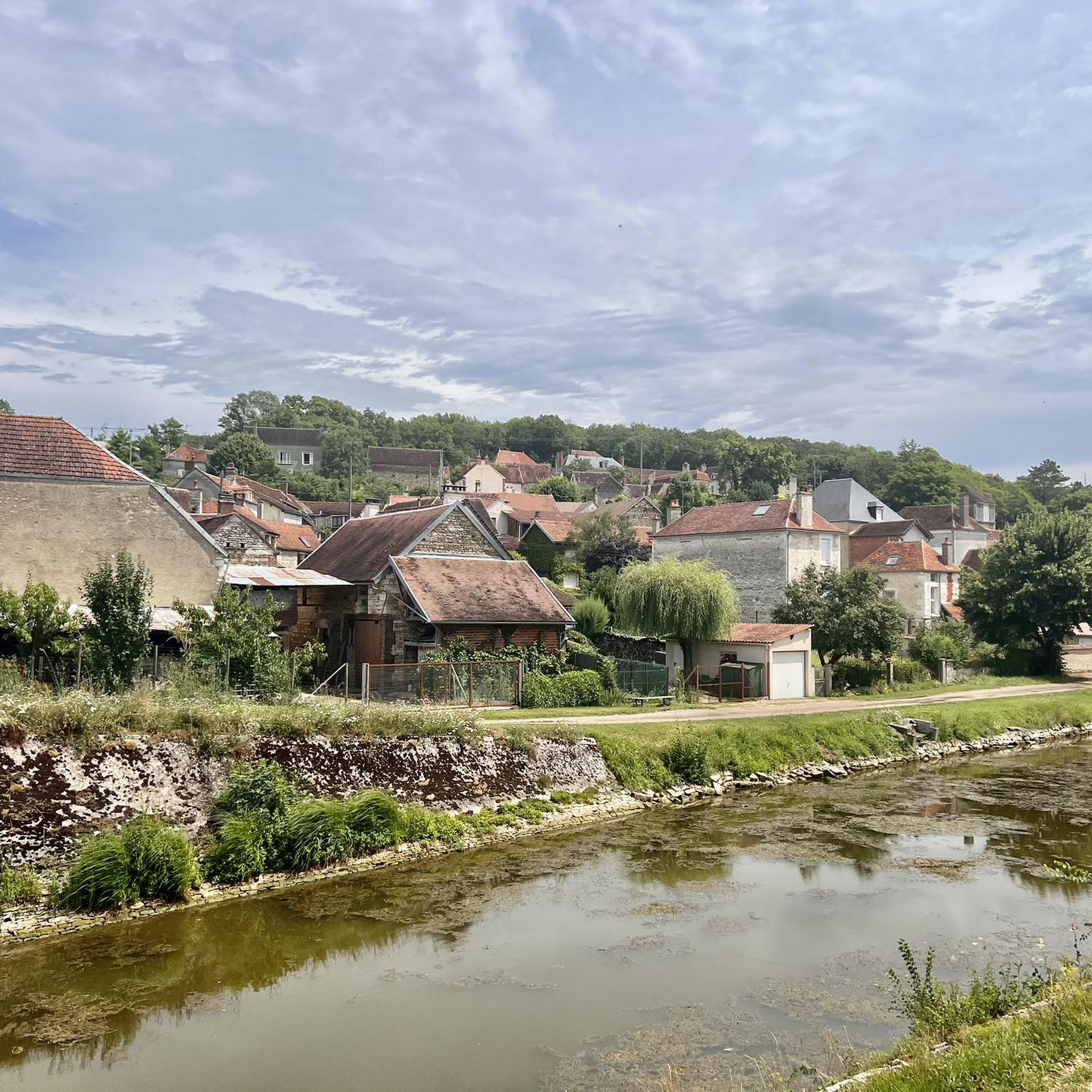
The Burgundy Canal is 242 km long, it connects the Seine basin to the Rhône basin. Previously used for moving goods, but since the 1960s the canal has been used almost exclusively for recreational boating.
0
0

A long ribbon of water crossing the countryside for 242 kilometers: here is the Burgundy Canal, which connects the Yonne to the Saône and Migennes to Saint-Jean-de-Losne. For some, it is the heart of Burgundy that opens up through these quiet valleys dotted with famous churches and castles.
1
0

The Canal de Bourgogne connects the rivers Yonne and Saône, and thus the Atlantic and the Mediterranean via other rivers and canals. Here the river bike path is paved and nice to ride a racing bike.
4
1
Frequently Asked Questions
What types of terrain can I expect on running routes around Lignières?
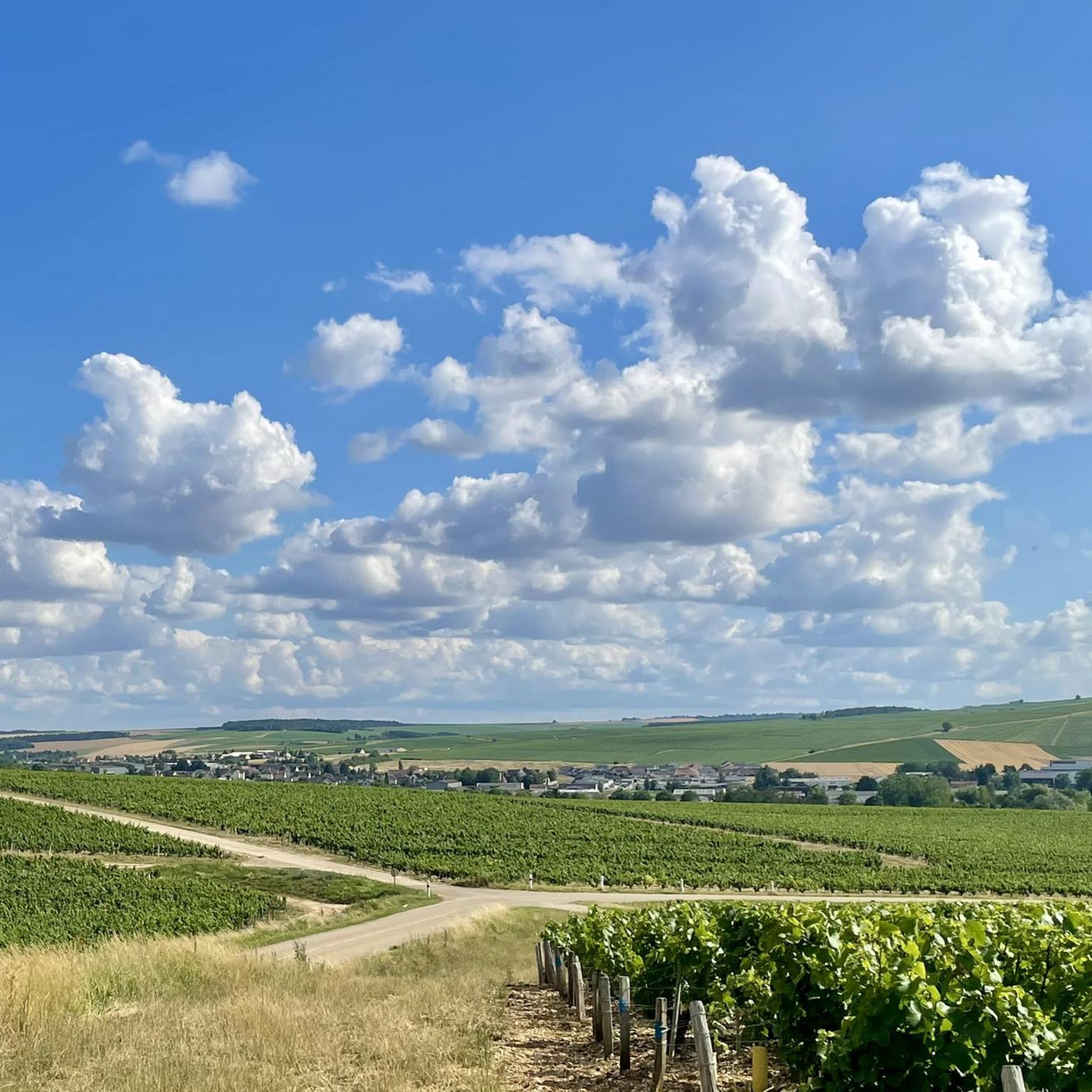
The Lignières area offers a diverse range of terrain for runners. You'll find extensive forest paths, particularly within the Forêt d'Ecouves, providing shaded routes through beech and oak trees. There are also gentle hills and picturesque sections, such as those near La Roche-Mabile, which add variety to your run. Many routes feature a mix of forest and open sections, with some leading along scenic waterways like the Burgundy Canal.
How many running trails are available in the Lignières region?
Komoot offers a selection of nearly 50 running routes around Lignières. These routes cater to various preferences, ranging from easy loops to more challenging moderate trails, ensuring there's something for every runner.
Are there any easy or beginner-friendly jogging routes in Lignières?
Yes, Lignières has several easy jogging routes suitable for beginners or those looking for a less strenuous run. Out of the nearly 50 routes available, 4 are specifically categorized as easy. These typically feature flatter profiles and shorter distances, perfect for a relaxed outing.
What kind of elevation gain should I expect on running trails in Lignières?
Elevation gain on running trails in Lignières varies. While many routes feature gentle hills, some offer more significant climbs. For example, the Étang du Crot Saint-Marc loop from Flogny-la-Chapelle has an elevation gain of over 100 meters, providing a good workout. Other routes, like the Running loop from Cheney, are relatively flat with minimal elevation changes, ideal for a quicker pace.
Are there any circular running routes around Lignières?
Yes, many of the running routes in Lignières are designed as circular loops, allowing you to start and finish at the same point. Examples include the Étang du Crot Saint-Marc loop from Flogny-la-Chapelle and the Burgundy Canal – Canal de Bourgogne loop from Cheney, offering convenient options for your run.
What do other runners say about the trails in Lignières?
The running routes in Lignières are highly regarded by the komoot community, boasting an average rating of 4.6 stars from over 5 reviews. Runners often praise the diverse landscapes, the peaceful forest paths, and the well-maintained trails that make for an enjoyable experience.
Are there any scenic viewpoints or natural features to see while running in Lignières?
Absolutely! The Lignières area is part of the Normandy-Maine Regional Natural Park, offering beautiful natural features. While running, you might encounter sections of the extensive Forêt d'Ecouves or enjoy views of the surrounding countryside. The broader region also features Mont des Avaloirs, the highest point of the Armorican massif, which provides panoramic 360° views, though it might require a slight detour from some specific running paths.
Can I combine my run with visiting historical sites or attractions near Lignières?
Yes, the region around Lignières offers opportunities to combine your run with cultural exploration. For instance, you could run along the Towpath of the Canal de Bourgogne. Nearby attractions also include the historic Fosse Dionne and the town of Tonnerre, or the impressive Hôtel-Dieu de Tonnerre, which could be visited before or after your run.
Are there any running routes that follow waterways or canals?
Yes, you can find running routes that follow waterways. The Burgundy Canal – Canal de Bourgogne loop from Cheney is a great example, offering a scenic run along riverside landscapes. This provides a relatively flat and picturesque environment, perfect for a steady pace.
What is the typical length and duration of running routes in Lignières?
The running routes in Lignières vary in length and duration. You can find shorter loops, such as the Running loop from Roffey, which is about 5.9 km and takes around 40 minutes. Longer options like the Étang du Crot Saint-Marc loop from Flogny-la-Chapelle cover about 13.2 km and can take over an hour to complete, depending on your pace.
Are there any running routes that offer a mix of forest and open landscapes?
Many routes in Lignières provide a balanced experience of both forest and open landscapes. For example, the Running loop from Coussegrey takes you through varied terrain, allowing you to enjoy the shade of the woods and the expansive views of the countryside.
Most popular attractions around Lignières

Get inspired with the komoot mobile app


Explore more
Browse the best Running Trails & Routes in other regions.
