The best running trails around Labessette
4.6
(11)
571
runners
52
runs
Jogging around Labessette offers diverse terrain within the Puy-de-Dôme department of the Auvergne-Rhône-Alpes region. The area is characterized by a volcanic and mountainous massif, featuring rolling hills and elevations ranging from 524 to 806 meters. Water bodies such as the retention lake of the Bort-les-Orgues dam on the Dordogne river and the Panouille stream provide scenic backdrops for running. Proximity to the Natural Regional Park of the Volcanoes further enhances the opportunities for exploring forested volcanic landscapes.
Best jogging routes…
Last updated: June 29, 2026
112
runners
36.9km
04:31
930m
930m
Hard run. Very good fitness required. Mostly paved surfaces. Suitable for all skill levels.
4.5
(2)
45
runners
11.2km
01:19
200m
200m
Moderate run. Good fitness required. Mostly paved surfaces. Suitable for all skill levels.

Sign up for free
29
runners
71.8km
09:27
2,440m
2,440m
Hard run. Very good fitness required. Mostly accessible paths. Some sure footedness required.
49
runners
5.77km
00:42
110m
110m
Moderate run. Good fitness required. Mostly paved surfaces. Suitable for all skill levels.
3
runners
7.78km
00:49
100m
110m
Moderate run. Good fitness required. Mostly paved surfaces. Suitable for all skill levels.
Get access to more routes and recommendations from other explorers.
Sign up for free
Already have an account?
Our route recommendations are based on thousands of hikes, rides, and runs completed by other people on komoot.
Start today with a free account
Your next adventure awaits.
Login or Signup


Tips from the Community

Beautiful castle, close for the siesta
0
0

The castle, which once dominated the Dordogne valley from a rocky outcrop, has stood since 1952 on a headland that juts out into the Barrage de Bort-les-Orgues reservoir. The original character of the castle can only be guessed at when the water level is low. The multi-storey building is surrounded by five towers of roughly the same thickness and one thinner one, each with overhangs and conical roofs. The individual floors are connected by a spiral staircase in the vestibule. The inner courtyard was originally roofless. The first floor consists of three large rooms with decorated fireplaces from the mid-19th century and various furniture. An art exhibition with works by painters, mostly from the region, takes place every year on the second floor. The artistically crafted roof trusses of the towers can be seen from the battlement on the top floor. Source: https://de.wikipedia.org/wiki/Schloss_Val
0
0
Wikipedia has information about the dam: FR: https://de.wikipedia.org/wiki/Barrage_de_Bort-les-Orgues DE: https://fr.wikipedia.org/wiki/Barrage_de_Bort-les-Orgues
1
1

The Bort dam is a structure 120 meters high and 390 meters long, straddling the municipalities of Bort and Lanobre, and creating a reservoir of more than 10 km2. Built between 1942 and 1952, it was then a veritable concrete juggernaut and today it remains one of the largest dams in France (and still the third in mainland France if we look at the quantity of water retained by a concrete construction). It is also the first and largest reservoir in the hydroelectric system of the Dordogne valley.
0
0
The Bort dam is a structure 120m high and 390m long, straddling the municipalities of Bort and Lanobre, and creating a reservoir of more than 10 km2. Built between 1942 and 1952, it was then a veritable behemoth of concrete and it remains today one of the largest dams in France (and even still the third largest in mainland France if we look at the quantity of water retained by a construction of concrete). It is also the first and largest reservoir of the hydroelectric system in the Dordogne valley.
1
0
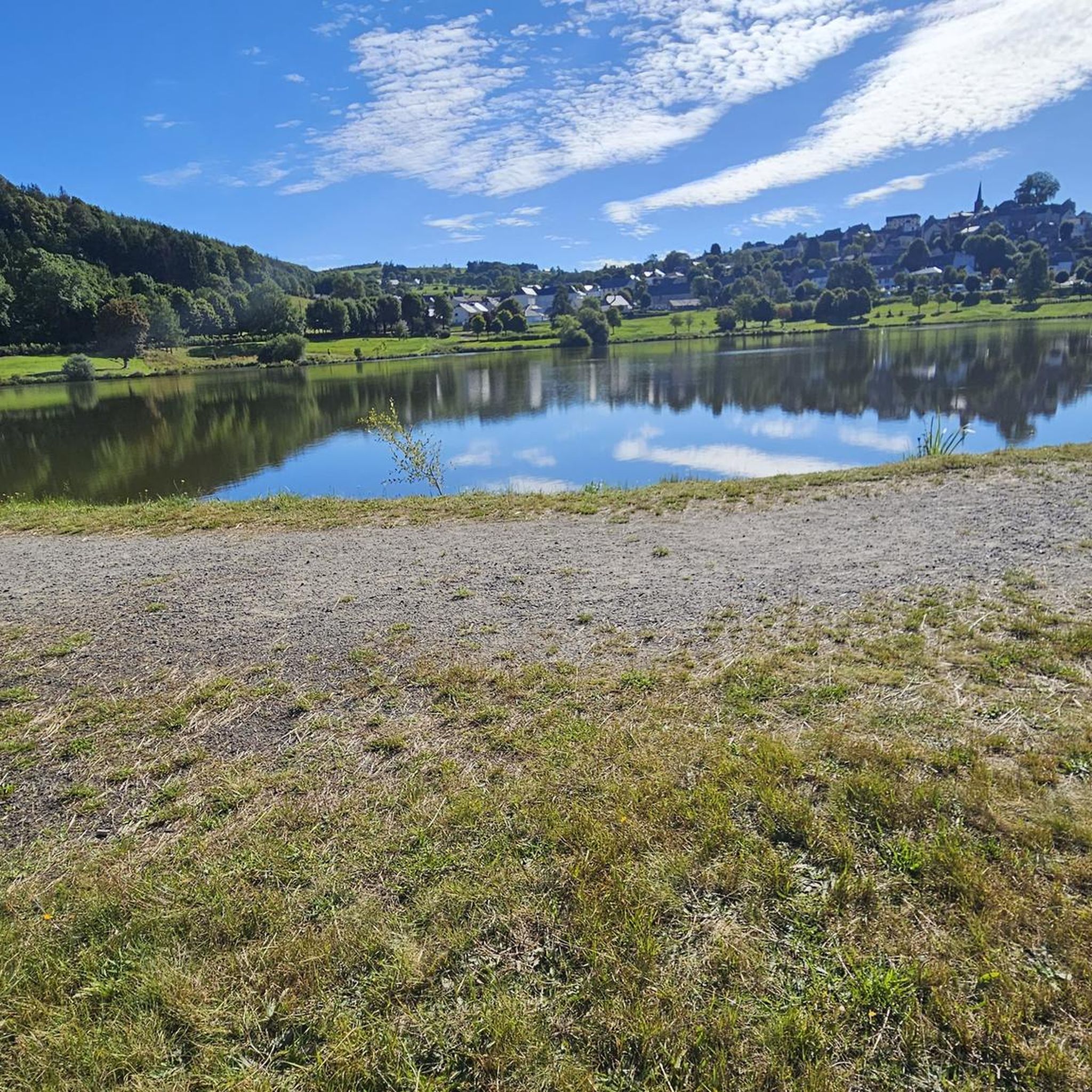
Pleasant path on the Cantal banks of the dam. Possibility to make a short loop from the castle going up on the Monteil or to extend to the Siauve for a longer loop.
2
0

Small supervised family beach, very clean water with the possibility of eating in a nice atmosphere
0
0

Thank you to Alain for his welcome and to the kind souls of this campsite. A very human contact that is very rare these days! Thank you all 🖤
0
0
Frequently Asked Questions
How many running routes are available around Labessette?
There are over 50 running routes available around Labessette, offering a wide variety of options for different skill levels and preferences. The komoot community has explored these trails over 500 times, highlighting the area's popularity for outdoor activities.
Are there easy running trails suitable for beginners or families in Labessette?
Yes, Labessette offers several easy running trails perfect for beginners or families. For instance, the Siauve Beach loop from Château de Val is an easy 3.1-mile (4.9 km) route that takes about 35 minutes, leading through scenic lakeside areas and past the historic Château de Val.
What kind of terrain can I expect on the jogging routes in Labessette?
The jogging routes in Labessette feature diverse terrain, characteristic of its location within a volcanic and mountainous massif. You can expect rolling, verdant hills, elevations ranging from 524 to 806 meters, and scenic paths alongside water bodies like the retention lake of the Bort-les-Orgues dam on the Dordogne river. The region offers a mix of forested volcanic landscapes and open country lanes.
What are some scenic viewpoints or attractions I can see while running in Labessette?
Many running routes in Labessette offer stunning views and pass by notable attractions. You can enjoy extensive views of the Bort-les-Orgues Dam and Val Castle. Other scenic spots include the confluence of the Dordogne and the Arpiat, and picturesque lakeside areas. The region's volcanic landscape itself provides many beautiful vistas.
Are there any circular running routes in the Labessette area?
Yes, many of the running routes around Labessette are circular, allowing you to start and end at the same point. Examples include the popular Chateau – Siauve Beach loop from Lanobre, a moderate 5.2-mile (8.4 km) path combining historical sights with lakeside scenery, and the Siauve Beach loop from Château de Val.
What is the best time of year to go running in Labessette?
Labessette's diverse natural features make it suitable for running throughout much of the year. Spring and autumn offer pleasant temperatures and vibrant scenery with changing foliage. Summer is also great, especially near water bodies for a refreshing experience. While the region can experience winter conditions, specific routes might still be accessible for those prepared for colder weather and potentially snowy or icy paths.
Are there dog-friendly running trails around Labessette?
While specific regulations for dogs on every trail are not detailed, generally, many outdoor trails in rural areas like Labessette are dog-friendly, especially if dogs are kept on a leash. Given its proximity to the Natural Regional Park of the Volcanoes, it's always advisable to check local park rules regarding pets, particularly in protected areas, to ensure a pleasant experience for everyone.
What do other runners enjoy most about jogging in Labessette?
The running routes in Labessette are highly rated by the komoot community, with an average score of 4.4 stars from 9 reviews. Runners often praise the region's pure, unspoilt beauty, the variety of terrain from rolling hills to volcanic landscapes, and the serene environment provided by the numerous water bodies and forested areas. The mix of challenging and easy routes also contributes to its appeal.
Are there longer, more challenging running routes for experienced runners?
Absolutely. For experienced runners seeking a challenge, Labessette offers several difficult routes. The Val Castle – Bort-les-Orgues Dam loop from Lanobre is a challenging 22.9-mile (36.9 km) trail with significant elevation gain, taking approximately 4 hours and 30 minutes to complete, and offering extensive views of the dam and Val Castle.
What should I wear for running in Labessette?
Given the varied terrain and potential for elevation changes, it's recommended to wear appropriate running shoes with good grip, especially for trails that might be uneven or muddy. Layered clothing is advisable to adapt to changing weather conditions, as the mountainous environment can lead to temperature fluctuations. Always check the local weather forecast before heading out.
Are there running routes that start near parking areas?
Many routes in the Labessette area, particularly those starting from villages or popular attractions like Château de Val or Lanobre, typically have nearby parking facilities. While specific parking details for every route are not listed, it's common for trailheads in this region to be accessible by car, allowing for convenient access to your run.
Can I find running routes that are less frequented, offering a 'hidden gem' experience?
While the most popular routes are well-loved, Labessette's extensive network of over 50 trails means there are many opportunities to discover less-frequented paths. Exploring routes slightly off the main attractions, or those with moderate difficulty like the Running loop from Beaulieu, can often lead to a more secluded and 'hidden gem' running experience amidst the tranquil landscapes.
Most popular attractions around Labessette

Get inspired with the komoot mobile app


Explore more
Browse the best Running Trails & Routes in other regions.
