The best walks and hikes around Harbonnières
4.1
(88)
351
hikers
45
hikes
Hiking around Harbonnières offers access to the gentle, undulating terrain of the Santerre plateau in the Somme department of France. The landscape is characterized by open agricultural fields, small woodlands, and proximity to the Somme river valley, providing varied scenery for walks. Elevation changes are generally modest, making many routes accessible for a range of fitness levels. The area's trails often follow quiet country lanes and paths through cultivated land.
Best hiking trails around Harbonnières
- The most popular hiking route…
Last updated: July 13, 2026
4.9
(12)
53
hikers
8.11km
02:30
30m
30m
Moderate hike. Good fitness required. Easily-accessible paths. Suitable for all skill levels.
4.0
(3)
13
hikers
6.98km
01:46
20m
20m
Easy hike. Great for any fitness level. Easily-accessible paths. Suitable for all skill levels.

Sign up for free
4.5
(2)
22
hikers
8.46km
02:12
60m
60m
Moderate hike. Good fitness required. Easily-accessible paths. Suitable for all skill levels.
4.7
(3)
18
hikers
8.21km
02:08
50m
50m
Moderate hike. Good fitness required. Easily-accessible paths. Suitable for all skill levels.
4.1
(7)
8
hikers
8.99km
02:18
30m
30m
Moderate hike. Good fitness required. Easily-accessible paths. Suitable for all skill levels.
Get access to more routes and recommendations from other explorers.
Sign up for free
Already have an account?
Our route recommendations are based on thousands of hikes, rides, and runs completed by other people on komoot.
Start today with a free account
Your next adventure awaits.
Login or Signup

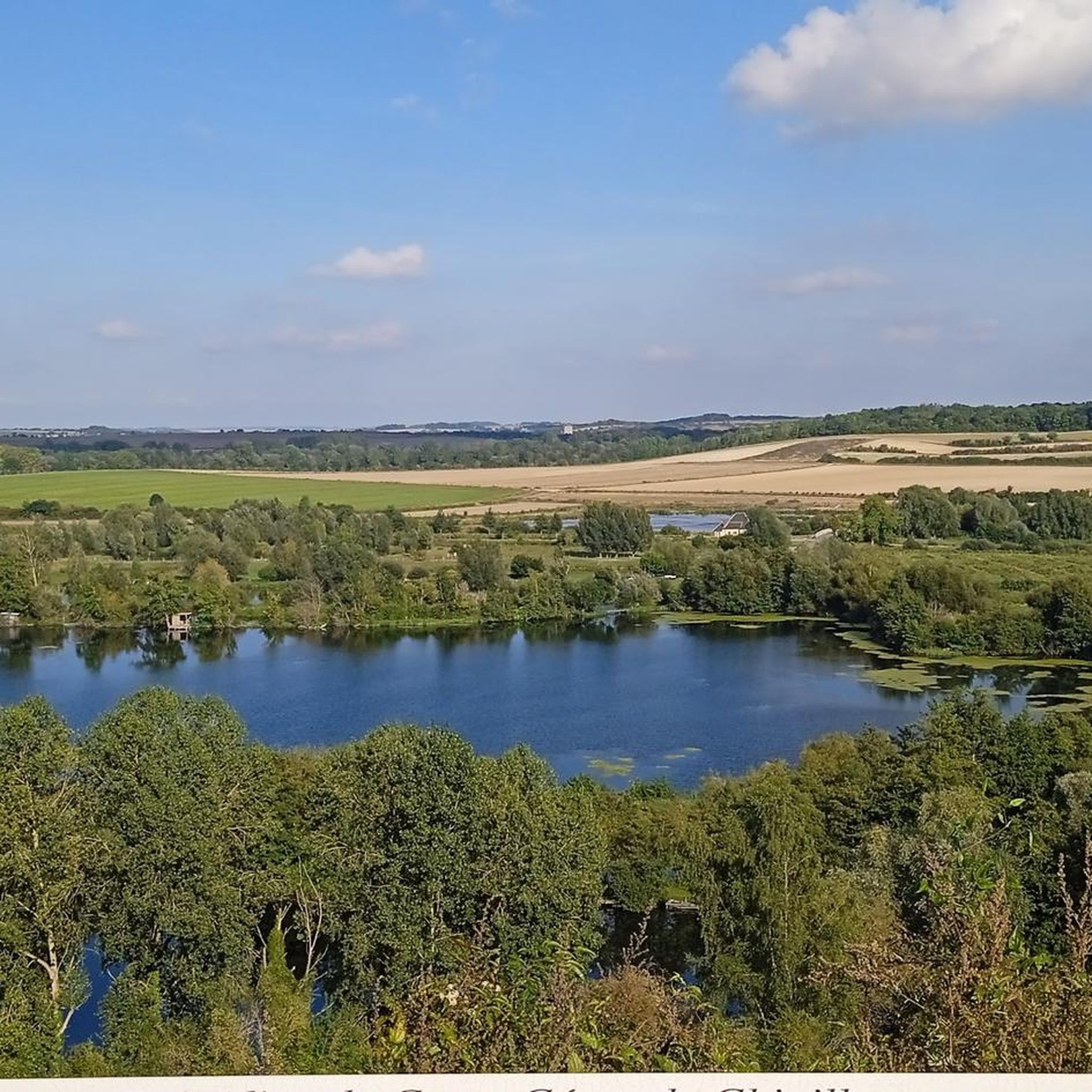



Tips from the Community

The Les Marais de la Violette trail is an 8.5-kilometer loop that will take you through wetlands, forests, lakes, and rivers, where you can admire the diversity of the region's flora and fauna.
3
0
Throughout this stretch, you will appreciate the views of the marshes and the river, as well as the flora and fauna and historical markers that mark the route.
3
0
Frequently Asked Questions
How many hiking trails are available around Harbonnières?
There are over 45 hiking routes available around Harbonnières, offering a variety of options for different preferences and fitness levels. These trails explore the gentle terrain of the Santerre plateau and the Somme river valley.
What are the typical difficulty levels of hikes around Harbonnières?
The trails around Harbonnières are generally accessible, with 19 routes rated as easy and 24 as moderate. There are also a couple of more challenging options for experienced hikers. The modest elevation changes make many routes suitable for a wide range of fitness levels.
What kind of terrain can I expect on hikes near Harbonnières?
Hikes near Harbonnières primarily feature the gentle, undulating terrain of the Santerre plateau. You'll encounter open agricultural fields, small woodlands, and paths along the Somme river valley. Many routes follow quiet country lanes and paths through cultivated land, offering varied scenery.
Are there any circular walks available in Harbonnières?
Yes, many of the routes around Harbonnières are designed as circular walks. For example, the Les marais de la Violette — loop from Méricourt-sur-Somme is a popular moderate loop exploring wetlands, and the Old Dite Bridge loop from Cerisy offers an easy circular path along the Somme river.
Are there family-friendly hiking options in Harbonnières?
Absolutely. With 19 easy routes and generally modest elevation gains, Harbonnières offers several family-friendly hiking options. Trails like the Old Dite Bridge loop from Cerisy are suitable for most ages and fitness levels, providing pleasant walks through the local landscape.
Can I hike with my dog in Harbonnières?
Yes, many trails in the Harbonnières area are suitable for hiking with dogs. Given the rural nature of the region, with agricultural fields and woodlands, dogs are generally welcome. However, always keep your dog under control, especially near livestock or cultivated areas, and check for any specific local regulations.
What landmarks or attractions can I see while hiking near Harbonnières?
While hiking, you can discover several points of interest. Notable attractions include the historic Château de Suzanne, the scenic Camp César de Chipilly viewpoint, and the tranquil Estate of the Little Corks. Many trails also offer views of the Somme river and its surrounding landscapes.
Is parking available for hikers near the trails in Harbonnières?
Yes, parking is generally available in the villages and towns that serve as starting points for many of the trails around Harbonnières. Specific parking information can often be found on individual route descriptions on komoot, or by checking local village amenities.
How can I reach the hiking trails using public transport?
Public transport options to reach specific trailheads around Harbonnières may be limited, as the area is predominantly rural. It's advisable to check local bus schedules for services connecting to Harbonnières and surrounding villages. For more flexibility, driving to a trailhead is often the most convenient option.
What is the best time of year to hike in Harbonnières?
The best time to hike in Harbonnières is typically from spring through autumn (April to October). During these months, the weather is generally mild and pleasant, making for comfortable walking conditions. Spring brings blooming fields, while autumn offers beautiful foliage. Winter hiking is possible, but trails may be muddy, and daylight hours are shorter.
What do other hikers say about the trails in Harbonnières?
The trails around Harbonnières are highly rated by the komoot community, with an average score of 3.9 stars from over 80 reviews. Hikers often praise the peaceful rural atmosphere, the gentle terrain suitable for all levels, and the varied scenery encompassing agricultural fields, woodlands, and river views.
Are there any long-distance trails near Harbonnières?
While Harbonnières itself is known for its local loops, the region's trails can connect to longer networks, particularly those following the Somme river. The Canal de la Somme Cycle Path and the Path from Corbie to Sailly-le-Sec offer opportunities for extended walks or linking multiple shorter routes.
Most popular routes around Harbonnières
Most popular attractions around Harbonnières

Get inspired with the komoot mobile app


Explore more
Browse the best Hikes in other regions.
