The best running trails in the Trans-Mexican Volcanic Belt
4.8
(477)
21,461
runners
486
runs
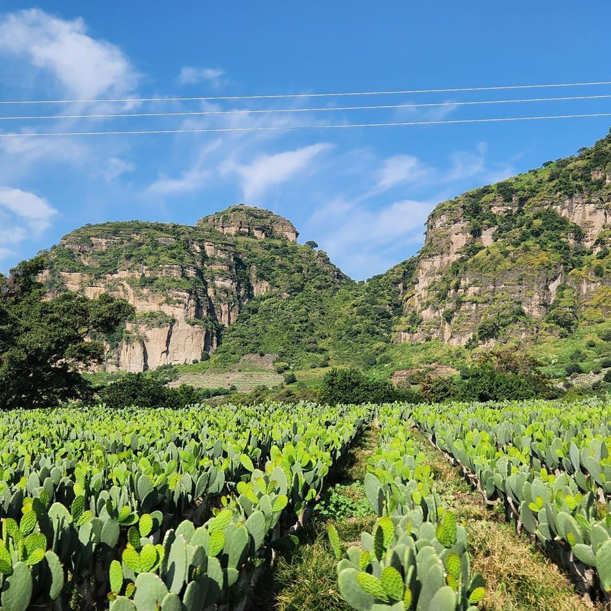
Jogging in the Trans-Mexican Volcanic Belt offers diverse terrain across an active volcanic arc stretching central-southern Mexico. This region is characterized by majestic stratovolcanoes, extensive pine-oak forests, and varied ecosystems. Runners can explore routes ranging from temperate forest paths to higher volcanic slopes, providing a wide array of natural features for trail running. The volcanic ash contributes to fertile soils, supporting lush vegetation and diverse microhabitats.
Best jogging routes in the Trans-Mexican Volcanic Belt
- The most popular jogging route is…
Last updated: October 10, 2026
5.0
(11)
1,227
runners
19.9km
02:05
120m
120m
Hard run. Very good fitness required. Mostly paved surfaces. Suitable for all skill levels.
4.9
(10)
1,066
runners
24.1km
02:32
160m
160m
Hard run. Very good fitness required. Mostly paved surfaces. Suitable for all skill levels.

4.5
(8)
776
runners
12.8km
01:19
70m
70m
Moderate run. Good fitness required. Mostly paved surfaces. Suitable for all skill levels.
5.0
(6)
665
runners
14.0km
01:27
70m
70m
Moderate run. Good fitness required. Mostly paved surfaces. Suitable for all skill levels.
4.9
(12)
623
runners
Moderate run. Good fitness required. Mostly paved surfaces. Suitable for all skill levels.
4.8
(10)
640
runners
18.4km
01:55
110m
110m
Hard run. Very good fitness required. Mostly paved surfaces. Suitable for all skill levels.
4.9
(10)
587
runners
11.6km
01:13
120m
120m
Moderate run. Good fitness required. Mostly paved surfaces. Suitable for all skill levels.
5.0
(2)
524
runners
8.30km
00:51
20m
20m
Moderate run. Good fitness required. Mostly paved surfaces. Suitable for all skill levels.
4.7
(3)
512
runners
6.79km
00:42
20m
20m
Moderate run. Good fitness required. Mostly paved surfaces. Suitable for all skill levels.
4.6
(11)
527
runners
5.71km
00:38
20m
20m
Moderate run. Good fitness required. Mostly paved surfaces. Suitable for all skill levels.
Get access to more routes and recommendations from other explorers.
Already have an account?
Our route recommendations are based on thousands of hikes, rides, and runs completed by other people on komoot.
Start today with a free account
Your next adventure awaits.
Popular around Trans-Mexican Volcanic Belt
From the Arctic Ocean to the Panama Canal — North American Epic

Triathlon 360 – my journey around the world
Hiking in the Trans-Mexican Volcanic Belt
Cycling in the Trans-Mexican Volcanic Belt
Road Cycling Routes in the Trans-Mexican Volcanic Belt
MTB Trails in the Trans-Mexican Volcanic Belt

Mountain Hikes in the Trans-Mexican Volcanic Belt

Gravel biking in the Trans-Mexican Volcanic Belt
Other adventures in the Trans-Mexican Volcanic Belt


Tips from the Community

A great place to go for a run or just take a walk. (Bicycles are not allowed.)
0
0

The Rubén Darío promenade is part of the Chapultepec forest perimeter and houses sculptures of the writer himself and Mahatma Gandhi.
0
0

This is a spectacular bronze statue representing the Roman goddess of the hunt. It was unveiled in 1942.
0
0
This is one of the city's most iconic landmarks. The column and statue together reach almost 50 meters in height. It symbolizes the freedom of the Mexican people from Spanish rule.
0
0
This historic monument in Chapultepec Park commemorates the six cadets of the Military Academy who defended Mexico during the American invasion of 1847. Built of Carrara marble and inaugurated in 1952, it is notable for its six monumental semicircular columns adorned with sculptures representing the defense of national sovereignty. Strategically located at the entrance to the First Section, along Avenida Juventud Heroica, its neoclassical architecture and historical significance make it an essential stop for connecting with Mexican military history while exploring the park's paths.
0
0

It's one of Mexico City's most important green spaces. Its paths, lakes, and museums invite you to stroll at a leisurely pace, discover vibrant corners, and enjoy a respite in the heart of the city.
0
0

The Paseo de los Compositores (Walk of the Composers), located in the Jardín de la Tercera Edad (Garden of the Third Age), pays homage to great figures of Mexican music with bronze busts created by sculptor Octavio Ponzanelli. Among them are Agustín Lara, María Grever, Silvestre Revueltas, and Juventino Rosas, composer of the famous waltz "Over the Waves." It is a peaceful and shaded promenade, ideal for relaxing and enjoying the cultural surroundings. In the same area, a fountain featuring the figure of "Cri-Cri" commemorates the beloved character created by Francisco Gabilondo Soler.
1
0

the ideal place to walk, jog or run.
0
0
Frequently Asked Questions
How many running routes are available in the Trans-Mexican Volcanic Belt?
The Trans-Mexican Volcanic Belt offers a vast network of over 500 running routes. These trails cater to various preferences, from easy forest paths to challenging volcanic ascents, ensuring a diverse experience for every runner.
What kind of terrain can I expect when jogging in the Trans-Mexican Volcanic Belt?
You'll encounter a diverse range of terrain, from temperate pine-oak forests at lower elevations to more exposed volcanic slopes. The region is characterized by majestic stratovolcanoes like Pico de Orizaba and Nevado de Toluca, offering varied landscapes and significant elevation changes. The volcanic ash contributes to fertile soils, supporting lush vegetation throughout the area.
Are there routes suitable for beginners or those looking for an easy run?
Yes, the Trans-Mexican Volcanic Belt has options for all skill levels. There are over 50 easy running routes available, perfect for beginners or those seeking a relaxed jog. These often traverse the temperate pine-oak forests, providing a gentler experience.
What about more challenging running trails in the Trans-Mexican Volcanic Belt?
For experienced runners seeking a challenge, the region offers over 120 difficult routes. These often involve significant elevation gains on the slopes of volcanoes or longer distances. An example of a challenging route is the Monument to the Boy Heroes – Paseo de los Compositores loop from San Joaquín, which covers nearly 24 km with considerable elevation changes.
When is the best time of year for jogging in the Trans-Mexican Volcanic Belt?
The Trans-Mexican Volcanic Belt generally offers a temperate climate, making it suitable for jogging year-round. However, higher volcanic slopes may experience snow, especially during cooler months. The pine-oak forests provide excellent conditions for trail running, and the varied altitudes allow for different experiences depending on the season.
Are there any circular jogging routes in the Trans-Mexican Volcanic Belt?
Yes, many routes in the Trans-Mexican Volcanic Belt are designed as loops, offering a convenient way to start and finish at the same point. For instance, the Viveros de Coyoacán loop from Miguel Ángel de Quevedo is a moderate 7.2 km circular route, popular among local runners.
What natural landmarks or points of interest can I see while running in the Trans-Mexican Volcanic Belt?
The region is rich in natural beauty. You can encounter majestic stratovolcanoes like Popocatépetl and Iztaccíhuatl, and explore diverse ecosystems within the pine-oak forests. Some routes may lead you past picturesque crater lakes, such as those found near Nevado de Toluca. While running, you might also spot unique wildlife like the volcano rabbit or experience the annual monarch butterfly migration in certain areas.
Are there any specific attractions near the running trails?
Yes, several attractions are close to the running trails. You can find beautiful lakes like Oyameles Dam or Iturbide Dam. For those interested in unique natural features, the Xochimilco Ecological Park offers a distinct experience. Additionally, there are mountain huts like Las Plumas Mountain Hut for those exploring higher elevations.
Are there family-friendly running routes in the Trans-Mexican Volcanic Belt?
While specific 'family-friendly' designations can vary, many of the easier and moderate routes through the pine-oak forests or urban parks are suitable for families. These often have less challenging terrain and provide a pleasant environment for a group run or walk. Always check route details for distance and elevation to ensure it matches your family's capabilities.
Can I bring my dog on the running trails in the Trans-Mexican Volcanic Belt?
Many outdoor areas in the Trans-Mexican Volcanic Belt are dog-friendly, especially in national parks and forests, though regulations can vary. It's always best to check local park rules or specific trail guidelines before heading out with your canine companion. Ensure your dog is on a leash and you clean up after them to maintain the natural environment.
Are there running routes accessible by public transport or with parking?
Many running routes, particularly those closer to urban centers within the Trans-Mexican Volcanic Belt, offer good access via public transport or have designated parking areas. For example, routes like the Lions' Gate – Angel of Independence loop from Constituyentes are often easily reachable. It's advisable to check the starting point of your chosen route for specific transport and parking information.
What do other runners say about the trails in the Trans-Mexican Volcanic Belt?
The running trails in the Trans-Mexican Volcanic Belt are highly regarded by the komoot community, boasting an impressive average rating of 4.8 stars from over 400 reviews. More than 20,000 runners have explored this region, often praising the diverse terrain, stunning volcanic backdrops, and the opportunity to connect with nature.
Most popular routes in the Trans-Mexican Volcanic Belt
Most popular attractions in the Trans-Mexican Volcanic Belt

Get inspired with the komoot mobile app


Explore more
Browse the best Running Trails & Routes in other regions.
