The best road cycling routes around Saint-Martin-Cantalès
4.5
(32)
803
riders
54
rides
Road cycling around Saint-Martin-Cantalès is characterized by a landscape of rolling hills and significant elevation changes, typical of the Massif Central region. The area features numerous mountain passes and scenic routes that traverse varied terrain, including valleys and higher plateaus. Road cyclists can expect routes that navigate through rural settings, often with views of the surrounding volcanic formations and traditional villages.
Best road cycling routes around Saint-Martin-Cantalès
- The most popular road cycling route is Col de Saint-Georges (954 m) loop…
Last updated: November 1, 2026
4.8
(6)
46
riders
Moderate road ride. Good fitness required. Mostly well-paved surfaces and easy to ride.
5.0
(1)
39
riders
Hard road ride. Very good fitness required. Mostly well-paved surfaces and easy to ride.

3.0
(1)
39
riders
52.3km
03:03
1,190m
1,190m
Hard road ride. Very good fitness required. Mostly well-paved surfaces and easy to ride.
18
riders
Moderate road ride. Good fitness required. Mostly well-paved surfaces and easy to ride.
4.0
(1)
8
riders
28.9km
01:36
490m
490m
Moderate road ride. Good fitness required. Mostly well-paved surfaces and easy to ride.
Get access to more routes and recommendations from other explorers.
Already have an account?
Our route recommendations are based on thousands of hikes, rides, and runs completed by other people on komoot.
Start today with a free account
Your next adventure awaits.


Tips from the Community

In memory of one of the biggest air drops during WWII. (https://fr.wikipedia.org/wiki/Op%C3%A9ration_Cadillac)
0
0

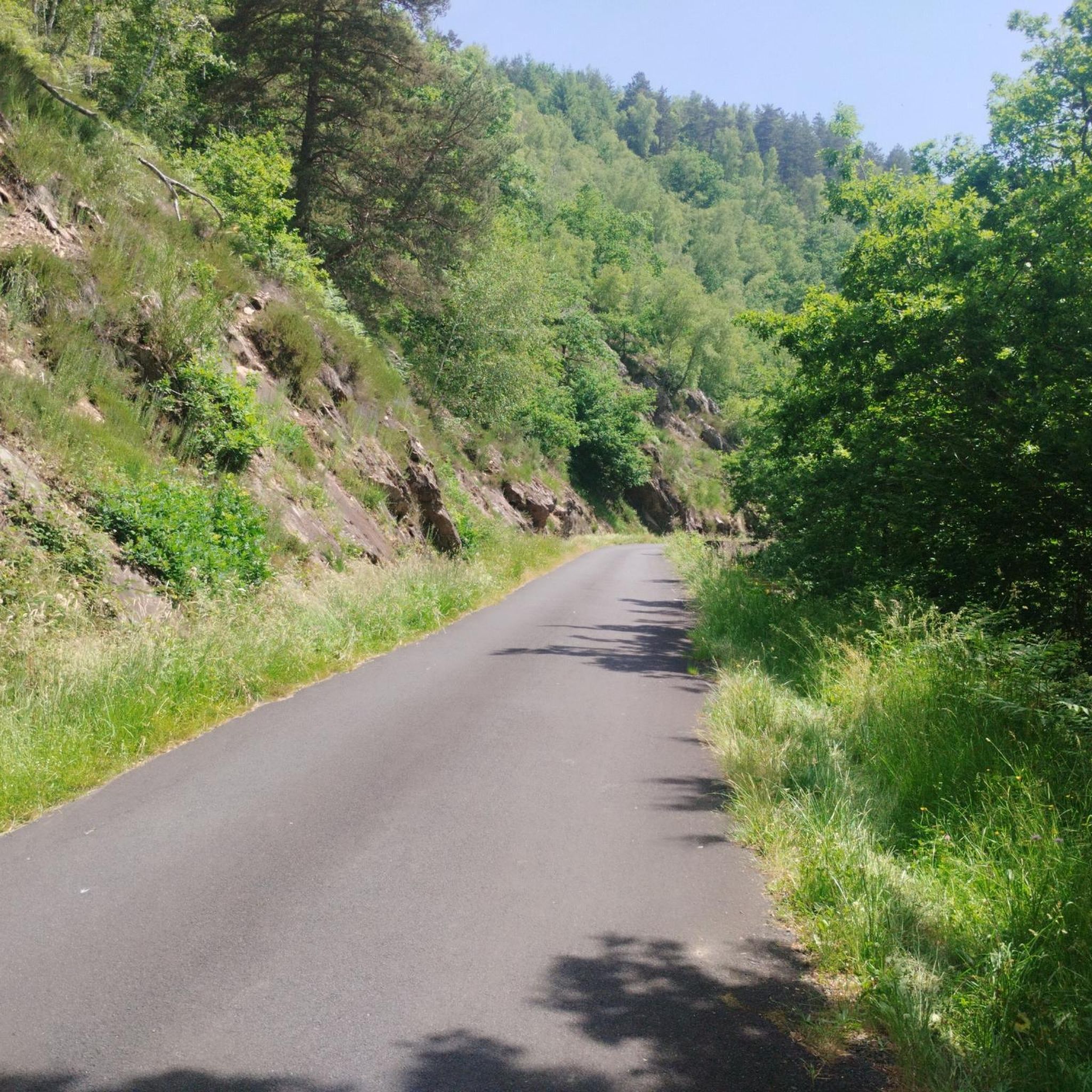
Very calm, little sail. At the end four more difficult.
0
0

Cross with a great view over Saint-Martin-Valmeraux
1
0

At 954 meters, the Col Saint-Georges is a 2.8 kilometer long climb from Saint Projet de Salers with an elevation gain of 153 meters and an average gradient of 5.5%.
0
0

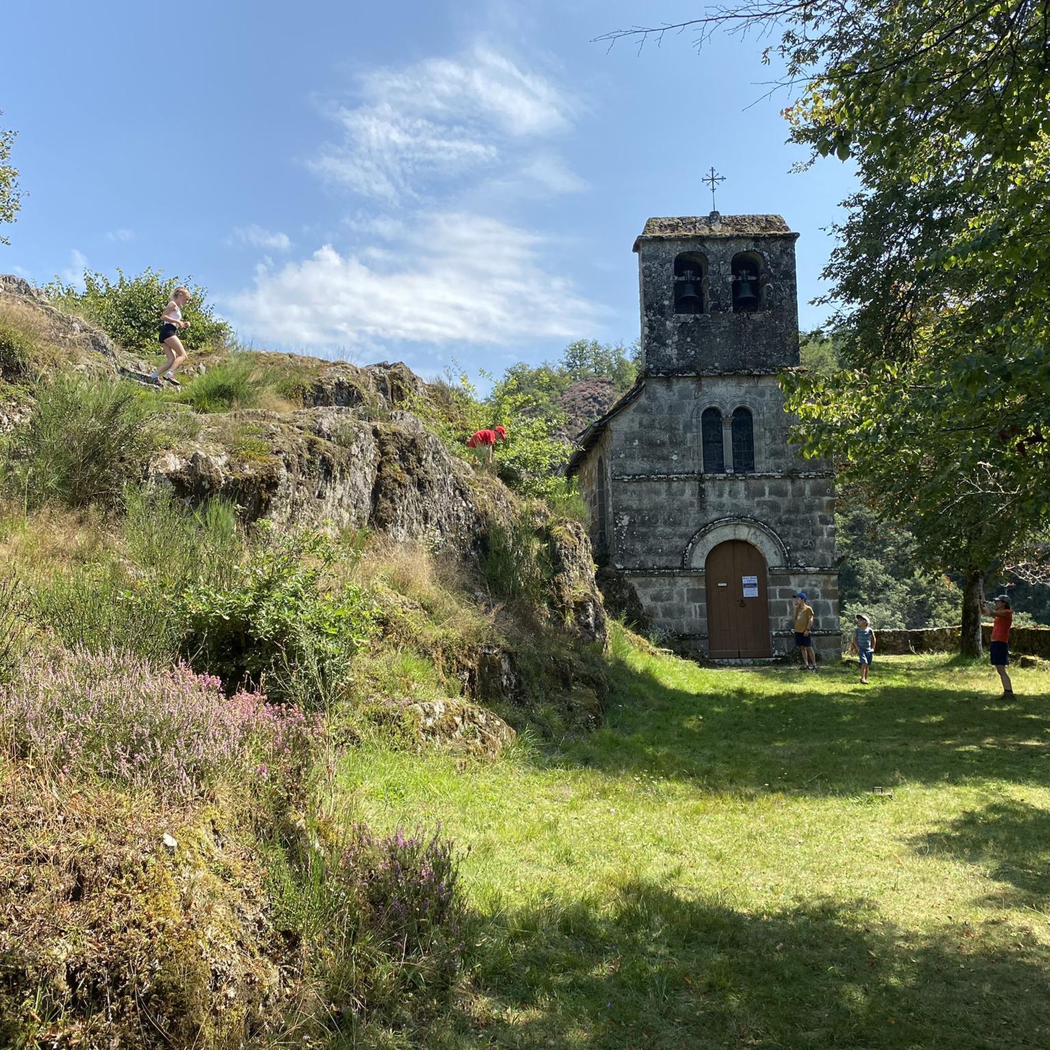
At the entrance or exit (depending on your direction) of the village of Fontanges, the Saint-Michel chapel, inaugurated in 1901, has the particularity of having been carved out of an enormous volcanic rock surmounted by a statue of the Virgin.
0
1

The route map for different routes starting in St. Illide.
0
0
Frequently Asked Questions
How many road cycling routes are available around Saint-Martin-Cantalès?
There are over 50 road cycling routes available around Saint-Martin-Cantalès, offering a wide range of options for cyclists of all levels. The region is known for its varied terrain, from rolling hills to challenging mountain passes.
Are there easy road cycling routes suitable for beginners in Saint-Martin-Cantalès?
Yes, Saint-Martin-Cantalès offers a few easier road cycling routes. While the region is characterized by significant elevation changes, there are options that provide a more gentle introduction to road cycling. These routes typically feature less intense climbs and shorter distances, allowing beginners to enjoy the scenic landscape without excessive challenge.
What are the best times of year for road cycling in Saint-Martin-Cantalès?
The best time for road cycling in Saint-Martin-Cantalès is generally from late spring to early autumn (May to October). During these months, the weather is typically milder and more stable, making for pleasant riding conditions. Summer offers warmer temperatures, while spring and autumn provide beautiful scenery with fewer crowds.
Are there challenging road cycling routes for experienced riders?
Absolutely. Saint-Martin-Cantalès is part of the Massif Central, known for its demanding terrain. Experienced riders will find numerous challenging routes featuring significant elevation gains and mountain passes. For example, the Stone Archway and Balcony loop from Camping Pont du Rouffet is a difficult 38.2-mile route with over 1,300 meters of ascent.
Can I find circular road cycling routes in the Saint-Martin-Cantalès area?
Yes, many of the road cycling routes around Saint-Martin-Cantalès are designed as loops, allowing you to start and finish at the same point. A popular example is the Col de Saint-Georges (954 m) loop from L'Hopital, which offers a 27.6-mile circular ride through varied terrain.
What kind of scenery can I expect on road cycling routes here?
Road cycling routes in Saint-Martin-Cantalès offer diverse and picturesque scenery. You can expect to ride through rolling hills, past traditional villages, and alongside volcanic formations. Many routes provide panoramic views of the surrounding Cantal landscape, including glimpses of higher plateaus and valleys.
Are there any family-friendly road cycling options in Saint-Martin-Cantalès?
While many routes in Saint-Martin-Cantalès feature significant elevation changes, families looking for less strenuous rides can find suitable options. It's advisable to look for routes described as 'easy' or those that stick to flatter valley sections or designated greenways if available, which might be found closer to larger towns or specific recreational areas.
What do other road cyclists enjoy most about the routes in Saint-Martin-Cantalès?
The road cycling routes in Saint-Martin-Cantalès are highly rated by the komoot community, with an average score of 4.1 stars from over 19 reviews. Cyclists often praise the challenging climbs, the stunning volcanic landscapes, and the quiet, scenic roads that wind through traditional villages and past mountain passes.
Are there routes that pass through or near notable towns or villages?
Yes, many routes in the region connect or pass through charming towns and villages, offering opportunities to experience local culture and find amenities. For instance, the Col de Saint-Georges (954 m) – Salers loop from Loupiac includes the historic town of Salers, known for its medieval architecture and local produce.
What are the typical distances and durations for road cycling routes in this area?
Road cycling routes around Saint-Martin-Cantalès vary widely in distance and duration. You can find moderate routes like the Neronne Pass – Route du Puy Mary loop from Loupiac, which is about 30.9 miles (49.7 km) and takes around 2 hours 30 minutes. More challenging routes can extend to over 38 miles (60 km) and require 3-4 hours or more to complete.
Is parking readily available near the starting points of road cycling routes?
Parking availability varies by route and starting point. In general, you can find parking in or near the villages and towns that serve as common starting points for routes. For example, routes starting from Loupiac or L'Hopital typically have designated parking areas. It's always a good idea to check specific route details for recommended parking locations.
Are there any less-known or 'hidden gem' road cycling routes in Saint-Martin-Cantalès?
While many routes are well-loved, the extensive network around Saint-Martin-Cantalès means there are always less-traveled roads to discover. Exploring routes that venture slightly off the main passes can reveal quieter roads and unique perspectives of the volcanic landscape and rural charm, offering a true 'hidden gem' experience for those willing to explore.
Most popular routes around Saint-Martin-Cantalès
Most popular attractions around Saint-Martin-Cantalès

Get inspired with the komoot mobile app


Explore more
Browse the best Road cycling routes in other regions.
