The best running trails around Argut-Dessous
4.6
(15)
892
runners
54
runs
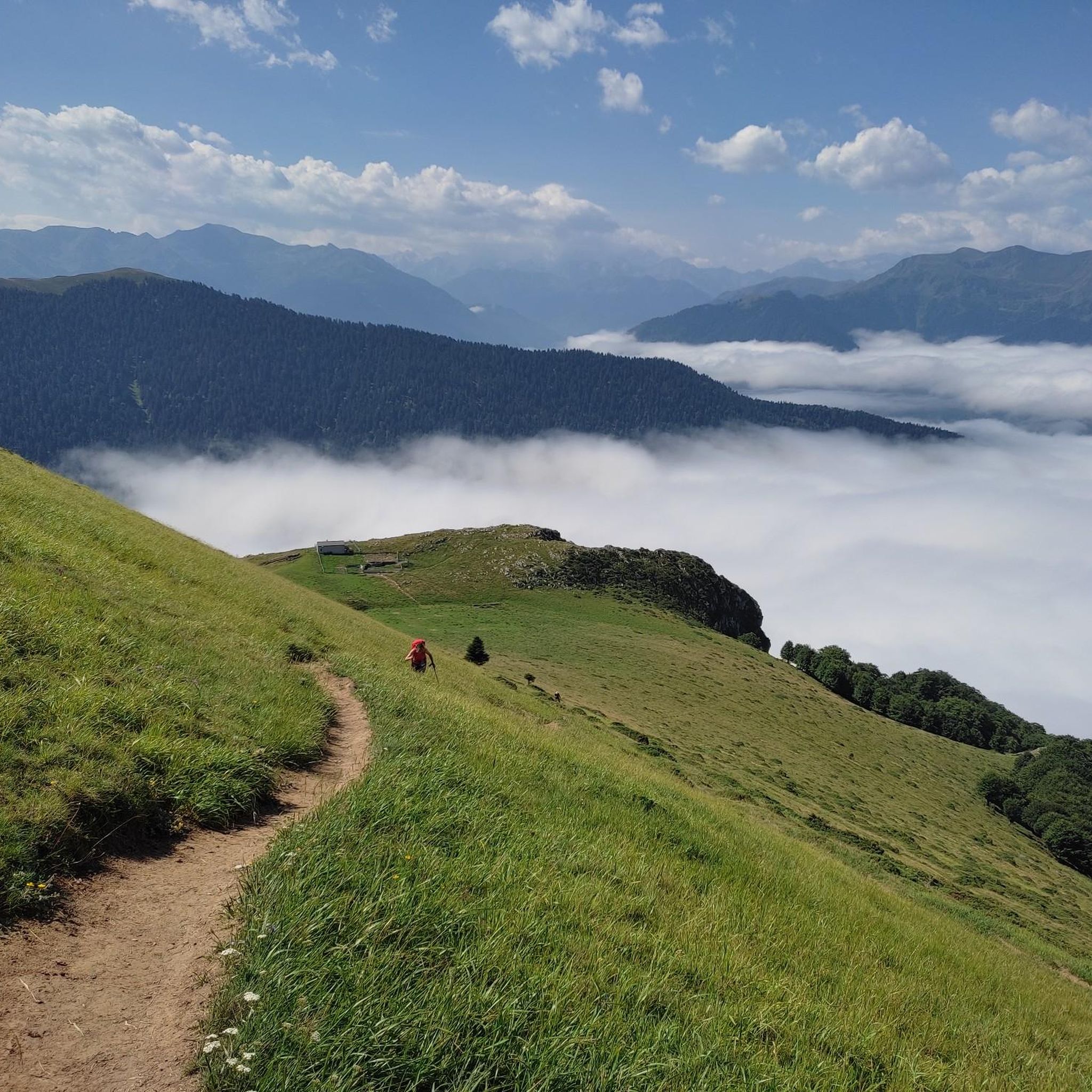
Jogging around Argut-Dessous provides access to varied terrain within the Pyrenees, characterized by an elevation range from 513 to 1090 meters. The region features challenging mountain passes like the Col de Menté and the panoramic Col des Ares, alongside prominent peaks such as Pic du Gar and Pic de Cagire. Runners can also explore gentler routes through the picturesque Garonne valley and shaded beech forests.
Best jogging routes around Argut-Dessous
- The most popular jogging route is View of the Cagire…
Last updated: July 4, 2026
54
runners
27.0km
04:57
1,750m
1,750m
Hard run. Very good fitness required. Sure-footedness, sturdy shoes and alpine experience required.
5.0
(1)
31
runners
11.4km
01:53
640m
650m
Hard run. Very good fitness required. Sure-footedness, sturdy shoes and alpine experience required.

Sign up for free
9
runners
8.30km
01:29
580m
580m
Hard run. Very good fitness required. Sure-footedness, sturdy shoes and alpine experience required.
7
runners
8.47km
01:16
380m
370m
Hard run. Very good fitness required. Mostly paved surfaces. Suitable for all skill levels.
8
runners
5.03km
00:34
40m
40m
Moderate run. Good fitness required. Mostly paved surfaces. Suitable for all skill levels.
Get access to more routes and recommendations from other explorers.
Sign up for free
Already have an account?
Our route recommendations are based on thousands of hikes, rides, and runs completed by other people on komoot.
Start today with a free account
Your next adventure awaits.
Login or Signup



Tips from the Community

A very beautiful summit just before the Pic du Cagire. It offers a very beautiful view of many peaks: Pic de Midi de Bigorre, Aneto, etc. You can also see the Boutx ski resort!
0
0

Also, stop at the Là Soulan hostel for a well-deserved break. Very warm welcome. 👍
0
0
Very beautiful peak! Magnificent view of the Aneto massif! I recommend it!
0
0

I would like to make hikers aware that this route can become particularly dangerous in winter, particularly because of the ridge towards the Pas de l'Ane which can become covered in ice. In this case, ice axes and mountaineering crampons are essential. 2 people died at this location on 1/1/2025, which triggered access bans. I have taken steps to have these bans lifted while raising awareness in a constructive way. Take the time to find out about the snow conditions before undertaking this hike. Enjoy your walks!
9
1

Crossroads for the Cagire and the Pic d'Escalette
0
0

One of the mythical Pyrenean ports of the Tour de France, known largely for the tragic fall of Luis Ocaña in the 1971 Tour when he was leading the general classification. Its 2 aspects have a lot of crumbs: - west slope that starts from Saint Béat: it is the hardest. It is 9.7 km with an average slope of 8.7%. It is a very constant climb, with a small break when passing through Boux. The first part is a little harder and uglier since you barely have any views and you go up through the middle of a valley. The final part is spectacular with its many horseshoe curves, good panoramic views and the monument to the place where Luis Ocaña fell. - east slope: it is longer, with an initial section of 7 km very winding with a slope of 4%. It also has a break in its intermediate zone. Once the hard part starts, it is also very constant, like the west slope, although the average slope is 7-8%. This aspect has even more twists than the previous one. For more information, consult the profile published by cylcingcols.com -- > http://www.cyclingcols.com/col/Mente
0
0

The Col de Menté connects the Garonne valley to that of the Ger, culminating at an altitude of 1,349 meters. Its ascent from the village of Saint-Béat is 9.3 kilometers long with an average of 9.13%, including some passages at more than 11%. It is also possible to climb there from the Oule bridge. The climb extends over 10.9 kilometers with an average of 6.6%.
3
0

The Col de Caude, accessible from Boutx or Bezins, offers lovely views and provides access to the Pic du Gar to the west and to the Pic de l'Escalette and then to the Pic de Gagire to the east.
0
0
Frequently Asked Questions
How many running routes are available around Argut-Dessous?
There are over 60 running routes available in the Argut-Dessous area, offering a wide range of options for different preferences and fitness levels. The komoot community has explored these trails over 900 times.
What kind of terrain can I expect on the jogging trails in Argut-Dessous?
The terrain around Argut-Dessous is highly varied, ranging from challenging mountain passes like the Col de Menté to more moderate inclines around the Col des Ares. You'll find paths through dense beech forests, offering shaded routes, as well as open sections with panoramic views over the Garonne valley and Pyrenean peaks. Surfaces can include rugged and rocky paths, grassy sections, and trails covered with fallen leaves.
Are there any easy or moderate running routes for beginners in Argut-Dessous?
Yes, while many routes are challenging, there are options for easier runs. For instance, the Running loop from Eup is a moderate 5 km path with minimal elevation gain. Another moderate option is the Lake Gery loop from Marignac, which is just over 6 km long and relatively flat. Overall, there are 3 easy and 13 moderate routes available.
What do other runners enjoy most about the trails in Argut-Dessous?
The running routes in Argut-Dessous are highly rated by the komoot community, with an average score of 4.7 stars from over 10 reviews. Runners frequently praise the diverse landscapes, from challenging mountain ascents to scenic valley paths, and the stunning views of the Pyrenees.
Are there any circular running routes in the Argut-Dessous area?
Yes, many of the running routes in Argut-Dessous are circular. For example, the popular Running loop from Boutx offers a challenging 8.5 km circular path through forested and open terrain. Another option is the Easy pen trick loop from Col de Menté, an 8.5 km circular trail around the mountain pass.
What are some notable landmarks or viewpoints I might encounter on a run?
The region offers several impressive landmarks and viewpoints. You could encounter the challenging Col de Menté or the panoramic Col des Ares. For stunning vistas, trails around the Gar Peak and Pic de Cagire are highly recommended. Additionally, strategically located cabins like the Saunères Hut offer breathtaking views of the Luchonnais chain.
When is the best time of year to go running in Argut-Dessous?
Argut-Dessous offers good running conditions throughout much of the year. During warmer months, the trails winding through dense beech forests provide welcome shade. Spring and autumn offer pleasant temperatures and vibrant scenery, while the challenging mountain passes can be particularly invigorating outside of heavy snow seasons.
Are there any huts or cabins along the running trails for rest stops?
Yes, the area features several strategically located huts and cabins that can serve as rest points or destinations for longer runs. The Saunères Hut is a notable example, offering stunning views. Other options include the Artigie stopover and group accommodation and the Bergerie du Col de Menté.
What is the elevation range for running in Argut-Dessous?
The elevation in the Argut-Dessous region ranges from 513 meters to 1090 meters. This significant variation means you can find routes with gentle inclines in the valleys or challenging ascents up mountain passes and peaks, catering to different levels of intensity.
Can I find routes that offer views of the prominent Pic de Cagire?
Absolutely. The View of the Cagire loop from Bezins-Garraux is a popular 24.8 km trail specifically designed to offer impressive views of the prominent Pic de Cagire.
Are there running routes that follow river valleys?
Yes, for those preferring gentler routes, the picturesque Garonne valley provides excellent options for running alongside the river. These routes often offer a more relaxed experience compared to the mountain trails.
Most popular attractions around Argut-Dessous

Get inspired with the komoot mobile app


Explore more
Browse the best Running Trails & Routes in other regions.
