
The best running trails around Harprich
4.7
(3)
413
runners
36
runs
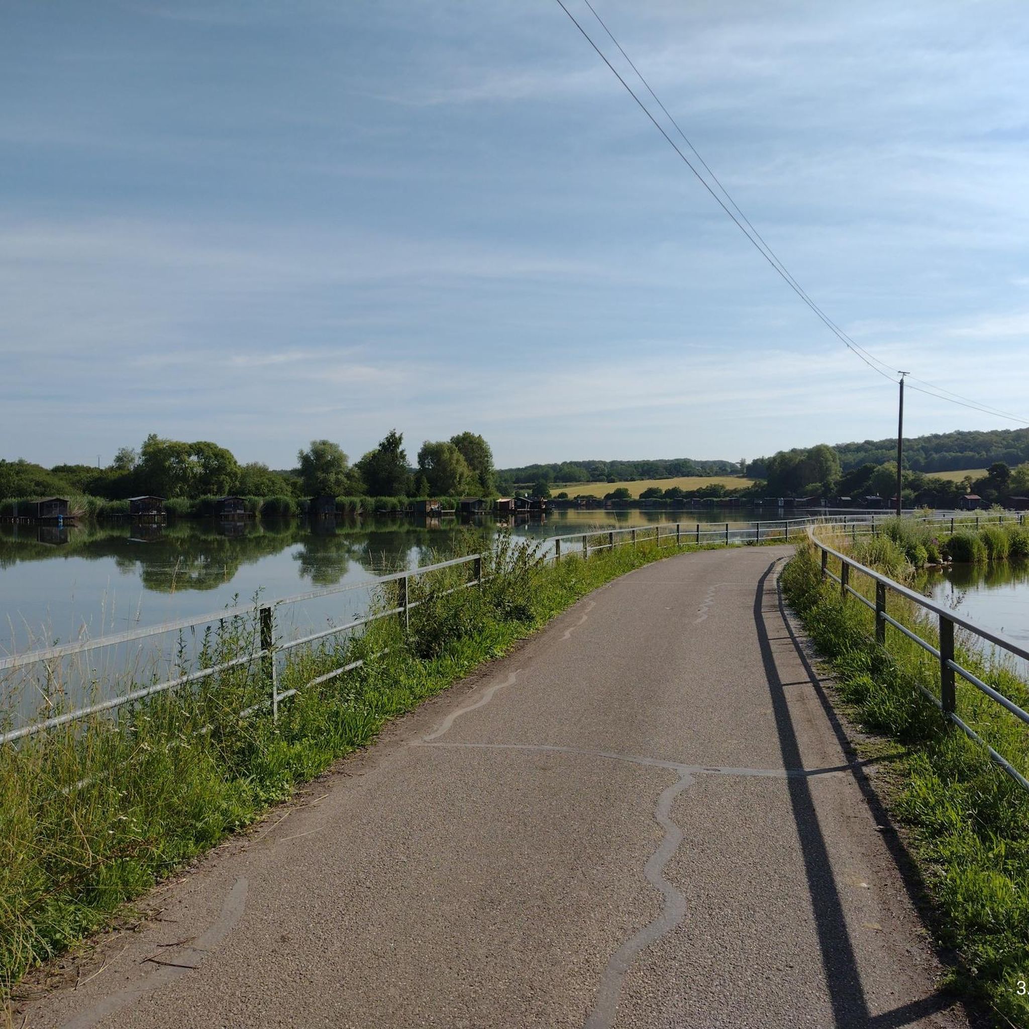
Jogging routes around Harprich, located in the Moselle department of France, offer a variety of natural settings for runners. The region is characterized by tranquil landscapes, including the expansive Étang de la Mutche and the diverse environments of the Lorraine Regional Nature Park. Jogging trails often wind along water edges, through wetlands, and into dense forests, providing varied terrain and scenic views. The area features well-maintained paths suitable for different fitness levels, with gentle elevation changes across its routes.
Best…
Last updated: July 5, 2026
71
runners
4.87km
00:33
10m
10m
Easy run. Great for any fitness level. Mostly paved surfaces. Suitable for all skill levels.
28
runners
16.5km
01:49
80m
80m
Hard run. Very good fitness required. Mostly paved surfaces. Suitable for all skill levels.

Sign up for free
4.0
(1)
48
runners
13.6km
01:32
110m
110m
Moderate run. Good fitness required. Mostly paved surfaces. Suitable for all skill levels.
12
runners
9.76km
01:06
80m
80m
Moderate run. Good fitness required. Mostly paved surfaces. Suitable for all skill levels.
7
runners
4.32km
00:27
30m
30m
Easy run. Great for any fitness level. Mostly paved surfaces. Suitable for all skill levels.
Get access to more routes and recommendations from other explorers.
Sign up for free
Already have an account?
Our route recommendations are based on thousands of hikes, rides, and runs completed by other people on komoot.
Start today with a free account
Your next adventure awaits.
Login or Signup

Frequently Asked Questions
How many running routes are available around Harprich?
Harprich offers a wide selection of running routes, with over 35 trails available for you to explore. These routes cater to various preferences, from easy loops to more challenging long-distance runs.
What kind of terrain can I expect on running trails in Harprich?
The running trails in Harprich feature varied terrain, often winding along water edges, through diverse wetlands, and into dense forests. You'll find well-maintained paths with gentle elevation changes, providing a dynamic and stimulating environment for runners.
Are there any scenic viewpoints or natural features to enjoy while running in Harprich?
Absolutely! The region is known for its tranquil landscapes, especially around the expansive Étang de la Mutche (Mutche Pond), where paths wind along the water's edge offering magnificent scenery. The nearby Lorraine Regional Nature Park also provides diverse environmental landscapes, including wetlands and forests, with open panoramas of surrounding valleys.
Can I find easy running routes suitable for beginners in Harprich?
Yes, Harprich has several easy running options. For instance, the Running loop from Harprich is an easy 3.0-mile (4.9 km) path, ideal for a quick and gentle run, potentially circling local green spaces or the tranquil Étang de la Mutche. Overall, 5 easy routes are available.
Are there longer running trails for more advanced runners in the Harprich area?
For more advanced runners seeking a challenge, Harprich offers longer routes. The Grand Bois loop from Racrange is a notable option, covering 10.2 miles (16.5 km) through extensive forest, typically completed in about 1 hour 50 minutes. There is also a difficult route available for those looking for an even greater challenge.
Are the running routes around Harprich generally circular?
Many of the running routes in Harprich are designed as loops, offering a convenient way to start and finish your run in the same location. Examples include the Grand Bois loop from Harprich and the Running loop from Harprich, which are both circular trails.
What do other runners say about the trails in Harprich?
The running routes in Harprich are highly rated by the komoot community, with an average score of 4.7 stars from numerous reviews. More than 450 runners have used komoot to explore Harprich's varied terrain, often praising the quiet woodlands and well-maintained paths.
Is Harprich a good place for family-friendly running?
Yes, Harprich can be suitable for family-friendly running, especially around the Étang de la Mutche. The 'Tour de la Mutche' is approximately 4.9 km long with tranquil lake views and winding asphalt paths, which can be enjoyable for families. The presence of picnic areas also makes it convenient for breaks.
Can I bring my dog on the running trails in Harprich?
While specific regulations for dogs on trails are not detailed, the natural environment of Harprich, particularly the extensive trail networks within the Lorraine Regional Nature Park and around Étang de la Mutche, generally welcomes responsible dog owners. It's always recommended to keep dogs on a leash and clean up after them to preserve the natural beauty for everyone.
Are there parking facilities available near the running trails?
Yes, the presence of camping facilities like Camping Capfun - Tensch Jolie and Camping Clicochic - Etang de la Mutche near the Étang de la Mutche suggests that there are likely parking options available for visitors looking to access the trails and enjoy outdoor activities in the area.
How accessible are the running routes in Harprich by public transport?
While the region is known for its natural beauty, specific public transport links directly to trailheads in Harprich are not extensively highlighted. Visitors typically access these areas by car, especially given the rural nature of the Moselle department. It's advisable to check local transport schedules if relying on public transport.
What is the best time of year to go running in Harprich?
Harprich offers a refreshing experience throughout the year. Spring and autumn provide pleasant temperatures and vibrant scenery, making them ideal for running. Summer is also enjoyable, especially on shaded woodland trails, while winter runs can be serene, offering a different perspective of the tranquil landscapes.
Are there any amenities like picnic areas or observatories along the running routes?
Yes, the area around Étang de la Mutche enhances the jogging experience with amenities. You'll find a bird observatory along the pond, allowing for a peaceful pause during your run. Strategically placed picnic areas also offer convenient spots for a post-jog cool-down or a scenic break.
Are there any specific routes that offer a mix of lakeside and woodland scenery?
The 'Autour de la Mutche et de la Claire Forêt' trail, an 8.82 km loop, is specifically mentioned as passing through communal forests of Harprich and the Mutche area. This route offers an easy yet engaging experience for runners who enjoy a blend of lakeside views and woodland scenery.

Get inspired with the komoot mobile app


Explore more
Browse the best Running Trails & Routes in other regions.
