The best mountain hikes around La Morte
4.6
(11)
105
hikers
13
hikes
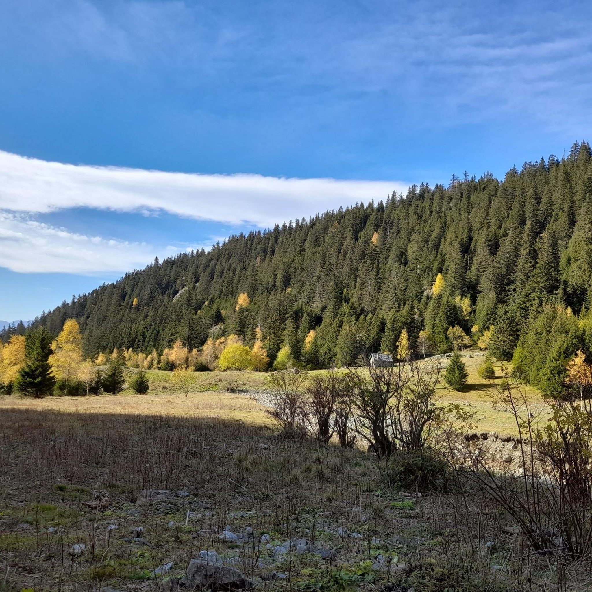
Mountaineering routes around La Morte are situated in the Isère department of the French Alps, within the Auvergne-Rhône-Alpes region. The area features elevations ranging from 3,488 to 8,704 feet (1,063 to 2,653 meters) and is part of the Taillefer massif. The landscape is characterized by forested roads, mountain pastures, and high-alpine terrain, offering challenging ascents.
Best mountaineering routes around La Morte
- The most popular mountaineering route is Via Ferrata du Grand Bec – Lac de Brouffier loop from La Morte…
Last updated: August 25, 2026
4.5
(2)
16
hikers
10.2km
05:52
850m
850m
Hard mountaineering route. Very good fitness required. Sure-footedness, sturdy shoes and alpine experience required.
14
hikers
9.18km
04:16
790m
790m
Hard mountaineering route. Good fitness required. Sure-footedness, sturdy shoes and alpine experience required.

Sign up for free
11
hikers
13.3km
06:30
1,060m
1,060m
Hard mountaineering route. Very good fitness required. Sure-footedness, sturdy shoes and alpine experience required.
4.0
(1)
11
hikers
8.99km
04:04
830m
830m
Hard mountaineering route. Good fitness required. Sure-footedness, sturdy shoes and alpine experience required.
5.0
(1)
8
hikers
11.1km
04:35
820m
820m
Hard mountaineering route. Good fitness required. Sure-footedness, sturdy shoes and alpine experience required.
Get access to more routes and recommendations from other explorers.
Sign up for free
Already have an account?
Our route recommendations are based on thousands of hikes, rides, and runs completed by other people on komoot.
Start today with a free account
Your next adventure awaits.
Login or Signup

Tips from the Community

A high-altitude lake, very quiet and rarely visited. The lake is at an altitude of 2,115 m. It offers breathtaking 360° views.
0
0

An easy pass, away from traffic, in the very heart of the Alpe du Grand Serre Station. From Séchilienne, approx. 15km for D+ 1000m. To do in summer to enjoy the freshness of this shady slope.
2
0

The Col de la Morte opens a window onto the Alpine landscapes. A Mecca for cyclists, hikers and trail runners, it is the scene of memorable climbs and outdoor adventures!
0
0
At the heart of the Oisans massif is Lake Brouffier, a high-altitude jewel in Isère. Its shimmering waters reflect the surrounding peaks.
0
0

The Col de la Morte from Sechilienne is 15.3 km long with a total drop of 1003 m. The average gradient is 6.56% with maximum gradients of 9.3%. A very nice climb to do during the summer months because the climb is mostly in the shade. When you get to the top you can go down the other side to La Mure.
3
0

Hike from the "waterfall", climb in the forest then following the return path of the via ferrata. Attention passages require to put the hands, cables.
0
0
Frequently Asked Questions
How many mountaineering routes are available around La Morte?
There are over 15 mountaineering routes available around La Morte, primarily located in the Isère department of the French Alps. These routes offer a range of challenging ascents within the Taillefer massif.
What is the typical difficulty level for mountaineering routes in La Morte?
The mountaineering routes in La Morte are predominantly challenging, with 13 out of 15 routes rated as difficult. There are also 2 routes of moderate difficulty, but none are classified as easy, indicating the area is best suited for experienced mountaineers.
What is the best time of year for mountaineering in La Morte?
The French Alps, where La Morte is situated, are generally best for mountaineering during the warmer months, typically from late spring to early autumn. This period offers more stable weather conditions and less snow at higher elevations, making routes more accessible. However, conditions can vary, so always check local forecasts before heading out.
Are there any circular mountaineering routes in La Morte?
Yes, several mountaineering routes in La Morte are circular. For example, you can explore the Via Ferrata du Grand Bec – Lac de Brouffier loop from La Morte, which offers significant elevation gain and alpine views. Another option is the Lac de Prévourey loop from La Morte, leading through the high-alpine environment of the Taillefer massif.
What kind of landscapes can I expect on these mountaineering routes?
Mountaineering routes around La Morte offer diverse landscapes characteristic of the French Alps. You'll encounter forested roads, expansive mountain pastures, and rugged high-alpine terrain within the Taillefer massif. Expect breathtaking views and challenging ascents through varied environments.
What notable landmarks or viewpoints can I discover along the routes?
The La Morte area is rich with natural landmarks. You can find impressive peaks like La Croix de Chamrousse Summit and Le Taillefer. There are also stunning viewpoints such as the Astonishing view of Mont Aiguille and a View of Chamrousse, offering panoramic vistas of the surrounding alpine scenery.
Are there any mountain passes to explore in the La Morte area?
Yes, the region around La Morte features several notable mountain passes. You can explore the Ornon Pass, Solude Pass, and Lessines Pass. The Col de Chamrousse is also a significant pass in the vicinity, offering scenic routes and challenging climbs.
How long do mountaineering routes around La Morte typically take?
The duration of mountaineering routes in La Morte varies depending on the specific trail and your pace. For instance, the Lac Charlet – L'Oreille du Loup loop from Villard-Saint-Christophe typically takes around 4 hours 15 minutes, while the Le Tabor loop from Villard-Saint-Christophe can be completed in about 4 hours 5 minutes.
What do other mountaineers say about the routes in La Morte?
The mountaineering routes in La Morte are highly regarded by the komoot community, holding an average rating of 4.7 stars from over 10 reviews. Mountaineers often praise the challenging nature of the trails and the stunning high-alpine scenery of the Taillefer massif.
Are there any specific permits required for mountaineering in the Taillefer Massif?
While general access to the Taillefer Massif for hiking is usually unrestricted, specific activities like climbing or accessing certain protected areas might require permits or adherence to local regulations. It's always advisable to check with the local tourist office or park authorities in La Morte or the Isère department for the most current information regarding permits for mountaineering activities.
Can I bring my dog on the mountaineering trails in La Morte?
Regulations regarding dogs on trails can vary, especially in mountainous and protected areas. While some trails might be dog-friendly, others, particularly those passing through nature reserves or sensitive wildlife habitats, may have restrictions or require dogs to be on a leash. It's best to check specific trail rules or contact the local tourist information for the Alpe du Grand Serre or La Morte area for detailed guidance on dog regulations.
Is public transport available to access mountaineering routes in La Morte?
La Morte is located in a mountainous region of the French Alps. While public transport options like buses might connect larger towns to the area, direct access to specific trailheads for mountaineering routes can be limited. It's recommended to research bus schedules from nearby cities like Grenoble to La Morte and consider local taxi services or carpooling for reaching more remote starting points.
Are there places to eat or stay near the mountaineering routes?
La Morte and the nearby Alpe du Grand Serre ski resort offer some options for accommodation, cafes, and pubs. These establishments cater to visitors engaging in outdoor activities, providing places to refuel and rest after a day of mountaineering. It's advisable to book accommodation in advance, especially during peak seasons.
Most popular routes around La Morte
Most popular attractions around La Morte

Get inspired with the komoot mobile app


Explore more
Browse the best Mountain Hikes & Routes in other regions.
