The best cycling routes around Allenay
4.4
(1444)
8,812
riders
174
rides
Touring cycling routes around Allenay are characterized by coastal paths, nature reserves, and low-lying areas near the Baie de Somme. The terrain largely consists of paved roads and some gravel sections, offering routes that traverse along the coastline with views of the English Channel. Minimal elevation changes are present, making the area suitable for various fitness levels. The landscape includes agricultural fields and protected natural areas.
Best touring cycling routes around Allenay
- The most popular touring cycling route is Nature…
Last updated: June 26, 2026
4.6
(9)
58
riders
Moderate bike ride. Good fitness required. Mostly paved surfaces. Suitable for all skill levels.
4.3
(11)
39
riders
Moderate bike ride. Good fitness required. Mostly paved surfaces. Suitable for all skill levels.

Sign up for free
4.0
(2)
14
riders
42.8km
02:52
320m
320m
Moderate bike ride. Good fitness required. Mostly paved surfaces. Suitable for all skill levels.
4
riders
17.3km
01:25
160m
160m
Moderate bike ride. Good fitness required. Mostly paved surfaces. Suitable for all skill levels.
2.5
(2)
10
riders
15.2km
00:56
130m
130m
Easy bike ride. Great for any fitness level. Mostly paved surfaces. Suitable for all skill levels.
Get access to more routes and recommendations from other explorers.
Sign up for free
Already have an account?
Our route recommendations are based on thousands of hikes, rides, and runs completed by other people on komoot.
Start today with a free account
Your next adventure awaits.
Login or Signup

Tips from the Community

Very worthwhile canal, recommended!
0
0


Steam train from St Valéry, allows you to return to Noyelles station to take a TER
0
0

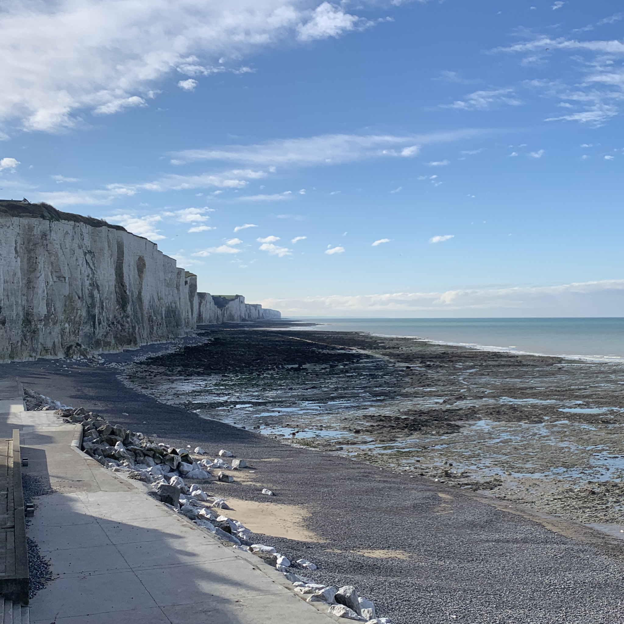
The cliffs are made of chalk and are impressive to look at.
3
0
Here in Ault begin the chalk cliffs, which stretch all the way to Normandy and repeatedly appear as enormous cliffs.
4
0

The cliffs around the beach of Ault are composed of chalk from the Upper Cretaceous, more precisely from the Turonian and Coniacian (around 83 million years ago to 90 million years ago). They are strewn with flint nodules which highlight the subhorizontal stratification planes (the formation of flint has already been discussed in Discovery of the geology of the cliffs of Étretat, presentation of an excursion from the beach of Tilleul (Antifer) to the Porte d'Amont (Étretat Nord)). The relative proportion of chalk and flint is around 90-95% chalk to 5-10% flint. Flint horizons are stratigraphic markers. On the cliffs of Ault, the regular flint band called Seven Sisters is recognizable and characterizes the boundary between the Middle Coniacian and the Upper Coniacian (around 87 million years ago). The boundary between the lower and middle Coniacian is marked by the Shoreham 2 marl level, which is more difficult to identify. These lithostratigraphic markings allow in particular the correlation of distant deposits, such as between the Normandy and Picardy coasts, or between the French and English coasts.
3
0
The cliffs around the beach of Ault are composed of chalk from the Upper Cretaceous, more precisely from the Turonian and Coniacian (around 83 million years ago to 90 million years ago). They are strewn with flint nodules which highlight the subhorizontal stratification planes (the formation of flint has already been discussed in Discovery of the geology of the cliffs of Étretat, presentation of an excursion from the beach of Tilleul (Antifer) to the Porte d'Amont (Étretat Nord)). The relative proportion of chalk and flint is around 90-95% chalk to 5-10% flint. Flint horizons are stratigraphic markers. On the cliffs of Ault, the regular flint band called Seven Sisters is recognizable and characterizes the boundary between the Middle Coniacian and the Upper Coniacian (around 87 million years ago). The boundary between the lower and middle Coniacian is marked by the Shoreham 2 marl level, which is more difficult to identify. These lithostratigraphic markings allow in particular the correlation of distant deposits, such as between the Normandy and Picardy coasts, or between the French and English coasts.
2
0

There is a lot to do in Ault, a small town on the cliffs in France.
0
0
Frequently Asked Questions
How many touring cycling routes are available around Allenay?
There are over 150 touring cycling routes available around Allenay, offering a wide range of options for different skill levels and preferences.
Are there easy touring cycling routes suitable for beginners or families in Allenay?
Yes, Allenay offers a good selection of easy touring cycling routes. For instance, the Nature reserve coastal trail — loop from Onival is an easy 14.5-mile (23.4 km) route that explores a coastal nature reserve with minimal elevation changes, making it ideal for a relaxed ride.
What are the typical distances of touring cycling routes in Allenay?
The routes vary in length, but many popular touring cycling routes range from approximately 14 miles (23 km) to over 30 miles (48 km). For example, the Architecture balnéaire – Cliffs loop from Ault is a moderate 21.3-mile (34.2 km) path, while the Port of Saint-Valery-sur-Somme – Saint-Valery-sur-Somme Lock loop from Woignarue extends to about 30.6 miles (49.2 km).
Are there challenging touring cycling routes for experienced riders in Allenay?
While the terrain around Allenay is generally low-lying, there are routes classified as moderate or difficult for those seeking more of a challenge. These routes might feature longer distances or more varied terrain, though significant elevation changes are uncommon due to the coastal nature of the region. There are 28 difficult routes available.
What is the best time of year for touring cycling in Allenay?
The best time for touring cycling in Allenay is typically from spring through early autumn (April to October). During these months, the weather is generally milder and more stable, making for pleasant rides along the coast and through nature reserves. The coastal paths can be exposed, so checking the wind forecast is always a good idea.
Are there circular touring cycling routes available in Allenay?
Yes, many touring cycling routes in Allenay are designed as loops, allowing you to start and end at the same point. Examples include the Blockhaus du Hourdel – Cap Hourdel Lighthouse loop from Woignarue and the Cayeux-sur-Mer Church – Segment Gravel Hautebut loop from Friville-Escarbotin.
What can I see along the touring cycling routes in Allenay?
The routes often feature stunning coastal views of the English Channel, nature reserves, and charming seaside architecture. You can encounter natural landmarks like the Ault Chalk Cliffs and La Cise Cliff, or explore historical sites such as the Belle Époque houses of Mers-les-Bains.
Is parking available near the touring cycling routes in Allenay?
Yes, parking is generally available in the towns and villages that serve as starting points for many routes, such as Ault, Onival, Woignarue, and Friville-Escarbotin. Look for designated public parking areas, especially near popular coastal access points or town centers.
Can I reach touring cycling routes in Allenay by public transport?
While direct public transport to every trailhead might be limited, some larger towns in the Baie de Somme region are accessible by train or bus. From these points, you might be able to cycle to nearby route starting points. It's advisable to check local transport schedules and bicycle carriage policies in advance.
What do other touring cyclists enjoy the most about touring cycling in Allenay?
The touring cycling routes around Allenay are highly rated by the komoot community, with an average score of 4.4 stars from over 1100 reviews. Cyclists often praise the scenic coastal paths, the tranquility of the nature reserves, and the relatively flat terrain that makes for enjoyable rides with views of the English Channel.
Are there places to stop for refreshments along the touring cycling routes?
Yes, the routes often pass through or near coastal towns and villages where you can find cafes, restaurants, and shops to refuel. Places like Ault, Mers-les-Bains, and Saint-Valery-sur-Somme offer various options for a break and a bite to eat.
Most popular attractions around Allenay

Get inspired with the komoot mobile app


Explore more
Browse the best Cycling routes in other regions.
