The best running trails around Saint-Bonnet-L'Enfantier
3.6
(22)
1,321
runners
117
runs
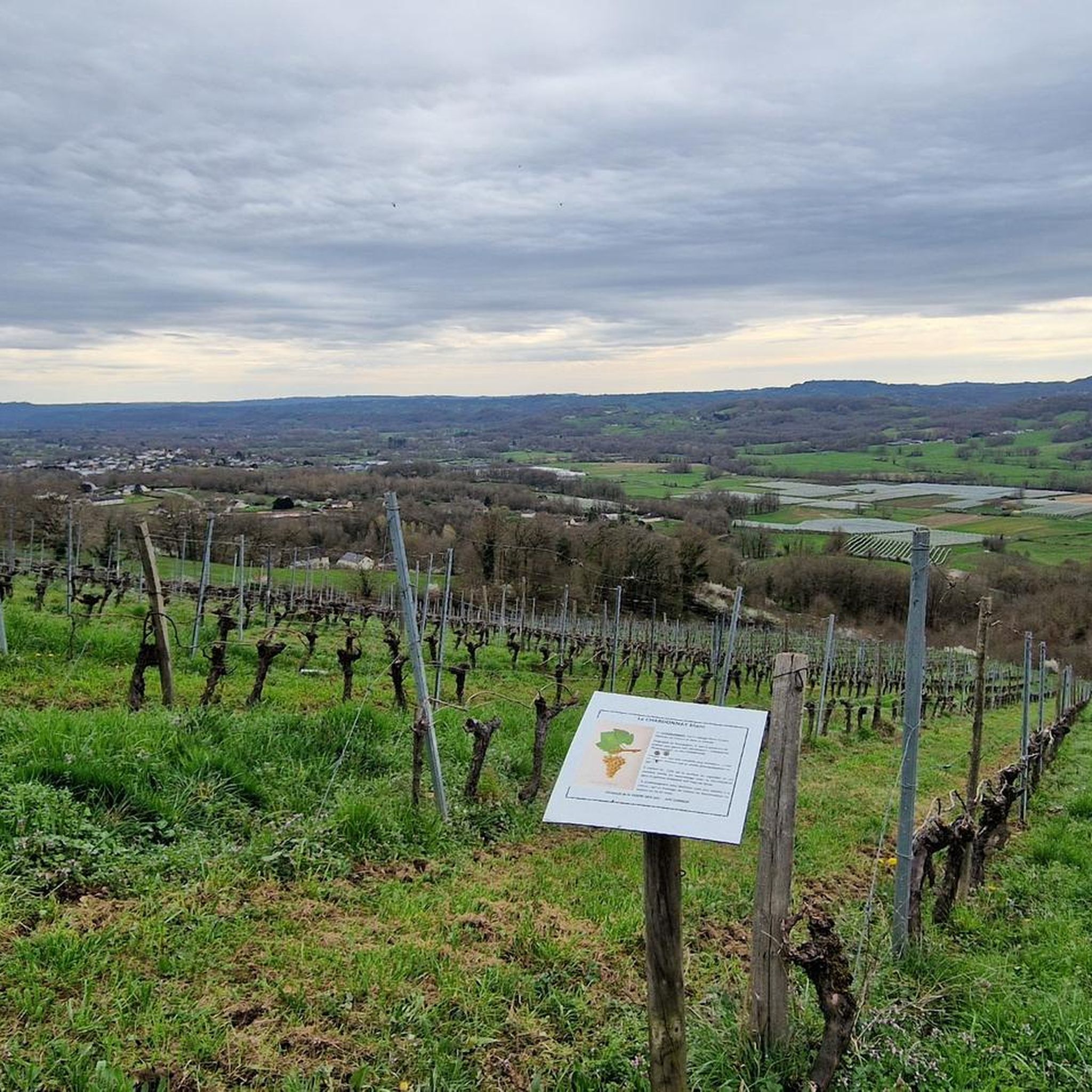
Jogging routes around Saint-Bonnet-l'Enfantier traverse a landscape characterized by low plateaus, depressions, forests, and meadows. This region in the Corrèze department offers varied terrain suitable for running. Natural springs and diverse flora and fauna are common features along the trails, providing a stimulating environment for outdoor sports.
Best jogging routes around Saint-Bonnet-l'Enfantier
- The most popular jogging route is Rocher du Chalard Viewpoint Trail, a 5.6 miles (9.1 km) trail that takes 1 hour 8 minutes to complete. This route offers panoramic views and features a waterfall.
- Another top favourite among local runners is Saillant Bridge – Saillant Bridge loop from Barrage du Saillant, a moderate 5.8 miles (9.3 km) path. This route leads through varied terrain, including forested sections and open meadows.
- Local runners also love the Running loop from Sadroc, a 3.3 miles (5.2 km) trail leading through low plateaus and open countryside, often completed in about 33 minutes.
- Jogging around Saint-Bonnet-l'Enfantier is defined by low plateaus, forests, and meadows. The network offers options for easy, moderate, and difficult running, catering to different ability levels.
- The routes in Saint-Bonnet-l'Enfantier are highly rated by the komoot community with an average score of 3.6 stars from more than 15 reviews. More than 1,200 runners have used komoot to explore Saint-Bonnet-l'Enfantier's varied terrain.
Last updated: July 13, 2026
3
runners
9.08km
01:09
250m
250m
Moderate run. Good fitness required. Mostly paved surfaces. Suitable for all skill levels.
3.0
(1)
49
runners
27.5km
03:34
870m
870m
Hard run. Very good fitness required. Sure-footedness, sturdy shoes and alpine experience required.

Sign up for free
3.0
(1)
9
runners
9.57km
01:01
110m
110m
Moderate run. Good fitness required. Mostly paved surfaces. Suitable for all skill levels.
4
runners
10.7km
01:10
210m
210m
Moderate run. Good fitness required. Mostly paved surfaces. Suitable for all skill levels.
5
runners
5.18km
00:32
50m
50m
Moderate run. Good fitness required. Mostly paved surfaces. Suitable for all skill levels.
Get access to more routes and recommendations from other explorers.
Sign up for free
Already have an account?
Our route recommendations are based on thousands of hikes, rides, and runs completed by other people on komoot.
Start today with a free account
Your next adventure awaits.
Login or Signup



Tips from the Community

From here, you can access the Saillant platform, which offers an exceptional view of the Vézère gorges. Continuing on, amidst the rocks, you will also find a bouldering course and a via ferrata.
0
0

A beautiful viewpoint on the valley of the Vezere.
1
0

Superb point of view, the area is quite demanding in terms of elevation gain
1
0
Superb point of view in height on the Dordogne! A nice hike to do
1
0
Nice little calm body of water. Perfect for a snack break during a hike!
2
0
Nice spot between the farms. With a small stream and bright flowers.
1
0
beautiful view over the gorge with the Vézère
0
0
Frequently Asked Questions
What kind of terrain can I expect on running routes around Saint-Bonnet-l'Enfantier?
The region around Saint-Bonnet-l'Enfantier features a diverse landscape ideal for running, including low plateaus, depressions, forests, and meadows. You'll find varied terrain with natural springs and diverse flora and fauna, offering a stimulating environment for outdoor sports. Routes range from easy, relatively flat paths to more challenging trails with significant elevation changes.
Are there any running routes with waterfalls or panoramic views?
Yes, the area offers scenic routes with natural attractions. For instance, the Rocher du Chalard Viewpoint Trail is a moderate 9.1 km route known for its panoramic views and a beautiful waterfall, providing both a physical challenge and scenic rewards.
How many running routes are available in the Saint-Bonnet-l'Enfantier area?
There are over 100 running routes around Saint-Bonnet-l'Enfantier, catering to various fitness levels. This includes 8 easy routes, 71 moderate routes, and 37 difficult routes, ensuring options for everyone from beginners to experienced trail runners.
Are there any family-friendly running paths suitable for beginners?
Yes, for families or beginners, there are easier options. The region includes shorter, less strenuous paths, such as a 5 km family-friendly path within the 'En passant par Comborn' nature discovery circuit. Additionally, the Running loop from Sadroc is a moderate 5.2 km trail through low plateaus and open countryside, often completed in about 33 minutes, making it a good choice for a quicker, less demanding run.
What do other runners say about the trails in Saint-Bonnet-l'Enfantier?
The running routes in Saint-Bonnet-l'Enfantier are highly rated by the komoot community, with an average score of 3.6 stars from more than 15 reviews. Over 1,200 runners have used komoot to explore the varied terrain, often praising the preserved natural environment and diverse landscapes.
Are there any longer, more challenging running circuits in the area?
For those seeking a longer challenge, the 'Tour de St Bonnet' offers a substantial circuit of 13.46 km with an elevation gain of 308 meters. This route highlights the Atlantic and Mediterranean watershed, leading runners through natural springs and unique geographical features. Another challenging option is the Balcon du Saillant – Saillant Bridge loop from Estivaux, a difficult 26.1 km route.
Can I find circular running routes around Saint-Bonnet-l'Enfantier?
Yes, many of the running routes in the area are designed as loops. For example, the 'Tour de St Bonnet' is a notable circular route, and the Saillant Bridge – Saillant Bridge loop from Barrage du Saillant is a popular moderate 9.3 km path that leads through varied terrain, including forested sections and open meadows.
Are there any historical or cultural points of interest along the running trails?
The region is part of a 'Pays d'Art et Histoire Vézère Ardoise,' offering opportunities to encounter historical elements. While running, you might pass by old stone houses in the village or explore areas with potential historical significance like dolmens on the 'En passant par Comborn' circuit. You can also find highlights such as the Château de Saillant or the Saillant Chapel and Marc Chagall Stained Glass Windows near some routes.
What is the best time of year for running in Saint-Bonnet-l'Enfantier?
The preserved natural environment of Corrèze makes it an excellent destination for outdoor sports throughout much of the year. Spring and autumn generally offer pleasant temperatures and vibrant scenery, while summer provides longer daylight hours. Winter running is possible, but conditions may vary, so checking local weather is always recommended.
Are there any specific events or organized runs in the area?
Yes, the annual 'Randonnée des omelettes' (Omelette Hike) event in Saint-Bonnet-l'Enfantier features various routes of 10, 17, and 22 kilometers. This indicates a well-maintained and extensive network of paths suitable for trail running and jogging, and participating in such an event can be a great way to explore the area. You can find more information about this event on the Brive Tourisme website: Randonnée des omelettes.
Are the running trails in Saint-Bonnet-l'Enfantier dog-friendly?
While specific regulations for each trail can vary, the Corrèze region is generally known for its natural environment, making it suitable for outdoor activities with dogs. It's always advisable to keep dogs on a leash and ensure you clean up after them to preserve the natural beauty of the trails. Always check local signage for any specific restrictions on individual paths.
Where can I find information about parking or public transport access to the trails?
Information regarding parking and public transport access often depends on the specific starting point of each trail. For detailed information on specific routes, it's best to consult local tourism resources or the komoot route details, which often include starting points and parking suggestions. For general information on natural areas in the wider region, you can visit Brive Tourisme.
Most popular routes around Saint-Bonnet-L'Enfantier
Most popular attractions around Saint-Bonnet-L'Enfantier

Get inspired with the komoot mobile app


Explore more
Browse the best Running Trails & Routes in other regions.
