The best walks and hikes around Cabariot
4.5
(114)
1,013
hikers
99
hikes
Hiking around Cabariot offers a network of trails characterized by relatively flat terrain and gentle elevation changes, making it accessible for various activity levels. The landscape features a mix of rural paths, historical architectural elements, and cultivated gardens, often near local waterways. The region's low hills and open spaces provide varied scenery for outdoor exploration.
Best hiking trails around Cabariot
- The most popular hiking route is Circuit of the Aqueducts, a 8.4 miles (13.5 km) trail that takes 3…
Last updated: July 1, 2026
5.0
(5)
27
hikers
13.5km
03:27
40m
40m
Moderate hike. Good fitness required. Easily-accessible paths. Suitable for all skill levels.
3.5
(2)
13
hikers
9.75km
02:29
30m
30m
Moderate hike. Good fitness required. Easily-accessible paths. Suitable for all skill levels.

Sign up for free
4.0
(1)
4
hikers
4.90km
01:16
30m
30m
Easy hike. Great for any fitness level. Easily-accessible paths. Suitable for all skill levels.
5.0
(1)
5
hikers
10.3km
02:36
30m
30m
Moderate hike. Good fitness required. Easily-accessible paths. Suitable for all skill levels.
5.0
(2)
5
hikers
14.8km
03:46
50m
50m
Moderate hike. Good fitness required. Easily-accessible paths. Suitable for all skill levels.
Get access to more routes and recommendations from other explorers.
Sign up for free
Already have an account?
Our route recommendations are based on thousands of hikes, rides, and runs completed by other people on komoot.
Start today with a free account
Your next adventure awaits.
Login or Signup
Tips from the Community

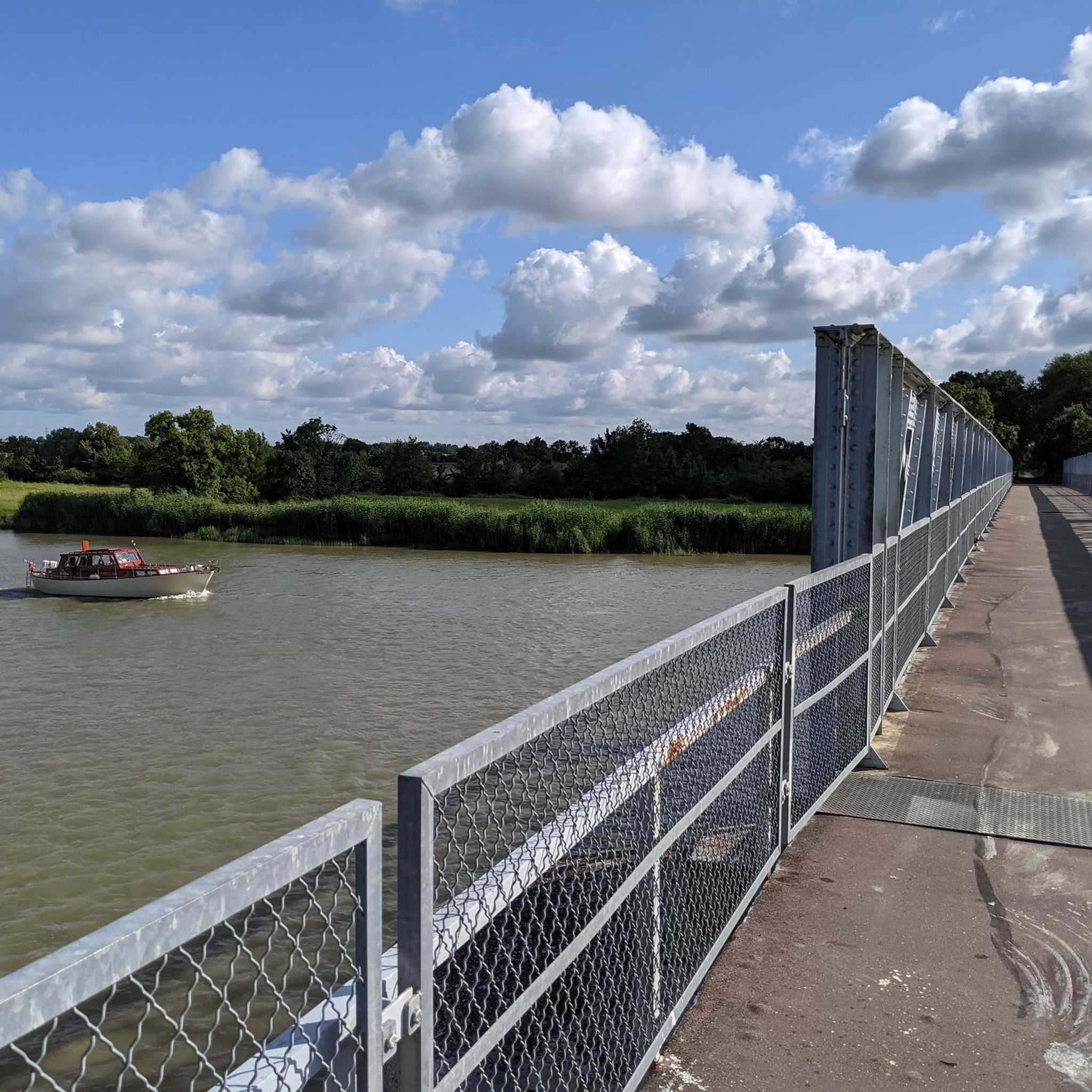
Impressive bridge. Well worth seeing!
1
0
A truly interesting bridge. It's worth a stop.
1
0

Almost obligatory passage to cross the Charente, but it’s worth the detour
0
0

Tonnay-Charente marina and view of the suspension bridge (One of the oldest suspension bridges in Europe - 1842)
0
0

It is another of the engineering jewels of the area.
0
0

Compensating for the needs of the Charentais who were formerly obliged to use the ferry to reach the other bank of the river, the bridge was built in 1842 with the constraint of not disrupting the passage of tall sailing ships to Tonnay-Charente in order to allow the port fluvial to continue its activity linked to the transport of salt, wines and spirits. With its 620 m long, it is one of the oldest suspension bridges in Europe. The deck, 204 m long and 5 m wide, is supported by 51 pointed arches and overlooks the river at a height of 23 m. Originally made of wood, it collapsed in 1884 and was replaced by a metal structure. The increase in road traffic eventually weakened the structure and it was closed to all traffic in the 1960s. After numerous rehabilitation works, it is now reopened, but reserved for pedestrians and cyclists. New restoration work is planned to begin at the end of 2023, because its structure remains fragile and its maintenance weighs heavily on the accounts of the small town of Tonnay-Charente.
0
0

Great to cycle the 3 bridges
0
0

old railway bridge with a view of the Charente see the impressive current during the rising tides
0
0
Frequently Asked Questions
How many hiking trails are available around Cabariot?
There are over 90 hiking routes in the Cabariot area, offering a variety of experiences. Approximately 55 of these are considered easy, while 37 are moderate, ensuring options for different fitness levels.
What kind of terrain can I expect on hikes in Cabariot?
Hiking around Cabariot is characterized by relatively flat terrain and gentle elevation changes. You'll find a mix of rural paths, historical architectural elements, cultivated gardens, and routes often near local waterways. The region's low hills and open spaces provide varied scenery.
Are there easy hikes suitable for beginners or families in Cabariot?
Yes, Cabariot offers many easy routes perfect for beginners or families. For example, the Art Nouveau" style house loop from Tonnay-Charente is an easy 4.9 km (3.0 miles) trail that takes about 1 hour 16 minutes to complete, showcasing distinctive architecture.
What are some interesting landmarks or attractions to see while hiking in Cabariot?
The region around Cabariot is rich in historical and architectural sights. You might encounter the impressive Rochefort Transporter Bridge or the Tonnay-Charente Suspension Bridge. Other notable points of interest include the Arsenal entrance and the Royal Ropeworks, offering glimpses into the area's heritage.
Are there any circular hiking routes in Cabariot?
Many routes in Cabariot are designed as loops, allowing you to start and end in the same location. An example is the Hiking loop from La Vallée, a moderate 10.2 km (6.3 miles) trail.
What do other hikers say about the trails in Cabariot?
The trails in Cabariot are highly regarded by the komoot community, with an average rating of 4.6 stars from over 100 reviews. Hikers often praise the gentle paths, historical aqueducts, and charming Art Nouveau architecture, as well as the rural settings and local gardens.
Are there any longer, more challenging hikes for experienced hikers?
While most trails feature gentle elevation, some routes offer longer distances. The Circuit of the Aqueducts is a moderate 13.5 km (8.4 miles) trail that takes around 3 hours 27 minutes, featuring historical water structures and open countryside. Another option is the Gardens of Beurlay loop from La Vallée, which covers 14.7 km (9.1 miles).
Is parking available at the trailheads in Cabariot?
Parking availability varies by trailhead. Many routes, especially those starting from villages or popular attractions, will have designated parking areas. It's always recommended to check the specific route details on komoot for parking information before you go.
What is the best time of year to go hiking in Cabariot?
Cabariot's mild climate makes it suitable for hiking for much of the year. Spring and autumn offer pleasant temperatures and beautiful scenery, with fewer crowds. Summer can be warm, so early morning or late afternoon hikes are often preferred. Winter hikes are also possible, given the generally flat terrain.
Can I find hikes that explore the local architecture in Cabariot?
Yes, Cabariot is known for its distinctive architecture. The Art Nouveau" style house loop from Saint-Hippolyte is a moderate 9.7 km (6.1 miles) path specifically designed to explore the local architectural heritage and surrounding natural areas.
Are there any hikes near Cabariot that pass by water features or aqueducts?
Absolutely. The region is known for its historical water structures. The Circuit of the Aqueducts is a prime example, offering a moderate 13.5 km (8.4 miles) trail that highlights these historical elements as it winds through the countryside.
Most popular attractions around Cabariot

Get inspired with the komoot mobile app


Explore more
Browse the best Hikes in other regions.
