The best cycling routes around Antrain
4.2
(210)
1,625
riders
23
rides
Touring cycling routes around Antrain are characterized by an extensive network of greenways, often converted from old railway lines, providing smooth and safe paths. The region features diverse countryside, including hedged farmland, forests, and verdant valleys shaped by rivers like the Couesnon and Loisance. These routes offer varied terrain, from flat sections along marshes to gently rolling landscapes, making them suitable for different cycling preferences.
Best touring cycling routes around Antrain
- The most popular touring cycling route is Railroad line…
Last updated: July 2, 2026
4.4
(14)
88
riders
69.4km
04:57
460m
460m
Hard bike ride. Very good fitness required. Mostly paved surfaces. Suitable for all skill levels.
4.1
(8)
29
riders
28.0km
01:53
210m
210m
Moderate bike ride. Good fitness required. Mostly paved surfaces. Suitable for all skill levels.

Sign up for free
3.0
(1)
22
riders
48.0km
03:39
470m
460m
Hard bike ride. Very good fitness required. You may need to push your bike for some segments of this route.
5.0
(1)
11
riders
36.2km
02:50
350m
340m
Hard bike ride. Good fitness required. You may need to push your bike for some segments of this route.
8
riders
43.3km
03:27
300m
300m
Hard bike ride. Good fitness required. You may need to push your bike for some segments of this route.
Get access to more routes and recommendations from other explorers.
Sign up for free
Already have an account?
Our route recommendations are based on thousands of hikes, rides, and runs completed by other people on komoot.
Start today with a free account
Your next adventure awaits.
Login or Signup




Other adventures around Antrain

Tips from the Community

The Notre-Dame de Chauvigné church is a pretty rural church in the heart of the village. Recognizable by its simple and typically Breton architecture, it is a calm place, ideal for a break, with a welcoming little village around it.
0
0
Antrain is a charming Breton village nestled between the Couesnon and Loysance rivers. The area is popular with hikers for its natural setting of hedged fields and marshes. Visitors can discover a remarkable heritage, including the Church of Saint-André and the Château de Bonnefontaine, as well as pretty old streets.
0
0

The cadastral records of the Château Fort de Fougères mention two towers—the Tour Raoul and the Tour Surienne (also called "tour de Surienne")—dated between 1480 and 1485. The tower was part of the fortifications that were reinforced or rebuilt in the 15th century.
1
0

The renowned landscape painter and avant-garde colorist Emmanuel de la Villéon, who associated with the greatest independent painters of his time, experimented with different styles and brushstrokes. This collection of oil, pastel, gouache, charcoal, and ink paintings traces his career through selected works. The museum is usually open during school holidays in Zone B. The museum is currently closed due to leaks!
1
0

The Tour Surienne was named after Françoise de Surienne. In March 1449, in the midst of a truce between France and England, François de Surienne, a Spanish mercenary in the pay of the English, attacked in the dead of night with his 600 men. The inhabitants were slaughtered and the city plundered. In 1450, Surienne settled there and entrenched himself. Only after a two-month siege by Francis I, Duke of Brittany, who was aided by a plague epidemic, did Surienne surrender.
0
0

The largest fortress in Europe, the castle of Fougères stands on a rocky outcrop surrounded by marshland. The first castle of Fougères was built around the turn of the millennium to defend the north-eastern part of the border area of the Duchy of Brittany. Built at the crossroads of important trade routes, this primitive fortress had the main objective of monitoring the powerful neighbors and preventing their raids on Breton lands. To the north, Normandy belonged to the kings of England at the time.
4
1
Frequently Asked Questions
How many touring cycling routes are available around Antrain?
There are over 20 touring cycling routes around Antrain, offering a variety of experiences for different skill levels. These routes are highly rated by the komoot community, with an average score of 4.2 stars from over 180 reviews.
What is the best time of year for touring cycling in Antrain?
The Brittany region, including Antrain, is generally pleasant for cycling from spring through early autumn. The weather is milder, and the natural landscapes, from hedged farmland to forests, are at their most vibrant. Many routes utilize former railway lines, offering safe and peaceful rides throughout these seasons.
Are there easy touring cycling routes suitable for beginners or families in Antrain?
Yes, Antrain is known for its 'voies vertes' (greenways), which are often converted old railway lines. These paths offer smooth, flat, and safe surfaces, making them ideal for relaxed rides and families with children. An example is the Railroad line to Pontorson – Regalante greenway loop from Antrain, which is a moderate route utilizing a greenway.
Are there any longer or more challenging touring cycling routes for experienced cyclists?
For more experienced cyclists seeking a challenge, routes like the Bois de Coquerel – L'Auge des Sabotiers loop from Antrain offer a difficult 29.7-mile (47.9 km) path traversing diverse countryside and forested areas. Another challenging option is the Notre-Dame Church of Chauvigné – Tunnel loop from Antrain.
Are there circular touring cycling routes around Antrain?
Many of the touring cycling routes around Antrain are designed as loops, allowing you to start and finish in the same location. Examples include the Railroad line to Pontorson – Regalante greenway loop from Antrain and the Tunnel – Path to the Voie Verte VD3 loop from Antrain.
What natural landscapes and attractions can I expect to see along the cycling routes?
Cycling routes around Antrain showcase diverse landscapes, including pastoral scenes, hedged farmland, forests, and verdant river valleys, particularly along the Couesnon and Loisance rivers. You can also encounter natural areas like the Marshes of La Folie and Sougéal, or explore the Forêt domaniale de Villecartier.
Are there any historical sites or villages to explore near the cycling paths?
Yes, cycling routes can lead to charming heritage villages and historical sites. For instance, the La Régalante route can take you towards Mont Saint-Michel, and the VD4 route links Antrain to notable sites like Bazouges-la-Pérouse. You might also pass by the Lavoir de la Loysance in Antrain or the Notre-Dame de Pontorson church.
Can I bring my dog on the cycling routes in Antrain?
Many greenways and rural paths in the Antrain area are generally dog-friendly, provided dogs are kept on a leash and owners clean up after them. Specific policies for routes like La Régalante or VD4 may vary, so it's always best to check local signage or specific route guidelines for any restrictions.
Are there facilities like cafes or accommodation along the cycling routes?
The Antrain area and surrounding villages offer various amenities for cyclists. Look for establishments with the 'Accueil Vélo' label, which signifies services catering specifically to cyclists, including cafes, restaurants, and accommodation options. These are often found in towns and villages along the major cycling routes.
What are the parking options for cyclists in Antrain?
Antrain and nearby towns typically offer public parking facilities where you can leave your vehicle while you cycle. Many trailheads for popular routes, especially those utilizing greenways, may also have designated parking areas. It's advisable to check specific starting points for the best parking availability.
Is it possible to use public transport with a bicycle in Antrain?
Public transport options for cyclists in the Brittany region can vary. While some regional buses may accommodate bikes, especially during off-peak hours or with dedicated bike racks, it's essential to check with local transport providers like BreizhGo for their specific policies regarding bicycles on buses or trains connecting to Antrain.
What makes the La Régalante route special for touring cyclists?
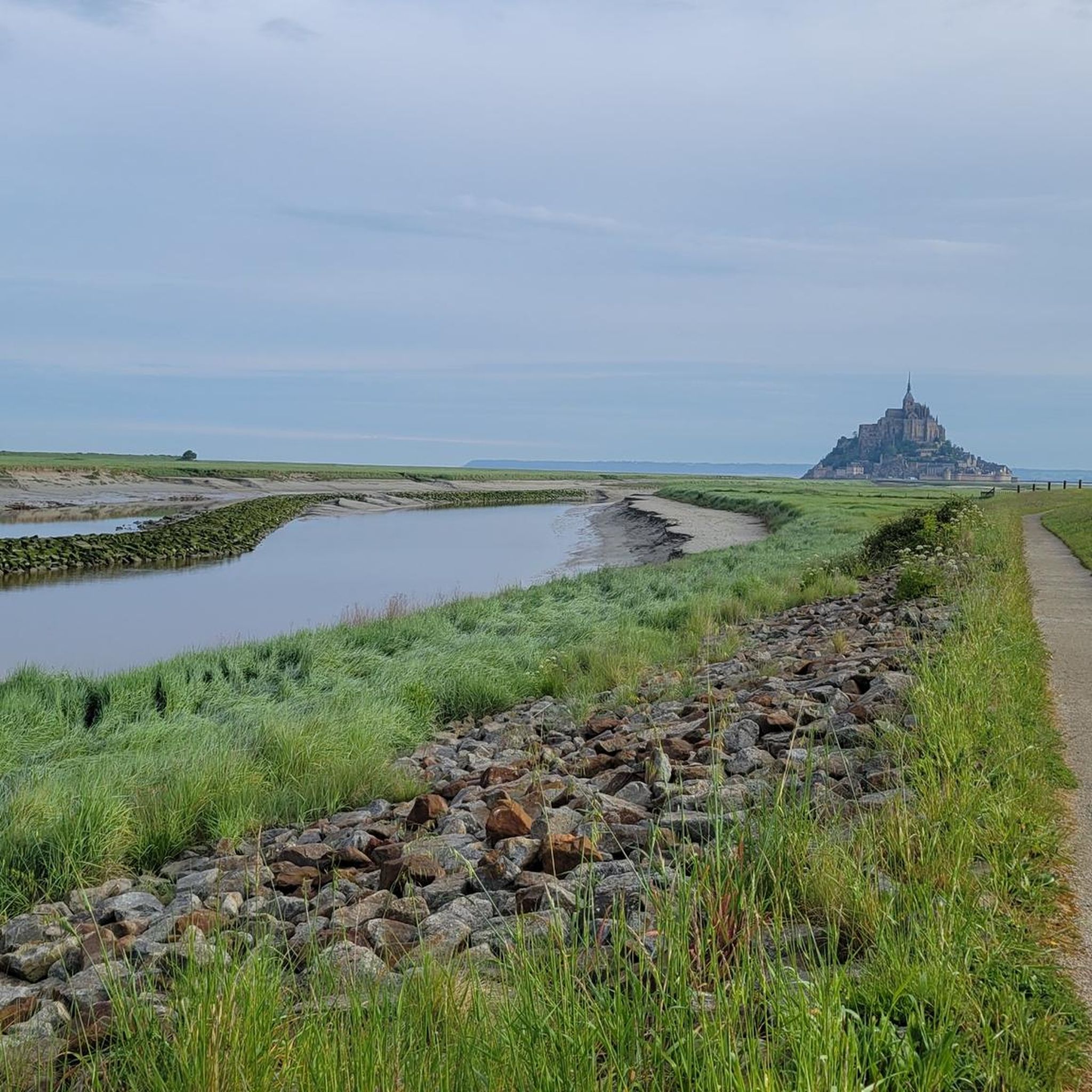
The La Régalante (V409) is a significant cycle route passing directly through Antrain. It's special because it utilizes former railway lines, offering a smooth and peaceful ride. To the north, it leads towards Mont Saint-Michel, following the Couesnon river, and to the east, it extends to Fougères, tracing the Loisance river through pastoral landscapes. The entire route is 275km between Mont Saint-Michel and Nantes.
What is the VD3 Fougères-Antrain greenway like for cycling?
The VD3 Fougères-Antrain is a 30-kilometer greenway that follows old train tracks, providing a tranquil cycling experience. It's known for its smooth surface and peaceful environment, making it suitable for a relaxed ride. This greenway can also connect to the cycle route leading towards Mont Saint-Michel.
Most popular attractions around Antrain

Get inspired with the komoot mobile app


Explore more
Browse the best Cycling routes in other regions.
