The best walks and hikes around Viré
4.6
(203)
875
hikers
119
hikes
Hiking around Viré offers diverse routes through the Bocage Virois, a region characterized by its wooded countryside, hedgerows, and rolling hills. The area is shaped by the Vire River, which meanders through the landscape, and features notable natural attractions like Dathée Lake. Numerous forests, such as Forêt de Saint-Sever, contribute to the varied terrain, providing a scenic backdrop for outdoor activities.
Best hiking trails around Viré
- The most popular hiking route is Port of Pont-de-Vaux – Fleurville lock loop from…
Last updated: June 27, 2026
5.0
(3)
8
hikers
4.25km
01:18
150m
150m
Easy hike. Great for any fitness level. Easily-accessible paths. Suitable for all skill levels.
5.0
(1)
9
hikers
19.4km
05:46
590m
590m
Hard hike. Very good fitness required. Easily-accessible paths. Suitable for all skill levels.

Sign up for free
6
hikers
10.5km
02:40
40m
40m
Moderate hike. Good fitness required. Easily-accessible paths. Suitable for all skill levels.
5.0
(2)
5
hikers
9km
02:34
190m
190m
Moderate hike. Good fitness required. Easily-accessible paths. Suitable for all skill levels.
4.5
(6)
8
hikers
5.77km
01:37
120m
120m
Easy hike. Great for any fitness level. Easily-accessible paths. Suitable for all skill levels.
Get access to more routes and recommendations from other explorers.
Sign up for free
Already have an account?
Our route recommendations are based on thousands of hikes, rides, and runs completed by other people on komoot.
Start today with a free account
Your next adventure awaits.
Login or Signup

Tips from the Community

The Église Saint-Jean-Baptiste de Burgy (Church of St. John the Baptist), a small, charming village church, is a typical Romanesque building from the 11th to 12th century. It is known for its stocky, solid construction. It has a massive square bell tower and a roof covered with traditional limestone slabs (laves). Inside, the church has a single nave. Due to its historical significance, it was officially protected as a French historical monument (Monument Historique) in 1979.
1
0
The Romanesque church originally dates from the 11th to 12th centuries. It is a classic example of the early Romanesque art of the Haut-Mâconnais region. The nave, the choir, and the distinctive square bell tower are entirely preserved in this style. Over the centuries (in the Gothic period as well as in the 19th century) there were minor architectural changes. Monument protection: The building has been classified as an official French cultural monument (Monument historique) since 1979.
1
0

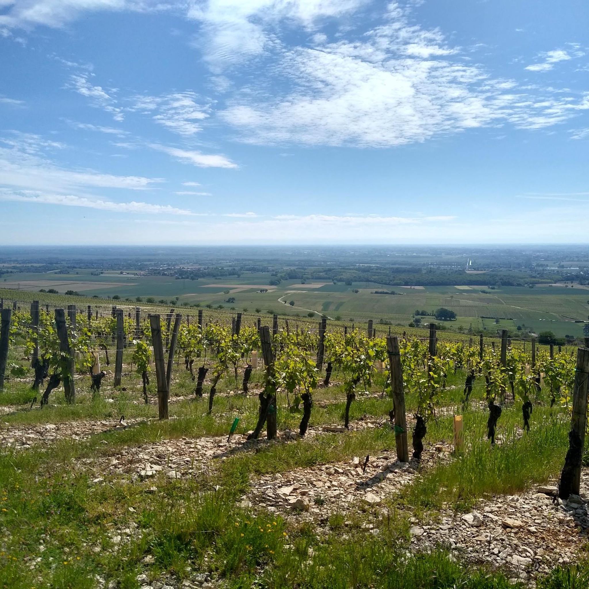
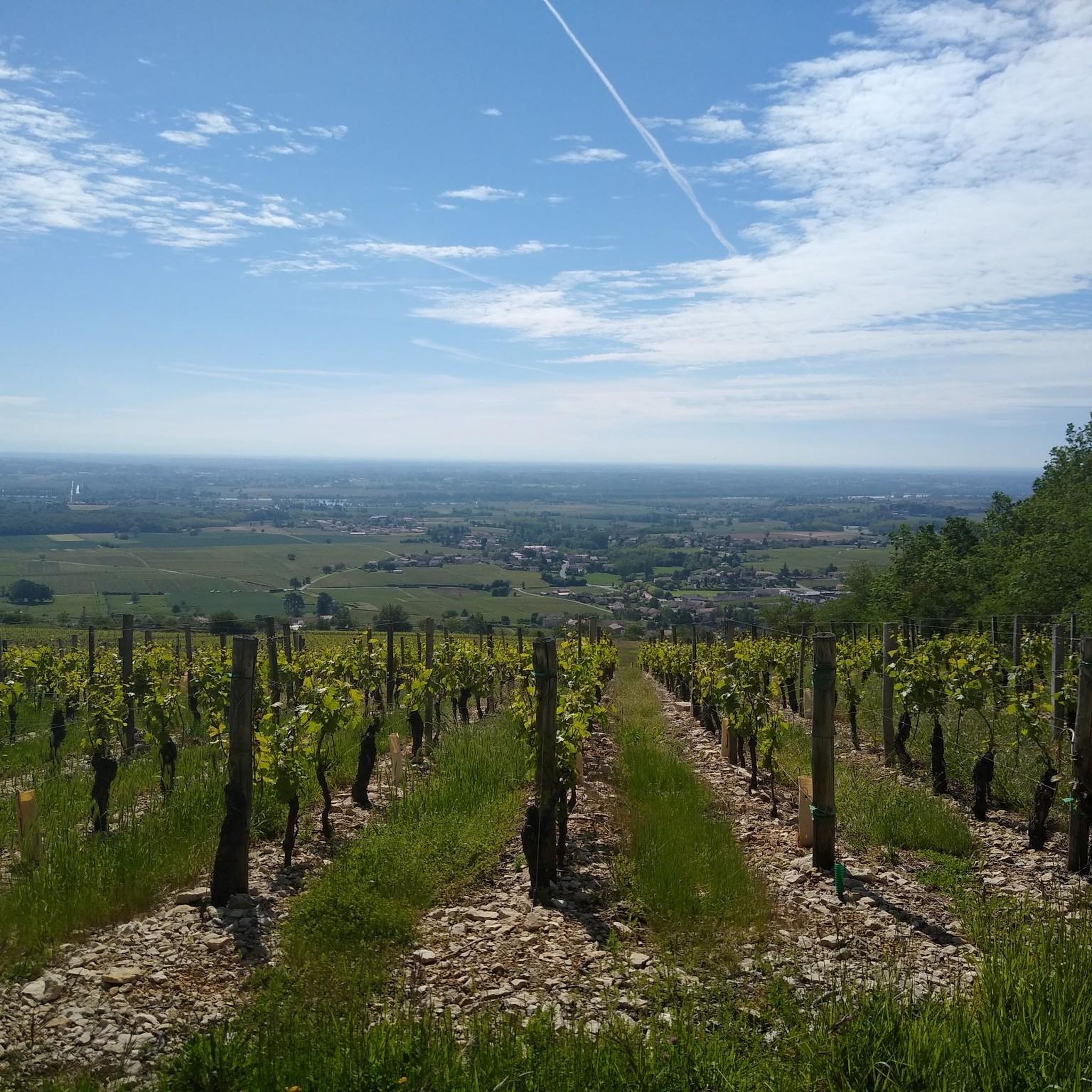
This Romanesque church is located on the heights of the commune of Burgy to which it is attached. It is said to have been built during the 12th century. Its position above the village allows it to open up pretty panoramas of the vineyards that surround it.
1
0

Nice corners for a picnic 🧺
1
0
Frequently Asked Questions
How many hiking trails are available in Viré?
There are over 100 hiking routes around Viré, offering a wide range of options for different skill levels. You'll find 35 easy trails, 62 moderate paths, and 11 more challenging routes to explore the diverse landscapes of the Bocage Virois.
What kind of landscape can I expect when hiking around Viré?
Hiking around Viré immerses you in the 'Bocage Virois,' a lush, wooded countryside characterized by small fields, hedgerows, and rolling hills. The Vire River meanders through the landscape, and you'll encounter notable natural features like Dathée Lake, as well as numerous forests such as Forêt de Saint-Sever. The scenery is dominated by verdant hues of pistachio, olive, sage, and grass green.
Are there easy hiking trails suitable for beginners or families in Viré?
Yes, Viré offers several easy hiking trails perfect for beginners or families. For instance, the Hiking loop from Viré is an easy 4.2 km path that starts directly from the town. Another accessible option is the Hiking loop from Burgy, a 5.8 km trail through the local countryside.
Can I find circular hiking routes in the Viré area?
Many trails around Viré are designed as circular routes, allowing you to start and end in the same location. The Fleurville Lake loop from Fleurville - Pont-de-Vaux is a 7.1 km easy circular hike. The Dathée Lake area also features a popular 14.0 km loop trail that explores the Dathée Valley.
What are some natural attractions or landmarks to see while hiking near Viré?
While hiking near Viré, you can discover several natural attractions. The Fleurville Lake is a beautiful spot, and the Between Tournus and Mâcon area offers scenic river views. Further afield, Mont Pinçon, the highest point in Calvados, provides panoramic views of 'Norman Switzerland' and has its own hiking trails.
Are there any trails that follow the Vire River?
Yes, the Vire River is a prominent feature of the region, and several trails follow its course. The 'Route des Gorges de la Vire' is a waymarked tourist route that showcases the attractive wooded valleys and granite cliffs along the river. While specific komoot routes are not listed, the general area offers numerous opportunities to hike alongside the river.
What is the best time of year to go hiking in Viré?
The best time to go hiking in Viré is typically during the spring, summer, and early autumn months. The mild climate of Normandy makes these seasons ideal for enjoying the lush green landscapes and diverse trails. Spring brings blooming wildflowers, while autumn offers beautiful foliage.
Are there dog-friendly hiking trails around Viré?
Many of the natural trails and paths around Viré are suitable for dogs, especially those in the Bocage Virois and forest areas. It's always recommended to keep your dog on a leash, especially near livestock or in protected natural areas, and to check local signage for any specific restrictions.
Where can I find parking for hiking trails in Viré?
Parking is generally available at trailheads or near popular starting points for hikes in and around Viré. For example, there is a designated parking area at Château de Brancion parking, which can serve as a starting point for nearby routes. Many villages and natural sites also offer public parking facilities.
What do other hikers say about the trails in Viré?
The hiking trails in Viré are highly rated by the komoot community, with an average score of 4.6 stars from over 160 reviews. Hikers often praise the quiet woodlands, the scenic river valleys, and the well-maintained paths that make exploring the Bocage Virois a pleasant experience.
Are there any longer or more challenging hikes in the region?
While many routes are easy to moderate, Viré also offers more challenging options. There are 11 difficult trails in the region. For example, the 'Au coeur de la Vallée de la Dathée' is an 18.4 km loop trail that takes about 5 hours. Additionally, the area around Mont Pinçon, the highest point in Calvados, features a moderate 5.7-mile trail with more significant elevation changes.
How long do hikes in Viré typically take?
The duration of hikes in Viré varies greatly depending on the trail's length and difficulty. Easy, shorter loops like the Hiking loop from Viré can be completed in about 1 hour 15 minutes. Longer, moderate trails, such as the Port of Pont-de-Vaux – Fleurville lock loop from Fleurville (11.9 km), typically take around 3 hours.
What are the elevation changes like on hikes around Viré?
Hikes around Viré generally feature gentle to moderate elevation changes, reflecting the rolling hills of the Bocage Virois. Many trails, especially those along the river or lake, have minimal ascent. However, some routes, particularly those venturing into the higher parts of the region or near Mont Pinçon, can include more noticeable climbs, offering varied terrain for different fitness levels.
Most popular attractions around Viré

Get inspired with the komoot mobile app


Explore more
Browse the best Hikes in other regions.
