The best running trails around Solbach
4.2
(80)
3,362
runners
221
runs
Jogging around Solbach offers varied landscapes, including notable hills and extensive forest coverage. The region is characterized by mountainous and valley topography, providing a mix of inclines and flatter stretches. Extensive natural areas like the Forests of Fouday and meadow-covered hills such as Mont Saint-Jean offer numerous routes. Solbach's location on the boundary of the Rothaine and Schirgoutte Valleys further contributes to diverse terrain for running.
Best jogging routes around Solbach
- The most popular jogging route is Le Champ du…
Last updated: October 8, 2026
15
runners
20.0km
02:34
1,000m
1,000m
Hard run. Very good fitness required. Mostly paved surfaces. Suitable for all skill levels.
106
runners
17.0km
02:13
650m
650m
Hard run. Very good fitness required. Mostly paved surfaces. Suitable for all skill levels.

9
runners
11.1km
01:23
420m
420m
Hard run. Very good fitness required. Mostly paved surfaces. Suitable for all skill levels.
14
runners
8.80km
01:01
220m
220m
Moderate run. Good fitness required. Mostly paved surfaces. Suitable for all skill levels.
3.0
(1)
4
runners
10.5km
01:17
330m
330m
Hard run. Very good fitness required. Mostly paved surfaces. Suitable for all skill levels.
Get access to more routes and recommendations from other explorers.
Already have an account?
Our route recommendations are based on thousands of hikes, rides, and runs completed by other people on komoot.
Start today with a free account
Your next adventure awaits.
Tips from the Community

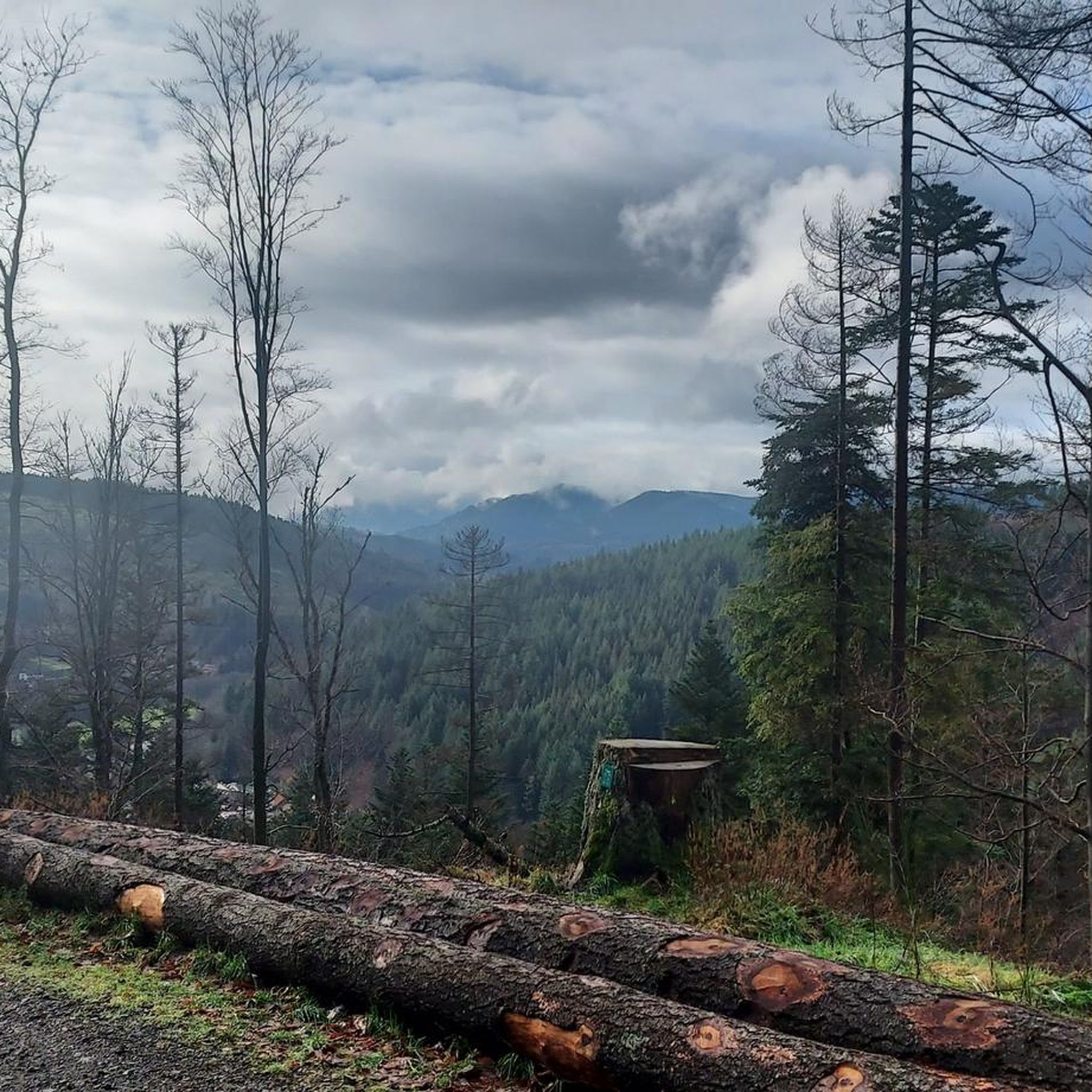
The Cascade de la Serva is located in the Vosges in Alsace, near the Champ du Feu. The stream La Serva originates there at an altitude of over 1000 m in the moor and forest areas of the high plateau. On its approximately 3 km long course, it flows through dense Vosges forest and forms the well-known Cascade de la Serva with several natural waterfall cascades, before later flowing into the Rothaine.
0
0


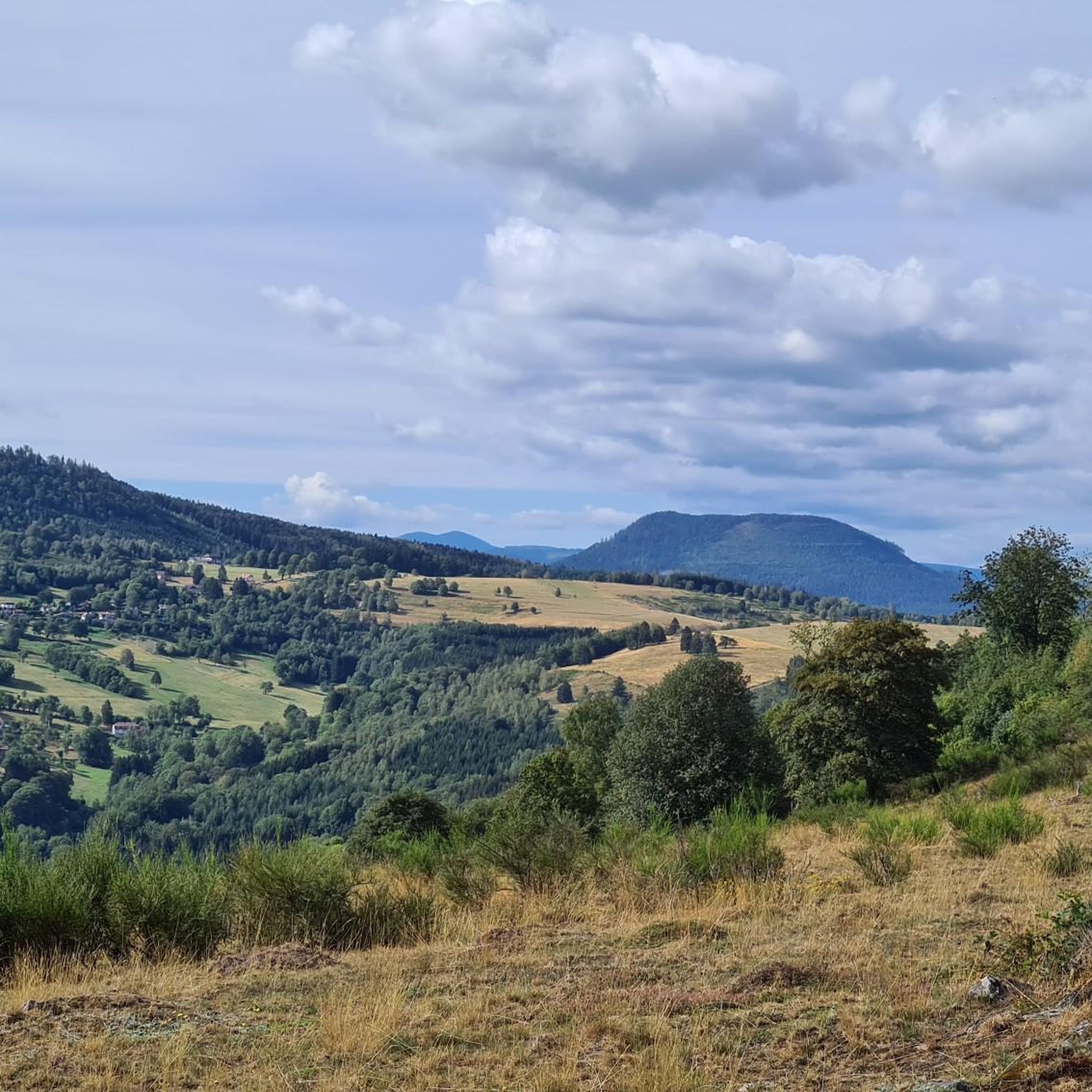
One of my favorite places in the Bruche Valley. Below the Champ du Feu, the vegetation fades to enhance the landscape. You can perfectly observe the Donon and the surrounding peaks in a hilly landscape, especially if you climb Mont Saint-Jean. The place is perfect for a picnic in summer. And for the most gourmet, the Perheux farmhouse inn is only a few meters away.
2
0

Great view of the Bruche valley including the Donon (on the other side of the river); see picture
0
0
Quite an impressive waterfall; Uphill with the MTB it is more of a pushing and carrying section
1
0
If the Champ du Feu plateau is characterized by beautiful stubble landscapes, it does not offer the typical altitude panoramas of the mountain. To get a high view, go down a few meters to the west. You will see the Bruche valley appear as if by magic. You can see other emblematic peaks of the Bas-Rhin in front of you, such as the Donon or the Mutzig rock.
1
0
Frequently Asked Questions
How many running routes are available around Solbach?
Solbach offers a wide variety of running trails, with over 190 routes documented on komoot. These routes cater to different fitness levels, ranging from easy loops to more challenging ascents through the mountainous terrain.
Are there easy jogging routes suitable for beginners in Solbach?
Yes, Solbach has several easy jogging routes. For instance, the Col de la Perheux – Col de la Perheux loop from Solbach is an easy 2.8-mile (4.5 km) trail that takes about 31 minutes to complete, offering a gentle introduction to the area's beautiful landscapes.
What kind of terrain can I expect on the running trails in Solbach?
The running trails in Solbach feature a diverse mix of terrain. You'll find mountainous and valley topography, offering both inclines and flatter stretches. The region is rich in extensive forests, such as the Forests of Fouday, and meadow-covered hills like Mont Saint-Jean, providing varied surfaces and scenic beauty for your runs.
Are there any challenging running paths for experienced runners?
Absolutely. Solbach is known for its challenging routes. A prime example is Le Champ du Feu, a difficult 12.4-mile (19.9 km) trail with significant elevation gain, typically taking over 2 hours 30 minutes to complete. Another demanding option is the Col de la Perheux – Col de la Perheux loop from Fouday, a difficult 6.8-mile (11.0 km) path with diverse terrain and elevation changes.
Can I find circular running routes in Solbach?
Yes, many of the running routes in Solbach are circular, allowing you to start and finish in the same location. The Col de la Perheux loop from Solbach is a great example, covering 10.5 km (6.5 miles) in a loop around the scenic Col de la Perheux area.
What are some scenic viewpoints or landmarks I can see while running in Solbach?
While running in Solbach, you'll encounter beautiful natural features. The routes often skirt around Mont Saint-Jean, a large meadow-covered hill offering expansive views. The area around Col de la Perheux also provides diverse terrain and scenic vistas. Additionally, the region's extensive forests, like the Forests of Fouday, offer tranquil and picturesque settings.
Is Solbach a good place for family-friendly jogging?
Solbach offers routes suitable for various abilities, including easier trails that can be enjoyed by families. The varied landscapes, with forests and meadows, provide a pleasant environment for outdoor activity. For a family outing, consider shorter, less strenuous loops to ensure everyone has an enjoyable experience.
Are the running routes in Solbach dog-friendly?
Generally, the natural trails and forest paths around Solbach are suitable for running with dogs, provided they are kept under control. It's always recommended to check local regulations for specific areas or nature reserves, but the extensive forest coverage and natural landscapes make it a popular choice for dog owners.
What do other runners say about the trails in Solbach?
The running trails in Solbach are highly regarded by the komoot community, boasting an average rating of 4.4 stars from over 50 reviews. Runners frequently praise the varied terrain, the beautiful natural scenery, and the well-maintained paths that offer options for all skill levels.
Are there places to park near the running trails in Solbach?
While specific parking information for every trailhead isn't detailed, Solbach is a commune with accessible points. Many routes, especially those linking the village to areas like Col de la Perheux, likely have designated or informal parking spots available near their starting points, particularly in or around the village itself.
Can I reach the running trails in Solbach using public transport?
Solbach is a commune in the Bas-Rhin department, and while public transport options might be limited compared to larger cities, local bus services or regional transport networks may connect to the village. It's advisable to check current schedules for public transport to Solbach from nearby towns to plan your access to the trails.
What is the best time of year to go running in Solbach?
Solbach experiences a montane climate with high precipitation, which contributes to lush vegetation and well-maintained natural environments. This makes it suitable for running for much of the year. Spring and autumn offer pleasant temperatures and vibrant scenery, while summer provides shaded forest trails. Always check local weather conditions before heading out.
Most popular attractions around Solbach

Get inspired with the komoot mobile app


Explore more
Browse the best Running Trails & Routes in other regions.
