The best MTB trails around Champcenest
5.0
(1)
8
riders
5
rides
Mountain biking around Champcenest features a landscape characterized by extensive woodlands and gently rolling terrain. The region offers a network of trails that traverse open fields and forested areas, providing varied surfaces for mountain bikers. Elevation gains are generally moderate, making for accessible routes across the countryside. The area is well-suited for exploring the rural French landscape on two wheels.
Best mountain bike trails around Champcenest
- The most popular mountain bike trail is Mountain bike trail – Aire de picnic…
Last updated: July 9, 2026
2
riders
49.0km
03:33
320m
320m
Moderate mountain bike ride. Good fitness required. Suitable for all skill levels.
5.0
(1)
2
riders
43.4km
03:04
280m
280m
Moderate mountain bike ride. Good fitness required. Advanced riding skills necessary.

Sign up for free
2
riders
30.0km
02:10
190m
190m
Moderate mountain bike ride. Good fitness required. Suitable for all skill levels.
1
riders
26.6km
01:56
130m
130m
Easy mountain bike ride. Great for any fitness level. Suitable for all skill levels.
1
riders
30.4km
01:57
120m
120m
Easy mountain bike ride. Great for any fitness level. Suitable for all skill levels.
Our route recommendations are based on thousands of hikes, rides, and runs completed by other people on komoot.
Start today with a free account
Your next adventure awaits.
Login or Signup
Popular around Champcenest


Tips from the Community


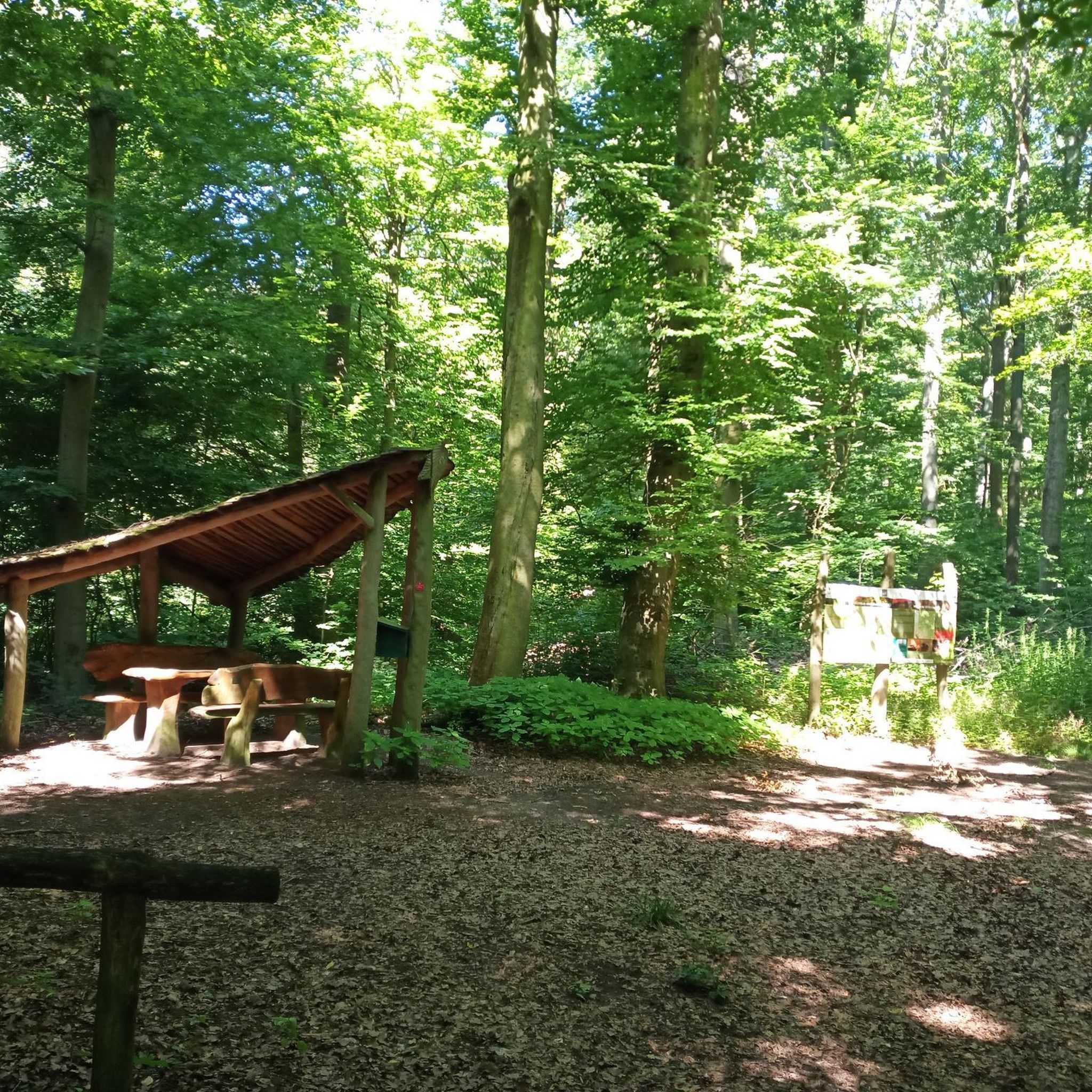
Treat yourself to a well-deserved break at the picnic area near the Montcet washhouse, on the banks of the Aubetin. With its three tables set in a calm and natural setting, this space is the ideal place to eat in complete tranquility. Enjoy the serenity of the place, between the murmur of the water and the freshness of the environment, to regain your strength before continuing on your way.
0
0
Parc des Capucins is considered one of the most beautiful parks in Île-de-France. The natural space mixes different regular and landscaped styles, all on the site of the former castle of the Duchess of Longueville, who inspired "the Princess of Clèves" to Madame de Lafayette. Built in 1613, a community of Capuchin monks settled there in 1625, taking their place in the convent complex that you see. The Notre-Dame-des-Anges church as well as the remains of the castle are classified as Historic Monuments.
0
0

Menhir of Pierrefitte 3 m high is known under the name of Saint-Aubierge gable or Saint Flodoberthe. These names testify to the Christianization of pagan sacred places during the early Middle Ages. According to the legend Saint FlodoBerthe, a nun from Faremoutiers Abbey in the 7th century decided to establish a chapel between Faremoutiers and Saintes. Not finding a stone to carry out her project, she shared her wish with her sister Sainte Aubierge, the latter brought back the menhir in her apron, the shape of which evokes a church gable, she let go of the corner of her apron and the stone stuck. in the Maillard pond in its current place.
1
0

The menhir is made up of a large sandstone slab 3.50 m high with a width at the base of 2.40 m and an average thickness of 0.50 m. It has an oblique groove approximately 2 m long by 4 cm wide on its face and obtained by staking to a depth of 1 cm. An excavation carried out at the foot of the menhir did not yield any archaeological material2. Sainte-Flodoberthe and her sister Sainte-Aubierge both built their respective chapels in Amillis and Saint-Augustin. Sainte-Flodoberthe having finished building hers wanted to offer a beautiful stone to her sister but on the way she met the latter who came to tell her that she had also completed her project. Sainte-Flodoberthe then abandoned the stone on the spot. As for the groove, it would have been made by the handle of Sainte-Flodoberthe's distaff which spun while walking with the stone under her arm2. Source: https://fr.wikipedia.org/wiki/Pierre-Fitte_(Beautheil)
0
0
This “cave” is in reality nothing natural since it is a reproduction of that of Massabielle, called the “Notre-Dame-de-Lourdes” cave in which Bernadette Soubirous says she saw her mother appear to her. Jesus. It is located south of the village on the heights of the Aubetin valley. It took place on land donated by Robert Olivier, a farmer from the town. This grotto of Our Lady of Lourdes was built in 1958, the centenary year of the apparitions of Our Lady in Lourdes. Created and built by Father Jean Fabing, parish priest of Amillis, it was built by workers from Moselle with the help of the parishioners of Amillis, Chevru and Dagny and many friends and benefactors on this land in the Bois de la Croix . Inauguration and blessing on July 13, 1958 by Monsignor Georges Romain, Vicar General. In 1962 Pope John XXIII granted the plenary indulgence to all those who helped with the construction of the building and to all those who come to make pilgrimage there. From this day on, the cave has enjoyed real local success, demonstrated by the crowds that flocked to it during the procession on August 15. Carefully maintained by the faithful of the village and surrounding areas, the Notre-Dame-de Lourdes cave is open daily to all those who wish to stop there. Pilgrimage on August 15. Source: https://www.amillis.fr/amillis/histoire/
0
0

The moats of Provins are today without water. This allows you to stroll in peace, admiring the width of the ditch and the magnitude of the ramparts that stand at your side.
0
0
The climb to the Trou au Chat is quite dreaded by the runners of the famous race of the ramparts of Provins. But where does the name of this trail come from? Several theories but no explanation that holds up 100%, so let yourself be carried away by its charm!
0
0
Frequently Asked Questions
How many mountain bike trails are available around Champcenest?
There are over 5 mountain bike trails recorded around Champcenest on komoot, offering various options for exploring the local countryside.
Are there easy mountain bike trails suitable for beginners in Champcenest?
Yes, Champcenest offers several easy mountain bike trails. For instance, the Trou au Chat Trail – Trou au Chat Trail loop from Chenoise-Cucharmoy is an easy 16.5-mile route, and the Bois de Chevru loop from Chevru is another easy option spanning 18.9 miles.
What is the typical length of mountain bike trails near Champcenest?
Mountain bike trails near Champcenest vary in length. You'll find routes ranging from approximately 16.5 miles, like the Trou au Chat Trail – Trou au Chat Trail loop from Chenoise-Cucharmoy, up to longer rides of around 30 miles, such as the Mountain bike trail – Aire de picnic + lavoir loop from Chevru.
Are there any family-friendly mountain bike trails in the Champcenest area?
The region's generally moderate elevation gains and extensive network of paths through open fields and forested areas make many trails suitable for families. Easy routes like the Bois de Chevru loop from Chevru are good choices for a family outing.
What kind of terrain can I expect on mountain bike trails in Champcenest?
The mountain bike trails around Champcenest are characterized by extensive woodlands, open fields, and gently rolling terrain. You can expect varied surfaces, including forest paths and rural tracks, with generally moderate elevation changes.
What do other mountain bikers say about the trails in Champcenest?
The mountain bike routes in Champcenest are highly rated by the komoot community, with an average score of 5.0 stars. Riders often praise the immersive experience through the local countryside and the mix of open and wooded sections.
Are there any circular mountain bike routes available?
Yes, many of the mountain bike trails in Champcenest are designed as loops. Examples include the Mountain bike trail – Aire de picnic + lavoir loop from Chevru and the Aire de picnic + lavoir loop from Choisy-en-Brie, both offering comprehensive circular rides.
What is the best time of year for mountain biking in Champcenest?
Given the region's landscape of woodlands and open fields, spring and autumn are generally ideal for mountain biking, offering pleasant temperatures and vibrant scenery. Summer can also be enjoyable, especially on shaded forest paths.
Are there any moderate difficulty mountain bike trails for more experienced riders?
Yes, for riders looking for a moderate challenge, trails like the Aire de picnic + lavoir loop from Choisy-en-Brie offer a good mix of open and wooded sections with gentle climbs over 27.8 miles. The Mountainbike loop from Dagny is another moderate option.
What kind of wildlife might I encounter on the trails?
As the trails traverse extensive woodlands and rural areas, you might encounter common forest wildlife such as various bird species, deer, and small mammals. Maintaining a respectful distance and observing quietly is recommended.
How long does it typically take to complete a mountain bike trail in Champcenest?
Completion times vary depending on the trail's length and your pace. For example, the 16.5-mile Trou au Chat Trail – Trou au Chat Trail loop from Chenoise-Cucharmoy typically takes about 1 hour 54 minutes, while longer routes like the 30.4-mile Mountain bike trail – Aire de picnic + lavoir loop from Chevru can take around 3 hours 33 minutes.

Get inspired with the komoot mobile app


Explore more
Browse the best MTB trails in other regions.
