The best walks and hikes around Sainte-Florine
4.6
(114)
685
hikers
73
hikes
Hiking around Sainte-Florine offers diverse natural environments, characterized by volcanic features, river valleys, and extensive forests. The region includes volcanic buttes and the significant Allier river valley, with its tributary, the Allagnon river. Trails often traverse varied terrain, including forests and pastures, providing access to these scenic waterways and elevated viewpoints.
Best hiking trails around Sainte-Florine
- The most popular hiking route is Lempdes-sur-Allagnon – Arrival loop from Lempdes-sur-Allagnon, a 5.9 miles (9.5 km) trail that takes 2 hours 38…
Last updated: July 13, 2026
4.8
(11)
44
hikers
9.49km
02:38
180m
180m
Moderate hike. Good fitness required. Easily-accessible paths. Suitable for all skill levels.
11
hikers
7.32km
02:01
130m
130m
Moderate hike. Good fitness required. Easily-accessible paths. Suitable for all skill levels.

Sign up for free
9
hikers
14.9km
04:18
380m
380m
Moderate hike. Good fitness required. Easily-accessible paths. Suitable for all skill levels.
4.0
(1)
5
hikers
10.5km
02:53
170m
170m
Moderate hike. Good fitness required. Easily-accessible paths. Suitable for all skill levels.
3.0
(1)
4
hikers
Moderate hike. Good fitness required. Easily-accessible paths. Suitable for all skill levels.
Get access to more routes and recommendations from other explorers.
Sign up for free
Already have an account?
Our route recommendations are based on thousands of hikes, rides, and runs completed by other people on komoot.
Start today with a free account
Your next adventure awaits.
Login or Signup



Tips from the Community

Pretty village, with a small picnic area, perfect for a lunch break
0
0

With a headframe 39 metres high, the shaft was put into service in 1924 with a depth of 680 m and a diameter of 5 m. Its operation ended in 1978.
0
0

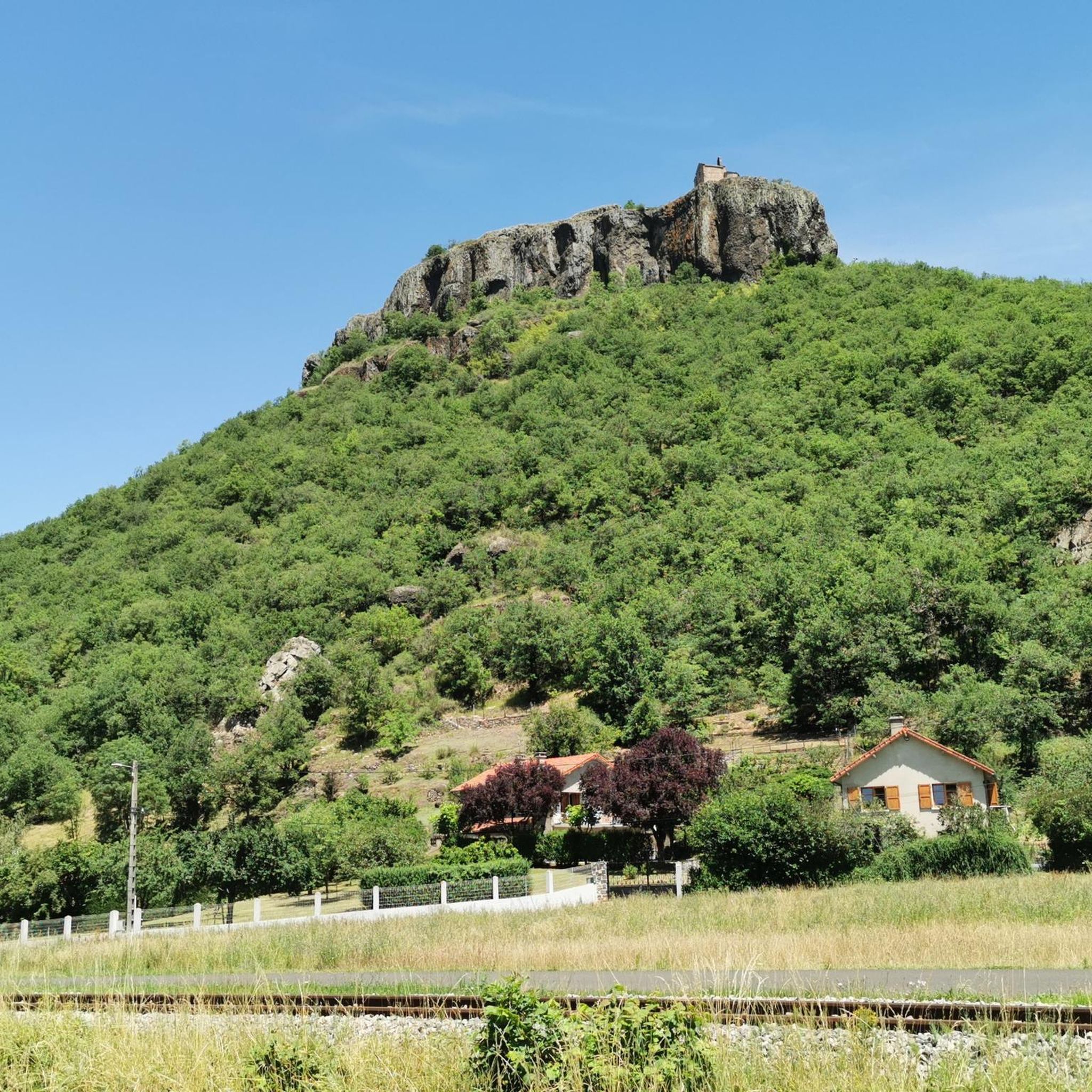
beautiful view of this fortified castle
0
0

In the northwest of Haute-Loire, Lempdes-sur-Allagnon is a welcoming stopover on the edge of the waters of Alagnon. The center of the town reveals two historic monuments with the Hall and the Saint-Giraud church.
0
0

Fantastic view over the Alagnon valley with the magnificent Château de Léotoing perched on its rocky peak on the other side.
0
0

View of the ruins of Léotoing castle, at the entrance to the Alagnon gorges. The climb to the ruins is via a small steep road.
1
0

very pretty ruin which offers a magnificent panorama of the region
0
1
Frequently Asked Questions
How many hiking trails are available around Sainte-Florine?
There are over 70 hiking trails around Sainte-Florine, offering a wide range of options for different skill levels and preferences. The area is well-equipped for outdoor enthusiasts, with routes exploring diverse natural environments.
What kind of landscapes can I expect to see while hiking near Sainte-Florine?
Hiking near Sainte-Florine offers a rich variety of landscapes. You'll encounter volcanic features, such as the butte of Nonette, scenic river valleys like the Allier and its tributary the Allagnon, and extensive forests and pastures. Many trails provide panoramic views, sometimes extending to distant landmarks like the Puys de Dôme.
Are there hiking trails suitable for beginners or families in Sainte-Florine?
Yes, Sainte-Florine offers a good selection of trails suitable for beginners and families. Approximately 23 easy routes are available, providing gentle walks through varied terrain. These trails are perfect for enjoying the natural beauty without significant challenges.
What historical or natural landmarks can I discover on hikes around Sainte-Florine?
Many hikes in the area integrate natural beauty with historical sites. You can explore the medieval village of Nonette, perched on a volcanic butte, or discover the Château Nonette. Other notable points include the View of Léotoing castle and the charming settlement of Lempdes-sur-Allagnon, often found along river valleys.
Can I find circular hiking routes in the Sainte-Florine area?
Yes, many of the hiking opportunities around Sainte-Florine are circular routes. For example, the Rocher Montfaucon loop from Jumeaux is a moderate 15.6 km trail that allows you to start and finish in the same location, exploring varied terrain and offering rewarding views.
Are there any trails that offer significant elevation changes or panoramic views?
Absolutely. The region's volcanic terrain means many trails offer rewarding elevation changes and stunning panoramic views. Hikes around volcanic buttes, such as Nonette, provide 360° vistas of the Lembro and Allier valleys. Routes like the Auzon – Collegiate Church of Auzon loop from Auzon also feature notable ascents and descents.
What do other hikers enjoy the most about hiking in Sainte-Florine?
The area is highly rated by the komoot community, with an average score of 4.6 stars. Reviewers often praise the diverse natural environments, including volcanic features and river valleys, as well as the well-maintained trails that offer a mix of forest paths and open pastures. The integration of historical sites into many routes is also frequently highlighted.
Are there any specific trails that highlight the region's mining history?
Yes, some trails around Sainte-Florine, particularly in the area near Charbonnier-les-Mines, offer glimpses into the region's mining past. These routes combine beautiful natural scenery with remnants of historical industrial activity, providing a unique hiking experience.
Is it possible to access hiking trails near Sainte-Florine using public transport?
While specific public transport links directly to trailheads can vary, Sainte-Florine itself is a town with some public transport connections. For many routes, especially those starting from smaller villages, it's advisable to check local bus schedules or consider driving to the starting points. Some routes, like those around Lempdes-sur-Allagnon, are accessible from settlements that may have transport options.
Are there good parking options available at the trailheads around Sainte-Florine?
Generally, parking is available near the starting points of many popular hiking trails in the Sainte-Florine area, especially in and around villages. It's always recommended to check specific route descriptions or local signage for designated parking areas to ensure convenience and respect for local residents.
What is the best time of year to go hiking in Sainte-Florine?
The best time to go hiking in Sainte-Florine is typically during spring, summer, and early autumn. These seasons offer pleasant weather conditions, with lush greenery in spring and summer, and vibrant foliage in autumn. Winter hiking is possible but may require appropriate gear due to colder temperatures and potential snow in higher elevations.
Are there any long-distance hiking opportunities or multi-day treks near Sainte-Florine?
While many routes around Sainte-Florine are designed for day hikes, the region's extensive network of trails and its proximity to larger natural parks mean that longer, multi-day treks can be planned by linking several routes. The diverse landscapes, including volcanic areas and river valleys, provide a rich backdrop for extended exploration.
Most popular routes around Sainte-Florine
Most popular attractions around Sainte-Florine

Get inspired with the komoot mobile app


Explore more
Browse the best Hikes in other regions.
