The best walks and hikes around Sainte-Agathe
4.6
(309)
2,037
hikers
151
hikes
Hiking around Sainte-Agathe offers diverse landscapes within the Laurentian Mountains of Quebec. The region is characterized by mountainous terrain, mixed forests of hardwood and conifers, and a network of wetlands and rivers. Lac des Sables is a prominent natural feature, contributing to the area's varied topography. This environment provides a range of hiking experiences across its protected lands.
Best hiking trails around Sainte-Agathe
- The most popular hiking route is Grün de Chignore Summit – Ayguebonne Forest loop from Montbartoux,…
Last updated: July 2, 2026
5.0
(1)
26
hikers
20.3km
06:24
800m
800m
Hard hike. Very good fitness required. Easily-accessible paths. Suitable for all skill levels.
4.5
(2)
13
hikers
7.16km
02:22
330m
330m
Moderate hike. Good fitness required. Easily-accessible paths. Suitable for all skill levels.

Sign up for free
5.0
(1)
16
hikers
9.08km
02:40
260m
260m
Moderate hike. Good fitness required. Easily-accessible paths. Suitable for all skill levels.
4.5
(4)
15
hikers
6.11km
02:14
400m
400m
Moderate hike. Good fitness required. Easily-accessible paths. Suitable for all skill levels.
7
hikers
5.48km
01:44
230m
230m
Easy hike. Great for any fitness level. Easily-accessible paths. Suitable for all skill levels.
Get access to more routes and recommendations from other explorers.
Sign up for free
Already have an account?
Our route recommendations are based on thousands of hikes, rides, and runs completed by other people on komoot.
Start today with a free account
Your next adventure awaits.
Login or Signup

Tips from the Community

LTO Tracker is a reliable tool designed to simplify how businesses monitor and manage Limited Time Offers with precision. By placing LTO Tracker (https://ltotracker.org/) at the center of your workflow, teams gain clear visibility into deadlines, offer progress, and promotional performance. This streamlined system reduces manual errors, enhances coordination, and supports quicker decision-making.
0
0

A very beautiful viewpoint; in good conditions, you can see the Alps.
0
0

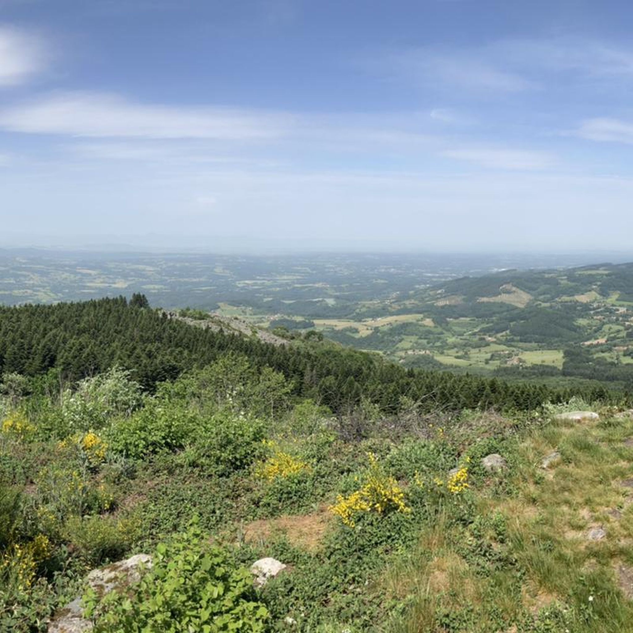
The Grün de Chignore is a summit in the Livradois-Forez nature park that culminates at 1,074 meters. Occupied since the metal age, there is a mound with remains of a wall, as well as a more recent cross, from 1902 to be exact. The view of the foothills of the Forez is superb.
1
0

Superb view - "Pierre Pamole" is a granite summit located at the northern end of the Monts du Forez, whose base is made up of magmatic and metamorphic rocks.
0
0

A great little pass with a nice view to enjoy from Vollore. Follow it up with the Col des Sagnes because the descent between the two is fantastic!
1
0

Pierre Pamole is a granite peak located at the northern end of the Forez Mountains, whose base is made up of igneous and metamorphic rocks. It is capped by several granite chaos formations. Two orientation tables provide all the information you need about the magnificent landscape that can be discovered there.
1
0

Accessible but a little technical with young children, intermediate level of difficulty.
1
0
At the end of a not very difficult ascent in the majestic forest of Ayguebonne one is rewarded by arriving at the top, the "Grün de Chignore" which culminates at 1070m, with a magnificent 360 ° view on the chain of the volcanoes of Auvergne in the distance.
0
0
Frequently Asked Questions
How many hiking trails are available in the Sainte-Agathe region?
The Sainte-Agathe region offers a wide variety of hiking experiences, with over 150 routes documented on komoot. These include 45 easy trails, 90 moderate options, and 18 more challenging routes, catering to all skill levels.
What kind of landscapes can I expect to see while hiking around Sainte-Agathe?
Hiking in Sainte-Agathe immerses you in the diverse landscapes of the Laurentian Mountains. You'll encounter picturesque mountainous terrain, extensive mixed forests with hardwood and conifers, and a network of wetlands, rivers, and lakes. Lac des Sables is a central feature, enhancing the area's natural beauty.
Are there any circular hiking routes in Sainte-Agathe?
Yes, many trails in the region are designed as loops. For example, you could explore the moderate Grün de Chignore Summit – Ayguebonne Forest loop from Montbartoux, which is about 8.2 km long, or the slightly longer Pierre Pamole loop from Tourbière relique, covering 9.1 km.
What do other hikers enjoy most about the trails in Sainte-Agathe?
The trails around Sainte-Agathe are highly rated by the komoot community, with an average score of 4.6 stars from over 270 reviews. Hikers often praise the diverse terrain, the stunning views from summits like Grün de Chignore, and the peaceful atmosphere of the Laurentian forests.
Are there any easy hiking options suitable for beginners or a relaxed walk?
Absolutely. The region offers 45 easy trails perfect for beginners or those seeking a leisurely stroll. While specific easy routes from the guide are not listed, the Sainte-Agathe-des-Monts Regional Park is known for its accessible trails, and the Petit-Lac-des-Sables Nature Reserve also provides gentle paths.
Can I find trails with significant elevation gain for a more challenging hike?
Yes, for a more strenuous experience, consider routes like the difficult Grün de Chignore Summit loop from Sainte-Agathe. This 21.3 km trail features substantial elevation changes, offering a rewarding challenge and expansive views of the surrounding Laurentian landscape.
What natural attractions or landmarks can I see near the hiking trails?
The Sainte-Agathe area is rich in natural beauty. You can discover several lakes, such as Lake Aubusson and Noirétable Lake. Notable natural monuments include Pierre Pamole and the Grün de Chignore Summit, offering impressive viewpoints. Don't miss Le Rocher de Borbes – Panoramic View and Metal Sculptures for unique vistas.
Are there any historical or cultural points of interest along the trails?
While the region is primarily known for its natural landscapes, you can find points of interest like the Sanctuary of Our Lady of the Hermitage, which offers a cultural stop amidst the natural surroundings. Additionally, the former Sainte-Agathe-des-Monts Train Station along the 'Le P'tit Train du Nord' path serves as a historical landmark.
What is the typical duration for a moderate hike in Sainte-Agathe?
Moderate hikes in Sainte-Agathe vary in length and duration. For instance, the Hiking loop from Escoutoux is about 7.2 km and typically takes around 2 hours 22 minutes, while the Ayguebonne Forest – Grün de Chignore Summit loop from Louchamp is 6.1 km and takes approximately 2 hours 14 minutes.
Is Sainte-Agathe-des-Monts Regional Park a good place to start hiking?
Yes, the Sainte-Agathe-des-Monts Regional Park is an excellent starting point. It encompasses 800 acres of protected land, offering a variety of trails for different skill levels. Access to hiking trails within the park is free for residents of Sainte-Agathe, and it's a major hub for outdoor activities.
Are there any unique experiences like treetop walks in the area?
Yes, for a unique perspective, the Laurentides Treetop Walk provides a spectacular 360-degree view of the surrounding nature. It features an impressive ascent tower and a memorable walk on a net at the top, offering a different way to experience the region's forests.
Most popular routes around Sainte-Agathe
Most popular attractions around Sainte-Agathe

Get inspired with the komoot mobile app


Explore more
Browse the best Hikes in other regions.
