The best walks and hikes around Schirrhein
4.4
(1009)
5,492
hikers
399
hikes
Hiking around Schirrhein is characterized by its flat terrain, often following the Rhine river and its associated waterways. The region features numerous ponds, natural forests, and open fields, providing a gentle landscape for outdoor activities. Elevation changes are minimal, making the area suitable for easy walks and family-friendly excursions.
Best hiking trails around Schirrhein
- The most popular hiking route is Navigation on the Rhine – The Rhine Pavilion loop from Drusenheim, a 4.9 miles (7.9 km) trail that takes…
Last updated: October 9, 2026
4.6
(17)
65
hikers
7.88km
01:59
10m
10m
Easy hike. Great for any fitness level. Easily-accessible paths. Suitable for all skill levels.
27
hikers
Easy hike. Great for any fitness level. Easily-accessible paths. Suitable for all skill levels.

5.0
(5)
19
hikers
6.67km
01:42
20m
20m
Easy hike. Great for any fitness level. Easily-accessible paths. Suitable for all skill levels.
4.4
(7)
24
hikers
16.2km
04:06
20m
20m
Moderate hike. Good fitness required. Easily-accessible paths. Suitable for all skill levels.
5.0
(1)
14
hikers
16.5km
04:09
20m
20m
Moderate hike. Good fitness required. Easily-accessible paths. Suitable for all skill levels.
Get access to more routes and recommendations from other explorers.
Already have an account?
Our route recommendations are based on thousands of hikes, rides, and runs completed by other people on komoot.
Start today with a free account
Your next adventure awaits.
Tips from the Community

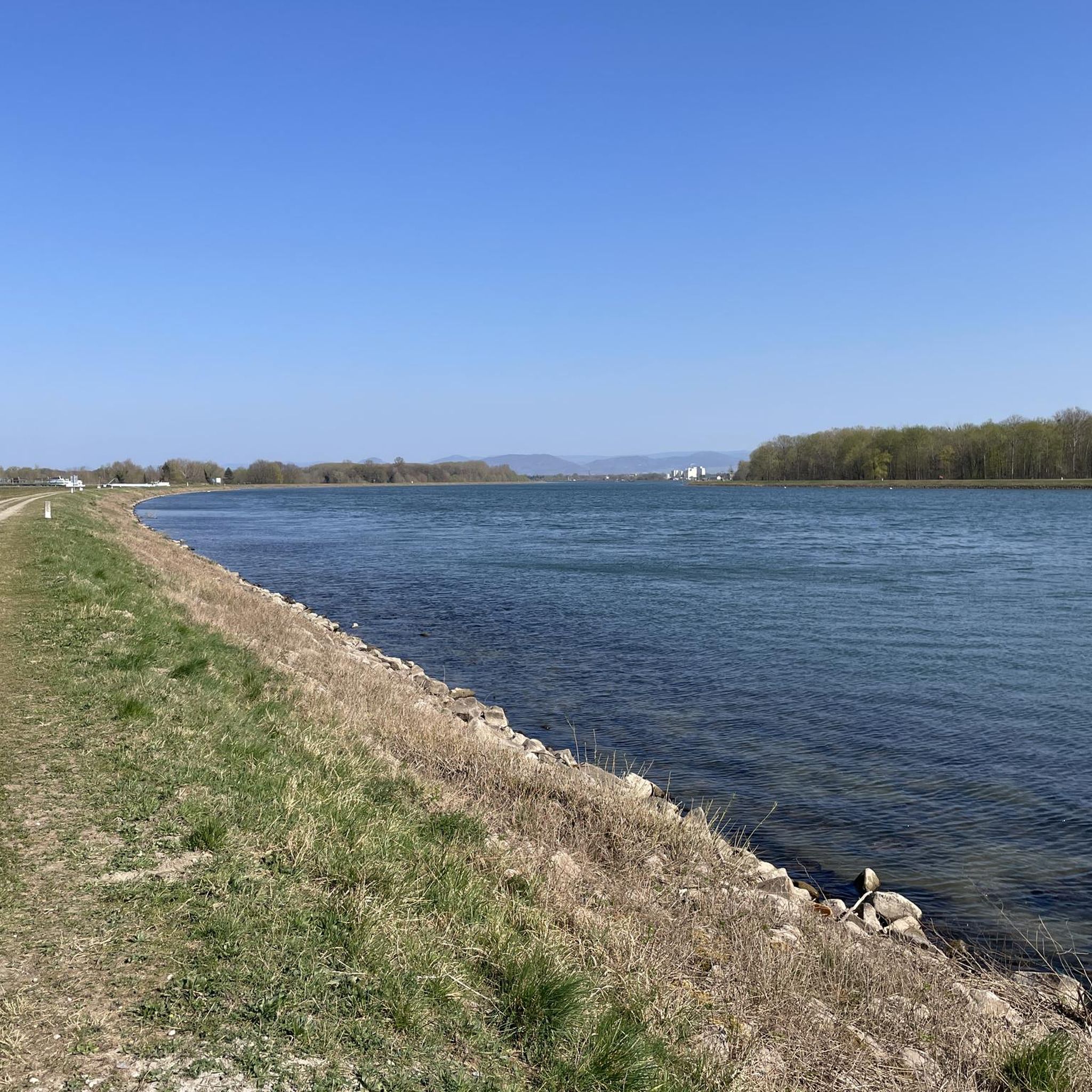
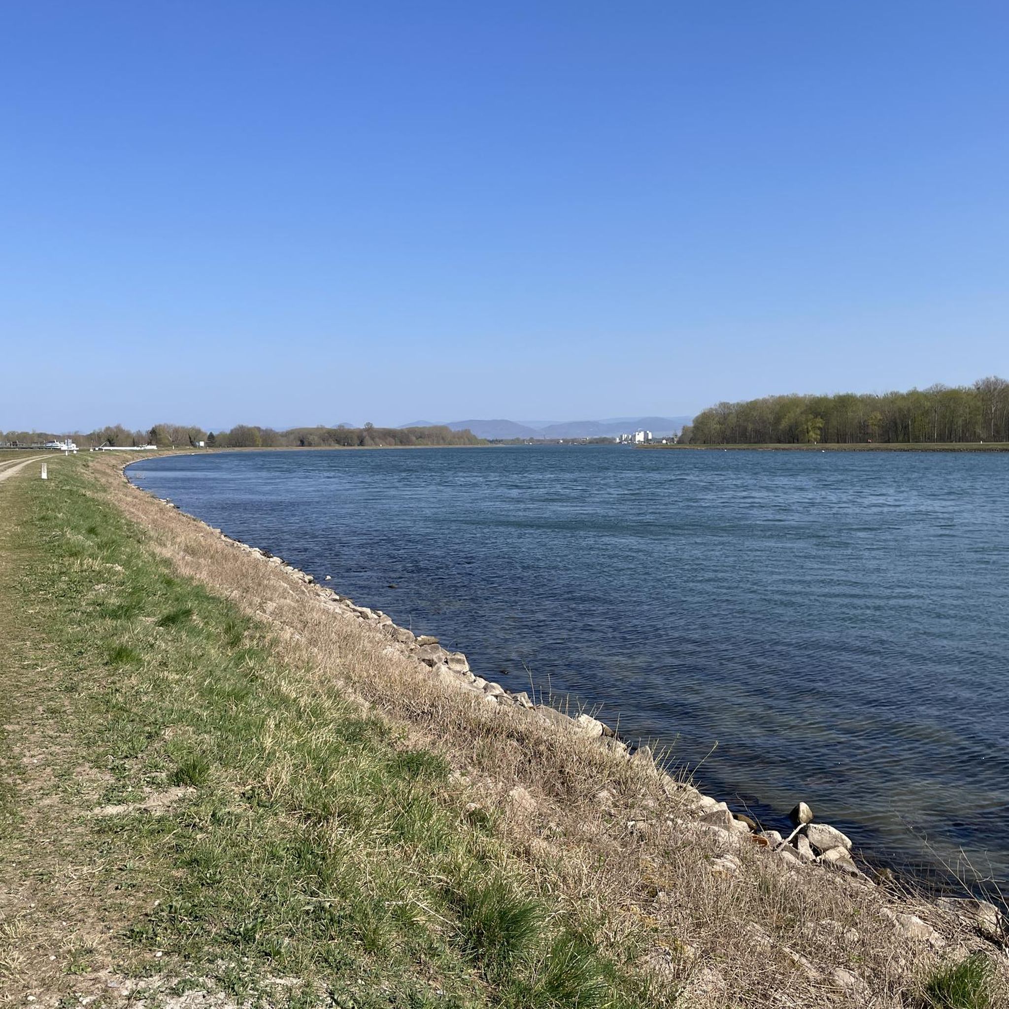
Great view of the Old Rhine from the cycle path.
0
0


very nice view of the Old Rhine
4
0

Main fort of Fort-Louis, former fortress In 1686, King Louis XIV of France ordered the construction of a fortress in Lower Alsace, directly on the border with the Margraviate of Baden. It was built over a period of ten years from 1687 on an island in the Rhine, which was not yet regulated at the time, according to plans by Sébastien Le Prestre de Vauban and the fortress engineer Jacques Tarade. The medieval palace in Haguenau, around twenty kilometers away, was razed to the ground and the usable stones were used to build the new fortress on the Rhine. Two outlying forts were built as bridgeheads on the opposite banks of the Rhine, Fort Alsace on the Alsatian side and Fort Marquisat on the Baden bank. To the south of the main fort, called Fort Carré, the regular street grid of the municipality of Fort-Louis was created on the island, and the king promoted its settlement with privileges. Fort Marquisat had to be abandoned after the Peace of Rijswijk in 1697, and finally after the Peace of Rastatt in 1714. The main fortress was stormed in 1793 in the First Coalition War and further destroyed in 1815-18. Since the Rhine was straightened in the 19th century, the fort and the municipality have been located on the left bank of the Rhine. Remains of the fortress are still there today, with information boards in front of and on the site of the former fortification.
1
0

The idyllically situated pond Hansegiessen can be reached after a short walk from the Route du Rhin, the road to the Rhine ferry Drusenheim-Greffern or from the Rhine embankment.
1
0
The 1-km fitness trail starts on the Route du Rhin and leads to L'étang Hansegiessen. In 2022, the path was renovated with new equipment.
0
0
A modern, open pavilion is located south of the car park at the Drusenheim Rhine ferry. It invites you to linger and offers shade or protection from the rain.
0
0
Frequently Asked Questions
How many hiking trails are available around Schirrhein?
There are over 370 hiking trails in the Schirrhein area, offering a wide variety of options for different preferences and skill levels.
Are there many easy hiking trails suitable for beginners in Schirrhein?
Yes, Schirrhein is known for its gentle terrain, and you'll find over 270 easy hiking trails. These routes are perfect for beginners or those looking for a relaxed walk, often following the Rhine river or winding through natural forests.
What kind of scenery can I expect on hikes around Schirrhein?
Hiking around Schirrhein offers a diverse landscape characterized by the Rhine river and its waterways, numerous tranquil ponds, natural forests, and open fields. The terrain is generally flat, providing a peaceful outdoor experience.
Are there any family-friendly hiking options in Schirrhein?
Absolutely. The flat and gentle nature of the trails around Schirrhein makes them very suitable for families. Many routes are easy and offer pleasant walks through forests and along ponds, perfect for all ages. For example, the Natural forest – L'Eberbach loop from Soufflenheim is an easy 4.1-mile path through natural forest landscapes.
Can I find circular walks in the Schirrhein area?
Yes, many routes around Schirrhein are designed as circular walks. These loops allow you to start and end at the same point, making planning easier. An example is the Hiking loop from Kaltenhouse, which is an easy 4.5-mile trail.
What do other hikers enjoy most about hiking in Schirrhein?
The hiking trails in Schirrhein are highly rated by the komoot community, with an average score of 4.4 stars from over 800 reviews. Hikers often praise the tranquil riverine paths, the peaceful natural forests, and the serene ponds that define the region's routes.
Are there any specific attractions or landmarks I can see while hiking near Schirrhein?
Yes, the area offers several interesting points. You might encounter the Greffern Marina, explore the peaceful Ameisensee or Riedsee Lichtenauer Rheinniederung lakes, or even see the Bac Drusus Ferry crossing the Rhine.
Are there longer hiking trails available for more experienced hikers?
While many trails are easy, there are also moderate options for those seeking a longer challenge. For instance, the Hansegiessen Pond loop from Drusenheim is a moderate 6.9-mile (11.1 km) route that takes about 3 hours to complete.
What is the best time of year to hike around Schirrhein?
The gentle terrain and diverse landscapes make Schirrhein enjoyable for hiking throughout much of the year. Spring and autumn offer pleasant temperatures and beautiful scenery, while summer is ideal for walks along the Rhine and around the ponds. Even in winter, many of the flat trails remain accessible for a refreshing walk.
Are there any cafes or places to stop for refreshments near the hiking trails?
Yes, you can find spots for refreshments. For example, the Hanfseeblick Snack Bar is located near some of the lake trails, offering a convenient stop during your hike.
Are there any trails that offer views of the Rhine river?
Many trails in the Schirrhein area follow the Rhine river, providing scenic views of the waterway. The The Rhine Pavilion – Hansegiessen Pond loop from Drusenheim is a 10-mile (16.2 km) trail that leads through the Rhine Pavilion area and along Hansegiessen Pond, offering extensive riverine scenery.
Most popular attractions around Schirrhein

Get inspired with the komoot mobile app


Explore more
Browse the best Hikes in other regions.
