The best running trails around Saint-Germain-Lès-Arpajon
4.1
(7)
358
runners
17
runs
Jogging routes around Saint-Germain-Lès-Arpajon traverse a landscape characterized by river valleys, open fields, and local basins. The region offers a mix of relatively flat terrain with gentle undulations, suitable for various running paces. Paths often follow waterways like the Orge, providing a consistent and accessible environment for runners. The area's natural features include small lakes and ponds, contributing to varied running experiences.
Best jogging routes around Saint-Germain-Lès-Arpajon
- The most popular jogging route is Carouge Basin – Carouge Basin loop from…
Last updated: July 18, 2026
4.5
(4)
258
runners
11.9km
01:14
30m
30m
Moderate run. Good fitness required. Mostly paved surfaces. Suitable for all skill levels.
20
runners
7.68km
00:49
70m
70m
Moderate run. Good fitness required. Mostly paved surfaces. Suitable for all skill levels.

Sign up for free
17
runners
Hard run. Very good fitness required. Mostly paved surfaces. Suitable for all skill levels.
12
runners
6.11km
00:39
50m
50m
Moderate run. Good fitness required. Mostly paved surfaces. Suitable for all skill levels.
5
runners
Hard run. Very good fitness required. Mostly accessible paths. Some sure footedness required.
Get access to more routes and recommendations from other explorers.
Sign up for free
Already have an account?
Our route recommendations are based on thousands of hikes, rides, and runs completed by other people on komoot.
Start today with a free account
Your next adventure awaits.
Login or Signup


Tips from the Community

Late afternoon bike ride: Magnificent track and path...in dry weather.
0
0
An early morning outing to enjoy all the wildlife around these lakes.
0
0

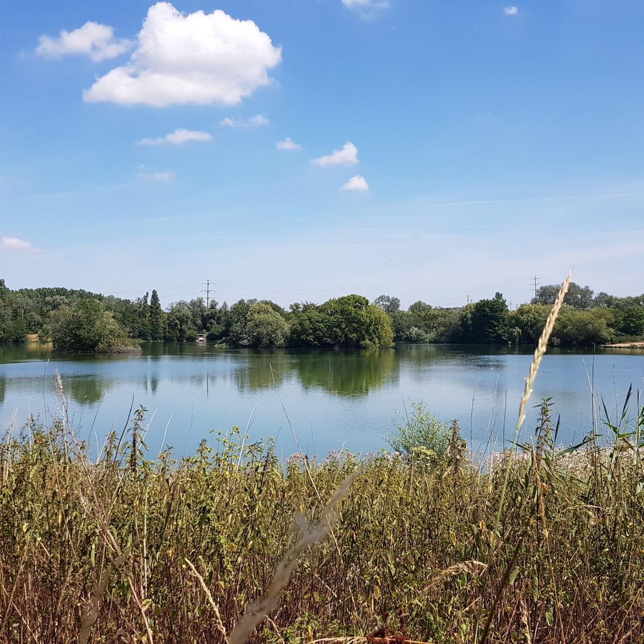
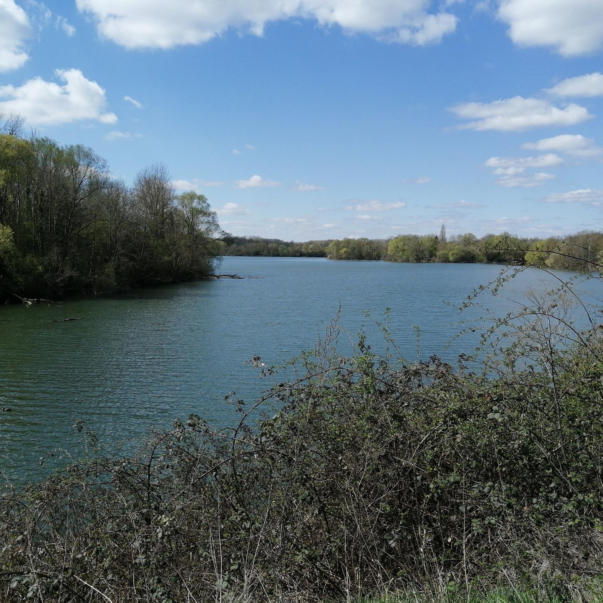
The Carouge basin is the point of convergence of the Orge, Blutin, Salmouille and Boële. The basin was dug in the 1970s to extract materials for road construction, and also to manage the floods of the Orge. Here you can see many species of birds, such as seagulls, cormorants and ringed plovers depending on the season. The path along the basin is safe and flat.
1
0
Be careful, some forest roads have been closed with barbed wire certainly by hunters, you can easily bypass these barriers. It is not a private forest but a state forest...
0
0

After having traveled about twenty kilometers along the barley starting from Morsang sur orge, this lake offered us a magnificent landscape, hidden between the trees. It was difficult to leave this place to come back home!
1
0

This mill, private property, can be seen by the gate or above the wall. It is crossed by the Rémarde. The Trévoix basin is a calm and very well-kept place offering pretty bucolic walks and allowing the observation of several avian species.
0
0
Located in a small clearing on a peninsula southwest of the Trévoix basin, this menhir dates from the Neolithic. Easy access on foot or by bicycle, it is, according to Wikipedia, made of a block of Fontainebleau sandstone, roughly triangular, about 1.90 m high, 2 m wide at the base and 0.25 thick m to 0.70 m. He is strongly inclined "from an unknown but ancient date". It would sink into the ground at least 1.5 m deep
1
0
It is one of the many Orge retention basins between Breuillet (Port Sud basin), Egly (Trévoix mill basin), Brétigny (Petit Paris and Carouge basins) and Longpont-sur-Orge (Parc de Lormoy) and beyond. These pools, very well maintained and offering exceptional flora and fauna, make it possible to make loops of more than twenty kilometers quite easily (as long as one remains in the valley). A set of exotic and relaxing pools.
1
0
Frequently Asked Questions
How many running routes are available in Saint-Germain-Lès-Arpajon?
There are over 15 running routes around Saint-Germain-Lès-Arpajon, catering to various fitness levels. You'll find options ranging from easy to difficult, with the majority being moderate.
Are there easy running routes suitable for beginners in Saint-Germain-Lès-Arpajon?
Yes, beginners can find suitable running paths. For instance, the Beginner Orge SGLA loop from Arpajon is a moderate 6.1 km route that offers a good starting point for those new to running in the area.
What kind of terrain can I expect on the running trails in Saint-Germain-Lès-Arpajon?
The running routes in Saint-Germain-Lès-Arpajon typically traverse a mix of river valleys, open fields, and local basins. You'll encounter relatively flat terrain with gentle undulations, often following waterways like the Orge, providing a consistent and accessible environment.
Are there any circular running paths in the region?
Yes, many routes in Saint-Germain-Lès-Arpajon are circular. A popular option is the Carouge Basin – Carouge Basin loop from Arpajon, which is 11.9 km long and offers scenic views of the local basin.
What are some notable natural features or landmarks I might see while running?
While running, you might encounter small lakes and ponds, which are characteristic of the region's natural features. The Lac d'Olainville – Trévoix Pond loop from Leuville-sur-Orge, for example, passes by both Lac d'Olainville and Trévoix Pond.
What do other runners enjoy most about jogging in Saint-Germain-Lès-Arpajon?
The area is highly rated by the komoot community, with an average score of 4.1 stars from over 7 reviews. Runners often praise the varied terrain, including river paths and open fields, and the options available for different ability levels.
Are there any longer, more challenging running routes for experienced runners?
Yes, for more experienced runners, there are challenging options. The Beginner Orge SGLA loop from La Norville - Saint-Germain-lès-Arpajon, despite its name, is a difficult 23.8 km route with significant elevation gain, offering a substantial workout.
What is the typical duration for running routes in Saint-Germain-Lès-Arpajon?
Running route durations vary widely. Shorter routes, like the Running loop from Arpajon (7.7 km), can be completed in under an hour, while longer, more difficult trails can take several hours.
Are there any attractions near the running trails that I could visit?
Yes, the region has several attractions. You could explore historical sites like the Château du Mesnil-Voisin or the Chamarande Castle and Park. There's also the Templars' Bridge and the impressive Sequoia Avenue at Villeroy Park.
What makes Saint-Germain-Lès-Arpajon a good place for running?
Saint-Germain-Lès-Arpajon offers a diverse running environment with its river paths, open fields, and local water features. The mix of terrain and difficulty levels ensures there's something for every runner, from casual joggers to those seeking a more strenuous workout.
Most popular routes around Saint-Germain-Lès-Arpajon
Most popular attractions around Saint-Germain-Lès-Arpajon

Get inspired with the komoot mobile app


Explore more
Browse the best Running Trails & Routes in other regions.
