Top 6 Mountain Passes around Percy
Best mountain passes around Percy are situated in a region characterized by its mountainous terrain, notably at the intersection of the Vercors and Diois massifs in the Auvergne-Rhône-Alpes region of France. This area features significant geological formations, including faults that have shaped the landscape, such as the separation of Mont Aiguille from the Vercors highlands. The passes offer routes through diverse landscapes, providing access to high-altitude views and connecting valleys. The region is known for its varied topography, suitable for…
Last updated: October 13, 2026
Aupet Pass
Highlight • Mountain Pass
Translated by Google •
Tip by

Col de Grimone (1318 m)
Highlight • Mountain Pass
Tip by

Sign up now to discover places like this
Get recommendations on the best single tracks, peaks, & plenty of other exciting outdoor places.
Col du Banchet
Highlight • Mountain Pass
Translated by Google •
Tip by

Croix Haute Pass
Highlight • Mountain Pass
Showing Translation
Tip by

Col de Menée Vulture Observation Point
Highlight • Mountain Pass
Translated by Google •
Tip by

Sign up for free to discover even more mountain passes around Percy.
Already have an account?
Start today with a free account
Your next adventure awaits.

Other adventures around Percy

Tips from the Community

At the top the panorama is satisfying.
8
0

It's a small pass that connects Lalley and Mens. It reaches an altitude of 900m. At the summit, there's a beautiful view of the Dévoluy mountains.
0
0

The Col de Menée is a pass in the French Alps, located between the Vercors and Diois massifs, in the communes of Percy and Treschenu-Creyers, in the Auvergne-Rhône-Alpes region, at 1,457 m above sea level. It is considered the limit between Trièves and Diois.
0
0

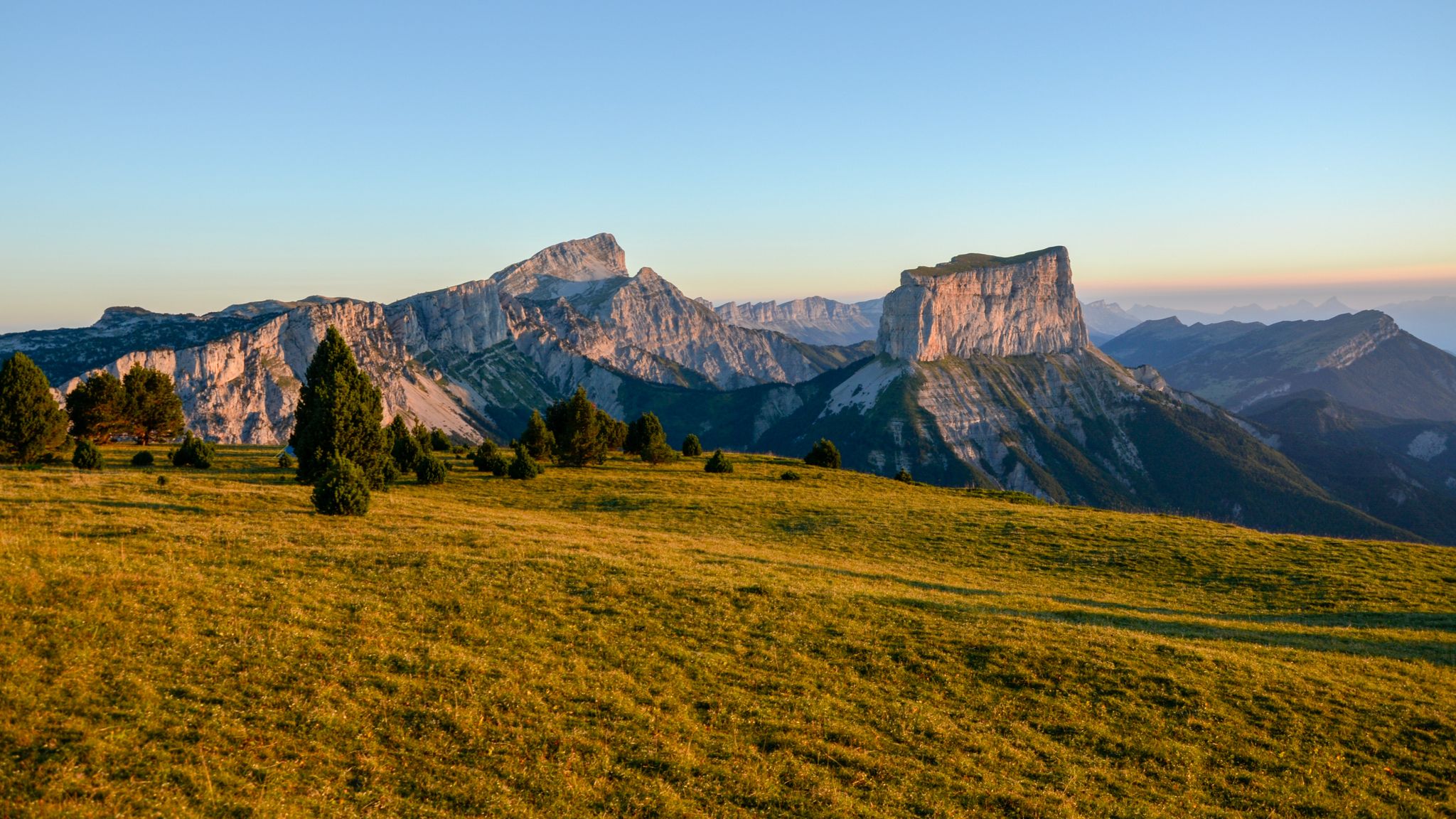
The Col de l'Aupet, located at an altitude of 1,627 meters, is located exactly where a geological fault passes. This favored the erosion and separation of Mont Aiguille from the Vercors highlands. From this passage of the Aupet, you can reach the foot of the cliffs of Mont Aiguille as well as the upper Vercors via the Pas de la Selle.
3
0

Quiet climb of the Col de la Menée before a long descent to Châtillon
0
0

The Col de la Croix Haute from Saint-Maurice-en-Trièves is 6km long with a total drop of 309m. The average gradient is 5.1% with maximum gradients of 13.5%.
1
0

Small pass with little elevation and a superb view of the Dévoluy and Vercors massifs.
0
0

Ideal for a short break with a great view
0
0
Frequently Asked Questions
Where are the mountain passes around Percy located?
The mountain passes around Percy are situated in the Auvergne-Rhône-Alpes region of France, specifically at the intersection of the Vercors and Diois massifs. This area is known for its significant geological formations and diverse topography.
Which mountain passes offer the best panoramic views in the Percy region?
For superb panoramic views, consider visiting Col du Banchet, which provides excellent vistas of the Dévoluy and Vercors massifs. Another great option is Col de Grimone (1318 m), which is also highlighted as a viewpoint.
Are there any mountain passes with unique geological features near Percy?
Yes, Aupet Pass is particularly notable. Located at an altitude of 1,627 meters, it sits exactly where a geological fault passes, which favored the erosion and separation of Mont Aiguille from the Vercors highlands.
What are some easier mountain passes to cycle around Percy?
If you're looking for an easier cycling ascent, Col de Grimone (1318 m) offers a gentle climb from Lus-la-Croix-Haute, covering 7.5 km with an average gradient of 4%. Col du Banchet is also described as a small pass with little elevation.
Can I observe wildlife, such as vultures, near the mountain passes?
Yes, the Col de Menée Vulture Observation Point is an excellent spot for wildlife enthusiasts. This pass is located between the Vercors and Diois massifs and is known for its opportunities to observe vultures.
What kind of outdoor activities can I do near the mountain passes around Percy?
The region around Percy offers a variety of outdoor activities. You can explore numerous mountain biking trails, gravel biking routes, and challenging mountain hikes. For more details on specific routes, check out the MTB Trails around Percy, Gravel biking around Percy, and Mountain Hikes around Percy guides.
Are there challenging cycling routes over the mountain passes?
Yes, some passes offer more challenging gradients. For instance, the Croix Haute Pass from Saint-Maurice-en-Trièves has an average gradient of 5.1% with maximum gradients reaching 13.5%, providing a more demanding ride.
What do visitors appreciate most about the mountain passes in this region?
Visitors frequently appreciate the diverse landscapes, from high-altitude views to connecting valleys. The passes are valued for offering both challenging cycle routes and geological interest, with many users contributing photos and upvotes to their favorite spots.
Which mountain pass connects the towns of Lalley and Mens?
The Col du Banchet is a small pass that connects Lalley and Mens, reaching an altitude of 900 meters and offering beautiful views of the surrounding massifs.
Are there any specific hiking routes that include the mountain passes?
Yes, many hiking routes in the region incorporate these passes. For example, the Aupet Pass allows access to the foot of the Mont Aiguille cliffs and the upper Vercors via the Pas de la Selle, which can be part of a longer hike. You can find more detailed hiking routes in the Mountain Hikes around Percy guide.
What is the highest mountain pass mentioned in the Percy area?
The highest mountain pass mentioned is Aupet Pass, located at an altitude of 1,627 meters.
Is the Croix Haute Pass easily accessible by road?
Yes, the Croix Haute Pass is accessible on a tarmac road, though it may have some traffic.
Most popular routes around Percy
Most popular attractions around Percy

Get inspired with the komoot mobile app


Explore more
See even more epic mountain passes by checking out these guides around Percy:
