The best walks and hikes around La Bollène-Vésubie
4.4
(434)
4,049
hikers
25
hikes
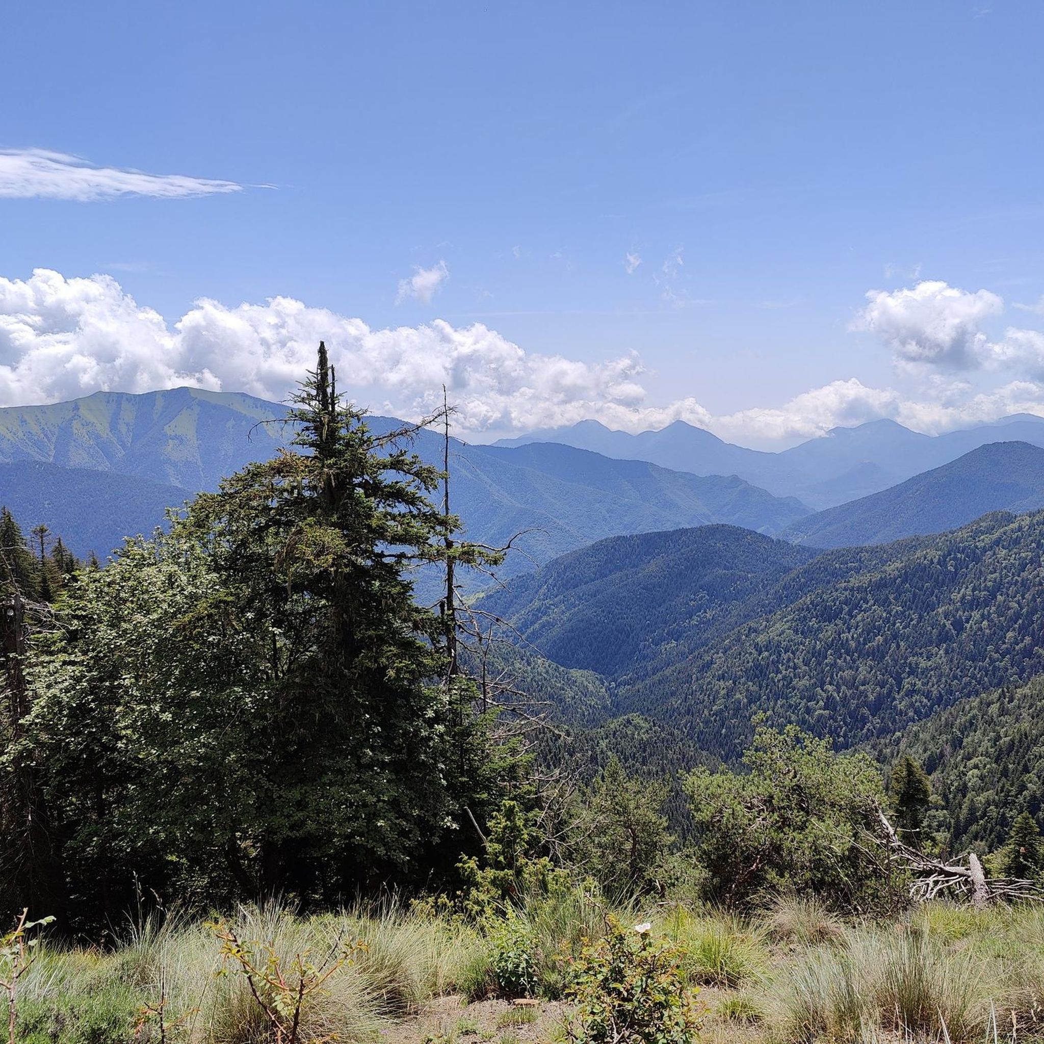
Hiking around La Bollène-Vésubie provides access to the Vésubie Valley and the Mercantour National Park, characterized by varied terrain. The region features rugged Alpine peaks, deep canyons, and forests of fir and Scots pine, transitioning to olive groves at lower elevations. Trails traverse pastoral limestone landscapes and lead to higher Alpine areas, offering diverse hiking experiences.
Best hiking trails around La Bollène-Vésubie
- The most popular hiking route is Fort de la Redoute. – Cime du Diable loop from La Redoute…
Last updated: July 8, 2026
4.8
(38)
410
hikers
19.8km
07:39
1,240m
1,240m
Hard hike. Very good fitness required. Mostly accessible paths. Sure-footedness required.
5.0
(11)
107
hikers
Moderate hike. Good fitness required. Easily-accessible paths. Suitable for all skill levels.

Sign up for free
4.8
(12)
97
hikers
8.71km
02:44
350m
350m
Moderate hike. Good fitness required. Easily-accessible paths. Suitable for all skill levels.
4.5
(15)
54
hikers
7.25km
02:16
270m
270m
Moderate hike. Good fitness required. Easily-accessible paths. Suitable for all skill levels.
4.9
(7)
57
hikers
6.40km
01:58
220m
220m
Hard hike. Great for any fitness level. Sure-footedness, sturdy shoes and alpine experience required.
Get access to more routes and recommendations from other explorers.
Sign up for free
Already have an account?
Our route recommendations are based on thousands of hikes, rides, and runs completed by other people on komoot.
Start today with a free account
Your next adventure awaits.
Login or Signup
Popular around La Bollène-Vésubie

Crossing the Mercantour National Park – GR 52

The Komoot Torino-Nice Rally
Road Cycling Routes around La Bollène-Vésubie
Cycling around La Bollène-Vésubie
Running Trails around La Bollène-Vésubie
MTB Trails around La Bollène-Vésubie
Gravel biking around La Bollène-Vésubie
Mountain Hikes around La Bollène-Vésubie
Other adventures around La Bollène-Vésubie


Tips from the Community

Built in 1897 as part of the Séré de Rivières system, it was one of the first French forts built in reinforced concrete. Located at an altitude of 2080 metres on the highest peak of the Authion massif, it was designed to defend the Franco-Italian border. During World War II, the redoubt was held by German troops of the 34th Division. It was involved in fighting during the French offensive during the Battle of Authion. On April 12, after artillery and air attacks, 5 volunteers of the 1st Free French Division, supported by a tank, approached it and obtained the surrender of the 38-man garrison
0
0

Today it was impossible to continue because there was too much snow, but the view was wonderful
0
0

Bicycle charging station with a compressor and a top wash THANK YOU to the tourist office. Exemplary facilities.
1
0

With its summit at +1600m, the Turini offers us an exceptional view of the hinterland of Nice. Closed during the winter, this ascent is a summer classic, it will offer you in addition to a superb panorama, a little freshness, a luxury at this time. You will find something to refuel at the top, the blueberry pie is more than recommended (after the effort the comfort and yes all the same 27km of climb). Itinerary more reserved for experienced cyclists.
1
0

pleasant hike very pleasant perhaps on the West side two to three passages a little tense depending on whether you have vertigo or not!! good hike biz
0
0

Camp d'Argent is a ski resort but not only. It offers walkers the possibility of finding accommodation between the Merveilles refuge and Sospel. L'estive is a bed and breakfast inn which arrives at the right time on the way. In addition to eating and sleeping well, stopping here will save you from accumulating the miles and the fatigue that goes with it. You must pass the station to find it. For more information, see the following link: http://estive-mercantour.fr/
2
0
The work and the barracks of La Forca are now ruins. They were built between January 1887 and November 1891 at a time of border tension. Its purpose was to monitor the Roya valley in order to control a possible invasion of troops from Italy. They come to replace an old Sardinian redoubt. The two buildings are located at the southern summit of the Massif de L'Authion at 2,078 meters above sea level. Besides this historic site, the climb to the top is worth doing just for the magnificent views.
1
0

Whatever the season, this Authion site will delight you with the unique landscapes and panoramas it offers, and where you often confuse winter, snow and clouds.
2
0
Frequently Asked Questions
What kind of landscapes can I expect to see while hiking near La Bollène-Vésubie?
The region around La Bollène-Vésubie offers a dramatic and varied natural environment. You'll encounter rugged Alpine peaks, deep river gorges like the Gorges de la Vésubie, and dense forests of fir and Scots pine. At lower elevations, the landscape transitions to Mediterranean-influenced terrain with olive trees and scrubland. Trails traverse pastoral limestone areas and lead into higher Alpine zones within the Mercantour National Park.
Are there hiking trails suitable for beginners or those looking for an easy walk?
Yes, La Bollène-Vésubie offers trails for various ability levels, including easy walks. For instance, the Col de Turini – Arpiha Pass loop from Col de Turini is an easy 6.4 km trail that takes about 2 hours to complete, leading through scenic mountain passes.
What are some notable landmarks or attractions I can see along the hiking trails?
The area is rich in natural and historical landmarks. You can explore the historic forts of the Authion massif, such as those found on the The Redoubt Fort. – Ouvrage de la Forca Ruins loop from La Redoute des 3 Communes. The Mercantour National Park is home to numerous natural lakes like Lake La Fous and Lac des Merveilles. For panoramic views, consider routes that offer glimpses of the Cime du Diable or the famous Col de Turini.
Are there any circular hiking routes available?
Yes, many trails around La Bollène-Vésubie are designed as loops. Examples include the challenging Fort de la Redoute. – Cime du Diable loop from La Redoute des 3 Communes, the moderate The Redoubt Fort. – Ouvrage de la Forca Ruins loop from La Redoute des 3 Communes, and the shorter Tour des deux cimes – Col de Turini loop from Col de Turini.
What do other hikers enjoy most about the trails in La Bollène-Vésubie?
The trails around La Bollène-Vésubie are highly rated by the komoot community, with an average score of 4.5 stars from nearly 400 reviews. Hikers often praise the varied terrain, from deep river gorges to high Alpine peaks, and the access to the Mercantour National Park's pristine natural surroundings.
Is it possible to hike to the Col de Turini from La Bollène-Vésubie?
The Col de Turini is a prominent feature in the area, famous for its scenic views and winding roads. While you can approach it from several directions, there are specific hiking routes that incorporate the pass, such as the Tour des deux cimes – Col de Turini loop from Col de Turini, which starts directly from the Col de Turini itself.
Are there any long-distance hiking routes that pass through this region?
Yes, the region is part of significant long-distance trails. The renowned GR®5, which connects Lake Geneva to the Mediterranean Sea, passes through the Mercantour massif. Additionally, the 'Route Pagarine' is a Franco-Italian hiking route that utilizes historical salt roads, showcasing landscapes between the Alps and the Mediterranean.
What kind of wildlife might I encounter while hiking in the Mercantour National Park?
The Mercantour National Park is a sanctuary for diverse wildlife. You might spot chamois, mouflons, marmots, and ibex. The park protects some 10,000 plant and animal species, making it a rich area for nature observation.
Are there any trails that offer views of the Authion Massif?
Yes, the Authion plateau is known for its exceptional panoramic views. Trails in the eastern part of the Mercantour massif, particularly those around La Redoute des 3 Communes, will allow you to admire the Authion Massif and the foothills of the Alps descending towards the Mediterranean. The The Redoubt Fort. – Ouvrage de la Forca Ruins loop from La Redoute des 3 Communes offers views of this historic area.
What is the best time of year to go hiking around La Bollène-Vésubie?
The Vésubie Valley and Mercantour National Park offer hiking opportunities across different seasons. Spring and autumn generally provide pleasant temperatures and vibrant scenery. During summer, higher altitude trails offer cooler conditions. In winter, snowshoe trekking is popular at resorts like Turini-Camp d'Argent, but higher trails may be inaccessible due to snow.
Are there any specific trails that lead to lakes?
The Mercantour National Park, accessible from La Bollène-Vésubie, is dotted with numerous natural lakes. While specific routes from La Bollène-Vésubie directly to all lakes aren't listed, many trails within the park will lead you to beautiful spots like Lake La Fous, Lac des Merveilles, and Lake Trem, offering breathtaking scenery.
Most popular routes around La Bollène-Vésubie
Most popular attractions around La Bollène-Vésubie

Get inspired with the komoot mobile app


Explore more
Browse the best Hikes in other regions.
