The best walks and hikes around Anères
4.2
(33)
320
hikers
29
hikes
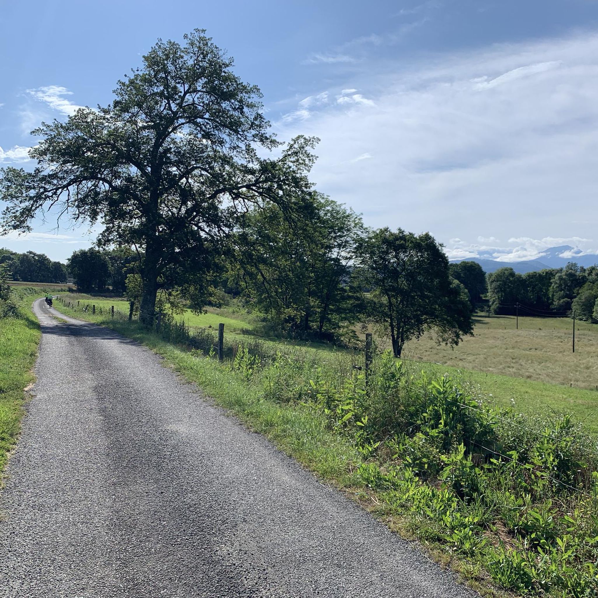
Hiking around Anères offers access to the scenic foothills of the Pyrenees, characterized by rolling hills, forested areas, and open landscapes. The region provides varied terrain, from gentle paths through valleys to more challenging ascents offering panoramic views. Limestone features, including caves, are present in some areas, contributing to the diverse natural environment. The trails often traverse agricultural land and connect small villages, providing a mix of natural beauty and cultural interest.
Best hiking trails around Anères
- The most popular…
Last updated: July 4, 2026
11
hikers
7.65km
02:02
80m
80m
Moderate hike. Good fitness required. Easily-accessible paths. Suitable for all skill levels.
4.3
(4)
8
hikers
7.83km
02:29
270m
270m
Hard hike. Good fitness required. Sure-footedness, sturdy shoes and alpine experience required.

Sign up for free
4.7
(3)
7
hikers
5.07km
01:39
180m
180m
Hard hike. Great for any fitness level. Sure-footedness, sturdy shoes and alpine experience required.
6
hikers
6.83km
01:57
160m
160m
Easy hike. Great for any fitness level. Easily-accessible paths. Suitable for all skill levels.
8
hikers
16.0km
04:37
370m
390m
Moderate hike. Good fitness required. Easily-accessible paths. Suitable for all skill levels.
Get access to more routes and recommendations from other explorers.
Sign up for free
Already have an account?
Our route recommendations are based on thousands of hikes, rides, and runs completed by other people on komoot.
Start today with a free account
Your next adventure awaits.
Login or Signup



Tips from the Community

Beautiful descent to do by bike with good brakes or on foot via the pedestrian path
0
0

Delicious restaurant, something special and different from the tourist stalls
2
0
Nice little town that hasn't lost its charm despite the tourists
4
1
The smaller of the two gates through which one entered the monastery complex in the Middle Ages
2
0
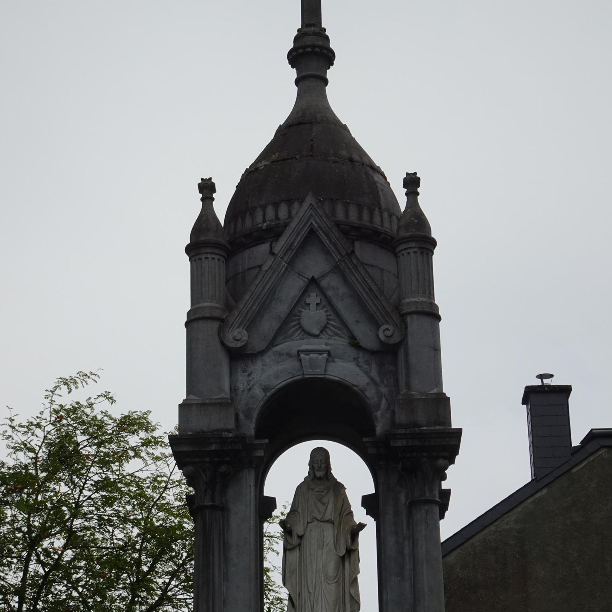
From the year 1120, the construction of a cathedral was begun on the orders of the Bishop of Comminges, around which a new small community formed, named after this bishop. In the 16th century, during the Huguenot Wars, the sacred building was severely destroyed.
3
0
Nice restaurant where you can sit right in front of the cathedral and watch the hustle and bustle in the square.
2
0
Small museum with free admission that shows a lot about the Middle Ages
2
0
Frequently Asked Questions
How many hiking trails are available around Anères?
There are over 30 hiking routes in the Anères area, offering a variety of experiences. These include 10 easy trails, 18 moderate options, and 3 more challenging routes, catering to different fitness levels.
Are there any easy or family-friendly hiking options in Anères?
Yes, Anères offers several easy trails suitable for families. One such route is the Rue de Cap de la Vielle – Hautaget Church loop from Nestier, an easy 6.8 km path that takes about 1 hour 55 minutes to complete. These trails often traverse gentle terrain through agricultural land and small villages.
What kind of views can I expect on hikes near Anères?
Many trails in Anères offer expansive vistas of the Pyrenees mountains from elevated positions, as well as views over rolling hills and forested areas. For example, the View of the Pyrenees loop from Gazave is specifically known for its panoramic mountain views.
Are there any circular walks available in the Anères region?
Yes, many of the hiking routes around Anères are circular, allowing you to start and end at the same point. Examples include the Gargas Cave loop from Aventignan and the View of the Pyrenees loop from Montsérié, both offering varied scenery on a loop.
What are some interesting landmarks or attractions to see while hiking in Anères?
The region around Anères is rich in natural and cultural points of interest. You can explore the notable Gargas Cave, or visit historical sites like the Cathedral of Saint Bertrand de Comminges. There are also viewpoints offering stunning perspectives, such as the View of the Cathedral of Saint-Bertrand-de-Comminges.
What is the typical duration of hiking routes in Anères?
Hiking routes in Anères vary in length and duration. Shorter trails, like the View of the Pyrenees loop from Montsérié, can be completed in about 1 hour 40 minutes. Longer routes, such as the Car park – Porte Majoue loop from Tibiran-Jaunac, can take over 4 hours, offering options for a quick stroll or a full day's adventure.
What do other hikers say about the trails in Anères?
The hiking trails in Anères are highly regarded by the komoot community, with an average rating of 4.2 stars from over 30 reviews. Hikers often praise the varied terrain, the scenic views of the Pyrenees, and the mix of forested areas and open landscapes that define the region.
Is Anères suitable for winter hiking?
While the Anères region is in the foothills of the Pyrenees, winter conditions can vary. Lower elevation trails might be accessible, but higher routes could be affected by snow or ice. It's always advisable to check local weather forecasts and trail conditions before planning a winter hike, and ensure you have appropriate gear.
Are there any specific trails that are particularly challenging?
Yes, for those seeking a more strenuous experience, Anères offers difficult routes. The View of the Pyrenees loop from Gazave and the View of the Pyrenees loop from Montsérié are both rated as difficult, featuring more significant elevation changes and requiring a good level of fitness.
What is the best season for hiking in Anères?
The Anères region is generally pleasant for hiking from spring through autumn. Spring brings blooming wildflowers, while autumn offers vibrant foliage. Summer is also popular, but it's advisable to start early to avoid the midday heat. Winter hiking is possible on some trails, but requires checking conditions due to potential snow or ice.
Are there options for longer day hikes in the area?
Yes, if you're looking for a longer day out, routes like the Car park – Porte Majoue loop from Tibiran-Jaunac offer a substantial challenge. This moderate 15.9 km trail takes approximately 4 hours 34 minutes to complete, providing an extended exploration of the region's diverse landscapes.
Most popular attractions around Anères

Get inspired with the komoot mobile app


Explore more
Browse the best Hikes in other regions.
