The best walks and hikes around Marigné
4.4
(56)
430
hikers
46
hikes
Hiking trails around Marigné offer a diverse landscape within the Anjou Bleu region of western France. The area is characterized by hedged farmland, picturesque vineyards, and verdant riverbanks, particularly along the Mayenne River which forms part of its western border. Marigné is situated within the extensive Loire-Anjou-Touraine Regional Natural Park, featuring a mosaic of sandy river shores, limestone hillsides, meadows, and woodlands. The terrain generally includes gentle elevations, making it accessible for various hiking experiences.
Best hiking trails around Marigné
…Last updated: July 2, 2026
3.0
(1)
5
hikers
11.7km
03:04
100m
100m
Hike the Bac de Ménil loop from Daon, a moderate 7.2-mile trail featuring the Mayenne River towpath and a unique ferry crossing.
4.8
(6)
18
hikers
14.0km
03:40
100m
100m
Moderate hike. Good fitness required. Easily-accessible paths. Suitable for all skill levels.

Sign up for free
8
hikers
7.64km
01:56
20m
20m
Easy hike. Great for any fitness level. Easily-accessible paths. Suitable for all skill levels.
12
hikers
11.8km
03:03
70m
70m
Moderate hike. Good fitness required. Easily-accessible paths. Suitable for all skill levels.
6
hikers
Easy hike. Great for any fitness level. Easily-accessible paths. Suitable for all skill levels.
Get access to more routes and recommendations from other explorers.
Sign up for free
Already have an account?
Our route recommendations are based on thousands of hikes, rides, and runs completed by other people on komoot.
Start today with a free account
Your next adventure awaits.
Login or Signup




Tips from the Community

Magnificent site with camping and a waterfront café. Relaxing and pleasant.
0
0

If you are looking for a unique way to discover Mayenne, you can try the Bac de Ménil, the last ferry in the department. You can cross the river on foot, by bike, on horseback or even by car, and enjoy the panoramic views of the countryside. The Bac de Ménil runs from April 15 to September 15 and is free. You can also enjoy the nearby picnic area and playground. The Bac de Ménil is an excellent option for a fun and original hike.
2
0
The Mayenne towpath is one of the most beautiful greenways in France. It crosses the department of Mayenne and offers an 85 km route in the countryside. You will be able to appreciate the views of the castles, the locks, the fauna and the flora all along the route. The greenway begins in the town of Mayenne and ends in Lion-d'Angers. You can explore it on foot, by bike or even on horseback. The Mayenne towpath is also part of the Vélo Francette, a cycle route that connects Normandy to the Atlantic coast. Whether you want to do a short loop or a bigger adventure, the Mayenne Towpath is a perfect choice for a relaxing and rewarding hike.
2
0
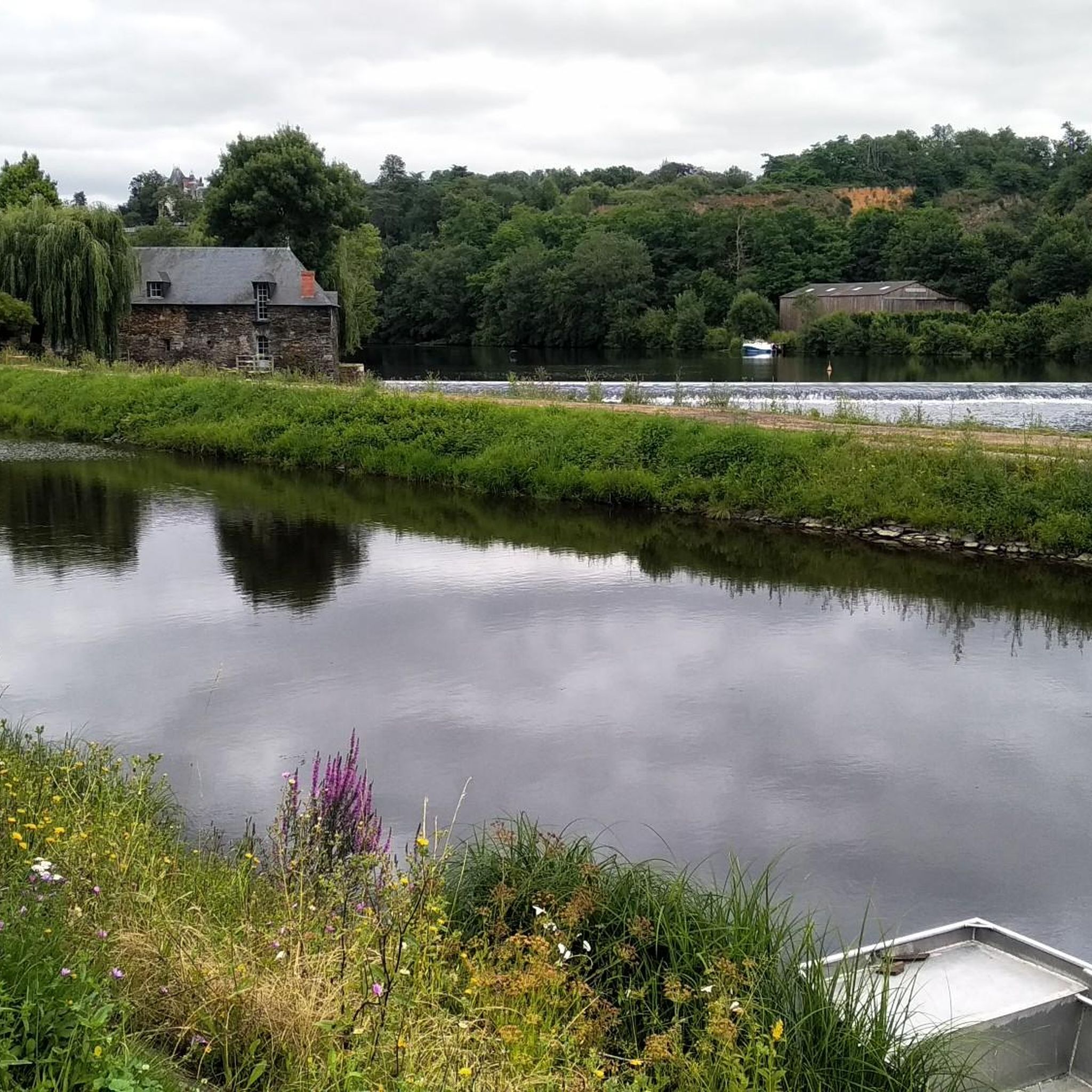
From the village of Daon, a breathtaking view of Mayenne awaits you.
3
0

Picnic air on the Mayenne towpath. View of the Chambellay bridge built between 1867-1869.
0
0
In the middle of the 19th century, the port of Chambellay was very busy and the crossing of the Mayenne on a bank, towards the axis from Segré to Durtal, was congested. Built from 1867 by the Escarraguelet Company, it entered service in December 1869.
0
0
In the middle of the 19th century, the port of Chambellay was very busy and the crossing of the Mayenne on a bank, towards the axis from Segré to Durtal, was congested. Built from 1867 by the Escarraguelet Company, the bridge came into service in December 1869.
0
0
Ideal for a lunch break after several kilometres.
0
0
Frequently Asked Questions
What types of landscapes can I expect to see while hiking around Marigné?
Hiking around Marigné offers a diverse landscape within the Anjou Bleu region. You'll encounter hedged farmland, picturesque vineyards, and verdant riverbanks, especially along the Mayenne River. The area is also part of the Loire-Anjou-Touraine Regional Natural Park, featuring a mosaic of sandy river shores, limestone hillsides, meadows, and woodlands.
Are there many hiking trails available in Marigné?
Yes, Marigné and its immediate surroundings offer a good selection of hiking opportunities. There are over 40 hiking trails available, catering to various experience levels from easy strolls to more challenging day hikes.
Are there any easy hiking trails suitable for beginners or families in Marigné?
Absolutely. Marigné has 16 easy hiking trails, perfect for beginners or families looking for a relaxed outing. These routes often feature gentle elevations and pleasant scenery, such as the tranquil paths along the Mayenne River.
Can I find circular hiking routes around Marigné?
Yes, many of the trails around Marigné are circular, allowing you to start and end at the same point. For example, the Ménil - Mayenne Towpath Loop is a popular moderate circular route that follows the Mayenne River.
What are some notable attractions or points of interest I can see along the hiking trails?
While hiking, you can discover several interesting spots. Along the Mayenne River, you might see historical elements like lock houses and water mills. Nearby attractions include the impressive Isle Briand Castle, and scenic spots like the port of Grez-Neuville or the Chambellay Bridge over the Mayenne River.
Are there any specific trails that highlight the region's cultural heritage?
Within Marigné itself, the 'Circuit des papillons' (Butterfly Trail) is a 10.1 km walk that combines cultural heritage with pastoral scenery. It guides visitors through the village's historic sites, including a feudal motte, a 16th-century church, a historic fountain, and a charming lavoir (washhouse).
What is the best way to explore the Mayenne River by foot?
The Mayenne River boasts an 85 km towpath, recognized as one of France's most beautiful greenways. This tranquil route is ideal for hiking, offering a peaceful immersion in nature free from motorized traffic. A great example is The Mayenne at Daon loop from Daon, which explores the riverbanks and local scenery.
What do other hikers say about the trails in Marigné?
The hiking routes in Marigné are highly rated by the komoot community, with an average score of 4.4 stars from over 50 reviews. Hikers often praise the peaceful environment, the scenic river views, and the well-maintained paths that make for an enjoyable experience.
Are there any places to stop for refreshments along the trails?
Yes, you can find spots for refreshments. For instance, the Ménil riverside café is a popular highlight along the Mayenne River, offering a pleasant break during your hike.
Is Marigné a good destination for wildlife spotting during a hike?
The tranquil environment along the Mayenne River towpath and within the Loire-Anjou-Touraine Regional Natural Park provides opportunities to observe local wildlife. The diverse landscapes, including riverbanks and woodlands, support various species.
What is the typical duration for a moderate hike in the Marigné area?
Moderate hikes in the Marigné area typically range from 2 to 4 hours. For example, the Château de La Jaille-Yvon loop from Chambellay takes about 2 hours and 8 minutes, while the The Mayenne at Daon – The Mayenne at Daon loop from Daon can take around 3 hours and 4 minutes.
Are there any challenging day hikes available for experienced hikers?
While the majority of trails are easy to moderate, there is at least one difficult trail available for those seeking a greater challenge. The region's gentle elevations mean that even longer routes tend to be more about distance than steep climbs.
Most popular attractions around Marigné

Get inspired with the komoot mobile app


Explore more
Browse the best Hikes in other regions.
