The best walks and hikes around Jonquières
4.5
(2171)
14,181
hikers
219
hikes
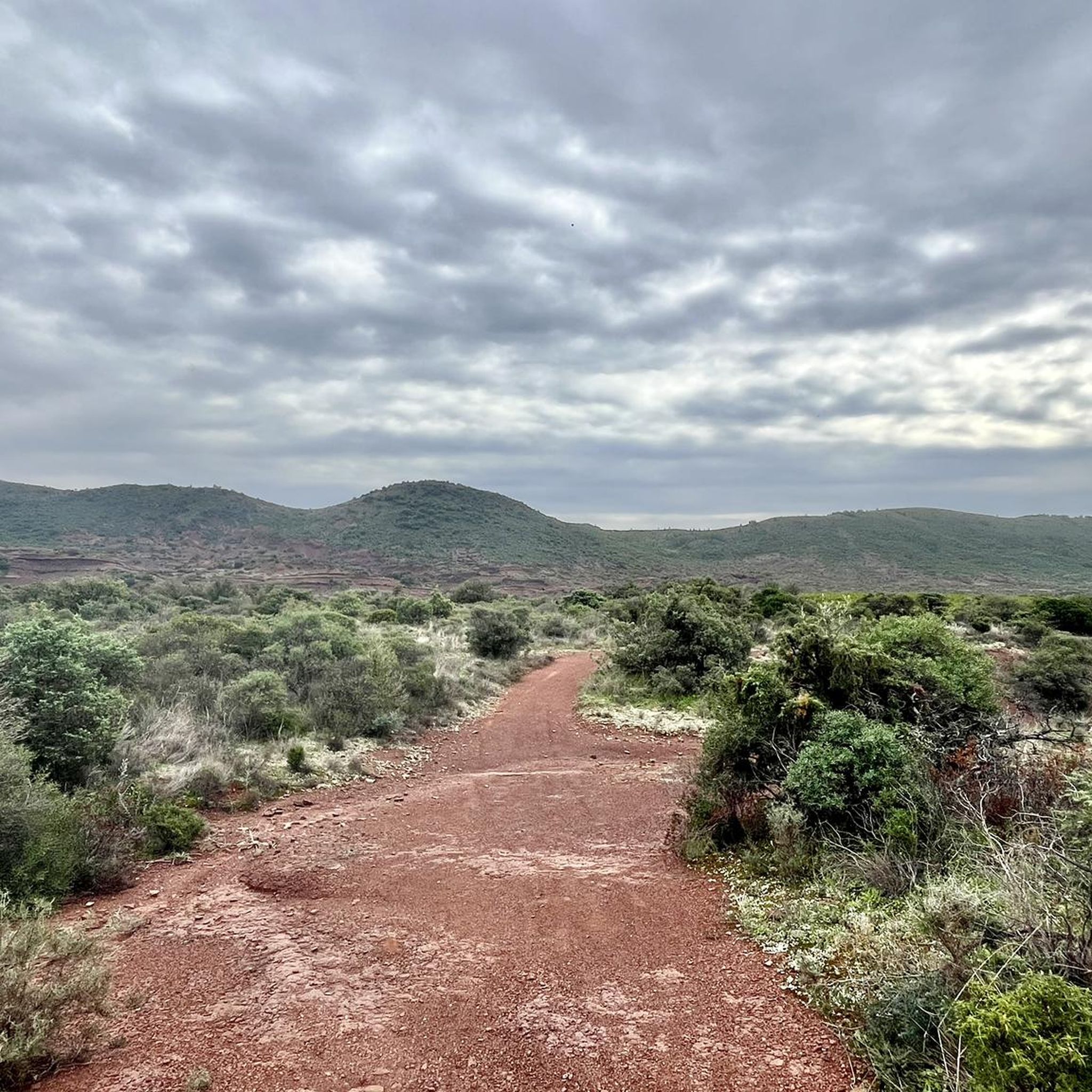
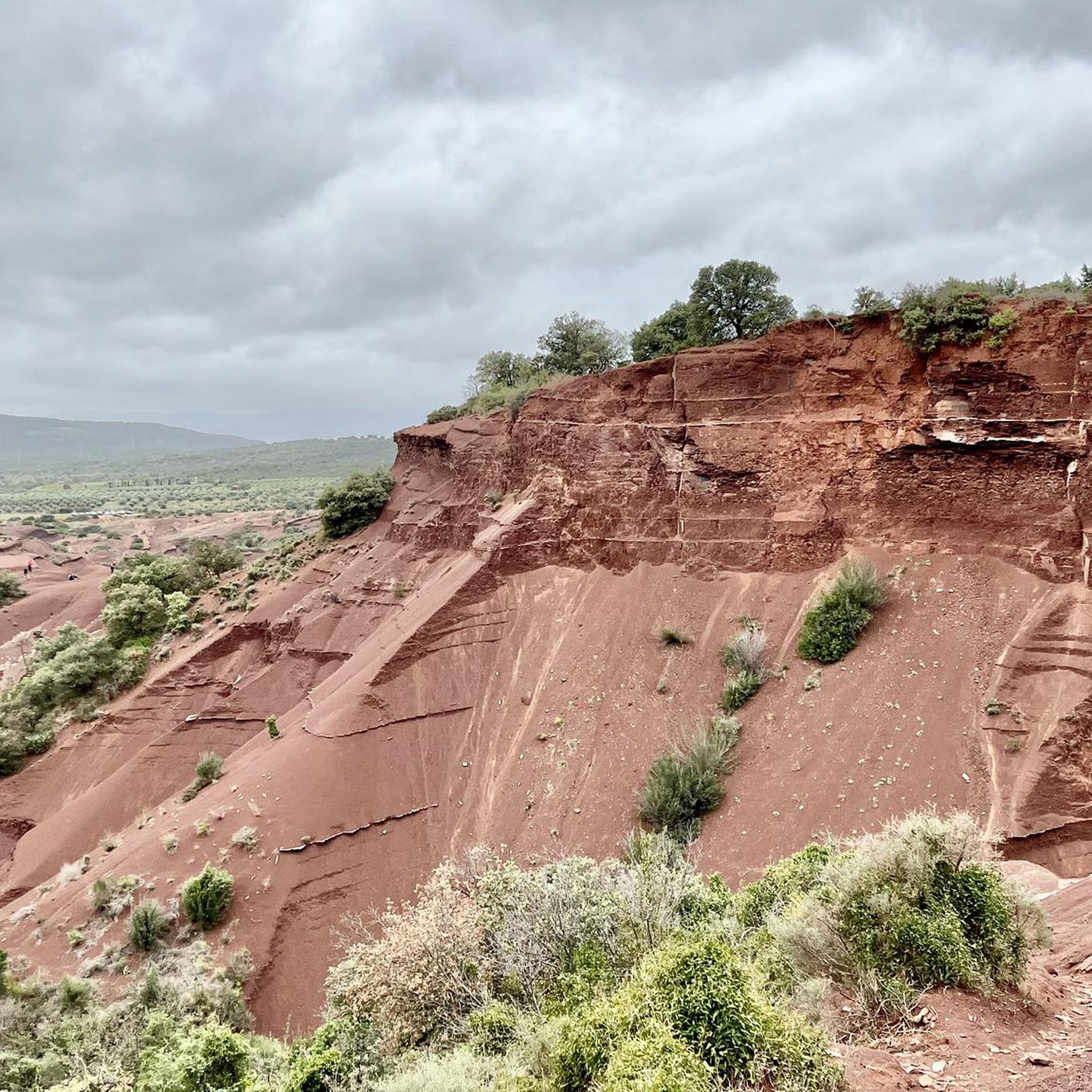
Hiking around Jonquières offers trails through varied landscapes characterized by hilly terrain, dramatic canyons, and distinctive red earth formations known as Ruffes. The region features a mix of open scrubland, vineyards, and areas with historical structures. Elevations on routes can reach several hundred meters, providing panoramic views of the surrounding countryside.
Best hiking trails around Jonquières
- The most popular hiking route is Gibret Cross via Devil's Canyon Loop, a 11.5 miles (18.6 km) trail that takes 5 hours 14…
Last updated: July 8, 2026
4.6
(12)
104
hikers
18.6km
05:14
400m
400m
Hike the difficult La Croix de Gibret loop from Rabieux, exploring the red rock formations of Canyon du Diable and enjoying summit views.
4.7
(27)
118
hikers
10.1km
03:00
310m
310m
Moderate hike. Good fitness required. Easily-accessible paths. Suitable for all skill levels.

Sign up for free
4.3
(35)
127
hikers
Hard hike. Good fitness required. Sure-footedness, sturdy shoes and alpine experience required.
4.2
(6)
84
hikers
Hard hike. Good fitness required. Sure-footedness, sturdy shoes and alpine experience required.
4.2
(10)
41
hikers
Hard hike. Very good fitness required. Sure-footedness, sturdy shoes and alpine experience required.
Get access to more routes and recommendations from other explorers.
Sign up for free
Already have an account?
Our route recommendations are based on thousands of hikes, rides, and runs completed by other people on komoot.
Start today with a free account
Your next adventure awaits.
Login or Signup

Tips from the Community

Here, only the two wooden beams form a cross in its simplest form. And yet, like all crosses encountered by hikers on their journeys, it is an essential Christian symbol. It stands for the memory of his crucifixion, but at the same time also for the resurrection of Jesus Christ. The important founder of the order, Bernard of Clairvaux, said: + "With us on earth, there is His memory, but in the Kingdom of Heaven is His presence: This presence is the joy of those who have already attained salvation. The memory is our consolation, as we are still wanderers, journeying toward the Fatherland."
2
0

stunning
0
1

A superb location, but be careful, some areas are difficult to access. Avoid the area after heavy rain.
1
0
A beautiful panorama, some paths are easy to access, others not!
1
0

A hike on Mars without needing Elon Musk (yuk)
0
0
Absolutely magnificent route, but be careful: it's steep, slippery and sometimes very wet since you use the stream bed to get around (wear appropriate footwear).
2
1
Very beautiful route and superb views at the summit
1
0
A refuge is accessible behind the chapel for possible shelter or bivouac if necessary.
0
0
Frequently Asked Questions
How many hiking trails are there in Jonquières?
Jonquières offers a wide variety of hiking experiences, with over 200 routes available. These trails traverse varied landscapes, including dramatic canyons and distinctive red earth formations.
Are there easy hiking trails suitable for beginners in Jonquières?
Yes, Jonquières has approximately 48 easy hiking routes. These trails are generally less strenuous, allowing beginners to enjoy the region's unique scenery, such as the open scrubland and vineyards, without significant elevation changes.
Can I find circular hiking routes around Jonquières?
Many of the trails in Jonquières are designed as loops, offering convenient circular walks. For example, the Le Castellas de Montpeyroux – loop from Montpeyroux is a moderate 6.3-mile (10.1 km) path that provides views of historic ruins and surrounding hills.
What are the best times of year for hiking in Jonquières?
The best times for hiking in Jonquières are typically spring and autumn. During these seasons, the weather is milder, making it more comfortable to explore the hilly terrain and dramatic canyons. Summers can be very hot, while winters are generally mild but can have occasional rain.
Are there any family-friendly hiking options in Jonquières?
While many routes feature rugged terrain, there are easier trails suitable for families. Look for routes with shorter distances and less elevation gain. These often pass through vineyards or offer gentle walks through the scrubland, providing a pleasant experience for all ages.
What kind of natural attractions can I see along the hiking trails?
Hiking trails in Jonquières often lead through spectacular natural features. You can explore dramatic canyons like the Devil's Canyon, and witness the distinctive red earth formations known as Ruffes. Some routes also offer panoramic views from higher elevations.
Are there any historical landmarks or points of interest to explore?
Yes, the region around Jonquières is rich in history. You can discover historic ruins, such as those visible from the Le Castellas de Montpeyroux trail. Other notable points of interest include the ancient Saint-Guilhem-le-Désert village and the impressive Devil's Bridge.
What do other hikers enjoy most about hiking in Jonquières?
The area is highly rated by the komoot community, with an average score of 4.5 stars from over 1,800 reviews. Hikers frequently praise the unique landscapes, particularly the dramatic canyons and the striking red Ruffes formations, as well as the diverse scenery ranging from vineyards to open scrubland.
Are there any trails that offer views of the distinctive red Ruffes formations?
Absolutely. The region is famous for its distinctive red earth formations, known as Ruffes. A great option to experience these is the The Devil's Canyon – Ruffes de Villerouge-Termenès loop from Saint-Saturnin-de-Lucian, a 4.6-mile (7.4 km) trail that leads directly through these dramatic landscapes.
Are there any challenging hikes for experienced trekkers?
Yes, Jonquières offers several challenging routes for experienced hikers. Trails like the Gibret Cross via Devil's Canyon Loop, an 11.5-mile (18.6 km) difficult trail, feature significant elevation changes and rugged terrain, providing a demanding yet rewarding experience.
What kind of terrain can I expect on the hiking trails?
The terrain around Jonquières is quite varied. You can expect hilly landscapes, rugged paths through dramatic canyons, and areas characterized by the distinctive red earth formations known as Ruffes. Trails also pass through open scrubland and vineyards, offering a diverse hiking experience.
Are there any hidden gem trails or less-traveled paths?
For those seeking a less-traveled path, consider exploring some of the region's numerous moderate and difficult trails beyond the most popular ones. These often lead to secluded viewpoints or through quieter sections of the canyons and Ruffes, offering a more intimate experience with the landscape.
Most popular routes around Jonquières
Most popular attractions around Jonquières

Get inspired with the komoot mobile app


Explore more
Browse the best Hikes in other regions.
