The best road cycling routes around Bagnot
4.3
(25)
823
riders
108
rides
Road cycling routes around Bagnot traverse a landscape characterized by river valleys, such as the Saône, and extensive woodlands like the Cîteaux Forest. The terrain is generally flat to gently rolling, with minimal elevation changes, making it suitable for various skill levels. This region offers a network of paths that wind through agricultural areas and along waterways.
Best road cycling routes around Bagnot
- The most popular road cycling route is Cîteaux Forest and Saône Valley Loop, a 31.0 miles…
Last updated: October 20, 2026
11
riders
37.4km
01:30
130m
130m
Easy road ride. Mostly well-paved surfaces and easy to ride.
3.0
(1)
9
riders
31.8km
01:13
40m
40m
Easy road ride. Mostly well-paved surfaces and easy to ride.

5
riders
Moderate road ride. Good fitness required. Mostly well-paved surfaces and easy to ride.
12
riders
29.3km
01:12
140m
140m
Easy road ride. Mostly well-paved surfaces and easy to ride.
5
riders
26.9km
01:08
120m
120m
Easy road ride. Mostly well-paved surfaces and easy to ride.
Get access to more routes and recommendations from other explorers.
Already have an account?
Our route recommendations are based on thousands of hikes, rides, and runs completed by other people on komoot.
Start today with a free account
Your next adventure awaits.



Tips from the Community

Very pretty, but beware from here and almost the entire Côte d'Or, it's ugly and full of asphalt/road until Châlons...
0
0

A small, nice place. Before the bridge, there is a bakery.
0
0


The Porte Saint-Nicolas is a former 18th-century city gate located in the French town of Beaune (Rue de Lorraine). Traffic entering Beaune from the north had to pass through the Porte du Bourgneuf. This gate was fortified and had a drawbridge. In the 18th century, the ramparts of Beaune lost their military function. Beaune was fortified as a border town with Franche-Comté, but in 1678 this region was annexed to France.
0
0

Originally, the Saint-Jean-de-Losne bridge was made of wood and crossed the river diagonally by road no. 27 linking Dijon to Losne. It started on the right bank, a little downstream from the current bridge, and then joined the old Seurre road. The structure was destroyed many times by floods and ice break-ups, but was always rebuilt in the same place until 1830. It was rebuilt in stone from 1833, then rebuilt again after being cut down during the war of 1870… The bridge suffered damage from the war twice more. On June 16, 1940, French engineers blew up an arch, and on September 7, 1944, the retreating Germans dynamited the rest. It was then replaced by a temporary wooden footbridge. After the liberation, the reconstruction work was put out to tender. After all these twists and turns, the bridge was finally rebuilt in the same place in 1950.
0
0

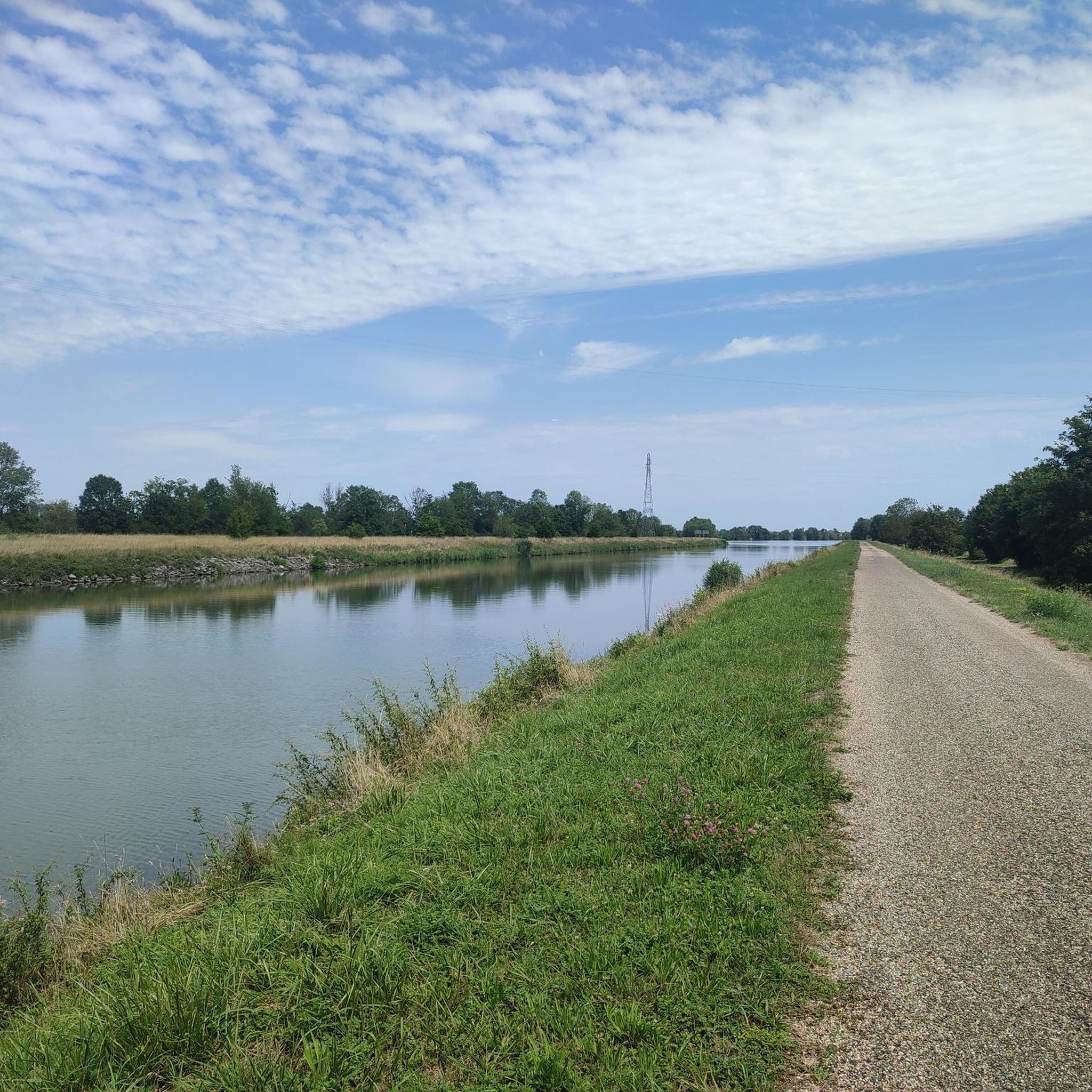
The banks of the Saône offer a very pleasant setting for cycling. Today, the towpaths are perfectly suited for two-wheelers, as seen here.
2
1
For a hiker, all locks look the same, automated or not.
1
1

The gate does not fit stylistically with the medieval city wall and is clearly the result of a later need for recognition. From here you can walk eastwards along a large part of the city wall, which is often still intact.
4
1
Frequently Asked Questions
How many road cycling routes are available around Bagnot?
There are over 100 road cycling routes around Bagnot, offering a wide range of options for different skill levels and preferences.
What is the terrain like for road cycling in Bagnot?
The terrain around Bagnot is generally flat to gently rolling, characterized by river valleys like the Saône and extensive woodlands such as the Cîteaux Forest. You'll find minimal elevation changes, making it suitable for various skill levels.
Are there road cycling routes suitable for beginners in Bagnot?
Yes, Bagnot offers many beginner-friendly road cycling routes. For instance, the Cîteaux Forest and Saône Valley Loop is an easy 31.0-mile (49.8 km) trail that winds through forest and along the Saône River, perfect for those new to road cycling.
Are there challenging road cycling routes in Bagnot?
While the region is generally flat, there are routes that offer longer distances and slightly more varied terrain for experienced cyclists. The Port of Saint-Jean-de-Losne – Pont St-Jean-de-Losne loop from Labergement-lès-Seurre is a difficult 115.7-mile (186.2 km) route with over 500 meters of elevation gain, providing a significant challenge.
What are the typical lengths of road cycling routes in Bagnot?
Route lengths vary significantly. You can find shorter, easy loops like the Confluence – Verdun-Ciel loop from Seurre at 24.0 miles (38.6 km), up to much longer, more challenging rides such as the Port of Saint-Jean-de-Losne – Pont St-Jean-de-Losne loop from Labergement-lès-Seurre, which is 115.7 miles (186.2 km).
Are there circular road cycling routes around Bagnot?
Yes, many of the road cycling routes in Bagnot are circular, allowing you to start and end at the same point. Examples include the popular Cîteaux Forest and Saône Valley Loop and the Tour de Dole – Pont St-Jean-de-Losne loop from Seurre.
What interesting places can I see along the road cycling routes near Bagnot?
Along your rides, you can explore various points of interest. Consider visiting the historic Abbey of Citeaux, or the picturesque bleachers along the Saône at Seurre. The region also features charming local churches like the Saint Martin Church.
What do other road cyclists say about the routes in Bagnot?
The road cycling routes in Bagnot are highly rated by the komoot community, with an average score of 4.1 stars from over 20 reviews. Cyclists often praise the quiet roads, scenic river views, and the peaceful atmosphere of the Cîteaux Forest.
What are the best times of year for road cycling in Bagnot?
The spring and summer months are generally ideal for road cycling in Bagnot. The weather is typically pleasant, and the natural landscapes, including the river valleys and woodlands, are at their most vibrant. Autumn also offers beautiful scenery with changing foliage.
Are there scenic road cycling routes in Bagnot?
Absolutely. Many routes offer beautiful scenery, particularly those that follow the Saône River or pass through the Cîteaux Forest. The Cîteaux Forest and Saône Valley Loop is a prime example, combining tranquil forest sections with picturesque riverside stretches.
What are the general trail conditions like for road cycling in Bagnot?
The road cycling routes in Bagnot primarily utilize paved roads and well-maintained paths. Given the region's flat to gently rolling terrain, conditions are generally smooth and suitable for road bikes, though it's always wise to check local conditions before heading out.
Most popular attractions around Bagnot

Get inspired with the komoot mobile app


Explore more
Browse the best Road cycling routes in other regions.
