The best walks and hikes around Trouhans
4.2
(111)
247
hikers
40
hikes
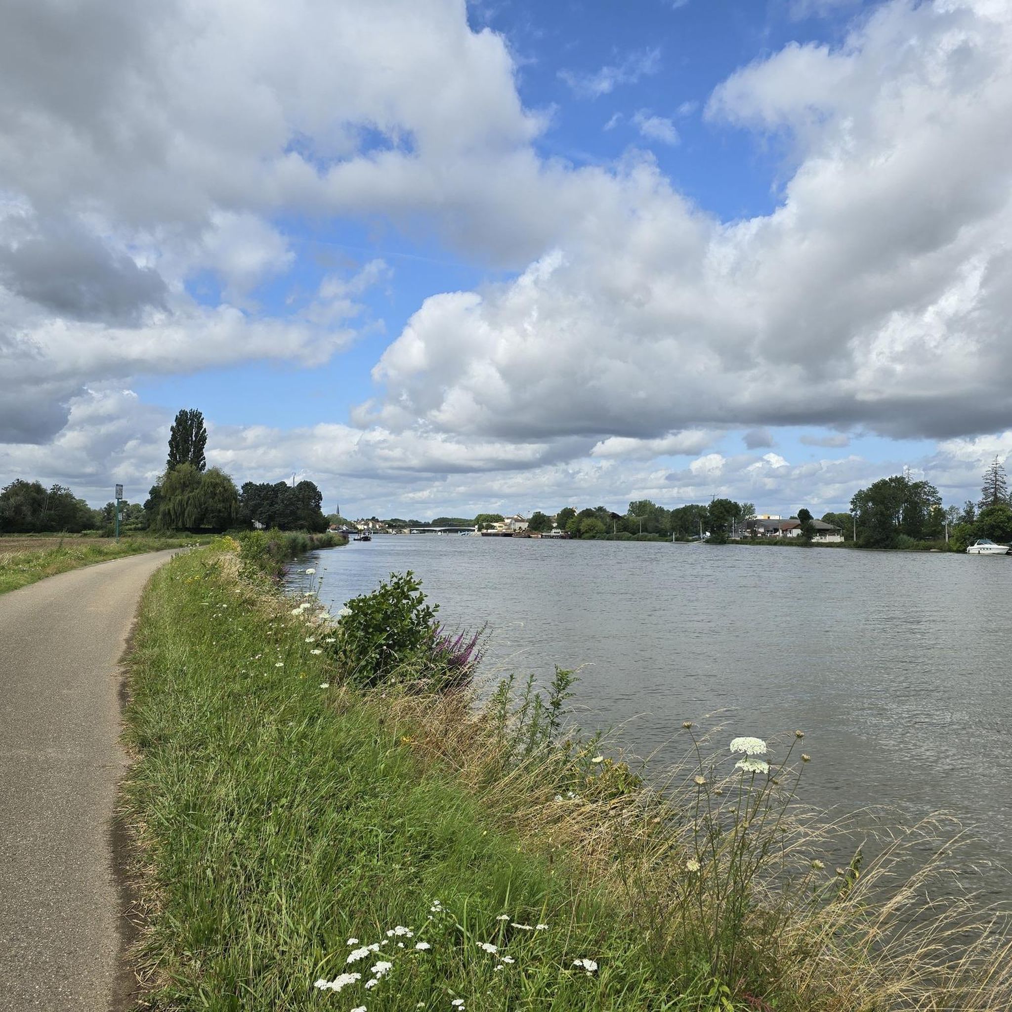
Hiking around Trouhans offers access to a landscape shaped by its extensive waterway network, including the Saône River, the Burgundy Canal, and the Rhine-Rhône Canal. The region is characterized by generally flat, picturesque routes along canal banks and through the rural countryside of the Val de Saône and Ouche Valley. These areas provide diverse environments for walking, from waterside paths to wooded sections.
Best hiking trails around Trouhans
- The most popular hiking route is Saint-Jean-de-Losne Bridge loop from Saint-Jean-de-Losne,…
Last updated: July 6, 2026
4.0
(1)
12
hikers
Moderate hike. Good fitness required. Easily-accessible paths. Suitable for all skill levels.
3
hikers
2.15km
00:33
10m
10m
Easy hike. Great for any fitness level. Easily-accessible paths. Suitable for all skill levels.

Sign up for free
4.0
(1)
5
hikers
11.1km
02:49
20m
20m
Moderate hike. Good fitness required. Easily-accessible paths. Suitable for all skill levels.
4.0
(1)
5
hikers
11.7km
02:58
20m
20m
Moderate hike. Good fitness required. Easily-accessible paths. Suitable for all skill levels.
6
hikers
7.75km
01:57
10m
10m
Easy hike. Great for any fitness level. Easily-accessible paths. Suitable for all skill levels.
Get access to more routes and recommendations from other explorers.
Sign up for free
Already have an account?
Our route recommendations are based on thousands of hikes, rides, and runs completed by other people on komoot.
Start today with a free account
Your next adventure awaits.
Login or Signup


Tips from the Community

A small, nice place. Before the bridge, there is a bakery.
0
0

Originally, the Saint-Jean-de-Losne bridge was made of wood and crossed the river diagonally by road no. 27 linking Dijon to Losne. It started on the right bank, a little downstream from the current bridge, and then joined the old Seurre road. The structure was destroyed many times by floods and ice break-ups, but was always rebuilt in the same place until 1830. It was rebuilt in stone from 1833, then rebuilt again after being cut down during the war of 1870… The bridge suffered damage from the war twice more. On June 16, 1940, French engineers blew up an arch, and on September 7, 1944, the retreating Germans dynamited the rest. It was then replaced by a temporary wooden footbridge. After the liberation, the reconstruction work was put out to tender. After all these twists and turns, the bridge was finally rebuilt in the same place in 1950.
0
0
For a hiker, all locks look the same, automated or not.
1
0

A lovely spot with good food – beautiful steps down to the river. Very relaxed!
2
0


This lock is one of the few not to be automated on the canal
0
0

Nice vantage point for us cyclists 👀😉✌️
3
0
Frequently Asked Questions
How many hiking trails are available around Trouhans?
There are over 40 hiking trails around Trouhans, offering a variety of experiences. These routes cater to different skill levels, including easy, moderate, and difficult options.
What kind of terrain can I expect on hikes around Trouhans?
Hiking around Trouhans is characterized by its extensive waterway network, including the Saône River, the Burgundy Canal, and the Rhine-Rhône Canal. You can expect generally flat, picturesque routes along canal banks, as well as paths through rural countryside and wooded sections. The area is situated at the end of the Ouche Valley, shortly before its confluence with the Saône River, offering diverse landscapes.
Are there any notable natural features or landmarks to see while hiking?
Yes, the region is rich in natural features and historical landmarks. You'll encounter the significant waterways like the Saône River, the Burgundy Canal, and the Rhine-Rhône Canal. Highlights include the Canal du Rhône au Rhin Entrance and Lock, and the bustling Port of Saint-Jean-de-Losne. The broader area also features forests and charming villages.
Are the hiking trails around Trouhans suitable for families with children?
Many of the trails around Trouhans are suitable for families, especially those along the canal banks. These paths are often flat and provide a relaxed environment for leisurely walks. For example, the Port of Saint-Jean-de-Losne – Lock loop from Saint-Usage is an easy 2.5 km route that could be a good option for a family outing.
Can I bring my dog on the hiking trails in Trouhans?
Generally, dogs are welcome on hiking trails in the Trouhans region, especially on paths along canals and in rural areas. However, it's always recommended to keep your dog on a leash, especially near livestock or in populated areas, and to check for any specific local regulations or signage on individual routes.
Are there options for circular hikes in the area?
Yes, there are several circular hiking options around Trouhans. For instance, the Saint-Jean-de-Losne Bridge loop from Saint-Jean-de-Losne is a popular 8.8 km circular route offering views of the Saône River. Another option is the Lock loop from Saint-Jean-de-Losne, which is a 12.1 km circular trail through waterside landscapes.
What is the best time of year to go hiking in Trouhans?
The region around Trouhans, like much of Burgundy, is pleasant for hiking from spring through autumn. Spring brings blooming flora, while autumn offers beautiful fall colors. Summer can be warm, but the canal-side paths often provide shade. Winter hiking is possible, but conditions may vary, so checking local weather is advisable.
How can I get to the hiking trails using public transport?
While Trouhans itself is a smaller commune, the wider region of Burgundy has some public transport options. However, for accessing specific trailheads directly, especially in more rural areas, personal transport is often more convenient. For information on regional transport, it's best to consult local tourism resources or transport providers for routes connecting to larger towns like Saint-Jean-de-Losne, which is a common starting point for many trails.
Is parking available near the trailheads?
Yes, parking is generally available in or near the starting points of many trails, especially in towns like Saint-Jean-de-Losne or other villages along the waterways. Look for designated parking areas in these locations when planning your hike.
Are there any places to eat or drink along the hiking routes?
The towns and villages along the waterways, such as Saint-Jean-de-Losne, offer various amenities including cafes, restaurants, and shops where you can find refreshments or a meal. While some rural sections of trails might not have direct access to establishments, planning your route to pass through these towns will provide opportunities for breaks.
What do other hikers say about the trails in Trouhans?
The hiking routes in Trouhans are highly rated by the komoot community, with an average score of 4.3 stars from over 70 reviews. Hikers often praise the peaceful waterside environments, the ease of navigation along the canals, and the charming rural scenery of the Val de Saône and Ouche Valley.
Are there any easy hiking options for beginners around Trouhans?
Yes, there are many easy hiking options perfect for beginners. Over 25 of the trails in the area are rated as easy. A good example is the Port of Saint-Jean-de-Losne – Lock loop from Saint-Jean-de-Losne, which is a short 1.8 km route with minimal elevation gain, ideal for a relaxed walk.
What makes hiking around Trouhans a unique experience?
Hiking around Trouhans offers a unique experience due to its prime location within a rich network of waterways, including the Saône River, the Burgundy Canal, and the Rhine-Rhône Canal. This provides generally flat, scenic paths ideal for leisurely exploration. The area also serves as a gateway to the diverse landscapes of the Val de Saône and Ouche Valley, blending waterside tranquility with rural countryside and forest sections, all within the broader, trail-filled Burgundy region.
Most popular attractions around Trouhans

Get inspired with the komoot mobile app


Explore more
Browse the best Hikes in other regions.
