The best MTB trails around Urvillers
4.4
(119)
412
riders
98
rides
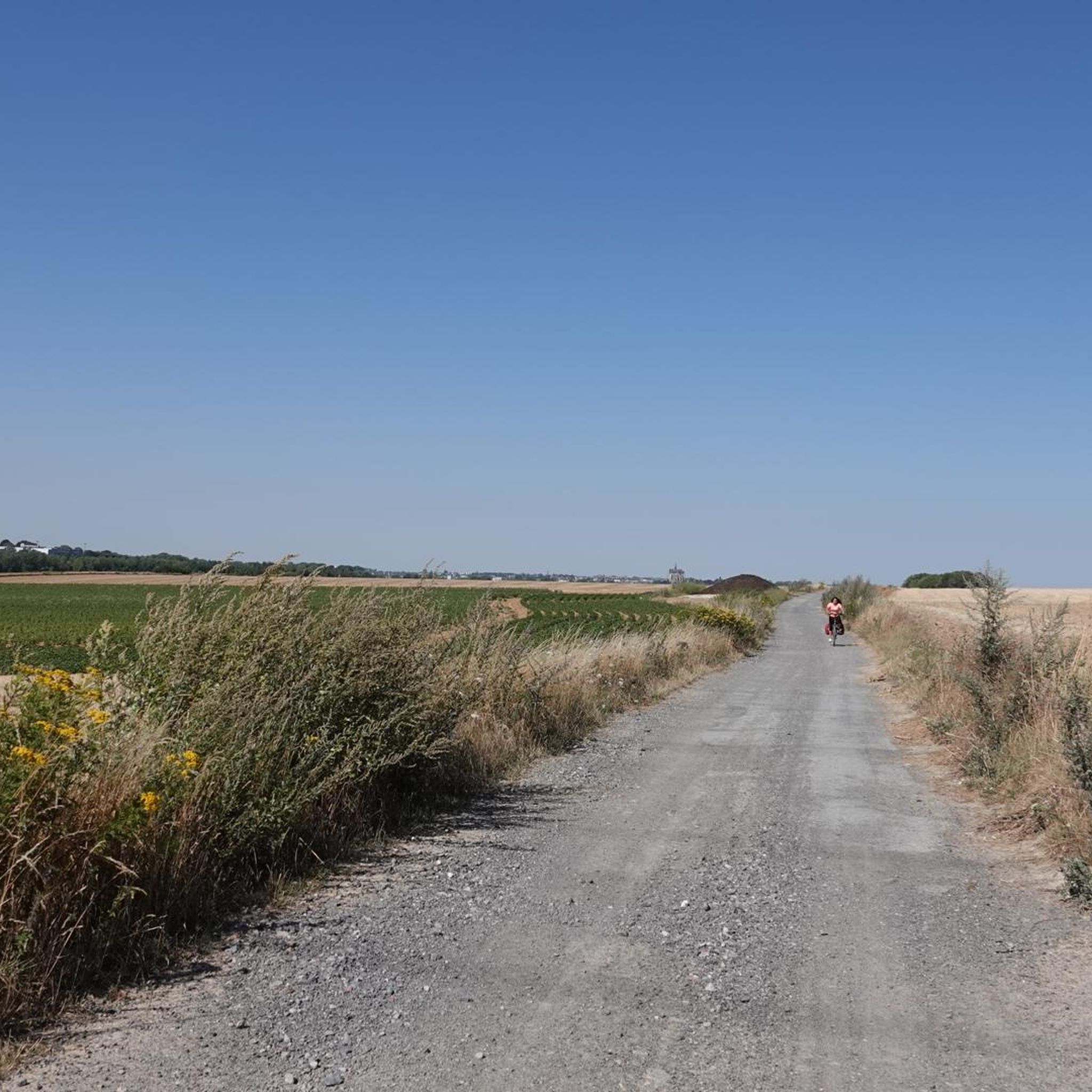
Mountain bike trails around Urvillers offer access to the varied landscapes of the Aisne department in the Hauts-de-France region. The area is characterized by its proximity to the Oise river, the Canal de Saint-Quentin, and natural reserves such as the Réserve naturelle des Marais d'Isle. Riders can expect routes that traverse wetlands, agricultural fields, and sections along waterways, providing a mix of terrain. This region serves as a convenient base for exploring the extensive trail networks around nearby Saint-Quentin.
Best…
Last updated: July 13, 2026
4.4
(11)
35
riders
32.5km
01:50
120m
120m
Moderate mountain bike ride. Great for any fitness level. Advanced riding skills necessary.
4.3
(3)
10
riders
30.0km
01:44
160m
160m
Moderate mountain bike ride. Great for any fitness level. Advanced riding skills necessary.

Sign up for free
4.0
(1)
4
riders
36.5km
02:26
250m
250m
Moderate mountain bike ride. Good fitness required. Advanced riding skills necessary.
3.0
(2)
4
riders
24.2km
01:34
120m
120m
Easy mountain bike ride. Great for any fitness level. Suitable for all skill levels.
6
riders
17.0km
00:55
60m
60m
Easy mountain bike ride. Great for any fitness level. Suitable for all skill levels.
Get access to more routes and recommendations from other explorers.
Sign up for free
Already have an account?
Our route recommendations are based on thousands of hikes, rides, and runs completed by other people on komoot.
Start today with a free account
Your next adventure awaits.
Login or Signup



Tips from the Community

Hello. This is a beautiful hike through nature and a nice park for recreation. the hike runs along a canal and a marshland with well-passable hiking trails. This hike is highly recommended !!!!!!!!!!!!!
0
0

This is where the Somme River rises. Its name is traced back to Celtic origins and also gives its name to the department of the same name. At the time when Gaul was part of the Roman Empire, the river was called the Samara. It ends its approximately 245-kilometer-long river life in the Baie de Somme, where it flows into the English Channel.
0
0

A beautiful, tree-lined trail around the Saint-Quentin Canal. An easy, family-friendly route. Enjoy your walk.
0
0

Voies Navigables de France operates the Tronquoy river tunnel (1,098 m) on the Saint-Quentin canal, which dates from the beginning of the 19th century.
0
0
As a memorial to the many dead, such a "MONUMENT AUX MORTS" (usually called a "Central Memorial" or "War Memorial" in German-speaking countries) is still very important today. "Now, Lord, you let your servant depart in peace, as you have said..." it says in the so-called "Hymn of Simeon" (Luke's Gospel, Chapter 2, Verse 29). However, the people who are remembered here did not depart in peace, but became victims of war and tyranny. Therefore, the term "fallen memorial" is now sometimes used instead of the "war memorial" that was previously common in German. In the French-speaking world, however, this aspect of commemoration of the dead has long been included in the most commonly used term "MONUMENT AUX MORTS". Regardless of language and nation, such a memorial has two important and at the same time everlasting tasks: -1- to keep the memory of the suffering and horror of war alive, -2- and to remind people of the need to maintain peace in the long term.
2
0

Parc de l'Isle in Saint-Quentin offers a variety of trails for different levels of difficulty, from flat, easy trails along the Somme to hilly, wooded routes in the nature reserve. You can also admire the flora and fauna of the park, which houses a free zoo, a farm and a conservation center. The park is open all year round, from 8 a.m. to 8 p.m. in summer and from 8 a.m. to 6 p.m. in winter. Whether you are a beginner or an expert, you will find at Parc d'Isle something to satisfy your tastes and your pace.
2
0
If you're looking for a scenic and historic route, you can try the Saint-Quentin Canal in northern France. This canal connects the Escaut, the Oise and the Somme, and crosses the watershed at a summit level 20.4 km long with two tunnels. You can run along the towpath, admire the views of the countryside and the waterway, and discover the towns and villages along the route. The canal was built in the 18th century and was an important link for trade and transport. You can learn more about its history and engineering at the Musée du Touage in Riqueval, where you can also see the electric tugboats that pull the boats through the long tunnel. The Saint-Quentin canal is an ideal destination for runners who love culture and adventure.
2
0
Frequently Asked Questions
How many mountain bike trails are available around Urvillers?
There are nearly 100 mountain bike trails around Urvillers, offering a wide variety of options for different skill levels. You'll find over 30 easy routes, more than 50 moderate trails, and several challenging options for experienced riders.
What kind of terrain can I expect on mountain bike trails near Urvillers?
The terrain around Urvillers is diverse, characterized by its proximity to the Oise river, the Canal de Saint-Quentin, and natural reserves like the Réserve naturelle des Marais d'Isle. Riders can expect routes that traverse wetlands, agricultural fields, and sections along waterways, providing a mix of surfaces from well-maintained paths to more natural, unpaved sections. Some routes may include significant elevation changes, particularly those considered difficult.
Are there family-friendly mountain bike trails near Urvillers?
Yes, Urvillers offers several family-friendly mountain bike trails. Many of the easy routes are suitable for families. For example, the St Quentin Canal – Canal de Saint-Quentin Path loop from Essigny-le-Grand is an easy 24.8 km (15.4 miles) trail that takes about 1 hour 30 minutes to complete, offering a pleasant ride along the canal.
Are there challenging mountain bike routes for experienced riders?
Yes, for experienced mountain bikers seeking a challenge, there are several difficult routes available. One such option is the Source of the Somme – Isle Park loop from Harly, a 43.49 km (27 miles) trail with over 350 meters (1,150 feet) of elevation gain, typically taking over 3 hours to complete. This route offers a more demanding experience through varied landscapes.
What do other mountain bikers enjoy most about the trails in Urvillers?
The mountain bike trails around Urvillers are highly rated by the komoot community, with an average score of 4.5 stars from over 100 reviews. Riders often praise the varied terrain, the scenic views along the Oise river and canals, and the accessibility to natural areas. The mix of easy, moderate, and difficult routes also means there's something for everyone.
Are the mountain bike trails around Urvillers circular?
Many of the mountain bike trails around Urvillers are designed as circular routes, allowing you to start and finish at the same point. This is convenient for riders who drive to the trailheads. For instance, the Cycle Path Along the Oise loop from Urvillers is a moderate 36.5 km (22.7 miles) loop offering scenic views along the Oise river.
What natural attractions can I see along the mountain bike trails?
The trails around Urvillers offer access to several natural attractions. You can ride along the Bike path along the Oise or the Canal cycling route, enjoying the tranquil waterways. The region is also close to the Réserve naturelle des Marais d'Isle, a wetland nature reserve, and features areas like Isle Park, which can be incorporated into longer rides.
Are there any historical landmarks or points of interest near the mountain bike routes?
Yes, beyond the natural beauty, you can explore historical landmarks. The nearby city of Saint-Quentin, easily accessible from Urvillers, features the impressive Basilique Saint-Quentin and the Saint-Quentin war memorial. Some routes, like the 'Hindenburg Line bunker – Riqueval Towing System loop from Nauroy' mentioned in regional research, also pass by significant historical sites related to World War I.
When is the best time of year to go mountain biking in Urvillers?
The best time for mountain biking in Urvillers, located in the Hauts-de-France region, is typically from spring through early autumn (April to October). During these months, the weather is generally milder and drier, making for more comfortable riding conditions. Summer offers longer daylight hours, while spring and autumn provide pleasant temperatures and beautiful scenery.
Are there any easy mountain bike trails suitable for beginners?
Absolutely. Urvillers has over 30 easy mountain bike trails perfect for beginners or those looking for a relaxed ride. An excellent option is the St Quentin Canal – Canal de Saint-Quentin Path loop from Essigny-le-Grand, which is 24.8 km (15.4 miles) long and has minimal elevation gain, making it very accessible.
What is the average duration of mountain bike trails in the Urvillers area?
The duration of mountain bike trails around Urvillers varies significantly depending on the route's length and difficulty. Easy trails, like the St Quentin Canal loop, can take around 1 hour 30 minutes. Moderate routes, such as The children's square loop from Gauchy, typically last about 1 hour 45 minutes. More challenging and longer routes can extend to 3 hours or more.
Most popular routes around Urvillers
Most popular attractions around Urvillers

Get inspired with the komoot mobile app


Explore more
Browse the best MTB trails in other regions.
