The best walks and hikes around Fuans
4.5
(767)
5,024
hikers
164
hikes
Hiking around Fuans offers a diverse landscape characterized by deep valleys, limestone cirques, and significant water features such as waterfalls and karst springs. The region's terrain includes varied elevations, providing routes that range from gentle paths to more challenging ascents. Dense woodlands often line the trails, contributing to the natural environment.
Best hiking trails around Fuans
- The most popular hiking route is Priest's Rock Trail, a 3.9 miles (6.2 km) trail that takes 2 hours 20 minutes to complete.…
Last updated: October 9, 2026
4.7
(62)
241
hikers
6.21km
02:20
370m
370m
Hike the moderate 3.9-mile Cirque de consolation et la roche du Prêtre loop, featuring waterfalls, cliffside stairs, and panoramic views.
4.8
(35)
209
hikers
12.0km
04:10
580m
580m
Moderate hike. Good fitness required. Mostly accessible paths. Sure-footedness required.

4.6
(12)
64
hikers
4.03km
01:19
180m
180m
Easy hike. Great for any fitness level. Easily-accessible paths. Suitable for all skill levels.
4.7
(7)
46
hikers
10.3km
03:11
350m
350m
Moderate hike. Good fitness required. Easily-accessible paths. Suitable for all skill levels.
4.8
(9)
46
hikers
11.2km
03:07
210m
210m
Moderate hike. Good fitness required. Easily-accessible paths. Suitable for all skill levels.
Get access to more routes and recommendations from other explorers.
Already have an account?
Our route recommendations are based on thousands of hikes, rides, and runs completed by other people on komoot.
Start today with a free account
Your next adventure awaits.

Tips from the Community

You shouldn't be afraid of heights. Not recommended for families with young children.
0
0

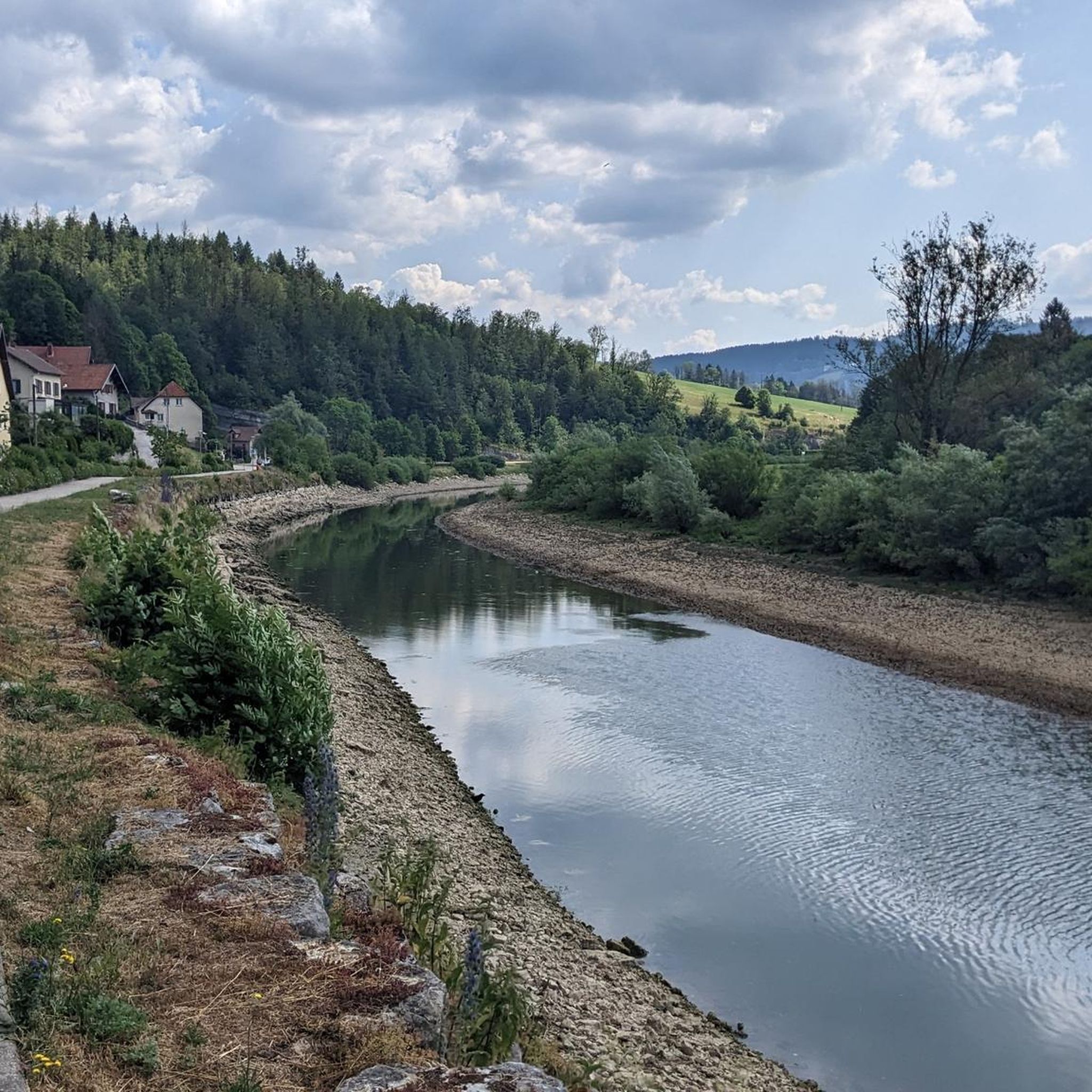
A little corner of freshness which is very welcome in summer. From here you see the Dessoubre river being born in a succession of small waterfalls which emanate from the rocks of the Cirque de Consolation.
1
0

The Dessoubre has its source in the Cirque de Consolation, at Consolation-Maisonnettes, and meanders through this superb valley. The valley is also classified as ZNIEFF (natural zone of ecological, fauna and flora interest), which means that it is a natural space considered remarkable. The Consolation site itself is also known for its monastery, viewpoints, waterfalls and botanical gardens.
1
0

If you are looking for a historic and picturesque hike, you can visit the ruins of the Reaumont castle in Bélieu, a commune in the Doubs department of France. The castle was built in the 14th century by Henry de Montfaucon, a nobleman who became the Count of Montbéliard. It was destroyed in 1639 by the troops of Louis XIII during the Thirty Years' War. We can still see the remains of the walls, towers and moats that defended this medieval fortress. The castle is located at an altitude of around 1000 meters and offers panoramic views of the valley below.
2
0
The Étang des Tourbières in Noël-Cerneux is home to forests, lakes and peat bogs which are themselves home to rare and endangered fauna. You can enjoy the panoramic views and the artistic inspiration of the painter Émile Isenbart, fascinated by the Noël-Cerneux peat bogs.
2
0
The Roche du Prêtre offers a breathtaking view of the Cirque de Consolation below as well as the forests and hills of the region.
2
0
Whether you visit the waterfall in full flow or not, this circus has something to offer. The deafening roar of flowing water contrasts with the majesty and serene tranquility of the circus in times of drought.
2
0
Highest point, before descending there, observe the Cirque de Consolation from the Roche du Prêtre.
2
0
Frequently Asked Questions
How many hiking trails are available around Fuans?
There are over 140 hiking trails in the Fuans region, offering a wide variety of options for different skill levels and preferences. You'll find everything from easy strolls to more challenging ascents.
What kind of terrain can I expect on hikes in Fuans?
Hiking around Fuans is characterized by diverse terrain, including deep valleys, dramatic limestone cirques, and significant water features like waterfalls and karst springs. Trails often wind through dense woodlands and feature varied elevations.
Are there easy hiking trails suitable for beginners in Fuans?
Yes, Fuans offers a good selection of easy trails. Approximately 56 of the routes are classified as easy, making them suitable for beginners or those looking for a more relaxed walk. An example is the Consolation Cirque – Karst spring of the Dessoubres loop from Consolation-Maisonnettes, which is an easy 2.5-mile (4.0 km) trail.
What is the typical length and duration of hikes in Fuans?
Hikes in Fuans vary significantly in length and duration. You can find shorter routes like the Consolation Cirque – Lançot Waterfall loop, which is about 1.8 miles (2.9 km) and takes around 1 hour. Longer, more moderate trails, such as the Lançot Waterfall – Consolation Cirque loop, can be up to 7.5 miles (12.1 km) and take over 4 hours.
Are there hiking trails in Fuans that feature waterfalls?
Absolutely! Waterfalls are a prominent feature of the Fuans region. You can explore trails that lead to impressive cascades like the Lançot Waterfall or the majestic Saut du Doubs Waterfall. Many routes incorporate these natural wonders.
Can I find hikes that explore the unique cirques and karst springs in the area?
Yes, the region is known for its dramatic geological formations. Trails often lead through the impressive Consolation Cirque and to natural karst springs. The Source of the Dessoubre – Karst spring of the Dessoubres loop is a great example of a hike focusing on these unique features.
Are there circular hiking routes available in Fuans?
Many of the trails in Fuans are designed as circular routes, allowing you to start and end at the same point. This is convenient for exploring the diverse landscapes. Examples include the Lançot Waterfall – Consolation Cirque loop and the Consolation Cirque – Karst spring of the Dessoubres loop.
What are some interesting natural landmarks or attractions to see while hiking near Fuans?
Beyond the trails themselves, you can discover several natural landmarks. Key attractions include the stunning Saut du Doubs Waterfall, the picturesque Brenets Lake, and the impressive Consolation Cirque. There are also viewpoints like the Belvédère des Taillards offering panoramic views.
What do other hikers say about the trails in Fuans?
The trails in Fuans are highly regarded by the komoot community, with an average rating of 4.5 stars from over 575 reviews. Hikers often praise the natural beauty, the variety of terrain, and the well-maintained paths that lead to stunning waterfalls and geological formations.
Are there any moderate trails for hikers looking for a bit more challenge?
Yes, Fuans offers a significant number of moderate trails, with about 80 routes falling into this category. These trails provide a good balance of distance and elevation gain. The Priest's Rock Trail, for instance, is a moderate 3.9-mile (6.2 km) route featuring varied terrain and natural rock formations.
Are there any lakes or bodies of water to explore near the hiking routes?
Yes, the region features beautiful bodies of water. The Brenets Lake is a notable highlight, offering scenic views and opportunities to enjoy the water. You might also encounter smaller lakes like the Bog Pond along some routes.
Most popular attractions around Fuans

Get inspired with the komoot mobile app


Explore more
Browse the best Hikes in other regions.
