The best walks and hikes around Condeissiat
4.2
(95)
566
hikers
89
hikes
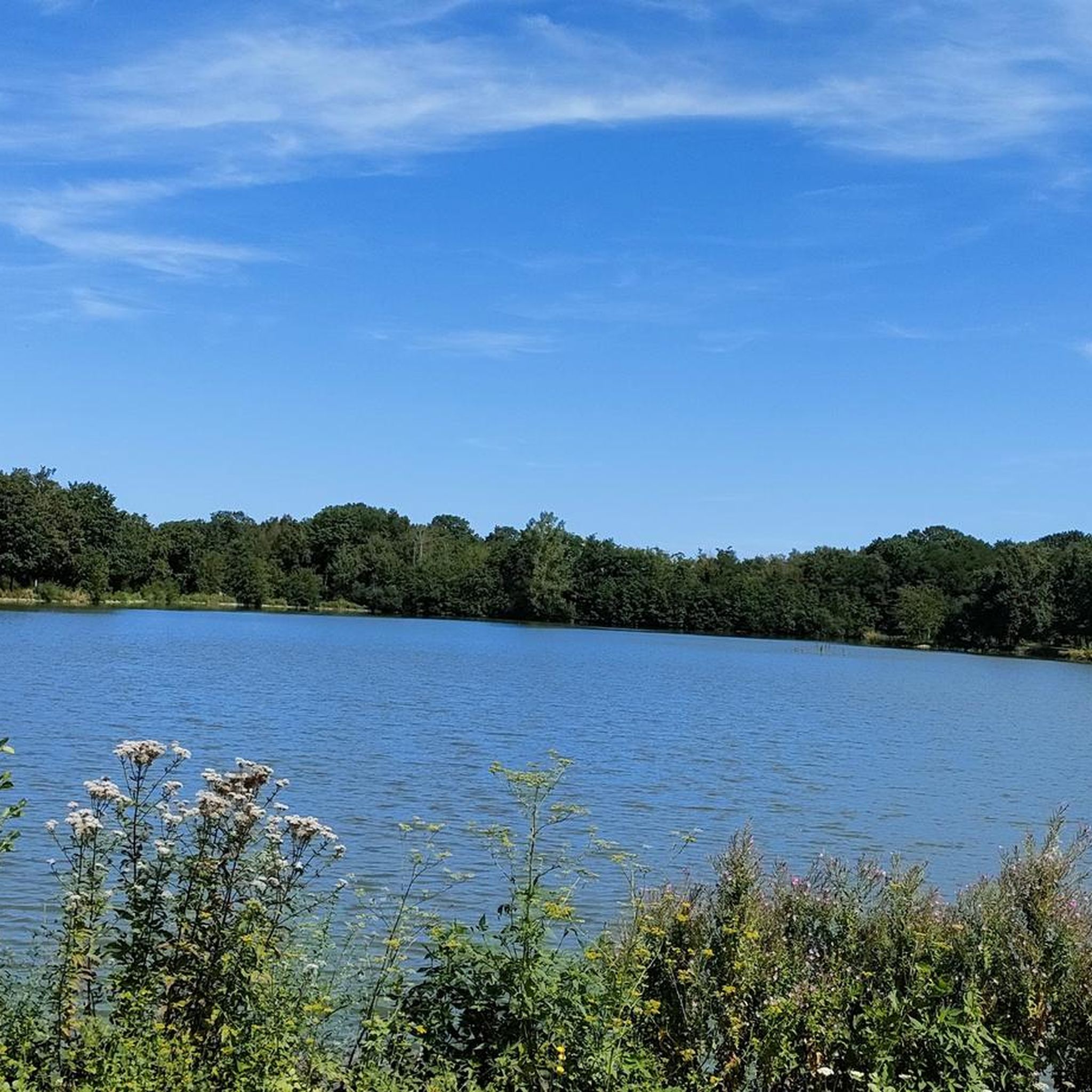
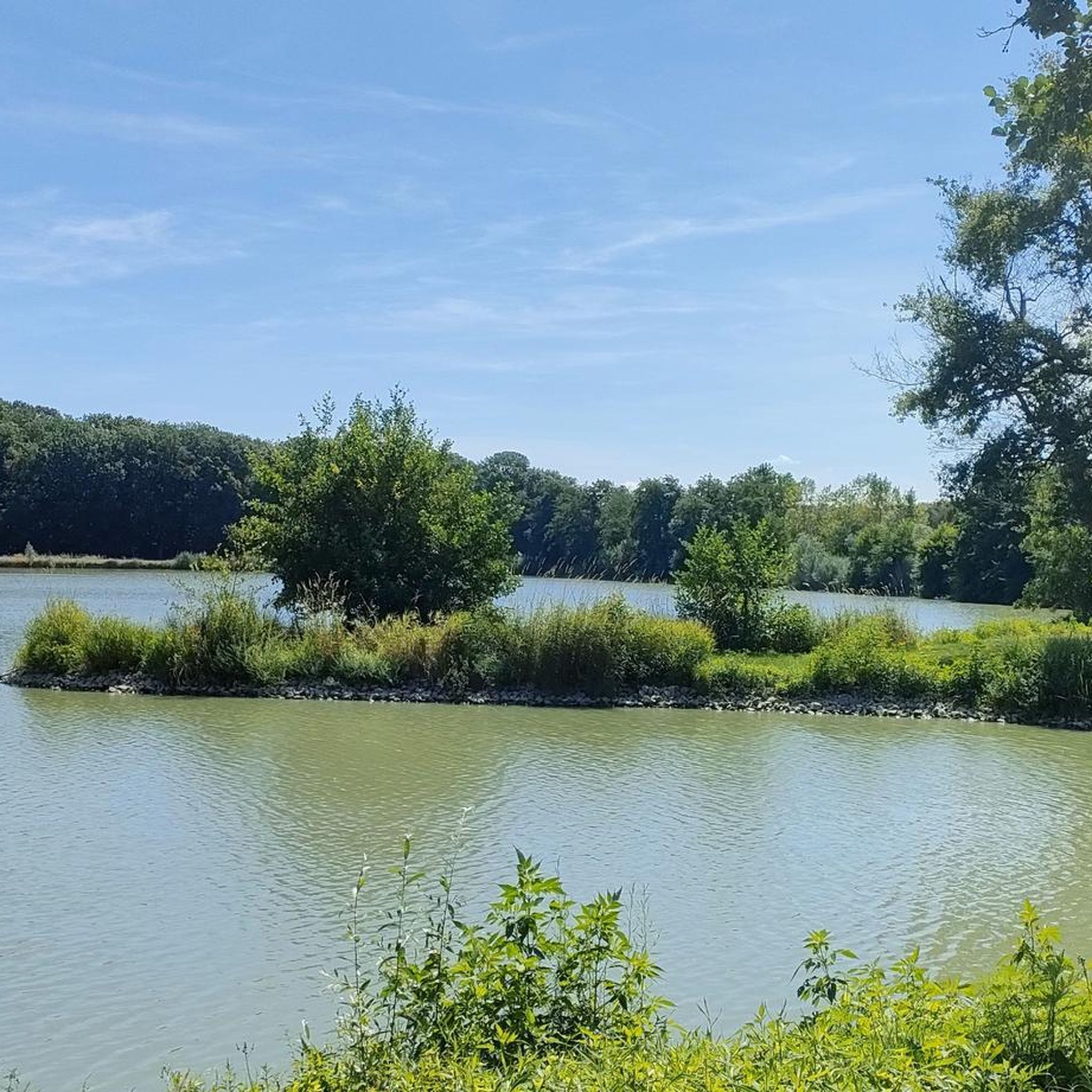
Hiking trails around Condeissiat are set within the Dombes region, known as the "land of a thousand ponds." This landscape, shaped by glacial action, features numerous rainwater pools and an undulating plateau. The terrain offers a mix of deep blue waters, lush green vegetation, and higher ground reaching up to 300 meters near the Ain and Rhône rivers.
Best hiking trails around Condeissiat
- The most popular hiking route is Roman Bridge loop from Étang des Petites Parquières, a 3.5…
Last updated: July 2, 2026
3.8
(4)
33
hikers
5.58km
01:27
30m
30m
Easy hike. Great for any fitness level. Easily-accessible paths. Suitable for all skill levels.
5.0
(2)
14
hikers
Moderate hike. Good fitness required. Easily-accessible paths. Suitable for all skill levels.

Sign up for free
3.8
(4)
33
hikers
5.56km
01:26
30m
30m
Easy hike. Great for any fitness level. Easily-accessible paths. Suitable for all skill levels.
13
hikers
4.47km
01:09
20m
20m
Easy hike. Great for any fitness level. Easily-accessible paths. Suitable for all skill levels.
Easy hike. Great for any fitness level. Easily-accessible paths. Suitable for all skill levels.
Get access to more routes and recommendations from other explorers.
Sign up for free
Already have an account?
Our route recommendations are based on thousands of hikes, rides, and runs completed by other people on komoot.
Start today with a free account
Your next adventure awaits.
Login or Signup

Tips from the Community

The road to Dompierre is a bit busy and be careful ⚠️, you cross the national road to Lyon twice, otherwise it's a nice and easy route.
0
0

You will find a lot of water here but also some remarkable oak trees.
0
0

The Saint-Martin church, whose name is an indicator of seniority, depended on the lords of Bâgé. They ceded it, before 1059, to the abbey of Tournus which founded a priory there. https://www.sauvegardeartfrancais.fr/projets/buellas-eglise-saint-martin/
2
0
The Poype des Fées (fairy mound) is a reconstructed motte (tower hill castle). Description: The earth for the construction of the poype came from the moat. On the hill there is a tower surrounded by a palisade. A footbridge made it possible to cross the moat to reach the kennel, also surrounded by a moat, which protected the inhabitants and their animals. https://de.wikipedia.org/wiki/Poype_des_F%C3%A9es A fascinating place with lots of information in French.
2
0

The fairy poype presents a motte with a two-story tower, the double moat, access to the top of the motte via a footbridge, an acacia palisade. This historical reconstruction replaces the poype destroyed not far from there in the 18th century. Free access site. This reconstruction of Buellas is the only one in Bresse that is complete. Others are visible like in Saint Cyr Sur Menthon, but only the mound remains.
2
0

The Dombes ponds are part of the large collection ponds of the Dombes departmental reserve. There are more than 1,000 of them.
1
1

The "poypes" or "mottes castrales" are often artificial mounds that house a defensive medieval habitat on their top.
0
1
Frequently Asked Questions
How many hiking trails are available around Condeissiat?
There are over 80 hiking trails around Condeissiat. These routes range from easy walks suitable for all fitness levels to moderate hikes for those seeking a bit more challenge, allowing you to explore the unique 'land of a thousand ponds' at your own pace.
What are the typical difficulty levels for hiking trails in Condeissiat?
The trails around Condeissiat are predominantly easy to moderate. You'll find approximately 36 easy routes, perfect for a relaxed stroll, and about 44 moderate trails that offer a bit more distance or gentle elevation changes. There are no difficult trails listed, making the area accessible to a wide range of hikers.
Are there any family-friendly hiking options in Condeissiat?
Yes, Condeissiat offers several family-friendly hiking options, particularly among its easy routes. Trails like the Étang Guillet loop from Boisson are relatively short with minimal elevation, making them suitable for families with children. The gentle terrain and scenic ponds provide an enjoyable outdoor experience for everyone.
Can I find circular hiking routes in the Condeissiat area?
Yes, many of the hiking routes around Condeissiat are circular, allowing you to start and end at the same point. For example, the Saint-Martin Church of Buellas – La Poype des Fées loop from Montcet is an easy circular trail that lets you explore local history and nature without retracing your steps.
What kind of natural landscapes will I encounter while hiking in Condeissiat?
Hiking in Condeissiat immerses you in the unique 'land of a thousand ponds' of the Dombes region. You'll experience a landscape shaped by glacial action, featuring numerous rainwater pools, lush green vegetation, and gently undulating terrain. The deep blue of the water contrasting with the greenery, along with the sounds of local wildlife, creates a distinctive and tranquil environment.
Are there any specific points of interest or attractions along the hiking trails?
While hiking, you can discover local curiosities and historical features. For instance, the area around Etang Moulin features a traditional 'silver well' and historic farms built from adobe, brick, and pebbles. For broader attractions, you might consider visiting the Abbey of Notre-Dame des Dombes or the charming town of Châtillon-sur-Chalaronne, both nearby.
What do other hikers enjoy most about hiking in Condeissiat?
The hiking routes in Condeissiat are highly rated by the komoot community, with an average score of 4.2 stars from over 80 reviews. Hikers often praise the tranquil pond-filled scenery, the accessibility of the trails for various fitness levels, and the opportunity to experience the preserved nature of the Dombes region.
Is there a trail that highlights the famous ponds of the Dombes region?
Absolutely. The Remarkable Oaks in the Dombes – The ponds of the Dombes loop from Saint-Paul-de-Varax is a moderate trail that specifically leads hikers through the characteristic ponds and remarkable oak trees of the Dombes, offering an immersive experience of the region's signature landscape.
Are there any trails that feature historical elements?
Yes, some trails incorporate historical elements. The Roman Bridge loop from Saint-Paul-de-Varax, for example, guides you through the local countryside, where you might encounter historical structures or remnants of the past, adding a cultural dimension to your hike.
What is the best time of year to go hiking in Condeissiat?
The Dombes region, with its vibrant ecosystem, offers a 'festival of colors, scents, and sounds' throughout much of the year. Spring and autumn are particularly pleasant, with mild temperatures and beautiful foliage or blooming flora. The numerous ponds create a refreshing atmosphere, making it enjoyable even during warmer months, though checking local weather is always recommended.
Are there any trails that offer views of the larger ponds, like Etang Moulin?
Yes, the region's largest ponds are often central to hiking experiences. While not explicitly listed in the guide data, the regional research highlights the 50-hectare Etang Moulin as a prominent feature in local hiking routes, allowing visitors to immerse themselves in its tranquil scenery. You can often find trails that skirt its edges or offer panoramic views.
Most popular routes around Condeissiat
Most popular attractions around Condeissiat

Get inspired with the komoot mobile app


Explore more
Browse the best Hikes in other regions.
