The best walks and hikes around Saint-Sornin
4.4
(83)
588
hikers
30
hikes
Hiking trails around Saint-Sornin traverse a landscape characterized by a limestone promontory, bordered by the Seudre estuary and the extensive Brouage marshes. This region, primarily in Charente-Maritime, features unique wetland ecosystems and diverse wildlife. The terrain is generally flat, with minimal elevation changes, making it suitable for various hiking abilities.
Best hiking trails around Saint-Sornin
- The most popular hiking route is Mornac-sur-Seudre Marshes Loop, a 5.1 miles (8.2 km) trail that takes 2 hours 4 minutes to complete. This…
Last updated: July 15, 2026
4.7
(9)
33
hikers
Moderate hike. Good fitness required. Easily-accessible paths. Suitable for all skill levels.
5.0
(2)
28
hikers
Easy hike. Great for any fitness level. Easily-accessible paths. Suitable for all skill levels.

Sign up for free
4.8
(5)
22
hikers
11.6km
02:55
10m
10m
Moderate hike. Good fitness required. Easily-accessible paths. Suitable for all skill levels.
3.8
(5)
22
hikers
6.19km
01:34
10m
10m
Easy hike. Great for any fitness level. Easily-accessible paths. Suitable for all skill levels.
4.0
(4)
10
hikers
Easy hike. Great for any fitness level. Easily-accessible paths. Suitable for all skill levels.
Get access to more routes and recommendations from other explorers.
Sign up for free
Already have an account?
Our route recommendations are based on thousands of hikes, rides, and runs completed by other people on komoot.
Start today with a free account
Your next adventure awaits.
Login or Signup


Tips from the Community

The port of Ribérou is a major heritage site in Saujon, bearing witness to a prosperous maritime past linked to the salt and wine trade. Transformed in the 19th century by ambitious works, it has now been reinvented as a place for living, relaxation, and preserving local history. 🛶 Origins and the Middle Ages The port of Ribérou takes its name from the Latin word ripa ("riverbank") or the Occitan word ribèira ("river"). It is located at the head of the Seudre estuary. It existed as early as the 11th century and became an important river and sea port thanks to its strategic position at the head of the estuary, used particularly for the salt trade—then called "white gold"—a highly sought-after product for preserving food. 🚢 Medieval Period and International Trade With the opening of British markets during the reigns of Eleanor of Aquitaine and Henry II Plantagenet, ships laden with wool, salt, wine, and other goods flocked to Ribérou. In the 16th century, the port exported local wines (such as cognac and pineau) throughout Europe. In 1577, during the Wars of Religion, the port was a strategic site: troops were stationed there, and battles took place. 🏗️ Decline, Reconstruction, and the 19th Century The estuary gradually silted up, making navigation difficult. By 1691, only smaller vessels could dock there. During the French Revolution, the sale of the tidal mill, which helped remove sediment, worsened the silting, leading to the port's decline. A modernization project began in 1822, but it wasn't until 1839 that an ambitious program was launched under the impetus of Jules Dufaure—a native of Saujon and Minister of Public Works—with the construction of sturdy quays, slipways, a lock bridge (marking the boundary between fresh and salt water), and reception facilities. In 1842, the work was completed, and the main quay was named Quai Dufaure in honor of this political support. 📉 Gradual Decline and Modernization The arrival of the railway in 1876 and the persistent problems of silting led to a decline in the port's traditional commercial activity, already facing competition from other transport networks. In the 20th century, the port gradually lost its economic importance but remained active for traditional fishing and became a place for pleasure boating, leisure, and local culture. Urban and tourism development projects (particularly in 2011–2012) modernized the port while preserving its historical charm. 🌊 Today The port of Ribérou is now a small fishing and pleasure port, much appreciated for its walks along the Seudre River, water sports (canoeing, kayaking, paddleboarding, etc.), and seasonal events.
0
0


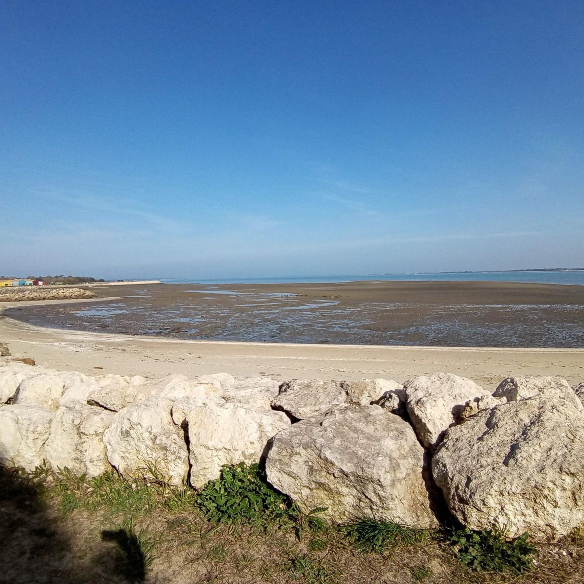
Pleasant walk in the autumn sun....a good balance between roads and paths....
0
0
The port of Ribérou is a fishing and pleasure port located at the end of the Seudre estuary, in Saujon. It is one of the two ports in the city, along with that of Breuil, a little downstream. Active since the 11th century, it took on its current appearance from 1842, under the impetus of the Minister of Public Works at the time, Jules Dufaure, a "local boy", who thus attempted to revive maritime trade and fishing activities, which were then in decline. Ideally located, on the edge of the city center, the La Lande leisure center and the preserved areas of the Seudre marshes (towpaths transformed into walking trails), it has become one of the major tourist attractions in Saujon, where theme evenings and the July 14 fireworks are organized. In 2011, the municipality began a renovation program for the port site, entrusted to the architect-urban planner Sophie Blanchet. It consists of transforming the old car parks into a pedestrian esplanade, a real meeting place with modern street furniture and, in the long term, green spaces. From the quays, lined with bourgeois buildings, small picturesque streets lined with hollyhocks allow you to crisscross the district and reach the city centre. The Ribérou lock bridge, known as the "bridge of opposing waters", was renovated in 2010. It marks the separation between the waters of the estuary (port side: brackish water) and the waters of the river (retention basin side: fresh water). Ribérou is a starting point for certain water sports (canoeing and kayaking). It is approximately 250 metres long and 40 metres wide. From Ribérou, it is possible to reach successively the ports of Breuil (Saujon), L'Éguille, Mornac, Chaillevette, Chatressac (Chaillevette), Grandes Roches and Orivol (Étaules), La Grève in Duret and Coux (Arvert), La Grève (La Tremblade) and La Cayenne (Marennes).
0
0
The SAINT-PIERRE church dominates the village from its fortified bell tower. Original in many ways, the Romanesque building houses a holy water font made of a real shell. From the side, you reach the small garden of the chevet, well hidden. Stone sarcophagi (Merovingian or Carolingian depending on the source) bear witness to the archaeological excavations that the church has undergone. There are many stories in Mornac but that of the fire of August 2, 1943 marked the identity of the village. Indeed, the bell tower has not always had this appearance. It had the more traditional shape of a spire until lightning struck it. Many young students come to Mornac-sur-Seudre to participate in the clearing and the excavations that follow. Seduced by the local atmosphere, many of them stayed and opened the first craft workshops in the village, some of which are still present, such as pottery and leather.
0
0
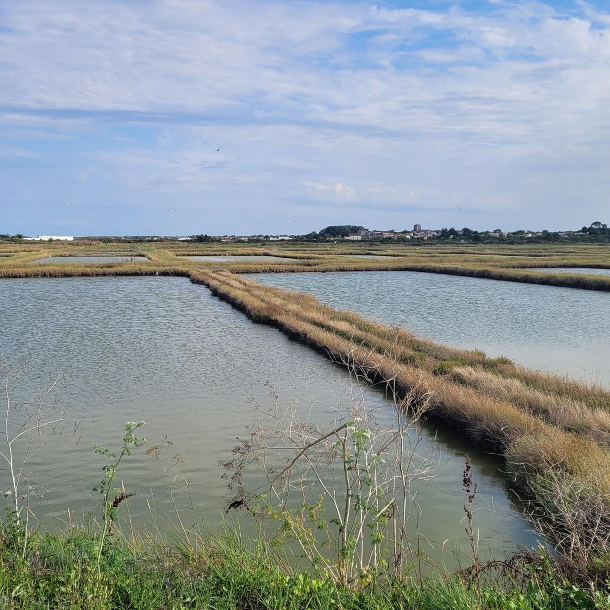
The Seudre marshes, which thus form a structuring component of the communal landscape, have a unique appearance, made up of mudflats with grey-blue reflections, punctuated by reed hedges and wild grasses. In the commune, they are delimited by the Seudre itself, with the Mouillelande bank which forms the boundary with Le Gua, its tributary the Liman, but also by the channels of Coulonges (administrative boundary with Chaillevette), Téger, Mornac (along which is the port), Plordonnier, Agnoux and Fontbedeau. Mornac being part of the Marennes-Oléron oyster basin, they are home to numerous oyster beds, or "claires", refining basins where the oysters acquire a particular flavour and colour under the action of a pigment (marennine) produced by a microscopic algae called blue navicula. From Roman times to the 18th century, the Seudre estuary and the outlet of the Liman were occupied by saltworks. The commune has rehabilitated this tradition and now preserves a small salt marsh, where salt is harvested in an artisanal way. The marshes are crisscrossed with small picturesque paths and observation posts that allow you to better understand this very rich natural space, where many birds come to stop and nest. Here more than anywhere else, you become aware of the almost island character of the commune, with this subtle interweaving of land and water and an infinite sky, often blue because swept by sea breezes where human activity tries to preserve the existing fauna and flora for the greatest pleasure of all.
0
0
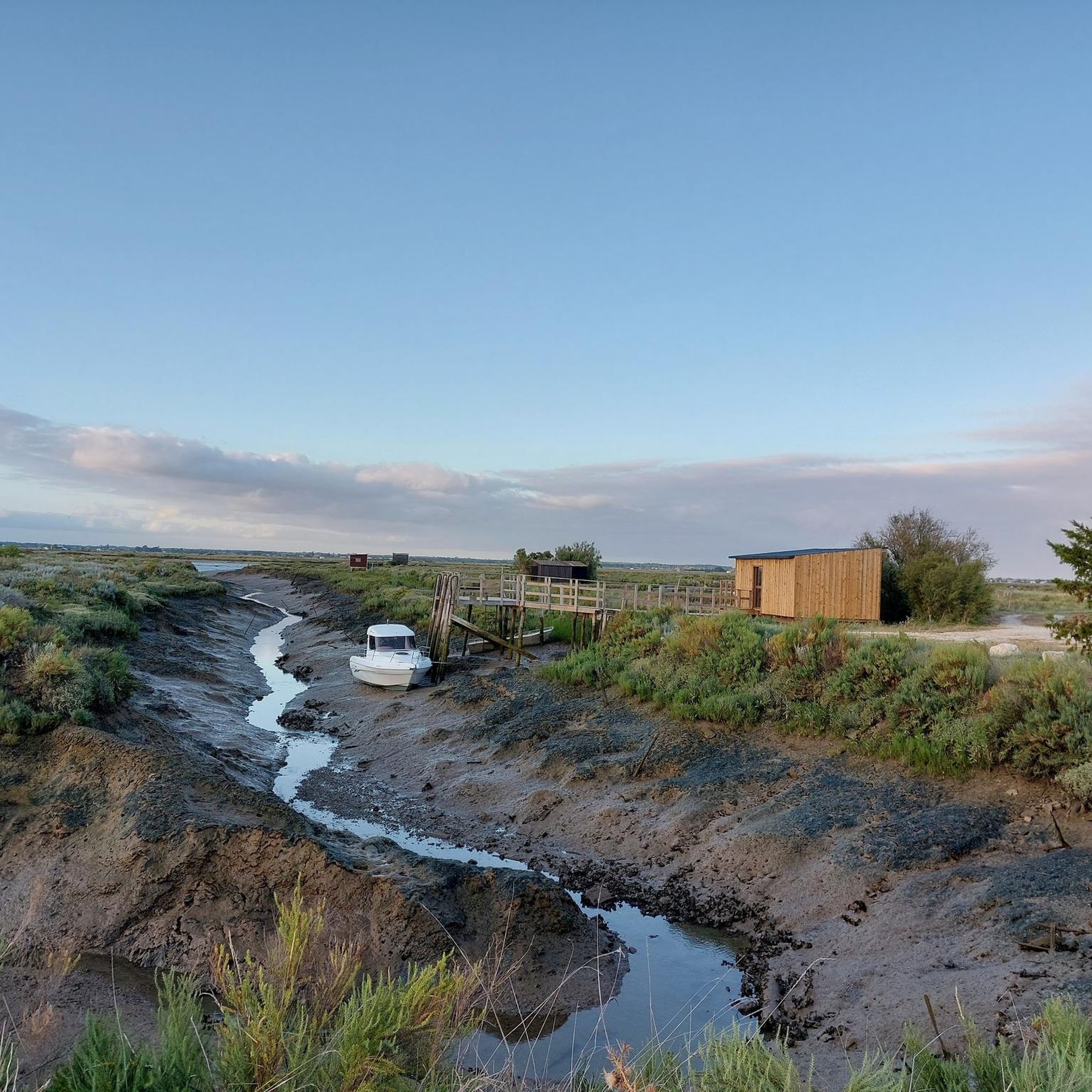
There are many shelters for hunting wild ducks in the marshes (some very well installed with all the comforts) right next to bodies of water where ducks are enthroned which serve as decoys in order to attract their fellows within rifle range. We find similar huts in Gironde for wood pigeon shooting but with much more rusticity.
0
0
Frequently Asked Questions
What kind of landscapes can I expect on hikes around Saint-Sornin?
Hikes around Saint-Sornin, primarily in Charente-Maritime, feature unique wetland ecosystems. You'll traverse a limestone promontory, enjoy views of the Seudre estuary, and explore the extensive Brouage marshes. The terrain is generally flat, offering opportunities for birdwatching and experiencing a rich natural environment.
How many hiking trails are available in Saint-Sornin?
There are over 25 hiking routes available around Saint-Sornin, catering to various preferences. These include both easy walks and more moderate excursions through marshland paths and rural countryside.
Are there any easy hiking trails suitable for beginners or families?
Yes, approximately half of the trails around Saint-Sornin are rated as easy. An example of an easy route is the Mornac-sur-Seudre Market – Mornac-sur-Seudre Marshes loop, which is about 3.5 km long and takes just under an hour. These routes are ideal for a relaxed outing with family.
What wildlife can I expect to see while hiking in the area?
The Brouage marshes and Réserve Naturelle de la Massonne are havens for diverse wildlife. You might spot European pond turtles, egrets, herons, and coypus. Protected species like the Dartford warbler, marsh gentian, scarce large blue butterfly, and European otters also inhabit the area, making it excellent for nature observation.
Are there any circular hiking routes available around Saint-Sornin?
Yes, many routes around Saint-Sornin are circular. For instance, the Mornac-sur-Seudre Marshes Loop is a popular circular trail offering views of the local marshlands. Another option is the Romanesque Church of St. Symphorien – The castle loop, which takes you through rural landscapes and past historical sites.
What are some interesting places to see near the hiking trails?
Along your hikes, you can explore several points of interest. The Mornac-sur-Seudre Marshes are a significant natural highlight. You can also visit historical sites like Saint Peter's Church in Marennes or Saint-Pierre Church in Mornac-sur-Seudre, and the charming Riberou Port.
What do other hikers enjoy most about hiking in Saint-Sornin?
The area is highly rated by the komoot community, with an average score of 4.2 stars from over 60 reviews. Hikers often praise the tranquil marshland paths, the scenic estuary views, and the opportunities for birdwatching in the natural reserves.
Is Saint-Sornin a good destination for hiking with dogs?
Many trails in natural areas like Saint-Sornin are generally dog-friendly, especially if dogs are kept on a leash to protect local wildlife and ensure a pleasant experience for all hikers. Always check specific trail regulations or local signage for any restrictions.
What is the best time of year to go hiking in Saint-Sornin?
The spring and autumn months are generally ideal for hiking in Saint-Sornin, offering pleasant temperatures and vibrant natural scenery. Spring brings blooming flora and active wildlife, while autumn provides comfortable weather and beautiful colors. Summer can also be enjoyable, but it's advisable to hike in the cooler parts of the day.
Are there any specific trails that offer panoramic views?
Yes, the hiking circuit 'Du village de Saint-Sornin à la tour de Broue' is known for offering panoramic views of the Brouage marshes from the Broue tower. This route also provides excellent opportunities to observe endemic birds like storks, herons, and egrets.
What should I pack for a hike in Saint-Sornin?
Given the marshland environment, comfortable waterproof footwear is highly recommended. Depending on the season, layers of clothing, sun protection, insect repellent, and sufficient water are essential. Binoculars would also be beneficial for birdwatching.
Most popular routes around Saint-Sornin
Most popular attractions around Saint-Sornin

Get inspired with the komoot mobile app


Explore more
Browse the best Hikes in other regions.
