The best road cycling routes around Étouvans
4.5
(289)
5,875
riders
337
rides
Road cycling routes around Étouvans traverse a landscape characterized by river valleys, canal paths, and rolling hills. The region, situated near the Doubs river and the Rhine-Rhone Canal, offers varied terrain for road cyclists. While many routes follow the flatter riverbanks, some extend towards more challenging ascents, such as the Col du Ballon d'Alsace. The area provides a mix of open countryside and routes passing through small towns.
Best road cycling routes around Étouvans
- The most popular road cycling route…
Last updated: October 11, 2026
38
riders
24.9km
01:02
100m
100m
Easy road ride. Great for any fitness level. Mostly well-paved surfaces and easy to ride.
34
riders
Hard road ride. Very good fitness required. Some segments of this route may be unpaved and difficult to ride.

18
riders
Moderate road ride. Good fitness required. Some segments of this route may be unpaved and difficult to ride.
19
riders
Moderate road ride. Good fitness required. Some segments of this route may be unpaved and difficult to ride.
18
riders
121km
05:42
1,510m
1,510m
Hard road ride. Very good fitness required. Mostly well-paved surfaces and easy to ride.
Get access to more routes and recommendations from other explorers.
Already have an account?
Our route recommendations are based on thousands of hikes, rides, and runs completed by other people on komoot.
Start today with a free account
Your next adventure awaits.


Tips from the Community

The Bassin de Champagney (or Champagney Reservoir) is an impressive artificial reservoir with a surface area of 107 hectares, located in the French department of Haute-Saône (Bourgogne-Franche-Comté region). The reservoir is situated in the southern foothills of the Vosges and was built between 1882 and 1905 to supply water to the never fully completed Canal de la Haute-Saône. Today, the lake has a capacity of 13 million m³ and is a popular destination for nature lovers, hikers, and fishermen.
6
0
The Étang du Malsaucy (often also called Lac du Malsaucy) is, with an area of 55 hectares, the largest lake in the French department of Territoire de Belfort. It is nestled in the Parc naturel régional des Ballons des Vosges, spread across the municipalities of Évette-Salbert, Lachapelle-sous-Chaux, and Sermamagny. Originally built at the end of the 15th century for fish farming, it is now one of the most important recreational and natural areas in the region.
6
0

René Pottier was the first participant to cross a pass by bicycle. The first pass of the Tour de France was the Ballon d'Alsace.
2
0


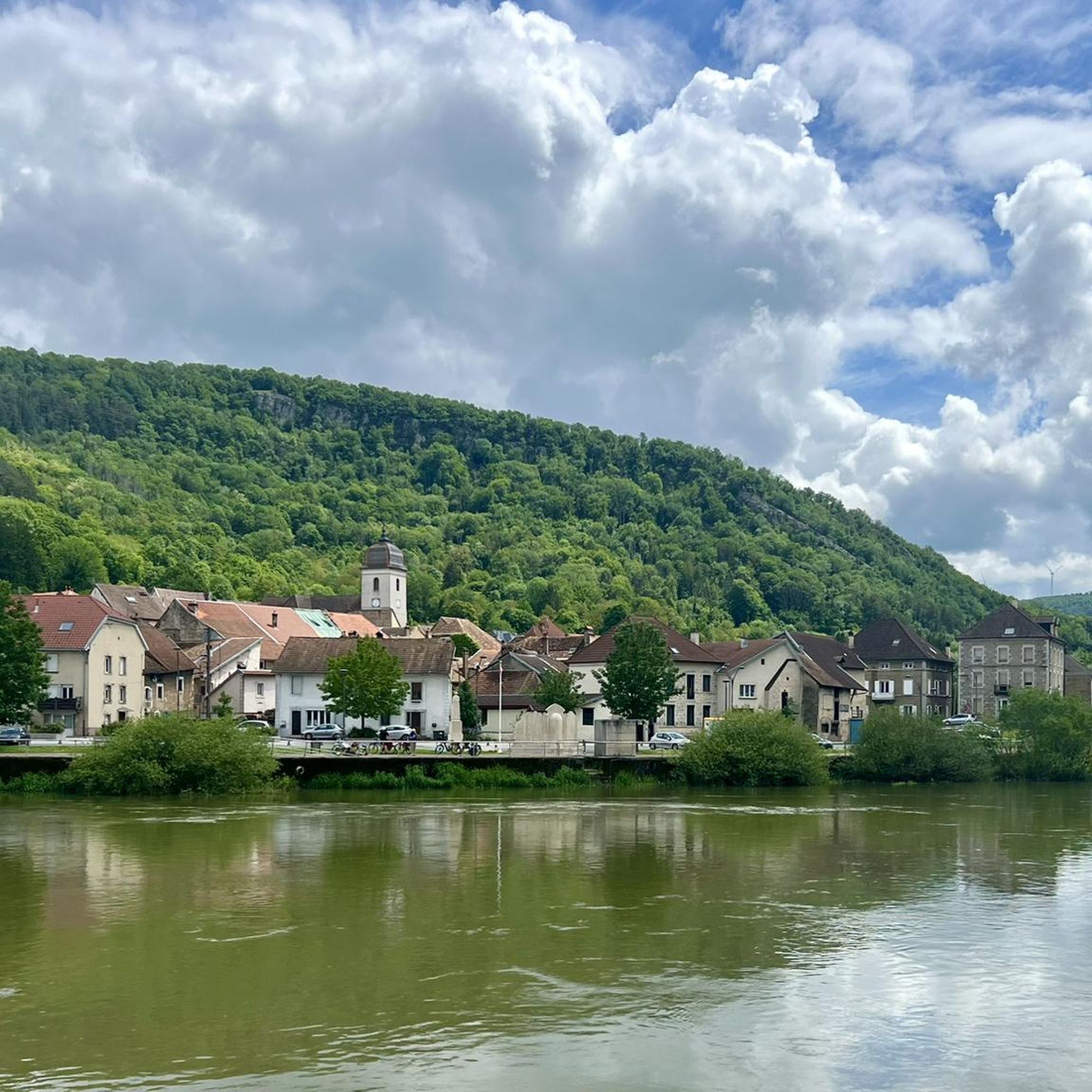
This magnificent section approaching Baume-les-Dames reveals a bucolic setting. Between the Rhône-Rhine Canal and the Doubs River, it's a delight to progress through this environment.
0
0

A beautiful tour to get from Freiburg into France. Then you can follow the Rhone to the South of France or cross the Saone to the Loire. A very, very nice ride.
0
0

This former customs house contains a repair station with tools, a room with a table, and toilets, making it ideal for fetching water and picnicking, even in the rain.
0
0

Frequently Asked Questions
How many road cycling routes are available around Étouvans?
There are over 320 road cycling routes in the Étouvans area, offering a wide range of options for different skill levels and preferences. This includes 36 easy routes, 212 moderate routes, and 74 difficult routes.
What kind of terrain can I expect on road cycling routes near Étouvans?
The region around Étouvans offers diverse terrain for road cyclists. You'll find routes traversing river valleys and canal paths, which are generally flatter. There are also options that extend into rolling hills and more challenging ascents, such as those leading towards the Col du Ballon d'Alsace.
Are there easy road cycling routes suitable for beginners in Étouvans?
Yes, Étouvans offers several easy road cycling routes perfect for beginners or those seeking a relaxed ride. For instance, the Montbéliard loop from Étouvans is an easy 15.8-mile (25.5 km) path that provides a relatively flat ride through the local countryside.
What are the options for challenging road cycling routes around Étouvans?
For experienced cyclists looking for a challenge, the Étouvans area features routes with significant elevation gain. A notable difficult route is the Col du Ballon d'Alsace – Ballon d'Alsace loop from Colombier-Fontaine, a 95.5-mile (153.7 km) trail that leads through mountainous terrain.
Can I find circular road cycling routes in the Étouvans area?
Yes, many road cycling routes around Étouvans are designed as loops, allowing you to start and end at the same point. An example is the Rhine-Rhone Canal – Le Doubs loop from Colombier-Fontaine, which follows river valleys and canal paths.
What do other road cyclists enjoy most about road cycling in Étouvans?
The road cycling routes in Étouvans are highly rated by the komoot community, with an average score of 4.5 stars from over 200 reviews. Cyclists often praise the varied terrain, from flat riverside paths to challenging climbs, and the scenic mix of open countryside and charming small towns.
Are there any interesting landmarks or attractions along the road cycling routes?
Yes, several routes pass by interesting landmarks. You might encounter historical sites like Château Peugeot or natural features such as the Rochedanne rock shelter. The routes also connect to towns like L'Isle-sur-le-Doubs, offering opportunities to explore.
Are there road cycling routes that offer scenic viewpoints?
While specific viewpoints are not always marked, the region's rolling hills and river valleys naturally provide scenic vistas. Routes that ascend into higher elevations, particularly those heading towards the Col du Ballon d'Alsace, will offer panoramic views of the surrounding landscape.
Are there road cycling routes with cafes or places to stop nearby?
Many routes in the Étouvans area pass through or near small towns and villages, offering opportunities to stop for refreshments. For example, the Montbéliard loop from Étouvans connects to Montbéliard, where you'll find various cafes and amenities.
Are there long-distance road cycling routes available?
Yes, for those seeking longer rides, the Étouvans area includes extensive routes. The Col du Ballon d'Alsace – Ballon d'Alsace loop from Colombier-Fontaine is a significant 95.5-mile (153.7 km) journey, ideal for a full day of cycling.
Is parking generally available near the starting points of road cycling routes?
Parking is typically available in the towns and villages that serve as common starting points for routes, such as Étouvans or Colombier-Fontaine. It's advisable to check local parking regulations upon arrival.
Are there road cycling routes that follow canals or rivers?
Absolutely. The region is characterized by its proximity to the Doubs river and the Rhine-Rhone Canal. Routes like the Rhine-Rhone Canal – Le Doubs loop from Colombier-Fontaine are specifically designed to follow these waterways, offering flat and picturesque rides.
Most popular attractions around Étouvans

Get inspired with the komoot mobile app


Explore more
Browse the best Road cycling routes in other regions.
