The best running trails around Tour-De-Faure
4.5
(30)
1,095
runners
68
runs
Jogging around Tour-De-Faure offers routes through varied terrain, characterized by the Lot River valley, historic villages, and sections along former towpaths. The landscape features a mix of riverside paths, gentle ascents into the surrounding hills, and views of limestone cliffs. Running routes in this region often follow the curves of the river, providing a blend of natural scenery and cultural points of interest.
Best jogging routes around Tour-De-Faure
- The most popular jogging route is Ganil towpath – Saint-Cirq-Lapopie loop from…
Last updated: October 25, 2026
4.8
(4)
175
runners
10.0km
01:11
220m
220m
Hard run. Good fitness required. Sure-footedness, sturdy shoes and alpine experience required.
4.5
(2)
42
runners
Moderate run. Good fitness required. Mostly paved surfaces.

20
runners
16.7km
02:12
500m
500m
Hard run. Very good fitness required. Sure-footedness, sturdy shoes and alpine experience required.
16
runners
5.83km
00:37
40m
40m
Moderate run. Good fitness required. Mostly paved surfaces.
4.0
(2)
164
runners
9.66km
01:09
210m
210m
Moderate run. Good fitness required. Mostly runnable paths. Some sure-footedness required.
Get access to more routes and recommendations from other explorers.
Already have an account?
Our route recommendations are based on thousands of hikes, rides, and runs completed by other people on komoot.
Start today with a free account
Your next adventure awaits.

Tips from the Community

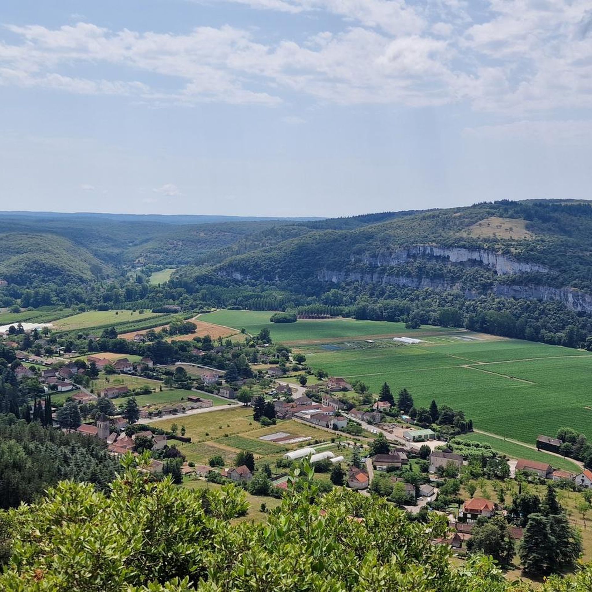
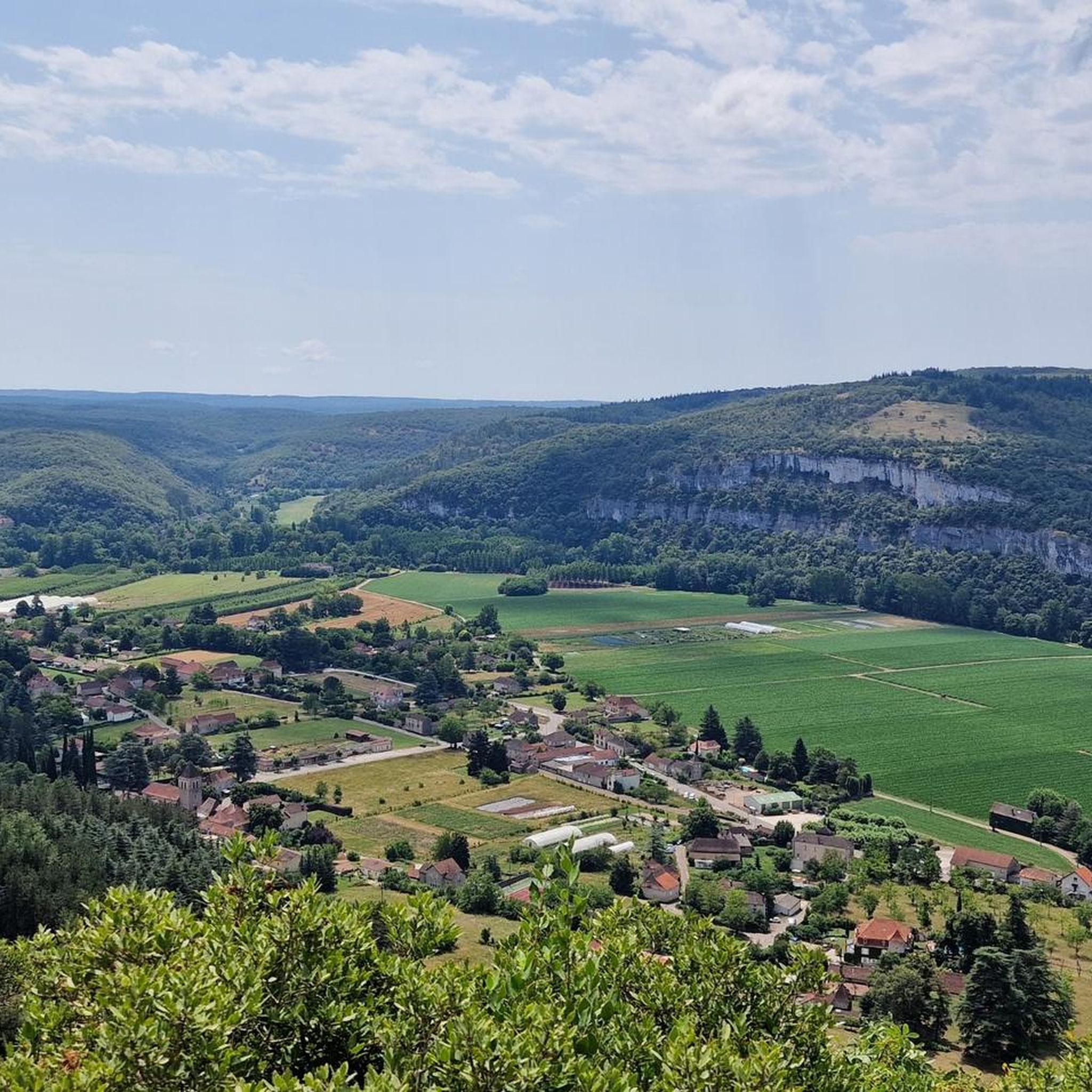
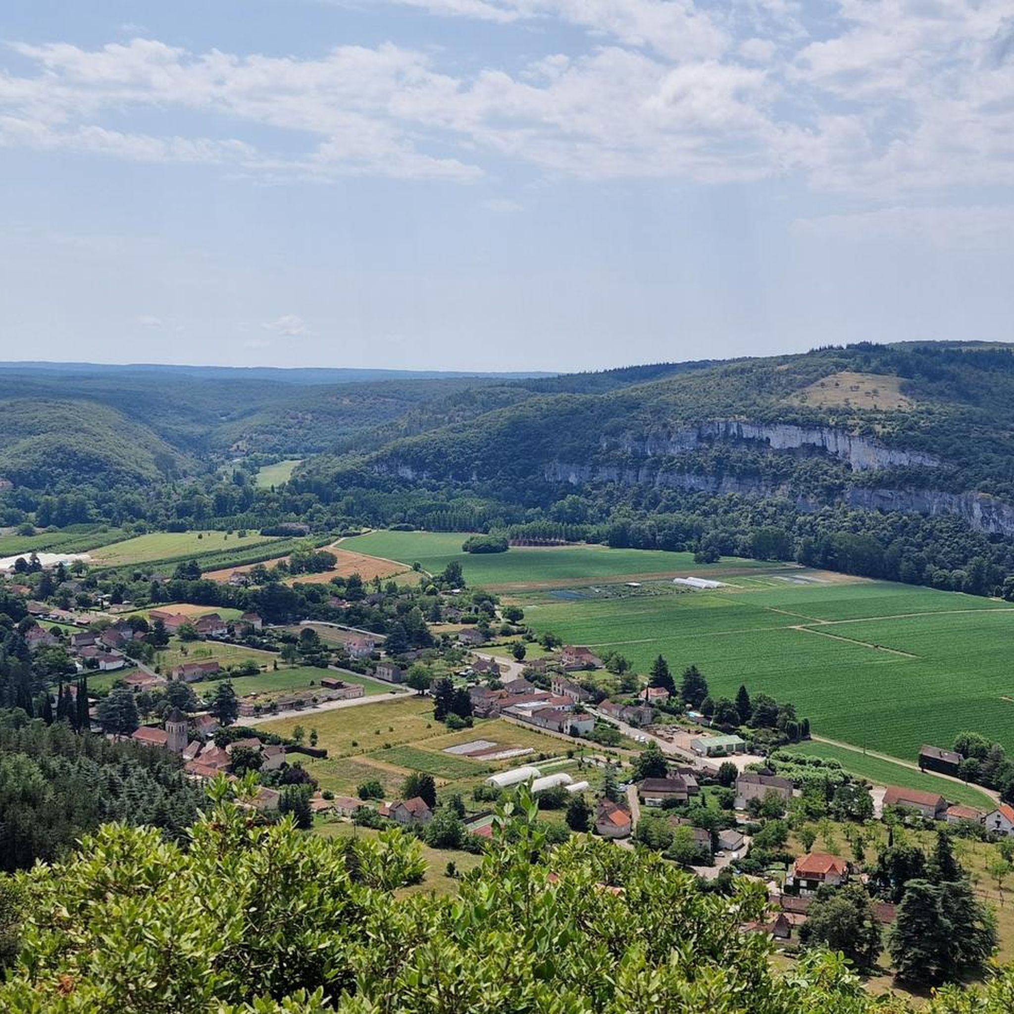
Ideally nestled on the left bank of the Lot, it is located in the heart of the Causses du Quercy Regional Natural Park, just 2 km from the famous medieval village of Saint-Cirq-Lapopie. It is a perfect destination for lovers of calm, old stones, and unusual geological curiosities.
0
0
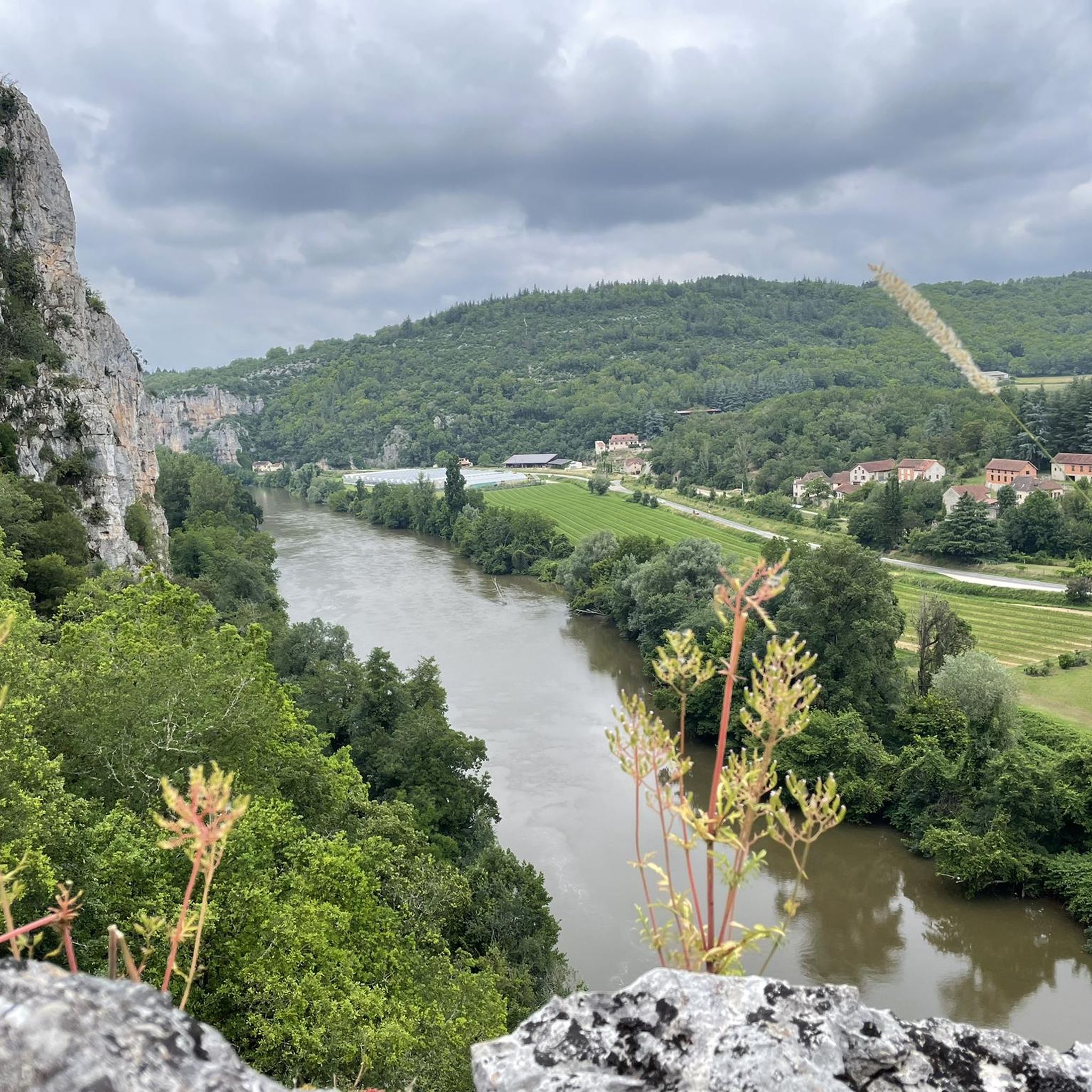
The magnificent corniche road overlooking the meanders of the river is located at the level of the spectacular Lot valley, particularly on the heights of the limestone plateaus and cliffs. In Saint-Cirq-Lapopie: The Lapopie rock and the Bancourel dovecote offer a spectacular 360-degree plunging view over the river.
0
0
The Ganil towpath: Carved directly into the limestone cliff rock in 1845, it once allowed horses to tow barges up the Lot river. Between 1985 and 1989, the artist Daniel Monnier sculpted an impressive bas-relief there, depicting local fauna and flora. The path connects Bouziès to Saint-Cirq-Lapopie over approximately 4 to 5 km of easy walking.
0
0
In the heart of the Causses du Quercy Regional Natural Park. Located at the confluence of the Lot and Célé valleys, the village of Bouziès, with around 90 inhabitants, is world-renowned for its spectacular natural and historical heritage. The Château des Anglais: Fortifications from the 11th and 12th centuries anchored directly into the vertical cliff face overlooking the road and the river. This site once served as a fortified refuge for the inhabitants during conflicts.
0
0

Pleasant walking spot, although touristy
0
0

Be careful when crossing these bridges. During my last hike, the metal sheets fixed between the rails were falling... you might take a nice dip in the Lot River!
1
0

Beautiful to do, it's worth a look
1
1

Frequently Asked Questions
How many running routes are available around Tour-De-Faure?
There are 10 dedicated running routes around Tour-De-Faure listed in this guide, offering a variety of distances and difficulty levels for runners to explore.
Are there any easy running trails suitable for beginners in Tour-De-Faure?
Yes, the region offers some easier options. For instance, the Ganil towpath – Saint-Cirq-Lapopie loop from Tour-de-Faure, while moderate overall, includes sections along the relatively flat historic towpath, which can be suitable for those looking for a less strenuous run.
What are the more challenging running routes in the Tour-De-Faure area?
For runners seeking a greater challenge, the Crégols Village loop from Crégols is a difficult 10.4-mile (16.8 km) trail with significant elevation gain, leading through rural landscapes and the village of Crégols.
Are there any circular running routes near Tour-De-Faure?
Many of the running paths in the area are designed as loops. A popular option is the Troglodytic Château des Anglais – Ganil towpath loop from Saint-Cirq-Lapopie, which combines riverside running with historical sights.
What kind of scenery can I expect on the running trails around Tour-De-Faure?
The routes are characterized by the Lot River valley, historic villages, and sections along former towpaths. You'll find a mix of riverside paths, gentle ascents into surrounding hills, and views of impressive limestone cliffs. The Ganil towpath – Cliffs Along the Lot River loop from Saint-Cirq-Lapopie offers particularly good views of the cliffs.
Are there any historical landmarks or points of interest along the running routes?
Absolutely. The region is rich in history. You can run past the famous village of Saint-Cirq-Lapopie, or see the English Castle of Bouziès. Some routes also offer views of historical troglodytic dwellings.
What do other runners say about the trails in Tour-De-Faure?
The running routes in Tour-De-Faure are highly rated by the komoot community, with an average score of 4.6 stars from over 20 reviews. Runners often praise the varied terrain, the scenic river views, and the blend of natural beauty with cultural points of interest.
Is Tour-De-Faure a good place for family-friendly running?
While specific 'family-friendly' routes aren't explicitly designated, the towpath sections along the Lot River offer relatively flat and safe surfaces that can be enjoyable for families running together. Consider routes that primarily follow these riverside paths for a more relaxed experience.
Are dogs allowed on the running trails in Tour-De-Faure?
Generally, dogs are welcome on trails in rural France, especially if kept on a leash. However, it's always advisable to check local signage, particularly in nature reserves or protected areas, and to ensure your dog is well-behaved and doesn't disturb wildlife or other trail users.
What is the best season for running in Tour-De-Faure?
Spring and autumn are generally ideal for running in Tour-De-Faure, offering pleasant temperatures and beautiful scenery as the landscape changes. Summer can be warm, so early morning or late evening runs are recommended, while winter can be cooler but still enjoyable on clear days, especially on the well-maintained towpaths.
Are there any running routes that pass by natural monuments or viewpoints?
Yes, the region boasts several natural highlights. The Igue de Crégols loop from Crégols takes you near the impressive Igue of Crégols. Many routes also offer stunning views from the St-Cirq-Lapopie Heights or along the Cliffs Along the Lot River.
How long are the typical running trails in this area?
The running trails around Tour-De-Faure vary in length. You'll find routes ranging from approximately 5.6 miles (9 km) to over 10 miles (16 km), with average durations from just over an hour to more than two hours, depending on your pace and the specific trail.
Most popular routes around Tour-De-Faure
Most popular attractions around Tour-De-Faure

Get inspired with the komoot mobile app


Explore more
Browse the best Running Trails & Routes in other regions.
