The best walks and hikes around Lauresses
4.6
(68)
421
hikers
30
hikes
Hiking around Lauresses offers diverse landscapes within the Lot department of the Occitanie region. The area is characterized by bocage landscapes, featuring small fields bordered by hedges and dry stone walls. Trails often lead through significant chestnut woods and along wild streams, providing varied ecological environments. The region's topography includes rolling hills and crest lines, offering expansive views over the Ségala region and towards the Aveyron and Cantal departments.
Best hiking trails around Lauresses
- The most popular hiking route is…
Last updated: June 30, 2026
4.6
(17)
155
hikers
5.31km
01:23
40m
40m
Easy hike. Great for any fitness level. Easily-accessible paths. Suitable for all skill levels.
4.2
(5)
56
hikers
9.07km
02:27
120m
120m
Moderate hike. Good fitness required. Easily-accessible paths. Suitable for all skill levels.

Sign up for free
5.0
(3)
13
hikers
14.3km
04:07
350m
350m
Moderate hike. Good fitness required. Easily-accessible paths. Suitable for all skill levels.
4.3
(4)
9
hikers
10.3km
02:55
240m
240m
Moderate hike. Good fitness required. Easily-accessible paths. Suitable for all skill levels.
5.0
(1)
8
hikers
5.78km
01:37
120m
120m
Easy hike. Great for any fitness level. Easily-accessible paths. Suitable for all skill levels.
Get access to more routes and recommendations from other explorers.
Sign up for free
Already have an account?
Our route recommendations are based on thousands of hikes, rides, and runs completed by other people on komoot.
Start today with a free account
Your next adventure awaits.
Login or Signup



Tips from the Community

The Château de Saint-Thamar dates back to the 15th century and was altered in the 17th and 18th centuries. Today, you can stay in style and dine there. Listed as a historical monument since 1975.
0
0


With a restaurant and public restrooms nearby, this picnic area is the perfect place to stop or have lunch during your hike.
3
0
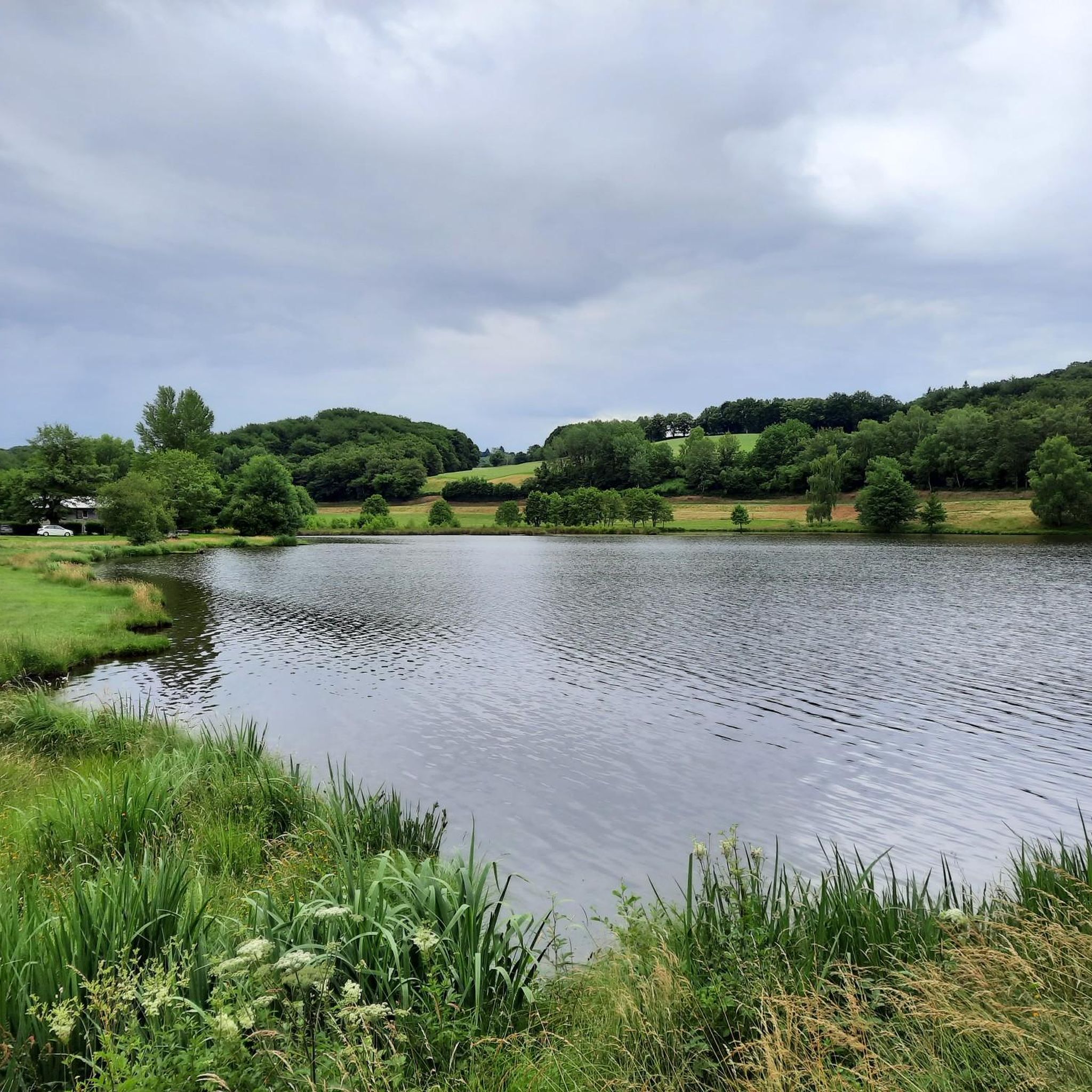
This lake is the largest artificial lake in the Lot department. With this varied plan, the shores of this lake make for an excellent hiking trail.
3
0

Frequently Asked Questions
How many hiking trails are available around Lauresses?
Lauresses offers a diverse network of nearly 30 hiking trails. These routes cater to various skill levels, from easy lakeside strolls to more challenging paths through varied terrain, ensuring there's something for every hiker.
What kind of landscapes can I expect to see while hiking in Lauresses?
The region is characterized by picturesque bocage landscapes, featuring small fields bordered by hedges and traditional dry stone walls. You'll also hike through significant chestnut woods and along wild streams. The varied topography includes rolling hills and crest lines, offering expansive views over the Ségala region and towards the Aveyron and Cantal departments.
Are there any easy, family-friendly hikes in Lauresses?
Yes, there are several easy options suitable for families. The Lac du Tolerme Circuit is a popular choice, offering a leisurely 3.3-mile (5.3 km) path with peaceful lake views, perfect for a relaxed outing.
What do other hikers enjoy most about the trails in Lauresses?
The hiking trails in Lauresses are highly rated by the komoot community, with an average score of 4.7 stars from over 60 reviews. Hikers often praise the well-maintained paths, the charming bocage landscapes, and the tranquil beauty of the chestnut woods and streams.
Are there any circular walks available in the area?
Many of the trails around Lauresses are designed as circular routes, allowing you to start and end at the same point. For example, the Lake Tolerme – Latronquiere loop from Sénaillac-Latronquière is a moderate 5.6-mile (9.1 km) circular path that explores chestnut groves and crosses the Ruisseau Noir.
Where can I find panoramic views during my hike?
For expansive vistas, consider routes that traverse the region's rolling hills and crest lines. The View of the Countryside loop from Boisset, for instance, is an 8.9-mile (14.3 km) trail that leads through hilly terrain and ridge lines, providing vast panoramas over the Ségala region and beyond.
Are there any historical or cultural landmarks to see while hiking?
Yes, hiking in the vicinity of Lauresses can lead to discoveries of cultural heritage. You might encounter vestiges of old water mills, such as those highlighted along the 'Circuit des deux moulins autour de Saint-Cirgues' (mentioned in regional research), or traditional Ségalian vernacular architecture. Nearby attractions include the historic Moulin d'Entraygues and the Saint-Césaire Abbey Church.
What is the best time of year to go hiking in Lauresses?
Lauresses offers enjoyable hiking experiences throughout much of the year. The chestnut woods provide refreshing shaded trails, particularly during warmer months. The well-maintained paths are generally accessible, allowing visitors to marvel at the landscapes in various seasons.
Are there any trails that feature water bodies like lakes or streams?
Absolutely. The region is home to beautiful water features. The Lac du Tolerme Circuit offers peaceful lake views. Other trails, like the Lake Tolerme – Latronquiere loop, cross wild streams such as the Ruisseau Noir, adding to the diverse scenery.
Is there parking available at the trailheads?
While specific parking details for every trailhead are not provided, hiking areas in the Lot department generally offer accessible parking options, especially for popular routes. It's advisable to check local signage or specific route descriptions for detailed parking information before you set out.
Can I find more challenging routes for experienced hikers?
While there are no trails explicitly graded as 'difficult' in the immediate komoot guide data for Lauresses, there are 18 moderate routes that offer more elevation gain and longer distances. For example, the View of the Countryside – La Maison Rouge, Vitrac loop from Boisset is a moderate 10.2 km (6.3 miles) hike with over 230 meters of elevation gain, providing a good workout.
Are dogs allowed on the hiking trails in Lauresses?
Generally, dogs are welcome on hiking trails in rural areas of France, especially if kept on a leash. However, it's always best to check specific local regulations or signage at trailheads, particularly if trails pass through nature reserves or private land. Always ensure your dog is under control and clean up after them.
Most popular attractions around Lauresses

Get inspired with the komoot mobile app


Explore more
Browse the best Hikes in other regions.
