The best running trails around Fleurie
4.4
(85)
3,346
runners
17
runs
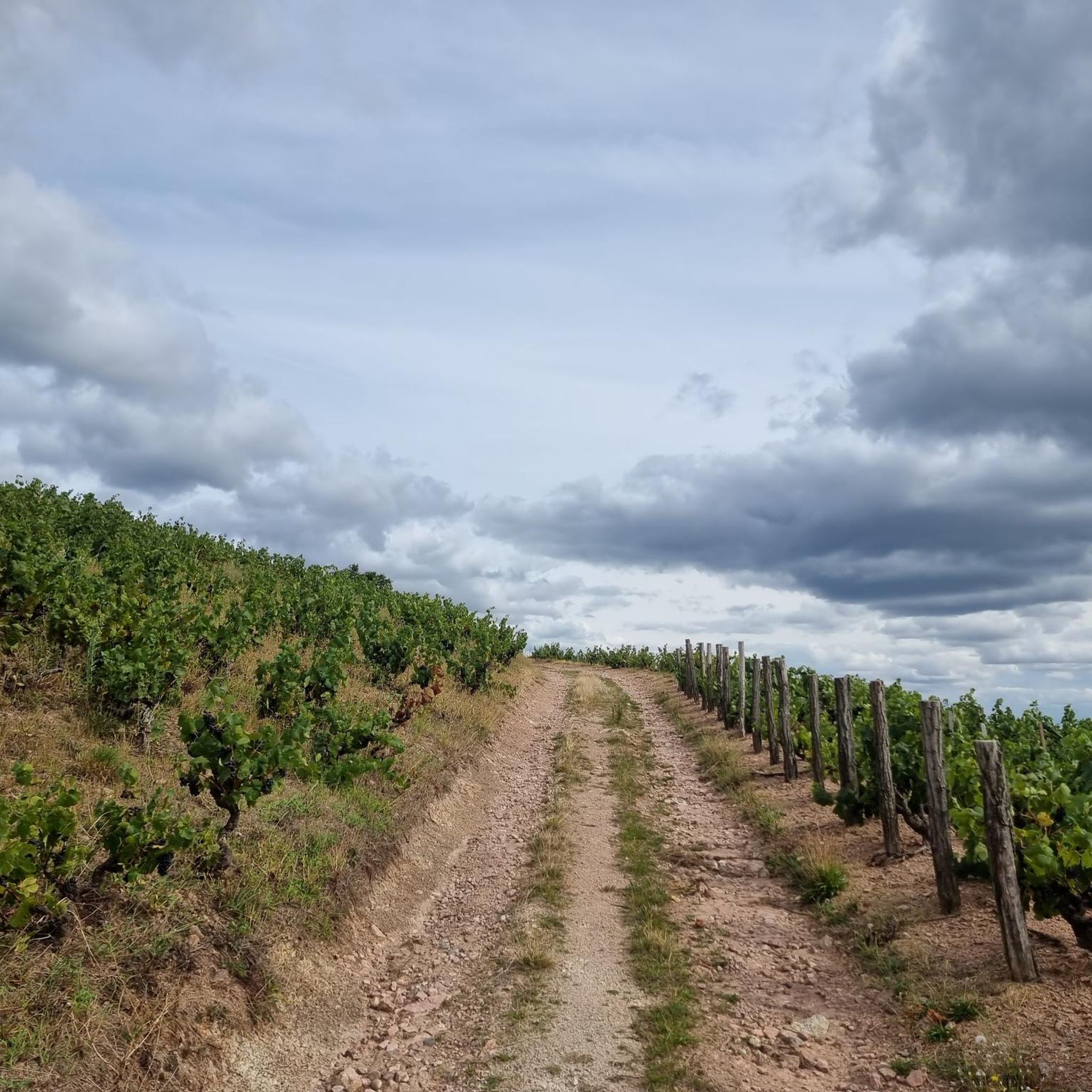
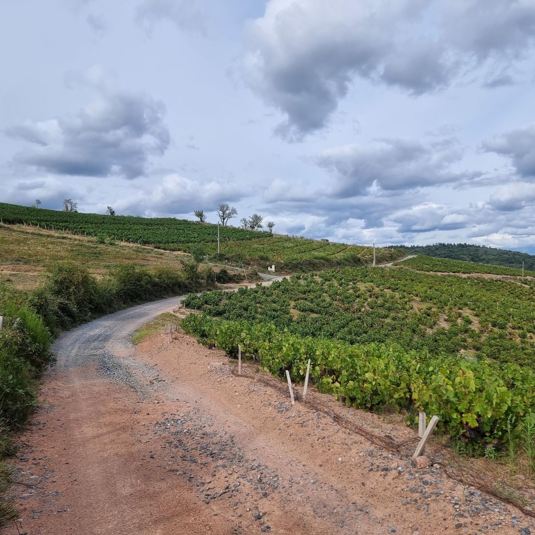
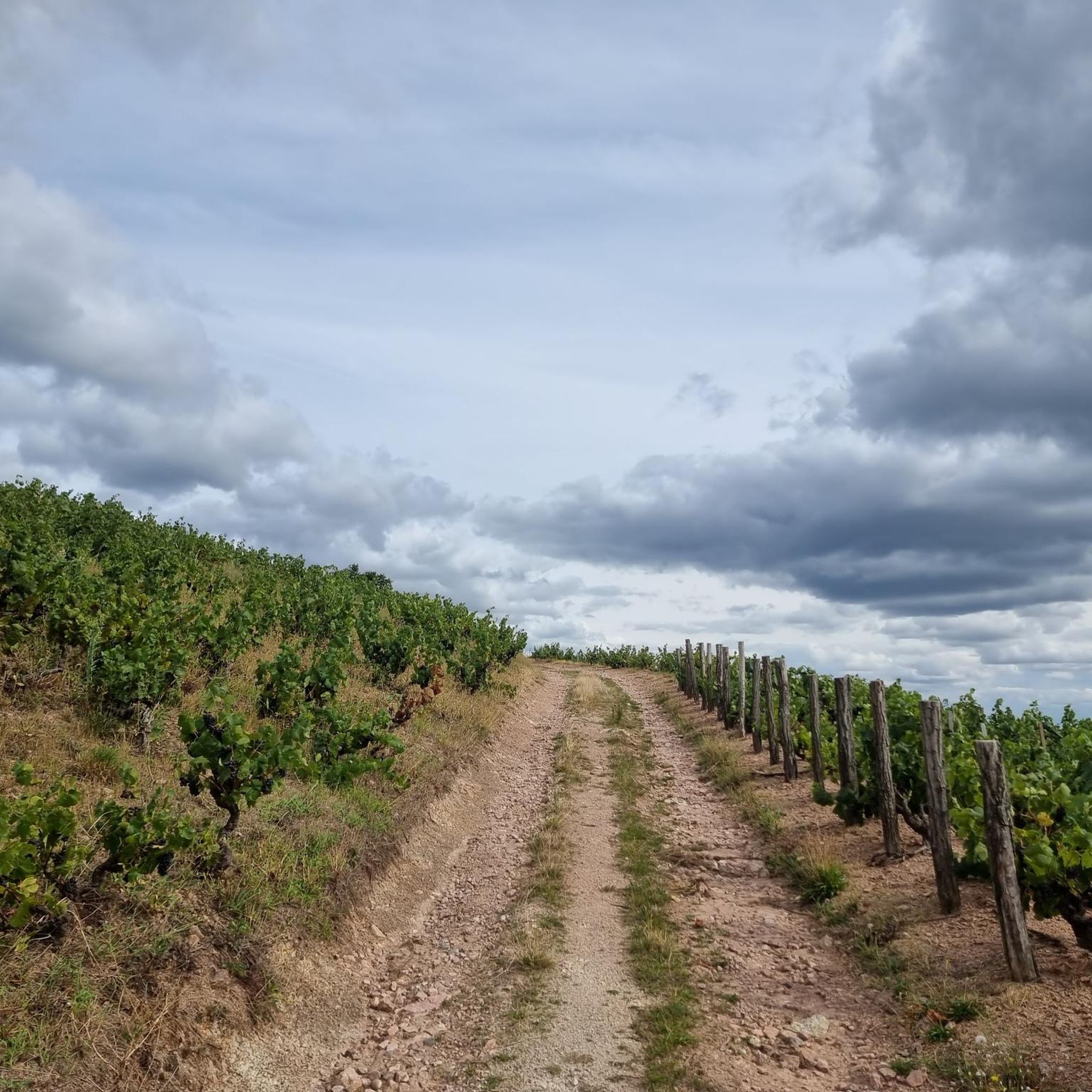
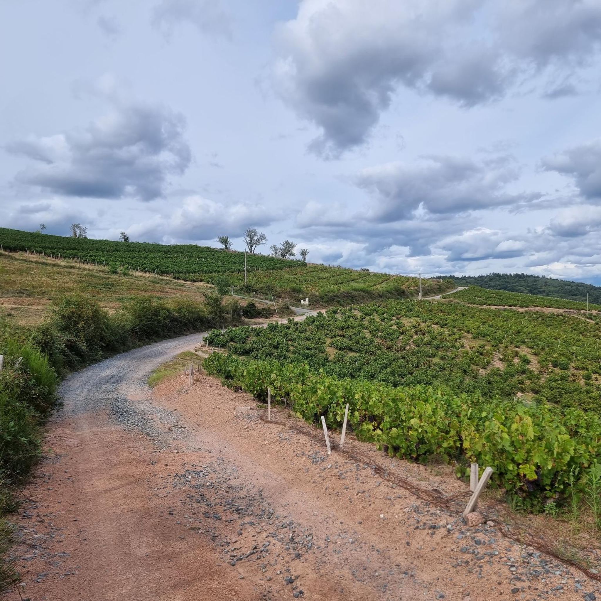
Jogging routes around Fleurie, France, traverse a landscape characterized by rolling hills and extensive vineyards. The region's terrain includes notable features such as the 425-meter La Madone hill, offering varied elevation for runners. Beyond the vineyards, Fleurie also features forests, providing diverse environments for running. The underlying pink granite soil contributes to the unique character of the area.
Best jogging routes around Fleurie
- The most popular jogging route is Saint Martin Church – Rémont Mountain loop from Fleurie, a…
Last updated: October 14, 2026
5.0
(3)
222
runners
18.7km
02:28
660m
660m
Hard run. Very good fitness required. Mostly paved surfaces. Suitable for all skill levels.
167
runners
27.5km
03:39
940m
940m
Hard run. Very good fitness required. Sure-footedness, sturdy shoes and alpine experience required.

89
runners
11.5km
01:25
290m
290m
Moderate run. Good fitness required. Mostly paved surfaces. Suitable for all skill levels.
5
runners
14.5km
01:41
370m
370m
Hard run. Very good fitness required. Mostly paved surfaces. Suitable for all skill levels.
3
runners
8.19km
00:57
200m
200m
Moderate run. Good fitness required. Mostly paved surfaces. Suitable for all skill levels.
Get access to more routes and recommendations from other explorers.
Already have an account?
Our route recommendations are based on thousands of hikes, rides, and runs completed by other people on komoot.
Start today with a free account
Your next adventure awaits.

Tips from the Community

The viewpoint is located in the well-known Beaujolais wine region, in the municipality of Chénas. It is an old stone ruin (historically often referred to as Cabane des Chasseurs or hunter's hut), which has been equipped with a modern metal staircase and a viewing platform. The ruin is located at 515 meters above sea level and offers hikers a spectacular 360-degree panoramic view of the surrounding vineyards and valleys of the region.
2
0
The Col de Durbize is a mountain pass at 550 meters above sea level in the municipality of Chiroubles, in the heart of the Beaujolais wine region. The pass is located in the Massif Central and, as an important road junction (intersection of roads D26, D86, and D18E1), connects surrounding wine villages such as Villié-Morgon and Beaujeu. It is particularly popular with road cyclists and hikers for its panoramic views.
0
0

Fleurie is a beautiful wine village in northern Beaujolais, known for its "Fleurie" cru. It has several wine cellars and a pleasant trail that starts from the town center and leads to the chapel of La Madone, which offers a superb view of the surroundings.
0
0

An imposing 5.20-meter-high and 900-kg wine sculpture, the Corten steel Chirouboam has proudly stood at the Col de Durbize since its inauguration on April 27, 2024. This monumental work, created by local sculptor Mathilde Pénicaud with characters drawn by Carine Baudet, symbolizes the identity of the Chiroubles cru, recognized as the highest of the ten Beaujolais crus with an average altitude of 410 meters. A true territorial marker visible from afar at an altitude of 543 meters, this giant bottle invites visitors to strike a pose and celebrates the viticultural excellence of this high-altitude appellation, while also being part of an innovative wine tourism approach for the region.
0
0


Several possible routes through the vineyards towards Villié-Morgon, notably via Chiroubles.
1
0

This path which winds through the vineyards offers beautiful panoramas of the Beaujolais hillsides.
2
0
Frequently Asked Questions
How many running trails are available around Fleurie?
There are over 15 running routes available around Fleurie, offering a variety of distances and difficulty levels. The komoot community has highly rated these routes, with an average score of 4.3 stars from over 70 reviews.
What kind of terrain can I expect on running routes in Fleurie?
Running routes in Fleurie are characterized by rolling hills and extensive vineyards, providing varied and scenic terrain. You'll also find shaded forest paths beyond the vineyards. The region's unique pink granite soil contributes to the distinct character of the landscape.
Are there running routes suitable for beginners in Fleurie?
While many routes feature significant elevation, there are options for those seeking a less strenuous run. For example, the Running loop from Fleurie is a moderate 5.9-mile (9.5 km) path with less elevation gain, making it a good choice for beginners or a lighter session.
What are some challenging running routes for experienced runners in Fleurie?
Experienced runners looking for a challenge will find several demanding routes. The Col de Durbize – Chemin du col de Durbize loop from Fleurie is a difficult 17.0-mile (27.3 km) path featuring challenging climbs and descents through vineyard-covered hills. Another difficult option is the Saint Martin Church – Rémont Mountain loop from Fleurie, which covers 11.6 miles (18.6 km) with significant elevation gain.
Are there circular running routes available in Fleurie?
Yes, many of the running routes in Fleurie are circular, allowing you to start and end in the same location. For instance, the Cercillon's Cabane loop from Fleurie is a 7.1-mile (11.5 km) circular trail that takes you through vineyards and forests.
What notable landmarks or viewpoints can I see while running in Fleurie?
Many routes offer stunning views and pass by significant landmarks. The iconic La Madone hill, towering at 425 meters, provides breathtaking panoramic views of the Cru Fleurie hillsides, the Saône valley, and even the distant Alps and Mont Blanc. You might also encounter highlights like Rémont Mountain or the Rochefort Cross.
Can I find routes that offer panoramic views of the region?
Absolutely. The hilly terrain of Fleurie, especially around landmarks like La Madone, offers numerous opportunities for panoramic views. Routes often traverse slopes that provide expansive vistas of the vineyards, the Saône valley, and on clear days, even the Alps and Mont Blanc.
What is the best time of year to go jogging in Fleurie?
Fleurie is an excellent destination for outdoor activities throughout much of the year. Spring and autumn offer pleasant temperatures and vibrant scenery with blooming vineyards or rich autumnal colors. Summer can be warm, so early morning or late afternoon runs are advisable. Winter runs are possible, but check local conditions for frost or snow on higher elevations.
Are there running routes in Fleurie that are accessible by public transport?
While specific public transport details for each trailhead are not provided in the route data, Fleurie is a village in the Beaujolais region. For detailed information on public transport options to reach specific starting points, it's recommended to check local bus schedules or regional transport services in advance of your visit.
Are there any dog-friendly running trails in Fleurie?
Many of the natural trails and paths through vineyards and forests in Fleurie are suitable for running with dogs, provided they are kept under control. Always ensure to follow local regulations regarding dogs on trails and be respectful of private property, especially within vineyards.
What do other runners enjoy the most about jogging in Fleurie?
The komoot community highly rates the running experience in Fleurie, with an average score of 4.3 stars. Runners frequently praise the stunning vineyard landscapes, the challenging yet rewarding hilly terrain, and the diverse environments that include both open fields and shaded forest paths. The panoramic views from higher points are also a common highlight.
Most popular attractions around Fleurie

Get inspired with the komoot mobile app


Explore more
Browse the best Running Trails & Routes in other regions.
