The best walks and hikes around Mörlingen
4.5
(625)
4,345
hikers
340
hikes
Hiking around Mörlingen offers diverse routes through a varied landscape. The region features pastoral environments, wooded areas with oak trees, and rural scenery. Trails often lead past historical sites, including castles, providing points of interest for hikers. The terrain generally includes gentle ascents and descents, suitable for a range of fitness levels.
Best hiking trails around Mörlingen
- The most popular hiking route is Cows in the Countryside – Other oak loop from Autrechêne, a 5.6 miles (9.0 km) trail…
Last updated: July 5, 2026
3.7
(3)
15
hikers
9.05km
02:20
50m
50m
Moderate hike. Good fitness required. Easily-accessible paths. Suitable for all skill levels.
3.5
(2)
13
hikers
5.08km
01:20
40m
40m
Easy hike. Great for any fitness level. Easily-accessible paths. Suitable for all skill levels.

Sign up for free
5.0
(2)
8
hikers
5.95km
01:35
60m
60m
Easy hike. Great for any fitness level. Easily-accessible paths. Suitable for all skill levels.
6
hikers
13.9km
03:38
110m
110m
Moderate hike. Good fitness required. Easily-accessible paths. Suitable for all skill levels.
5
hikers
3.45km
00:53
20m
20m
Easy hike. Great for any fitness level. Easily-accessible paths. Suitable for all skill levels.
Get access to more routes and recommendations from other explorers.
Sign up for free
Already have an account?
Our route recommendations are based on thousands of hikes, rides, and runs completed by other people on komoot.
Start today with a free account
Your next adventure awaits.
Login or Signup

Tips from the Community

Peacefully overlooking the vast green meadows, this statue of the Virgin Mary stands like a benevolent sentinel over the surrounding countryside. Perched on its immaculate white pedestal, it watches over the farmland that stretches as far as the eye can see.
0
0

Iconic oak tree, creatively decorated like a hobbit treehouse with painted wooden boards. The rest area has picnic tables and sunny and shady spots.
2
0

Memorial to the fallen of the two world wars 🕊️
0
0

History: The history of Novillard begins before 1251 but it is only on this date that we find the name of the village mentioned in an act concerning the priory of Froidefontaine in the form of Nueviller. The stronghold was part of the seigniory of Rougemont-le-Château in 1125, when Frederick I of Ferrette endowed the monastery of Valdieu, currently in the department of Haut-Rhin. A church then existed in Novillard, whose parish also included Eschêne, Autrage and Rechotte, all three currently grouped together in the commune of Autrechêne. Novillard was also the chief town of a town hall depending on the seigniory of Rougemont (of which it marked the southern limit) then the provostship of Angeot, seigniory of Belfort. The fate of the village generally follows that of the surrounding villages: attachment to the domains of the House of Austria from 1350 to 1648. The Saint-Julien church was built in the 1770s. In 1803 the population was 171 inhabitants, and 210 in the 1999 census. The activity of the commune is essentially agricultural.
0
0
the date 1866 is inscribed on this Calvary
0
0
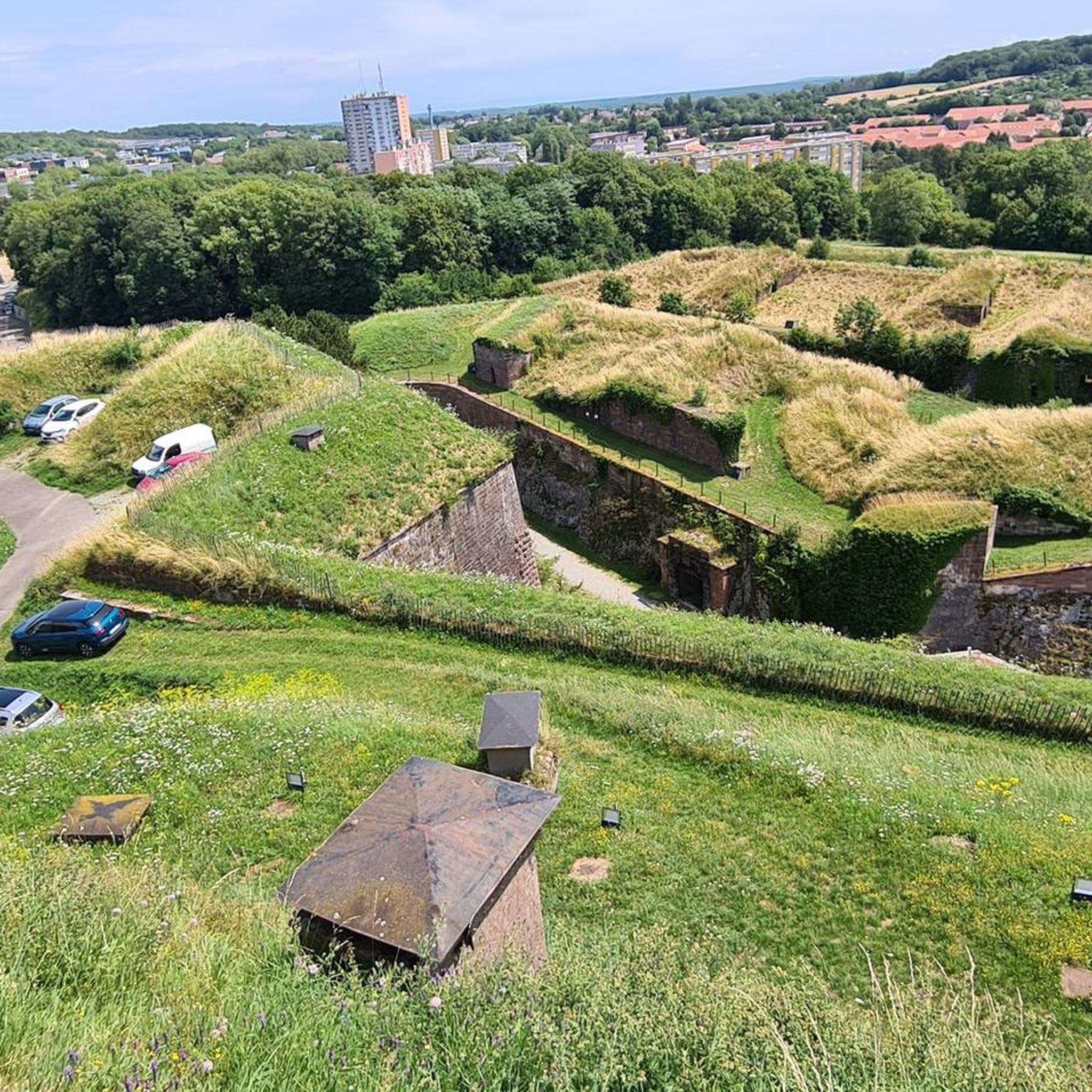
It was built from 1883 to 1886 by the Adrien Hallier company and takes its name Boulanger from the General of the Empire, Michel Ordener. Fort Ordener was built at the same time and with the aim of covering Fort Bessoncourt. Its role was to control the roads coming from Switzerland as well as the Mulhouse railway. From 1893 this fort was connected to a number of other forts around Belfort by a strategic railway. During the two World Wars Fort Ordener was inactive. It will then be used as an ammunition depot for the army. Fort Ordener was bought by the municipality of Vézelois in 1999. The association "Le Renouveau du Fort de Vézelois" takes care of the restoration and communication around the fort.
0
0
It was built from 1883 to 1886 by the Adrien Hallier company and takes its Boulanger name from the general of the Empire, Michel Ordener. Fort Ordener was built at the same time and with the aim of covering Fort Bessoncourt. His role was to control the roads coming from Switzerland as well as the Mulhouse railway line. From 1893 this fort was linked to a number of other forts around Belfort by a strategic railway. During the two World Wars Fort Ordener was inactive. It will then be used as an ammunition depot for the army. Fort Ordener was bought by the municipality of Vézelois in 1999. The association "Le Renouveau du Fort de Vézelois" takes care of the restoration and communication around the fort.
1
0
The village is located southeast of Belfort, 11km from the latter. Its territory, which covers 116 hectares, is bordered to the north by the Belfort-Mulhouse railway line. It is crossed by the small river La Madeleine which has its source in the Vosges massif, in the village of La Madeleine precisely. The average altitude is 350m. History: The history of Novillard begins before 1251 but it is only on this date that we find the name of the village mentioned in an act concerning the priory of Froidefontaine in the form of Nueviller. The stronghold was part of the seigniory of Rougemont-le-Château in 1125, when Frederick I of Ferrette endowed the monastery of Valdieu, currently in the department of Haut-Rhin. A church then existed in Novillard, whose parish also included Eschêne, Autrage and Rechotte, all three currently grouped together in the commune of Autrechêne. Novillard was also the chief town of a town hall depending on the seigniory of Rougemont (of which it marked the southern limit) then the provostship of Angeot, seigniory of Belfort. The fate of the village generally follows that of the surrounding villages: attachment to the domains of the House of Austria from 1350 to 1648. The Saint-Julien church was built in the 1770s. In 1803 the population was 171 inhabitants, and 210 in the 1999 census. The activity of the commune is essentially agricultural.
1
0
Frequently Asked Questions
How many hiking trails are there in Mörlingen?
Mörlingen offers a wide selection of hiking routes, with over 300 trails available. These range from easy walks to more challenging excursions.
What kind of terrain can I expect on Mörlingen's hiking trails?
The hiking trails around Mörlingen feature diverse terrain, including pastoral environments, wooded areas with mature oak trees, and rural scenery. You'll find a mix of gentle ascents and descents, with some routes offering more significant elevation changes.
Are there easy hiking trails suitable for beginners in Mörlingen?
Yes, Mörlingen has plenty of options for beginners and those looking for an easier walk. There are approximately 150 easy routes, such as the Fort de Vézelois loop from Meroux-Moval, which is about 3.3 miles (5.3 km) long.
What is the typical length and duration of hikes in Mörlingen?
Hikes in Mörlingen vary significantly in length and duration. For example, the Calvaries loop from Meroux-Moval is a shorter option at about 2.1 miles (3.4 km), taking just over an hour. Longer routes, like the Remembrance Square loop from Andelnans, can be around 7.1 miles (11.4 km) and take over 3 hours.
Are there many circular hiking routes in Mörlingen?
Yes, many of the hiking routes in Mörlingen are designed as loops, allowing you to start and finish at the same point. Examples include the Cows in the Countryside – Other oak loop from Autrechêne and the La Savoureuse loop from Andelnans.
What can I see along the hiking trails in Mörlingen?
Beyond the natural landscapes, you can discover various points of interest. Many trails pass by historical sites, including castles. You might also encounter waterways like the Canal du Rhône au Rhin or the Montbéliard–Haute-Saône Canal.
Are there any castles or historical sites to see while hiking?
Yes, the Mörlingen area is rich in historical sites. You can find several castles and fortifications, such as the impressive Citadel of Belfort or the Fort de Vézelois, which offer scenic and historical points of interest along the trails.
What do other hikers enjoy most about hiking in Mörlingen?
The hiking experience in Mörlingen is highly regarded by the komoot community, with an average rating of 4.4 stars from over 500 reviews. Hikers often praise the varied terrain, the peaceful pastoral and wooded environments, and the presence of historical sites along the routes.
Are the hiking trails in Mörlingen suitable for families?
Many trails in Mörlingen are suitable for families, especially the numerous easy and moderate routes. The varied landscapes and points of interest like castles can make for an engaging outing for all ages. Always check the specific trail details for length and difficulty to ensure it matches your family's capabilities.
Can I bring my dog on the hiking trails in Mörlingen?
Generally, dogs are welcome on hiking trails in Mörlingen. However, it's always recommended to keep your dog on a leash, especially in areas with livestock or wildlife, and to check for any specific local regulations or signage on individual routes.
Is parking available at the trailheads in Mörlingen?
While specific parking information varies by trailhead, many popular hiking areas and villages in the Mörlingen region typically offer designated parking facilities. It's advisable to check the starting point of your chosen route for detailed parking options.
Most popular routes around Mörlingen
Most popular attractions around Mörlingen

Get inspired with the komoot mobile app


Explore more
Browse the best Hikes in other regions.
