The best mountain hikes around Champdray
4.8
(13)
24
hikers
5
hikes
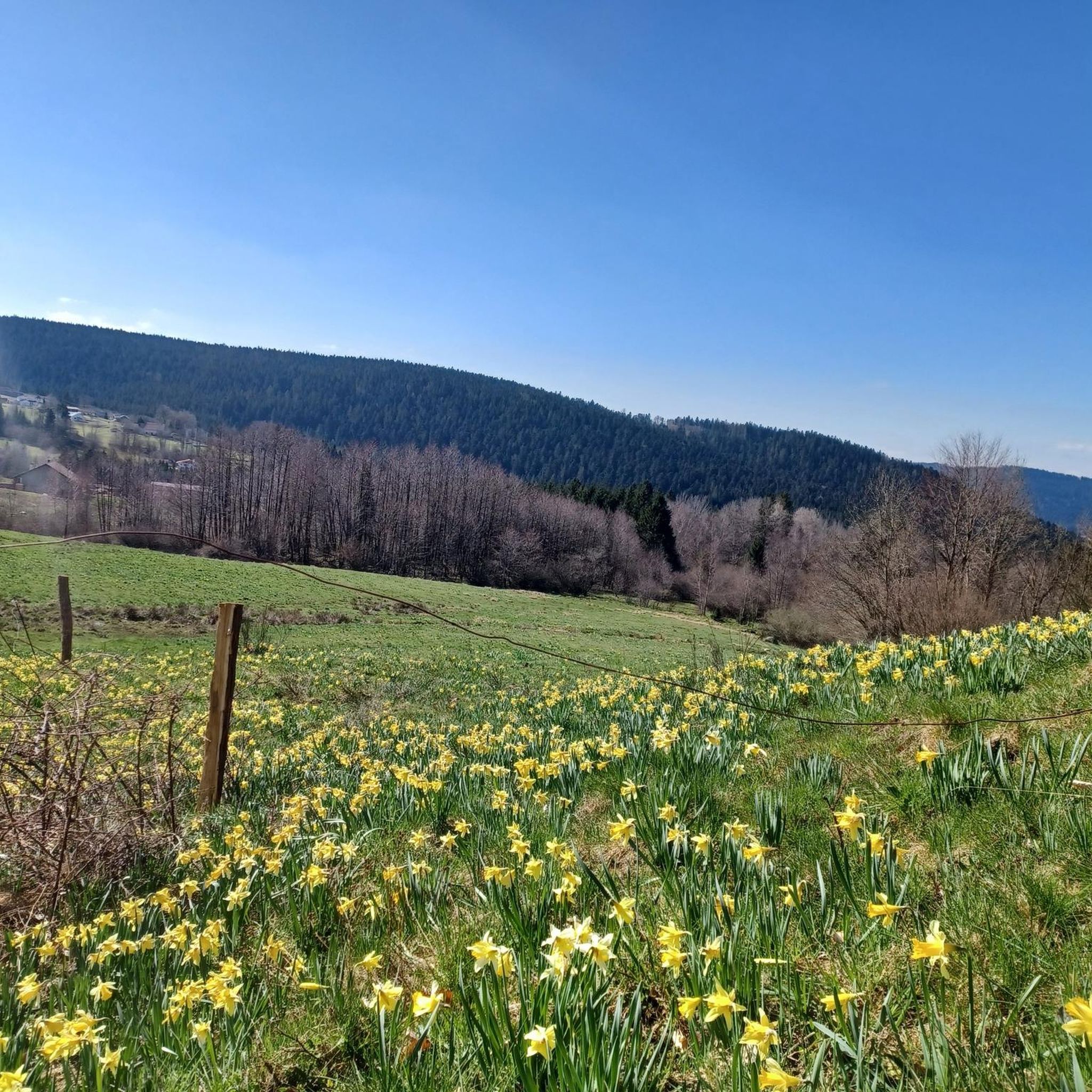
Mountaineering routes around Champdray are situated within the Vosges massif, characterized by diverse landscapes including dense forests, waterfalls, and lakes. The region features a plateau at 730 meters, with access to higher elevations such as Montagne de Spiémont and the broader Vosges peaks. Geological formations like the Champ de Roches, with its immense granite blocks, add to the varied terrain.
Best mountaineering routes around Champdray
- The most popular mountaineering route is Iron spring – Mérelle Waterfall loop from Gérardmer,…
Last updated: October 8, 2026
5.0
(4)
10
hikers
4.82km
01:48
230m
230m
Hard mountaineering route. Great for any fitness level. Sure-footedness, sturdy shoes and alpine experience required.
4.0
(2)
7
hikers
13.6km
04:06
300m
300m
Hard mountaineering route. Good fitness required. Sure-footedness, sturdy shoes and alpine experience required.

5.0
(4)
4
hikers
4.65km
01:48
230m
230m
Hard mountaineering route. Great for any fitness level. Sure-footedness, sturdy shoes and alpine experience required.
5.0
(2)
2
hikers
4.12km
01:41
230m
240m
Hard mountaineering route. Great for any fitness level. Sure-footedness, sturdy shoes and alpine experience required.
5.0
(1)
1
hikers
6.13km
01:58
190m
190m
Hard mountaineering route. Great for any fitness level. Sure-footedness, sturdy shoes and alpine experience required.
Our route recommendations are based on thousands of hikes, rides, and runs completed by other people on komoot.
Start today with a free account
Your next adventure awaits.
Tips from the Community

Image is an optical illusion 😂
0
0


This is and has been one of the most beautiful hikes in decades – a mystical (fairy) forest with a picturesque gorge through which a clear stream meanders, burbling and gurgling! Truly, simply beautiful – nature that captivates, fascinates, and casts its spell...!!! Again and again...
2
0

There are countless stone figures at this spot. Perhaps you'd like to expand your collection 😉
1
0

A wonderful rocky path right on the lakeshore. Simply beautiful.
4
0
An idyllic nature reserve with moorland and a small pond.
5
0
A beautiful wooden tower with a narrow spiral staircase, it can accommodate a maximum of four people at a time. During the week and in bad weather, you won't have to wait long.
6
0

As already mentioned several times, there can be long waiting times for the climb, as a maximum of 4 people are allowed on the tower. To be honest, I'm used to higher observation towers. This one, with 85 steps, is rather small in my opinion. More information at https://visitgrandest.com/tour-de-merelle
3
0
Frequently Asked Questions
What kind of mountaineering routes can I expect around Champdray?
The Champdray area, nestled in the Vosges massif, offers mountaineering routes characterized by diverse landscapes including dense forests, picturesque waterfalls, and varied terrain. All routes listed are classified as difficult, providing a good challenge for experienced hikers. The region also provides opportunities for more technical climbing experiences in the broader Vosges massif.
Are there any circular mountaineering routes in Champdray?
Yes, several routes around Champdray are circular. For example, you could explore the Iron spring – Mérelle Waterfall loop from Gérardmer, which is a 4.8 km difficult route. Another option is the longer Donkey's Leap – Merelle Observatory loop from Gérardmer, covering 13.7 km.
What natural features or attractions can I see along the mountaineering routes?
The routes often pass by stunning natural features. You can encounter beautiful waterfalls like the Mérelle Waterfall and the unique Donkey's Leap. Some routes also offer views towards Lake Gérardmer or reach viewpoints like the Merelle Observatory.
Are there any routes suitable for advanced mountaineers?
All five mountaineering routes listed around Champdray are classified as difficult, making them suitable for advanced mountaineers seeking a challenge. The broader Vosges massif also features peaks like Hohneck and Grand Ballon, offering more demanding climbs and spectacular vistas for those looking for technical ascents.
What is the typical duration for mountaineering routes in this area?
The duration varies depending on the route's length and your pace. For instance, the Towards Lake Gérardmer loop from Gérardmer is approximately 4.7 km and typically takes around 1 hour 47 minutes. A longer route like the Donkey's Leap – Merelle Observatory loop from Gérardmer, at 13.7 km, can take over 4 hours.
What do other mountaineers say about the routes around Champdray?
The mountaineering routes around Champdray are highly rated by the komoot community, with an average score of 4.8 stars from over 10 reviews. Users often praise the varied terrain, dense forests, and the scenic beauty of the waterfalls and viewpoints encountered along the trails.
Are there any specific waterfalls I can visit on a mountaineering route?
Yes, the Iron spring – Mérelle Waterfall loop from Gérardmer specifically passes by the beautiful Mérelle Waterfall. Another route, the Phény stream – Donkey's Leap loop from Lac de Gérardmer, will take you past the notable Donkey's Leap.
What are some notable viewpoints or observatories accessible via these routes?
The Donkey's Leap – Merelle Observatory loop from Gérardmer offers views from the Merelle Observatory. Additionally, the Montagne de Spiémont, at 811 meters, features an orientation table providing panoramic views of the Vosges mountains and surrounding valleys, though it may not be directly on these specific routes.
Are there any routes that lead towards Lake Gérardmer?
Yes, there are routes that offer views or lead towards Lake Gérardmer. The Towards Lake Gérardmer loop from Gérardmer and the Towards Lake Gérardmer loop from Lac de Gérardmer both provide opportunities to experience the area around the lake.
What is the elevation gain on these mountaineering routes?
The elevation gain varies by route. For example, the Iron spring – Mérelle Waterfall loop from Gérardmer has an elevation gain of approximately 228 meters. The longest route, Donkey's Leap – Merelle Observatory loop from Gérardmer, involves about 298 meters of ascent.
What is the best season for mountaineering in Champdray?
The Vosges massif, where Champdray is located, offers diverse outdoor activities throughout the year. While specific mountaineering conditions depend on the route and weather, the region is generally popular for hiking from spring through autumn. In winter, the area transforms, offering activities like snowshoeing, which might appeal to mountaineering enthusiasts.
Most popular routes around Champdray
Most popular attractions around Champdray

Get inspired with the komoot mobile app


Explore more
Browse the best Mountain Hikes & Routes in other regions.
