The best walks and hikes around Naucelles
4.3
(52)
567
hikers
61
hikes
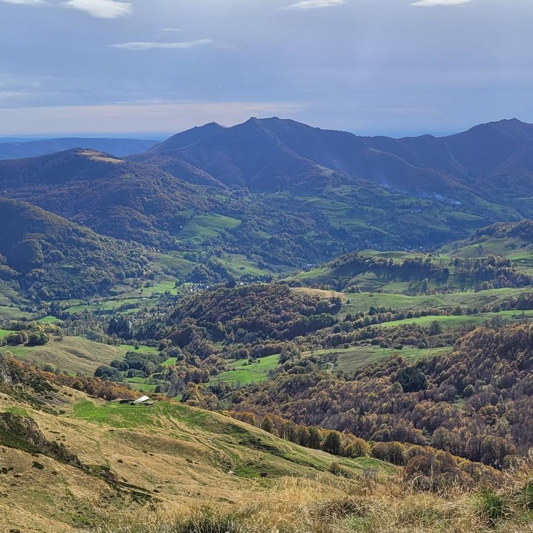
Hiking around Naucelles offers diverse landscapes shaped by its volcanic origins within the Cantal department. The region features a varied terrain of mountains, verdant valleys, and high plateaus, forming part of the Auvergne Volcanoes Regional Nature Park. This area provides access to an extensive network of trails, accommodating various hiking experiences from gentle loops to more challenging mountain paths. The natural features include eroded rocky outcrops and rural landscapes.
Best hiking trails around Naucelles
- The most popular hiking route is…
Last updated: October 16, 2026
4.3
(3)
31
hikers
8.14km
02:23
200m
200m
Moderate hike. Good fitness required. Mostly walkable paths. Sure-footedness required.
3.5
(2)
13
hikers
15.5km
04:18
280m
280m
Moderate hike. Good fitness required. Easily walkable paths.

4.0
(1)
13
hikers
5.22km
01:34
140m
140m
Moderate hike. Mostly walkable paths. Sure-footedness required.
5.0
(1)
3
hikers
4.19km
01:09
70m
70m
Easy hike. Easily walkable paths.
13
hikers
6.82km
01:45
30m
30m
Easy hike. Easily walkable paths.
Get access to more routes and recommendations from other explorers.
Already have an account?
Our route recommendations are based on thousands of hikes, rides, and runs completed by other people on komoot.
Start today with a free account
Your next adventure awaits.



Tips from the Community

The Château Saint-Étienne dominates the town of Aurillac from its hill. The tower dates from Carolingian times. Few elements of the medieval castle remain, due to a fire in the early 19th century. Rebuilt at the end of the century, it now houses the Volcanoes Museum, a must visit if you are in the region! The castle's English gardens are perfect for a stroll.
0
0

The international street theater festival which takes place every year in the last weeks of August has made this beautiful town in Cantal famous. Aurillac is also a museum of art and archeology, a very contemporary museum of volcanoes and an ideal horse center for horse riding enthusiasts.
1
0
Frequently Asked Questions
How many hiking trails are available around Naucelles?
There are over 69 hiking routes around Naucelles, offering a wide range of options for all skill levels. These include 27 easy trails, 39 moderate routes, and 3 more challenging hikes.
What kind of terrain can I expect when hiking near Naucelles?
The terrain around Naucelles is highly varied due to its volcanic origins within the Cantal department. You can expect to encounter mountains, verdant valleys, and high plateaus. The region is part of the Auvergne Volcanoes Regional Nature Park, offering diverse landscapes from gentle countryside to rugged volcanic formations.
What do other hikers enjoy most about the trails around Naucelles?
The trails around Naucelles are highly rated by the komoot community, with an average score of 4.3 stars from over 40 reviews. Hikers often praise the diverse volcanic landscapes, the peaceful atmosphere of the valleys, and the well-maintained paths that cater to various experience levels.
Are there easy hiking options suitable for beginners or casual walkers?
Yes, Naucelles offers plenty of easy hiking options. There are 27 easy trails, perfect for beginners or those looking for a leisurely stroll. For example, the Puy Courny Cross loop from Aurillac is an easy 5.1 km path, and the Hiking loop from Aurillac is a 4.1 km trail. Local circuits like the 'Circuit de Varet' (3 km) and 'Circuit de Tourtoulou' (5 km) are also excellent for discovering the countryside.
Are there challenging hikes for experienced trekkers in the Naucelles area?
Absolutely. For experienced hikers, the Pays d'Aurillac and the Auvergne Volcanoes Regional Nature Park offer rugged terrain and demanding itineraries. The GR® 400, a 140-kilometer long-distance trail, circumnavigates the Plomb du Cantal, providing spectacular mountain vistas and a challenging experience. There are 3 difficult routes recorded in the immediate Naucelles area, with many more challenging options deeper within the park.
Can I find circular hiking routes around Naucelles?
Yes, many of the trails around Naucelles are circular, allowing you to start and end at the same point. Examples include the popular Saint-Étienne Castle loop from Aurillac, the Puy Courny Cross loop from Aurillac, and the Aurillac loop from Aurillac. These loops are great for exploring the local scenery without needing to retrace your steps.
Are there any notable natural features or landmarks to see while hiking?
The region is rich in natural and historical landmarks. You can explore the dramatic Route des Crêtes, visit the historic town of Aurillac, or discover the stunning Jordanne Gorges. Further afield, the majestic Puy Mary and Plomb du Cantal offer breathtaking panoramic views. The area's volcanic past is also evident in features like the Cascade de Faillitoux, a beautiful waterfall cascading over basaltic organs.
Are there any hikes that feature waterfalls near Naucelles?
While not directly on the listed routes, the region surrounding Naucelles is known for beautiful waterfalls. The most notable is the Cascade de Faillitoux, which plunges approximately forty meters over impressive basaltic columns, showcasing the area's volcanic geology. It's a popular natural attraction worth seeking out.
Are there any castles or historic sites accessible via hiking trails?
Yes, the area boasts several historic sites. The Saint-Étienne Castle loop from Aurillac offers views of a historic castle. You can also find other castles nearby, such as Fabrègues Castle and Château d'Oyez, which can be incorporated into longer hikes or visited as points of interest.
Are the hiking trails around Naucelles suitable for families with children?
Many trails around Naucelles are suitable for families. The shorter, easier routes like the 'Circuit de Varet' (3 km) and 'Circuit de Tourtoulou' (5 km) are ideal for family outings, offering a gentle introduction to the local countryside. The Puy Courny Cross loop from Aurillac is another easy option that families can enjoy.
Are there dog-friendly hiking options in Naucelles?
Most trails in the Naucelles area and the wider Auvergne Volcanoes Regional Nature Park are generally dog-friendly, provided dogs are kept on a leash, especially in areas with livestock or protected wildlife. Always check local signage for specific restrictions, particularly within nature reserves or around sensitive areas.
What is the best time of year to go hiking in Naucelles?
The best time to hike in Naucelles is typically from spring through autumn (May to October). During these months, the weather is generally pleasant, and the landscapes are vibrant. Summer offers expansive green pastures, while autumn brings beautiful foliage. Some higher elevation trails might be inaccessible due to snow in winter.
Is public transport available to access hiking trailheads near Naucelles?
Naucelles is well-connected to Aurillac, which serves as a regional hub. While direct public transport to every trailhead might be limited, local bus services connect Aurillac to surrounding villages. For more remote trailheads, a car is often recommended for convenience. The 'Rando autour d'Aurillac' mobile application can also provide guidance on accessing trails.
Most popular attractions around Naucelles

Get inspired with the komoot mobile app


Explore more
Browse the best Hikes in other regions.
