The best running trails around Thiaville-Sur-Meurthe
4.3
(36)
1,700
runners
107
runs
Jogging around Thiaville-Sur-Meurthe offers diverse terrain through the Meurthe Valley and the foothills of the Vosges mountains. The region features extensive forest areas, alluvial meadows, and woodlands, providing varied natural environments for running. Trails often follow the Meurthe River, known for its natural dynamism and rich biodiversity. Elevated areas provide scenic viewpoints over the surrounding valleys, making for engaging running experiences.
Best jogging routes around Thiaville-Sur-Meurthe
- The most popular jogging route is Le Bassin des Fées – Côte Beauregard loop from Thiaville-sur-Meurthe, a 7.3 miles (11.8 km) trail that takes 1 hour 28 minutes to complete. This moderate route includes a notable elevation gain, offering varied scenery.
- Another top favourite among local runners is Viewpoint 1 loop from Beaulieu, a difficult 6.9 miles (11.1 km) path. This route features significant climbs and offers expansive views from elevated sections.
- Local runners also love the Lac de la Plaine – Fontaine Jacquot loop from Raon-l'Étape, a 15.6 miles (25.2 km) trail leading through forests and past the Lac de la Plaine, often completed in about 2 hours 37 minutes.
- Jogging around Thiaville-Sur-Meurthe is defined by tranquil river valleys, extensive forest trails, and scenic viewpoints. The network offers options for easy, moderate, and difficult running, catering to various ability levels.
- The routes in Thiaville-Sur-Meurthe are highly rated by the komoot community with an average score of 4.36 stars from over 32 reviews. More than 1700 runners have used komoot to explore Thiaville-Sur-Meurthe's varied terrain.
Last updated: July 21, 2026
4.3
(4)
124
runners
Hard run. Very good fitness required. Mostly paved surfaces. Suitable for all skill levels.
42
runners
18.2km
02:36
790m
790m
Hard run. Very good fitness required. Mostly paved surfaces. Suitable for all skill levels.

Sign up for free
40
runners
25.6km
02:44
200m
200m
Hard run. Very good fitness required. Mostly paved surfaces. Suitable for all skill levels.
5.0
(1)
8
runners
11.3km
01:25
290m
290m
Moderate run. Good fitness required. Mostly paved surfaces. Suitable for all skill levels.
13
runners
10.5km
01:18
250m
250m
Moderate run. Good fitness required. Mostly paved surfaces. Suitable for all skill levels.
Get access to more routes and recommendations from other explorers.
Sign up for free
Already have an account?
Our route recommendations are based on thousands of hikes, rides, and runs completed by other people on komoot.
Start today with a free account
Your next adventure awaits.
Login or Signup


Tips from the Community

La Pierre d'Appel is located in the Côte de Repy, above Etival Clairefontaine and offers a view of both the Meurthe valley up to St Dié and the Rabodeau valley.
0
0

Tête de Répy is one of the many wooded peaks in the Madeleine massif. Well known to hikers, it offers beautiful views over the Meurthe valley and the Vosges mountains.
0
0
The Pierre d’Appel is a rock located on the Madeleine massif, above Saint-Dié-des-Vosges. It was once used as a gathering place and signal point, hence its name. This promontory offers a beautiful view over the Meurthe valley while being situated in a typical Vosges forest environment, peaceful and steeped in local traditions.
0
0


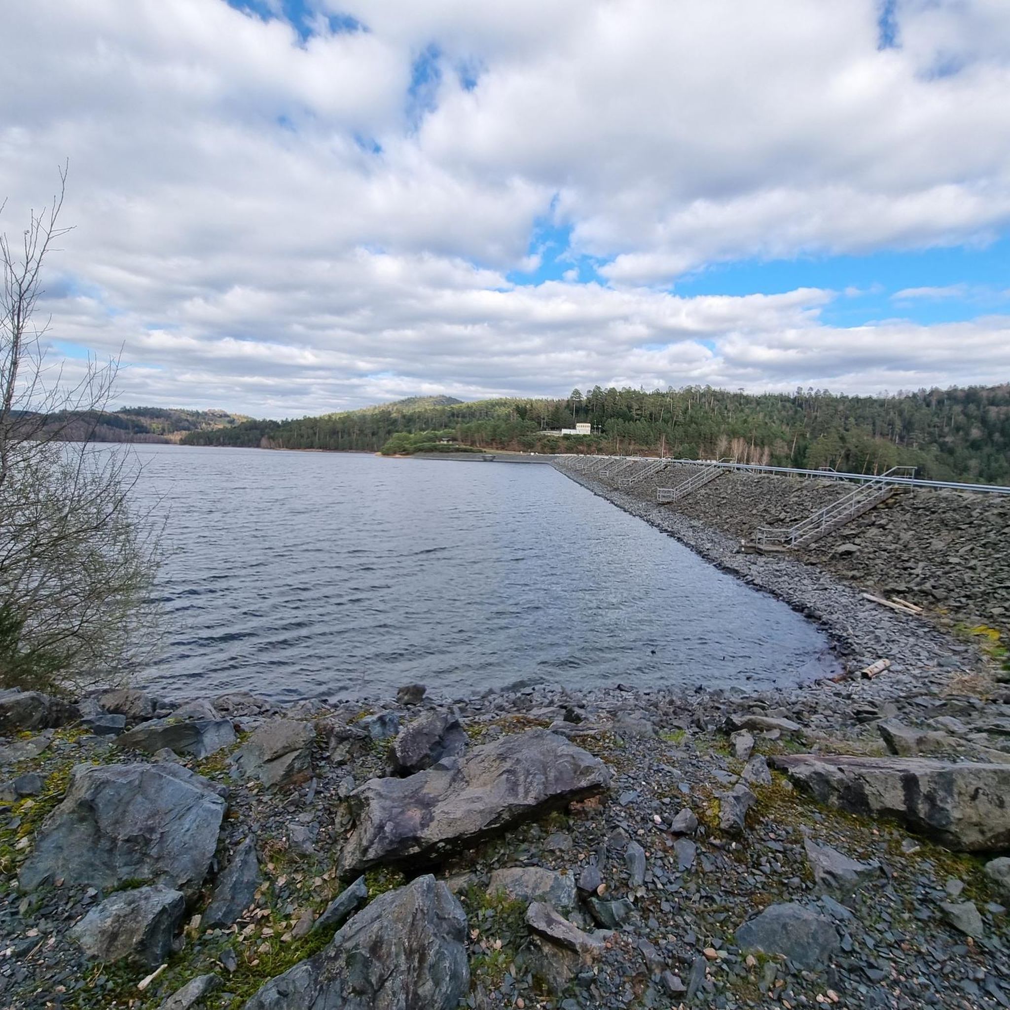
Situated in the heart of the Vosges, this dam, together with Lac de la Plaine, forms an important water reservoir. The dam was built to feed Lac de Pierre-Percée via an underground system. The climb up to it is gradual and rewards you with a view of the peaceful Lac de la Plaine. The road along the lake is ideal for a breather, with little traffic and lots of nature. Perfect for a short break or a photo opportunity during your ride.
9
0
Lac de la Plaine is a picturesque lake in the Vosges, located near Celles-sur-Plaine, near the larger Lac de Pierre-Percée. The lake is an artificial water reservoir of about 0.5 million m³ and serves as a supply basin for the reservoir above.
1
0

Near the Pierre-Percée lake, the Plaine lake is smaller, less known but just as charming. It also has the advantage of being bordered by a beautiful cycle path. Not the surface we prefer for mountain biking, but a great way to advance in the valley to access the many spots of the Vosges.
0
0

One of the most beautiful areas in Alsace/Lorraine. Ideal for cycling and hiking
2
0
Frequently Asked Questions
How many running routes are available around Thiaville-Sur-Meurthe?
There are over 100 dedicated running routes around Thiaville-Sur-Meurthe listed on komoot, offering a wide variety of distances and difficulty levels for joggers.
What types of terrain can I expect on the jogging trails in this region?
The region offers diverse terrain, from tranquil river valleys along the Meurthe to extensive forest trails and elevated areas in the foothills of the Vosges mountains. You'll find a mix of alluvial meadows, woodlands, and paths with scenic viewpoints.
Are there any easy or beginner-friendly running routes in Thiaville-Sur-Meurthe?
Yes, while many routes are moderate or difficult, there are several easier options. The Sentier La Clé des Champs, for example, is a 2.5 km educational path along the Meurthe River, suitable for a shorter, gentle jog or warm-up.
Which running routes offer the best scenic views?
Many routes provide breathtaking scenery. Trails leading to elevated areas like the Col de La Chipotte offer superb viewpoints over the Rabodeau, Meurthe, and Plaine Valleys. The Viewpoint 1 loop from Beaulieu is a difficult path featuring significant climbs and expansive views from its elevated sections.
Are there any long-distance running trails for experienced joggers?
Absolutely. For those seeking a longer challenge, the La Pierre d'Appel – Viewpoint 1 loop from Raon-l'Étape covers nearly 22 km with significant elevation gain. Another option is the Lac de la Plaine – Fontaine Jacquot loop from Raon-l'Étape, which is over 25 km and leads through forests and past the Lac de la Plaine.
What natural attractions can I see along the running routes?
The region is rich in natural beauty. You can encounter the ecologically important "Vallée de la Meurthe Sauvage" with its alluvial meadows and woodlands. Routes often pass by lakes such as Lake Pierre-Percée and Lac de la Plaine, and offer views from points like Raven Rock or the Vieux-Pré dam lookout point.
Are there circular running routes available?
Yes, many of the running routes in the area are circular, allowing you to start and finish at the same point. For instance, the popular Le Bassin des Fées – Côte Beauregard loop from Thiaville-sur-Meurthe is a moderate 11.8 km circular trail.
What do other runners say about the trails in Thiaville-Sur-Meurthe?
The running routes in Thiaville-Sur-Meurthe are highly rated by the komoot community, with an average score of 4.36 stars from over 30 reviews. Runners often praise the varied terrain, scenic viewpoints, and the immersive experience within the natural environments of the Meurthe Valley and surrounding forests.
Are the running trails suitable for families?
Yes, the region offers options suitable for families. Shorter, less challenging paths like the Sentier La Clé des Champs are ideal for family outings, introducing visitors to the valley's natural environments in an accessible way.
Is there parking available near the running routes?
Yes, for some routes, parking is conveniently available. For example, the Sentier La Clé des Champs has a free parking area at the village entrance, making it easy to access for a run.
What is the best time of year to go running in Thiaville-Sur-Meurthe?
The extensive forest areas, making up nearly a third of the Pays du Lunévillois territory, provide shade in warmer months, while the Meurthe Valley offers pleasant conditions. Spring and autumn are particularly beautiful with vibrant foliage, but the diverse landscapes make it enjoyable year-round, weather permitting.
Are dogs allowed on the running trails?
While specific regulations for each trail vary, generally, dogs are welcome on many outdoor trails in France, especially in natural areas like the Meurthe Valley and forest paths, provided they are kept under control, often on a leash, and owners clean up after them. It's always best to check local signage.
Most popular routes around Thiaville-Sur-Meurthe
Most popular attractions around Thiaville-Sur-Meurthe

Get inspired with the komoot mobile app


Explore more
Browse the best Running Trails & Routes in other regions.
