The best walks and hikes around Cuvry
4.4
(956)
6,435
hikers
458
hikes
Hiking trails around Cuvry offer a variety of paths through the local landscape. The region features relatively gentle terrain, with routes often following river courses or winding through open areas. Elevation changes are generally modest, making many trails accessible for different skill levels. The area provides opportunities to explore the natural surroundings of Cuvry.
Best hiking trails around Cuvry
- The most popular hiking route is Stadium loop from Marly, a 6.6 miles (10.6 km) trail that takes 2 hours…
Last updated: July 5, 2026
3.9
(11)
65
hikers
Moderate hike. Good fitness required. Easily-accessible paths. Suitable for all skill levels.
5.0
(3)
27
hikers
11.1km
02:53
80m
80m
Moderate hike. Good fitness required. Easily-accessible paths. Suitable for all skill levels.

Sign up for free
3.3
(3)
26
hikers
8.47km
02:14
70m
70m
Moderate hike. Good fitness required. Easily-accessible paths. Suitable for all skill levels.
4.8
(4)
31
hikers
10.5km
02:41
30m
30m
Moderate hike. Good fitness required. Easily-accessible paths. Suitable for all skill levels.
4.7
(3)
13
hikers
13.5km
03:48
280m
280m
Moderate hike. Good fitness required. Easily-accessible paths. Suitable for all skill levels.
Get access to more routes and recommendations from other explorers.
Sign up for free
Already have an account?
Our route recommendations are based on thousands of hikes, rides, and runs completed by other people on komoot.
Start today with a free account
Your next adventure awaits.
Login or Signup


Tips from the Community

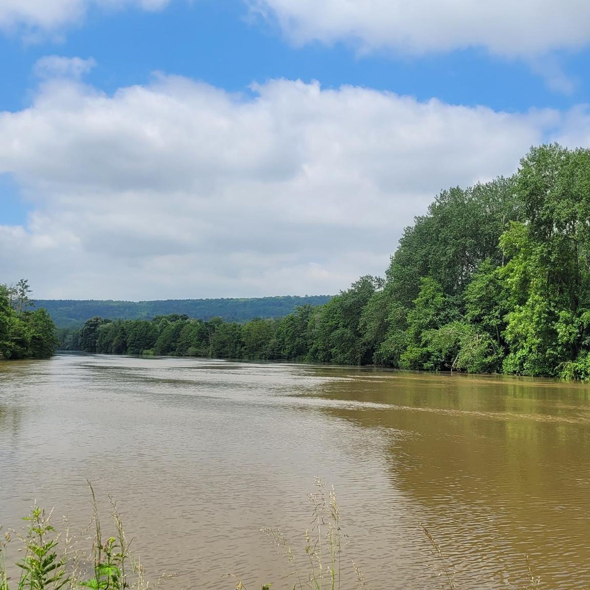
Very spacious park on the banks of the Saille with some nice special features, e.g. the footpaths along the Saille, the hill with the 'Flamme de la Liberté', or the fact that even the annually expected floods of the Saille with floodplains and marsh areas were included in the planning.
2
0

Beautiful Roman aqueduct on the edge of the cycle path towards Metz.
6
0
The aqueduct connecting Gorze to Metz is a Roman aqueduct built at the beginning of the second century. Divodurum (Metz) is the capital of the Mediomatris, at the crossroads of the south-north and east-west axes, i.e. on the Roman roads from Lyon to Trier and from Reims to Strasbourg. The city, which had about 20,000 inhabitants in the second century, needed a supply of spring water to supply the fountains, the three Roman baths, the public latrines and the craftsmen. The exact distribution points are not known because no trace remains (Wikipedia).
4
0
The aqueduct connecting Gorze to Metz is a Roman aqueduct built at the beginning of the second century (Wikipedia).
5
0

Parking lot with tables and benches and an information board directly on the cycle path
0
0

This impressive aqueduct is emblematic of the region. It was built at the beginning of the 2nd century and had the function of transporting drinking water from the source of "bouillons de Gorze" to the thermal baths and the fountain of Metz, formerly Divodorum. The aqueduct was 22 kilometers long at its origin. It spanned the Moselle valley for more than a kilometer. Today, there are 16 arches that can be seen on this site in Jouy-aux-Arches and 7 arches on the side of Ars-sur-Moselle.
6
0
Frequently Asked Questions
How many hiking trails are available in Cuvry?
The Cuvry area offers a wide selection of routes, with nearly 460 hiking trails recorded on komoot. This includes a diverse range of paths suitable for various skill levels.
What kind of terrain can I expect on hikes around Cuvry?
Hikes around Cuvry typically feature relatively gentle terrain, often following river courses or winding through open fields. Elevation changes are generally modest, making many trails accessible. You'll find paths connecting local villages and exploring the natural surroundings.
Are there easy hiking options in Cuvry?
Yes, Cuvry has a good selection of easy hiking routes. Over 220 trails are classified as easy, providing accessible options for casual walkers or those looking for a less strenuous experience. These often involve minimal elevation gain and well-defined paths.
Are there any longer or more challenging routes for experienced hikers?
For those seeking a more challenging experience, Cuvry offers some longer routes. One example is the Mountain biking in Sud Messin – Verny – Seille spillway loop from Marly, which is a difficult 26.6 km (16.5 miles) trail. While the name suggests mountain biking, it is also a recognized hiking route on komoot, offering a substantial distance and some varied terrain.
Can I find circular hiking routes in the Cuvry area?
Yes, many of the trails around Cuvry are designed as loops, allowing you to start and end at the same point. A popular moderate circular route is the Stadium loop from Marly, which covers 10.6 km (6.6 miles) and takes about 2 hours 42 minutes to complete.
What are some interesting natural features or landmarks to see while hiking?
While hiking around Cuvry, you can explore several natural monuments. Highlights include The Battle Beech, the impressive Giant Sequoia tree at Metz Botanical Garden, and the unique La Fraze Rocks. There's also the View of the Rupt de Mad Valley for scenic vistas.
Are there historical sites or castles near the hiking trails?
Yes, the region around Cuvry is rich in history. You can visit historical sites such as the Porte des Allemands and Metz Cathedral, Fort Saint-Quentin, and Fort Queuleu. For those interested in castles, Mercy Castle is also nearby.
What do other hikers say about the trails in Cuvry?
The hiking routes in Cuvry are highly regarded by the komoot community, holding an average rating of 4.4 stars from over 900 reviews. Hikers often praise the varied terrain, the peaceful river paths, and the opportunities to connect with local villages.
Is Cuvry suitable for family-friendly hikes?
Given the generally gentle terrain and numerous easy routes, Cuvry can be suitable for family-friendly hikes. Many trails offer modest elevation changes and pleasant paths through open areas, making them enjoyable for various ages and fitness levels. Consider shorter loop trails for younger children.
Are there options for parking near the trailheads?
While specific parking details for every trailhead are not provided, many hiking areas in regions like Cuvry typically offer designated parking spots near popular starting points or in nearby villages. It's advisable to check the individual route details on komoot for specific parking information before you go.
What is the best time of year to go hiking in Cuvry?
The best time to hike in Cuvry generally aligns with typical hiking seasons in temperate climates. Spring and autumn offer pleasant temperatures and beautiful scenery, with blooming flowers in spring and vibrant foliage in autumn. Summer can also be enjoyable, especially on shaded paths, while winter hiking is possible but may require appropriate gear for colder conditions.
Can I bring my dog on the hiking trails in Cuvry?
Many outdoor trails in regions like Cuvry are dog-friendly, especially those through open fields and natural areas. However, it's always recommended to keep your dog on a leash, especially near livestock or in populated areas, and to check for any specific local regulations or signage on individual trails regarding pets.
How long do hikes around Cuvry typically take?
Hikes around Cuvry vary in length and duration. For example, the moderate Bunker – pond loop from Fleury is 11.4 km (7.1 miles) and takes approximately 3 hours to complete. Longer routes like the Seille spillway – The Seille at Magny loop from Marly, at 14.4 km (9.0 miles), can take around 3 hours 40 minutes. You'll find options ranging from short walks to half-day or full-day excursions.
Most popular attractions around Cuvry

Get inspired with the komoot mobile app


Explore more
Browse the best Hikes in other regions.
