The 4 Most Amazing Peaks around Saint-Cergues
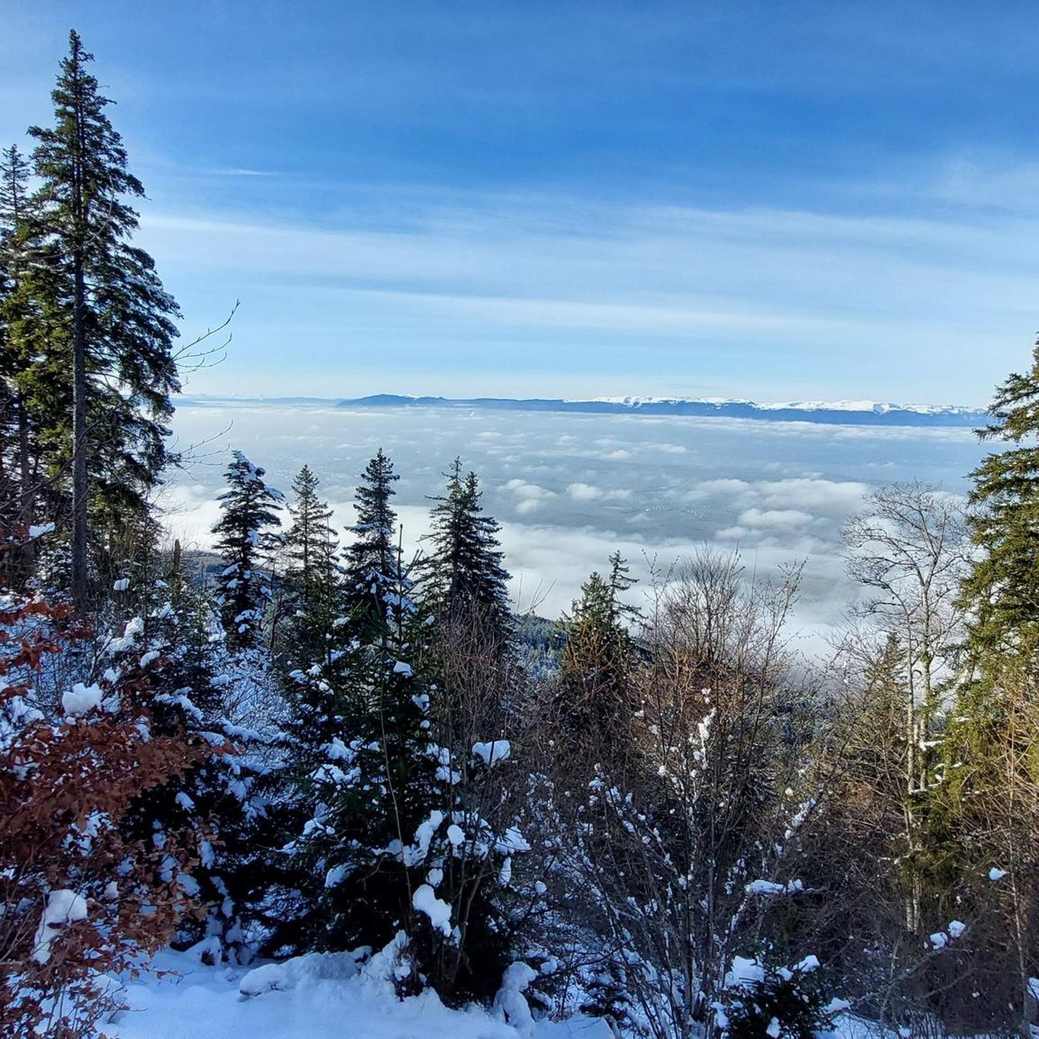
Best mountain peaks around Saint-Cergues are found within the Voirons massif, offering a diverse natural landscape in Haute-Savoie, France. This region is characterized by dense forests, high alpine meadows, and prominent summits. Visitors can explore various hiking trails around Saint-Cergues, providing opportunities to experience the local geology, flora, and fauna. The area is known for its panoramic views, extending to Lake Geneva, the Alps, and Mont Blanc on clear days.
Best mountain peaks around Saint-Cergues
- The most popular mountain peaks is Pointe de Miribel, a summit that is very rewarding and easy to reach. From the Chalets d’Ajon, an ascent of about 120 meters leads to the summit on a mountain path.
- Another must-see spot is Le Signal des Voirons Summit, a summit and viewpoint within the Voirons forest. This point offers an exceptional panorama of the Alps, the Jura, and Mont Blanc.
- Visitors also love Signal of the Voirons, a summit with signposts and orientation panels. On a clear day, the views towards Lake Geneva or the mountains are phenomenal.
- Saint-Cergues is known for its summits, viewpoints, and forest trails. The region offers a variety of mountain peaks to see and explore, from family-friendly ascents to more challenging routes.
- The mountain peaks around Saint-Cergues are appreciated by the komoot community, with 76 upvotes and 38 photos shared across the highlights.
Last updated: July 7, 2026
Pointe des Brasses
Highlight • Summit
Les Brasses is a toponym from a mountain pasture located above Viuz-en-Sallaz2. It could derive from the German Brache, which designates fallow or fallow land2,3, or from the Old German braka meaning “clearing”3. It is possible that it also derives from the Latin bracchium3 (“arm”), referring to the arms of the river, three of which have their source in Brasses: the Menoge, the Entreverges and Airets streams.
In June 2013, a cross made by students from the Viuz-en-Sallaz Catholic Automobile School was erected on its summit. Six meters high, it is made up of 33 metal cubes measuring 30 centimeters on each side, assembled on site and arranged in a spiral by the students themselves. She was blessed on July 7, 2013 by Mgr Boivineau, Bishop of Annecy.
Translated by Google •
Tip by

Signal of the Voirons
Highlight • Summit
On a clear day, the views towards Lake Geneva or the mountains are phenomenal.
Translated by Google •
Tip by

Sign up now to discover places like this
Get recommendations on the best single tracks, peaks, & plenty of other exciting outdoor places.
Sign up for free
Le Signal des Voirons Summit
Highlight • Summit
Translated by Google •
Tip by

Pointe de Miribel
Highlight • Summit
Translated by Google •
Tip by

Downhills at Petit Salève
Highlight • Summit
Tip by

Sign up for free to discover even more peaks around Saint-Cergues.
Sign up for free
Already have an account?
Start today with a free account
Your next adventure awaits.
Login or Signup
Tips from the Community

Impressive views and good trails.
1
0


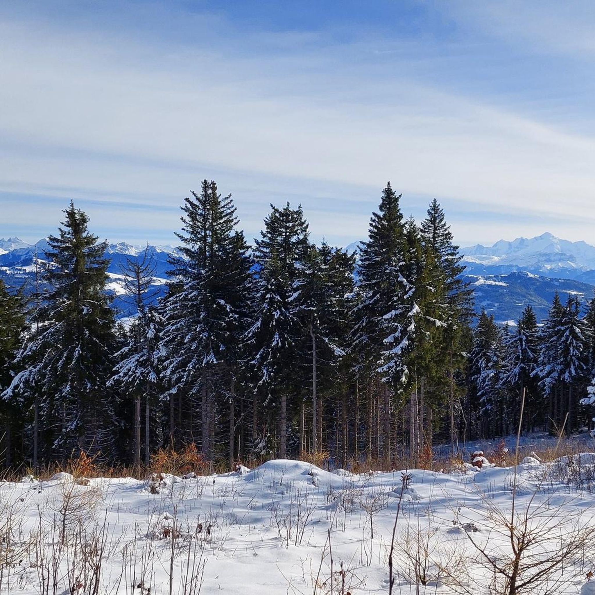
Beautiful view of the Mont Blanc massif
0
0

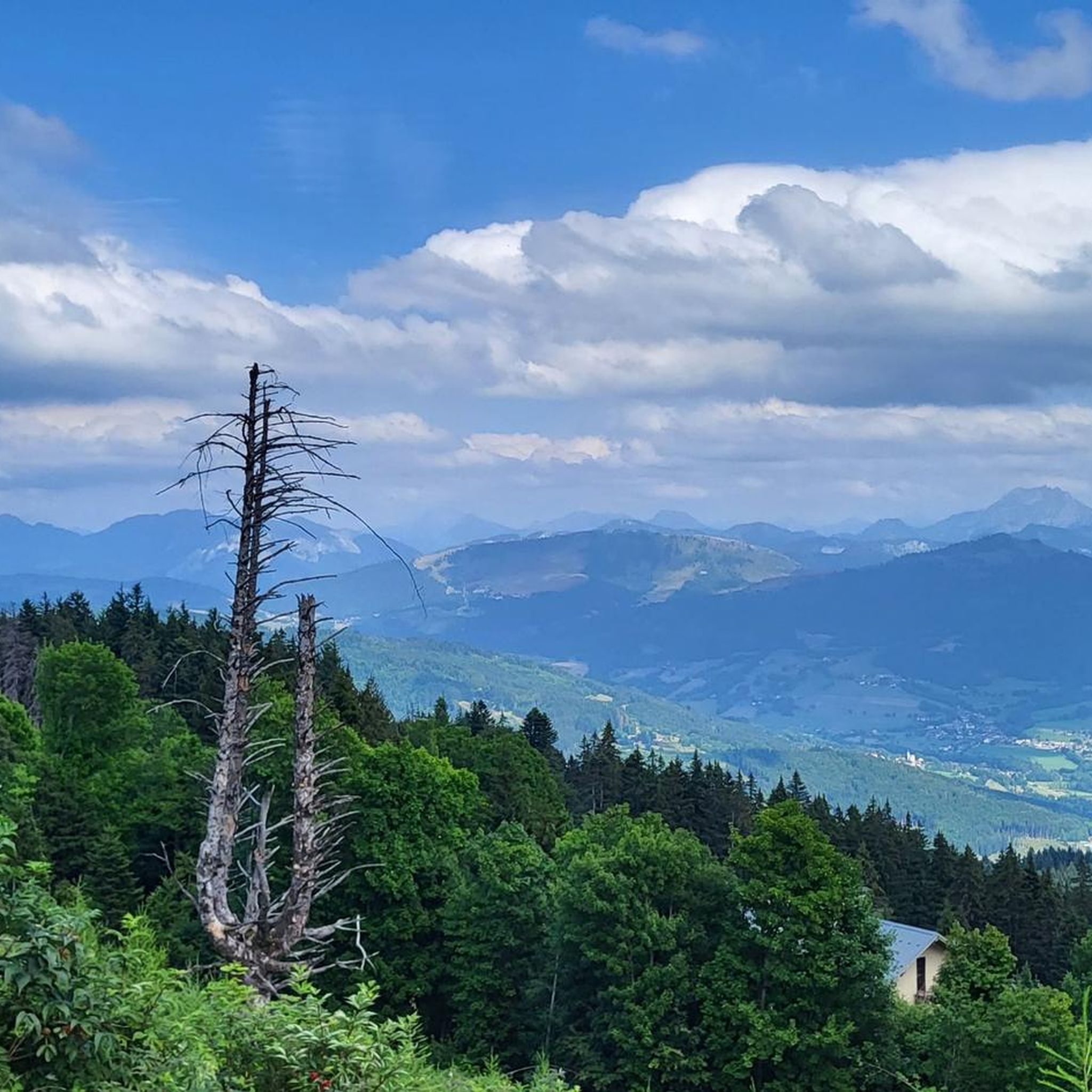
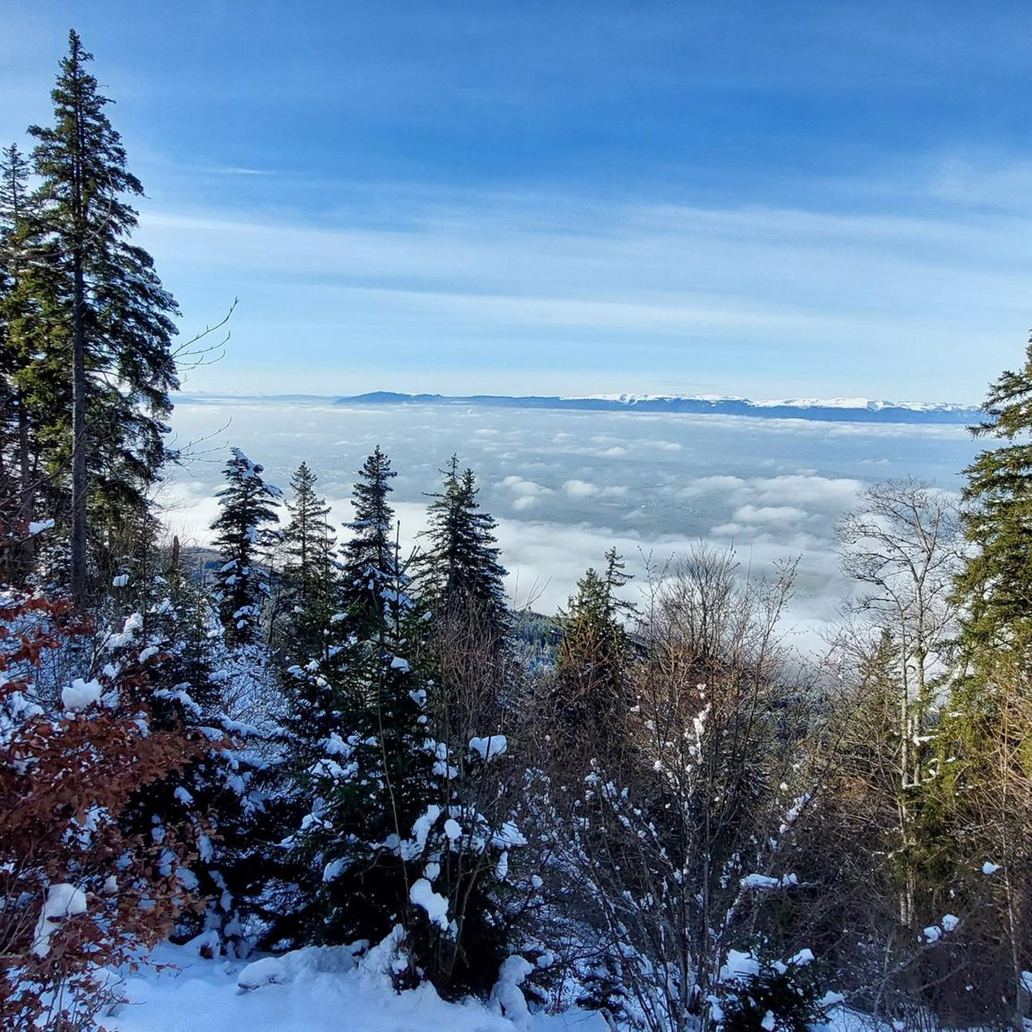
The Voirons signal, culminating at 1,485 meters, offers an exceptional panorama of the Alps, the Jura, and on a clear day, Mont Blanc. Accessible through the Voirons forest, this viewpoint is worth it, but the reward is breathtaking. The trails wind between fir trees and beech trees, offering glimpses of the Geneva Valley and the lake below. Perfect for a contemplative break, it is a popular site for mountain bikers and nature lovers.
6
0

It can blow hard up there! I recommend the path that goes down to La Tour from the east
0
1

The cross means summit of the Brasse mountain
1
0

Pointe des Brasses is a summit of Haute-Savoie located in the Chablais massif, straddling the municipalities of Saint-Jeoire and Viuz-en-Sallaz, and culminating at 1,503 meters above sea level. Les Brasses is a toponym from a mountain pasture located above Viuz-en-Sallaz2. It could derive from the German Brache, which designates fallow or fallow land2,3, or from the Old German braka meaning “clearing”3. It is possible that it also derives from the Latin bracchium3 (“arm”), referring to the arms of the river, three of which have their source in Brasses: the Menoge, the Entreverges and Airets streams. In June 2013, a cross made by students from the Viuz-en-Sallaz Catholic Automobile School was erected on its summit. Six meters high, it is made up of 33 metal cubes measuring 30 centimeters on each side, assembled on site and arranged in a spiral by the students themselves. She was blessed on July 7, 2013 by Mgr Boivineau, Bishop of Annecy.
1
0

There are two signposts called "Signal des Voirons", about 50 meters apart. One is at the top, the other at a viewpoint with orientation panels. On a clear day, the views towards Lake Geneva or the mountains are phenomenal.
3
0
Frequently Asked Questions
What are the most popular mountain peaks to visit around Saint-Cergues?
The most popular peaks in the Voirons massif near Saint-Cergues include Pointe de Miribel, known for its rewarding and easy-to-reach summit with Mont Blanc views. Another must-see is Le Signal des Voirons Summit, offering an exceptional panorama of the Alps, the Jura, and Mont Blanc. Also highly regarded is Signal of the Voirons, which provides phenomenal views towards Lake Geneva and the surrounding mountains.
Are there family-friendly mountain peaks or hikes in the Saint-Cergues area?
Yes, Pointe de Miribel is highlighted as a great hike to do with the family. It's considered a rewarding and easy-to-reach summit, with an ascent of about 120 meters from the Chalets d’Ajon, making it suitable for various fitness levels.
What kind of views can I expect from the mountain peaks around Saint-Cergues?
From the peaks in the Voirons massif, you can expect magnificent panoramic views. On clear days, you can see Lake Geneva, the majestic Alps, the Jura mountains, and even the iconic Mont Blanc. Le Signal des Voirons Summit and Signal of the Voirons are particularly noted for their exceptional vistas.
What outdoor activities can I do near the mountain peaks of Saint-Cergues?
Beyond hiking to the peaks, the Saint-Cergues region offers a variety of outdoor activities. You can explore numerous MTB trails, including routes like the 'Le Signal des Voirons Summit loop'. There are also options for road cycling and gravel biking, with routes offering views of Lake Geneva and the surrounding landscapes.
What is the terrain like on hiking trails in the Voirons massif?
The Voirons massif features a diverse natural landscape. Trails often wind through dense forests of fir and beech trees, offering glimpses of the Geneva Valley and Lake Geneva. While some paths are easy, like the final ascent to Pointe de Miribel, others, such as certain climbs to Signal of the Voirons, may require good fitness and surefootedness.
What do visitors enjoy most about the mountain peaks around Saint-Cergues?
Visitors particularly appreciate the exceptional panoramic views of the Alps, the Jura, Lake Geneva, and Mont Blanc from the summits. The rewarding nature of reaching peaks like Pointe de Miribel, even with a relatively easy ascent, is also a highlight. The diverse trails through the Voirons forest are popular among nature lovers and mountain bikers alike.
Are there any specific points of interest or landmarks on the peaks?
Yes, Signal of the Voirons features signposts and orientation panels at its summit, helping visitors identify the surrounding mountains and landmarks. Additionally, the Le Signal des Voirons Summit is a prominent viewpoint within the Voirons forest itself.
Can I find mountain biking trails near the peaks in Saint-Cergues?
Absolutely. The Voirons massif is a popular area for mountain biking. Le Signal des Voirons Summit is noted as a popular site for mountain bikers. You can find various MTB trails in the region, including challenging loops like the 'Le Signal des Voirons Summit loop from Machilly'.
What is the highest point in the Saint-Cergues area?
The highest point within the communal territory of Saint-Cergues, France, is situated within the dense Voirons forest, reaching an altitude of 1,480 meters. The Le Signal des Voirons Summit culminates at 1,485 meters, offering expansive views.
Are there any other notable viewpoints besides the main peaks?
Yes, the Statue of the Virgin Mary at L’Aiguille offers a beautiful vantage point with views of Lake Geneva if you walk a few hundred meters further north from the statue. This spot provides a different perspective of the surrounding landscape.
What kind of flora and fauna can be observed in the Voirons massif?
The Voirons massif is characterized by its diverse natural landscape, including dense forests and high alpine meadows. While specific species are not detailed, the region offers opportunities to discover the local geology, flora, and fauna typical of the Vaud Jura Park area, which is known for its biodiversity.
How accessible are the peaks for different fitness levels?
The peaks around Saint-Cergues offer a range of accessibility. Pointe de Miribel is considered easy to reach and family-friendly, with a modest 120-meter ascent. Other trails, particularly those leading to Signal of the Voirons, may require good fitness and surefootedness due to steeper sections.
Most popular routes around Saint-Cergues
Most popular attractions around Saint-Cergues

Get inspired with the komoot mobile app


Explore more
See even more amazing summits around Saint-Cergues with these guides:
