The best walks and hikes around Les Pontets
4.5
(421)
2,712
hikers
111
hikes
Hiking around Les Pontets offers trails through the Jura mountains, characterized by dense forests, river valleys, and unique wetland areas. The region is known for its natural springs, including the source of the Doubs River, which carves through the landscape. Hikers can expect varied terrain, from gentle paths alongside waterways to more undulating routes through woodlands and open countryside.
Best hiking trails around Les Pontets
- The most popular hiking route is Source of the Doubs Loop Trail, a 2.7…
Last updated: October 9, 2026
4.9
(30)
184
hikers
4.30km
01:14
90m
90m
Easy hike. Great for any fitness level. Easily-accessible paths. Suitable for all skill levels.
4.5
(15)
86
hikers
6.15km
01:45
130m
130m
Easy hike. Great for any fitness level. Easily-accessible paths. Suitable for all skill levels.

3.7
(19)
59
hikers
9.70km
02:39
150m
150m
Moderate hike. Good fitness required. Easily-accessible paths. Suitable for all skill levels.
4.2
(5)
67
hikers
3.97km
01:05
60m
60m
Easy hike. Great for any fitness level. Easily-accessible paths. Suitable for all skill levels.
4.5
(2)
7
hikers
8.31km
02:26
230m
230m
Moderate hike. Good fitness required. Easily-accessible paths. Suitable for all skill levels.
Get access to more routes and recommendations from other explorers.
Already have an account?
Our route recommendations are based on thousands of hikes, rides, and runs completed by other people on komoot.
Start today with a free account
Your next adventure awaits.

Tips from the Community

Small bridge in the Doubs source area with a beautiful view of the water.
2
0
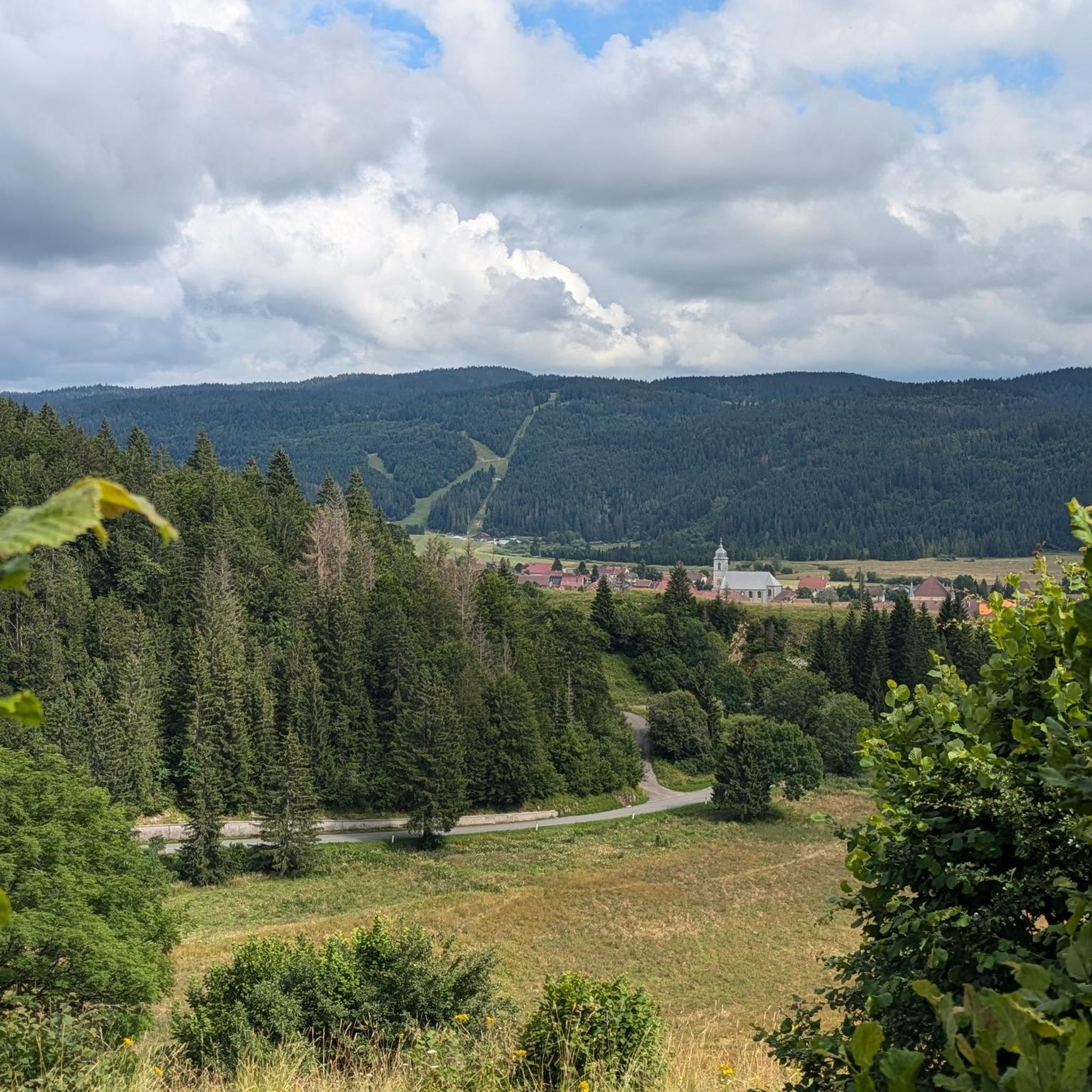
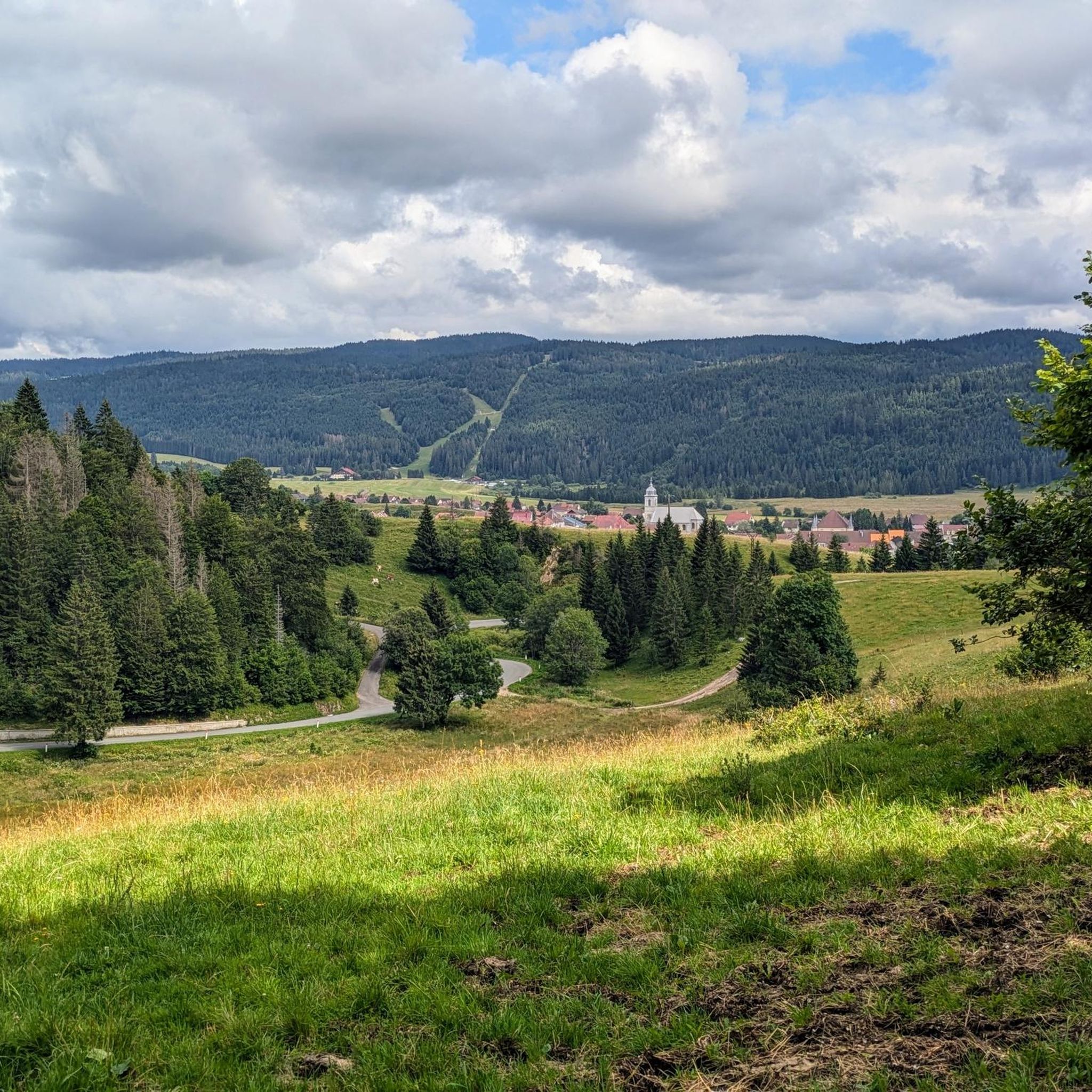
Viewpoint above the Doubs source with beautiful views through a forest clearing to Mouthe and the Doubs river.
6
0
The source of the Doubs River is a powerful karst spring in a heavily karstified area of the Jura Mountains. It lies at an altitude of 937 meters at the foot of the forested, up to 1,419-meter-high Mont Risoux mountain range, which straddles the border between France and Switzerland. The Doubs River rises from a small, approximately five-meter-deep spring basin in a cave in the rock.
6
0

We did a 3-day mountain bike trip in this magnificent region, the routes are great 👍
0
0


The Moutat peatlands form one of the most important peatlands in the region. These ecosystems contain an enormous quantity of CO2 thanks to their permanent humidity, hence the importance of protecting them. To raise public awareness of these environments while making them accessible, a wooden platform was installed so that they could walk on them without trampling on them.
0
0
Frequently Asked Questions
How many hiking trails are there in Les Pontets?
Les Pontets offers a wide variety of hiking experiences with over 90 trails. These range from easy strolls to more challenging moderate routes, catering to different fitness levels.
Are there easy or short walks suitable for beginners in Les Pontets?
Yes, Les Pontets has numerous easy and short walks perfect for beginners. An excellent option is the Source of the Doubs Loop Trail, which is 2.7 miles (4.3 km) long and explores the natural spring that feeds the Doubs River. Another easy choice is the Mouthe – The source of the Doubs loop from Mouthe, a 2.5-mile (4 km) route.
What natural attractions or viewpoints can I discover on hikes around Les Pontets?
The region is rich in natural beauty. You can visit The source of the Doubs, a significant natural spring. Other notable spots include Lake Remoray, the Saine Spring, and the unique Tourbières de Moutat peat bogs. For panoramic views, consider visiting the Two Lakes Viewpoint or Roche Fendue Viewpoint.
Are there circular hiking routes available in Les Pontets?
Many of the trails in Les Pontets are circular, offering convenient starting and ending points. A popular moderate circular route is the Source of the Doubs – The source of the Doubs loop from Mouthe, which is 4.9 miles (7.9 km) long and provides views of the river's source and surrounding forest.
What makes the hiking landscape around Les Pontets unique?
The hiking landscape around Les Pontets is characterized by its location in the Jura mountains, featuring dense forests, picturesque river valleys, and distinctive wetland areas. The presence of natural springs, including the source of the Doubs River, adds to its unique charm, with varied terrain from gentle paths to undulating woodlands.
What do other hikers enjoy the most about hiking in Les Pontets?
The trails in Les Pontets are highly rated by the komoot community, with an average score of 4.5 stars from over 300 reviews. Hikers frequently praise the diverse scenery, from the tranquil river valleys to the unique peat bogs, and the well-maintained paths that cater to various skill levels.
Are there more challenging or longer hikes for experienced hikers?
Yes, for those seeking a longer adventure, the The source of the Doubs – Mouthe loop from Mouthe is a moderate 8.5-mile (13.6 km) trail that offers a more extended exploration of the area's natural beauty.
Can I bring my dog on the hiking trails in Les Pontets?
Generally, dogs are welcome on many hiking trails in the Les Pontets region, especially if kept on a leash. However, it's always advisable to check specific trail regulations or local signage, particularly in nature reserves or protected areas, to ensure dog access is permitted.
When is the best time of year to go hiking in Les Pontets?
The best time for hiking in Les Pontets is typically from spring to autumn (May to October), when the weather is mild and the trails are clear. Summer offers lush greenery, while autumn brings beautiful fall foliage. Winter hiking is also possible, especially for snowshoeing, but requires appropriate gear and checking local conditions.
Is parking available at the trailheads in Les Pontets?
Parking is generally available at or near the main trailheads and popular starting points for hikes in Les Pontets and surrounding villages like Mouthe. Look for designated parking areas, often signposted, especially near attractions like the Source of the Doubs.
Are there any towns or villages worth exploring near the hiking trails?
Absolutely. The nearby village of Mouthe is a charming settlement often serving as a starting point for many hikes, including those to the Source of the Doubs. Chaux-Neuve is another village in the vicinity that offers local character and amenities.
Most popular routes around Les Pontets
Most popular attractions around Les Pontets

Get inspired with the komoot mobile app


Explore more
Browse the best Hikes in other regions.
