The best running trails around Frossay
4.4
(113)
4,811
runners
25
runs
Jogging around Frossay offers routes through diverse natural landscapes, including expansive wetlands and the banks of the Loire River. The region is characterized by its rural setting, featuring green fields and preserved natural environments like the Massereau and Migron wetlands. Joggers can expect mostly flat terrain with minimal elevation changes, providing accessible paths for various fitness levels. The area's proximity to the Canal Maritime de la Basse-Loire also provides scenic running opportunities along waterways.
Best jogging routes around Frossay
- The…
Last updated: July 5, 2026
7
runners
10.4km
01:05
50m
50m
Moderate run. Good fitness required. Mostly paved surfaces. Suitable for all skill levels.
4.0
(1)
9
runners
8.91km
00:55
0m
0m
Moderate run. Good fitness required. Mostly paved surfaces. Suitable for all skill levels.

Sign up for free
8
runners
5.38km
00:35
10m
10m
Moderate run. Good fitness required. Mostly paved surfaces. Suitable for all skill levels.
8
runners
6.68km
00:42
10m
10m
Moderate run. Good fitness required. Mostly paved surfaces. Suitable for all skill levels.
3
runners
14.8km
01:41
80m
80m
Moderate run. Good fitness required. Mostly paved surfaces. Suitable for all skill levels.
Get access to more routes and recommendations from other explorers.
Sign up for free
Already have an account?
Our route recommendations are based on thousands of hikes, rides, and runs completed by other people on komoot.
Start today with a free account
Your next adventure awaits.
Login or Signup

Tips from the Community

Behind the church is a big picnic area. A very nice place for a tent
0
0

This charming chapel, nestled in lush countryside, makes an intriguing backdrop to your itinerary and a welcome excuse to take a break and use the nearby picnic tables.
1
0

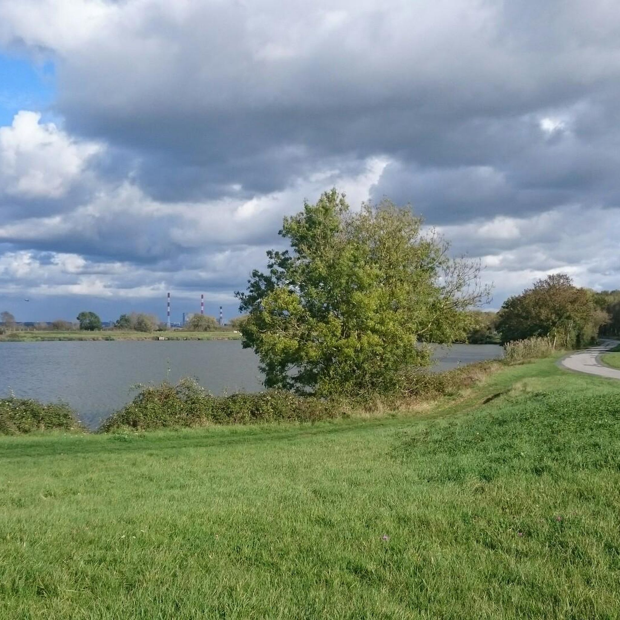
Bucolic and peaceful, almost without traffic.
0
0

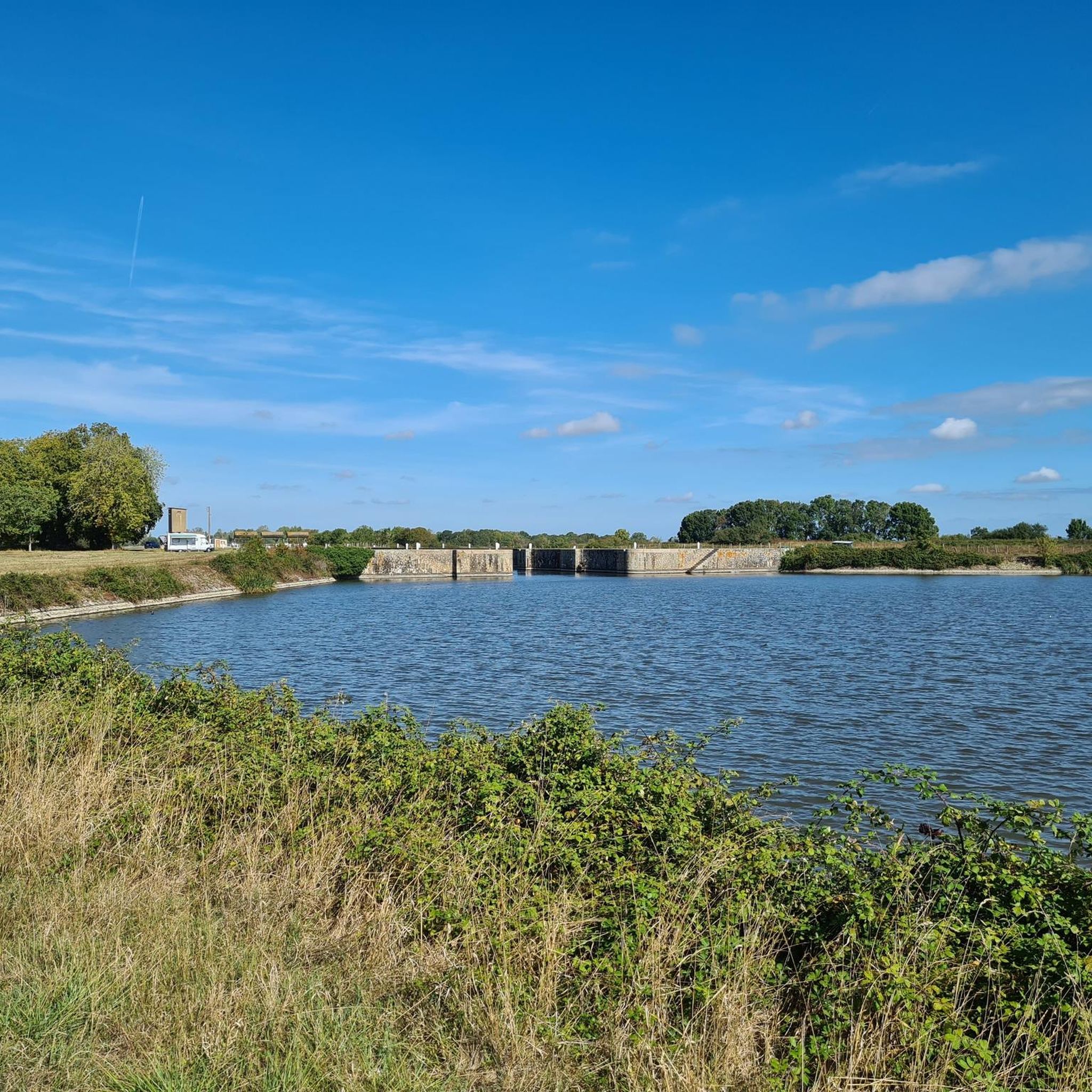
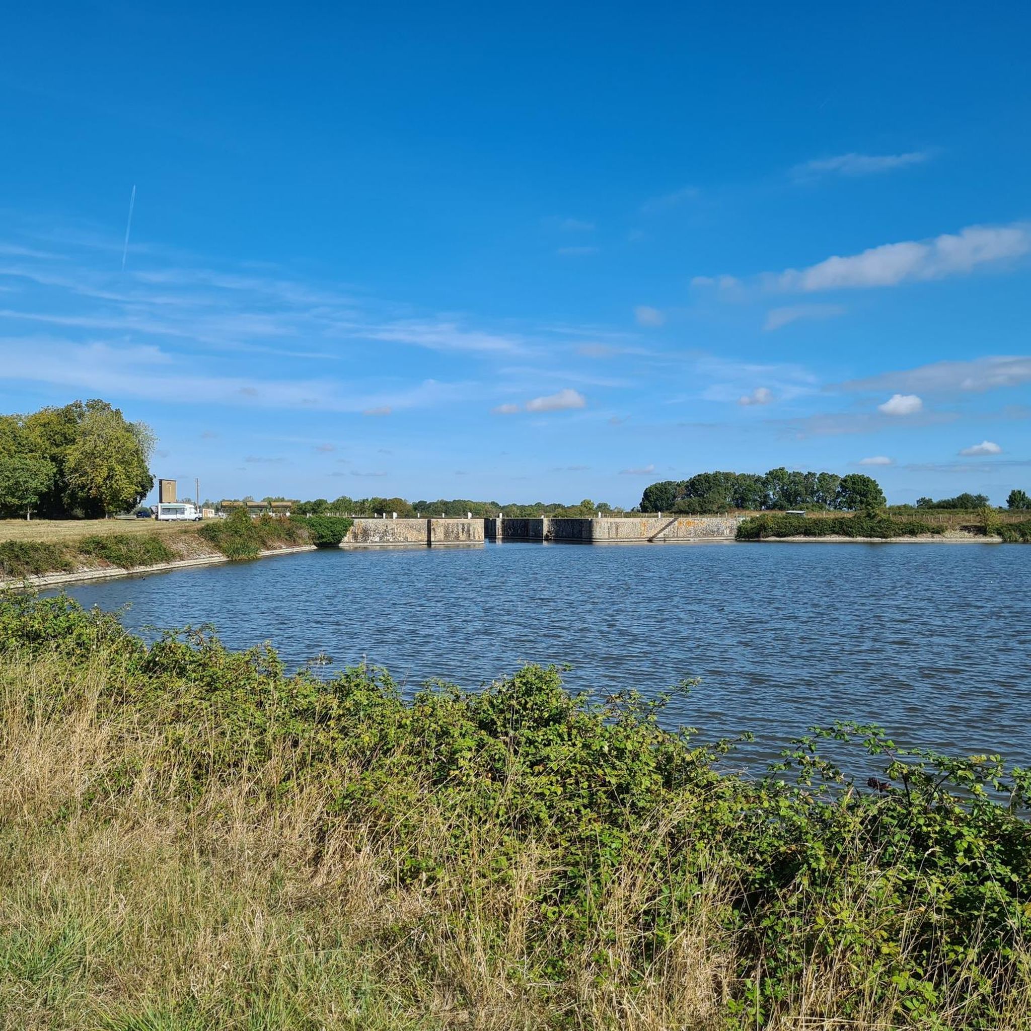
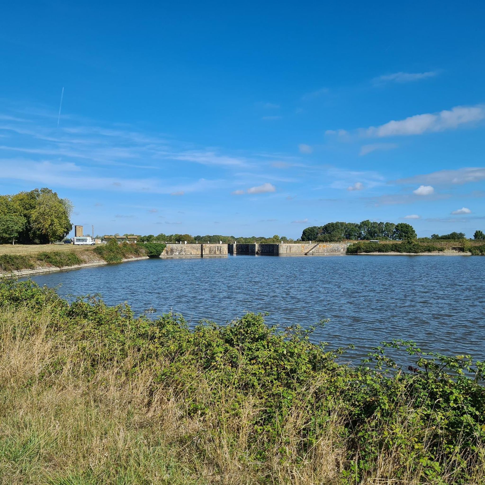
This lock marks the start of the Martinière canal and its separation from the Carnet natural area. Allows you to join the Chemin des Cavaliers north of the canal. Note the presence of "oides" drawn by the Nazairian artist Charles Cantin on two of the buildings.
2
0

Beautiful hydraulic work from the end of the 19th century, decorated with an Eiffel bridge
0
0

The Champs Neufs lock is located on the Martinière canal, built between 1882 and 1892 to move boats assembled in Nantes to the Atlantic Ocean. With the increase in the tonnage of boats, the industry moved to Saint-Nazaire, directly on the ocean and the canal lost its usefulness. Today, the lock is still used for leisure activities (line fishing, boating) in parallel with the Loire.
0
0

This lock of the Champs-Neufs halfway of the channel was also equipped with a siphon, allowing a differentiated water regulation between the moats of Vue marshes and those of the canal itself. Two other locks control the access to the canal: the Martinière (in the east), the Carnet (in the west). This canal runs along the south shore of the Loire Estuary for 15 kilometers, leaving at most 5 to 6 kilometers from the river. Proposed by engineer Adolphe Radiguel in 1861 to allow transatlantic ships to reach Nantes, the canal was started in 1882 and operational in 1892 after 10 years of pharaonic work. Some of the machinery and equipment was previously used for the construction of the Suez Canal. Two "boat parks" allow large vessels to cross at the "Teignouse" in Pellerin, and between Roche and Carnet Frossay. The canal has an intense period of activity with the great navigation which lasts 20 years until 1913, with approximately 10,000 passages during these 20 years, then the fluvial watercraft circulates until 1943. It becomes a cemetery of the tall ships between 1921 and 1927. During the Second World War, the Germans occupy it, then the Americans, from 1957 to 1967, will stock NATO material there. The sea canal is closed to navigation in 1959. In the 1960s, the canal became the hydraulic control tool of the Pays de Retz. Its devastation began in the 1990s, using small dredges. https://fr.wikipedia.org/wiki/Canal_de_la_Martini%C3%A8re
1
2
Frequently Asked Questions
How many running routes are available in Frossay?
There are over 20 running routes around Frossay, catering to various fitness levels. You'll find options ranging from easy strolls to more challenging runs, with 21 routes rated as moderate and 1 as difficult, alongside an easy option.
What do other runners enjoy most about jogging in Frossay?
The running trails in Frossay are highly rated by the komoot community, with an average score of 4.4 stars from over 120 reviews. Runners often praise the diverse natural landscapes, including expansive wetlands and scenic riverbanks, as well as the peaceful rural character of the area.
Are there any easy running routes suitable for beginners in Frossay?
Yes, Frossay offers easy running options perfect for beginners or those looking for a relaxed jog. For instance, the Running loop from La Sicaudais is an easy 3.6 km (2.2 miles) route that can be completed in about 22 minutes, offering a gentle introduction to the area's trails.
What kind of terrain can I expect on the running trails in Frossay?
The terrain in Frossay is generally flat with minimal elevation changes, making it accessible for most runners. You can expect routes that traverse green fields, follow riverbanks, and wind through preserved natural environments like the Massereau and Migron wetlands. Some paths, like the Chapelle Saint-Vital loop from La Poitevinière, offer slightly more varied rural countryside terrain.
Are there any scenic running routes along the Loire River or canals?
Absolutely. Frossay benefits from its proximity to the Loire River and the Canal Maritime de la Basse-Loire. The Pont tournant loop from Frossay offers beautiful views near the Loire River. Another excellent option is the Champs neufs triple lock loop from La Roche, which follows the Canal Maritime de la Basse-Loire, passing by its distinctive triple locks.
Can I find long-distance running trails in Frossay?
Yes, Frossay provides options for longer runs. The Chapelle Saint-Vital loop from La Poitevinière is a good example, stretching nearly 15 km (9.2 miles) through rural countryside, typically taking around 1 hour 40 minutes to complete. The region also features marked circuits like the 17.5 km Landes circuit and the 18.5 km Île Adet circuit, which are suitable for longer distances.
Are there any specific natural landmarks or attractions to see while running in Frossay?
Yes, Frossay's routes often pass by interesting natural and man-made features. You might encounter the expansive wetlands of Massereau and Migron, which are a haven for diverse wildlife. Along the Canal Maritime de la Basse-Loire, you can see the Champs Neufs Lock. Other nearby points of interest include the Martinière Lock and various small lakes like Mabille Valley Lake.
Are the running routes in Frossay suitable for families?
Many of Frossay's running routes, particularly the easier and flatter sections along the canal or through green fields, are suitable for families. The peaceful rural environment and minimal elevation make them enjoyable for all ages. The marked circuits also offer varying distances, allowing families to choose a route that fits their comfort level.
Is Frossay a good place for trail running with elevation?
While Frossay is generally known for its mostly flat terrain, some routes do offer slight elevation changes, particularly those that venture into the rural countryside. For example, the Chapelle Saint-Vital loop from La Poitevinière has an elevation gain of around 80 meters, providing a bit more challenge than the riverside paths. For more significant elevation, you might explore the orientation course at Défi Nature Park, which involves navigating through a forest.
Are there circular running trails available in Frossay?
Yes, Frossay offers several excellent circular running trails. The Pont tournant loop from Frossay and the Chapelle Saint-Vital loop from La Poitevinière are popular examples of circular routes. Additionally, the region has well-defined marked circuits like the 10 km Carnet circuit, the 17.5 km Landes circuit, and the 18.5 km Île Adet circuit, all designed as loops.
What is the best time of year for jogging in Frossay?
Frossay's diverse landscapes are enjoyable throughout the year. Spring and autumn offer pleasant temperatures and vibrant scenery, making them ideal for running. Summer can be warm, but routes along the Loire River or through shaded areas provide cooler options. Even in winter, the trails remain accessible, allowing for peaceful runs through the preserved natural environments.
Are there any dog-friendly running trails in Frossay?
Many of the rural paths and natural areas in Frossay are suitable for running with dogs, provided they are kept under control. The expansive wetlands and countryside offer plenty of space for you and your canine companion to enjoy. Always ensure to follow local regulations regarding dogs in natural reserves and public spaces.
Where can I find parking for the running trails in Frossay?
Parking is generally available near the starting points of many popular running circuits in Frossay. For instance, the marked circuits often start from the Place du Général de Gaulle, where parking facilities are typically present. For specific routes, checking the komoot tour details will often provide information on convenient parking spots.
Most popular attractions around Frossay

Get inspired with the komoot mobile app


Explore more
Browse the best Running Trails & Routes in other regions.
