The best walks and hikes around Chastel-Arnaud
4.5
(1280)
7,863
hikers
141
hikes
Hiking around Chastel-Arnaud offers a diverse landscape for outdoor enthusiasts. The region is characterized by its pre-Alpine foothills, featuring limestone ridges, forested slopes, and deep valleys. These geographical features provide varied terrain, from gentle paths along riverbeds to more challenging ascents to prominent viewpoints. The network of trails allows for exploration of both natural beauty and local heritage.
Best hiking trails around Chastel-Arnaud
- The most popular hiking route is Les Trois Becs Loop Trail, a 6.7 miles (10.8 km)…
Last updated: July 1, 2026
4.9
(164)
1,364
hikers
10.8km
04:44
720m
720m
This difficult 6.7-mile loop in the Saoû forest traverses the three peaks of Les Trois Becs, offering expansive views and a challenging hike
4.9
(42)
397
hikers
8.16km
04:08
650m
650m
Moderate hike. Good fitness required. Mostly accessible paths. Sure-footedness required.

Sign up for free
4.9
(41)
442
hikers
5.78km
03:03
510m
510m
Moderate hike. Good fitness required. Mostly accessible paths. Sure-footedness required.
4.7
(3)
48
hikers
16.4km
06:55
1,000m
1,000m
Hard hike. Very good fitness required. Mostly accessible paths. Sure-footedness required.
5.0
(12)
102
hikers
21.0km
09:15
1,380m
1,380m
Hard hike. Very good fitness required. Mostly accessible paths. Sure-footedness required.
Get access to more routes and recommendations from other explorers.
Sign up for free
Already have an account?
Our route recommendations are based on thousands of hikes, rides, and runs completed by other people on komoot.
Start today with a free account
Your next adventure awaits.
Login or Signup

Tips from the Community


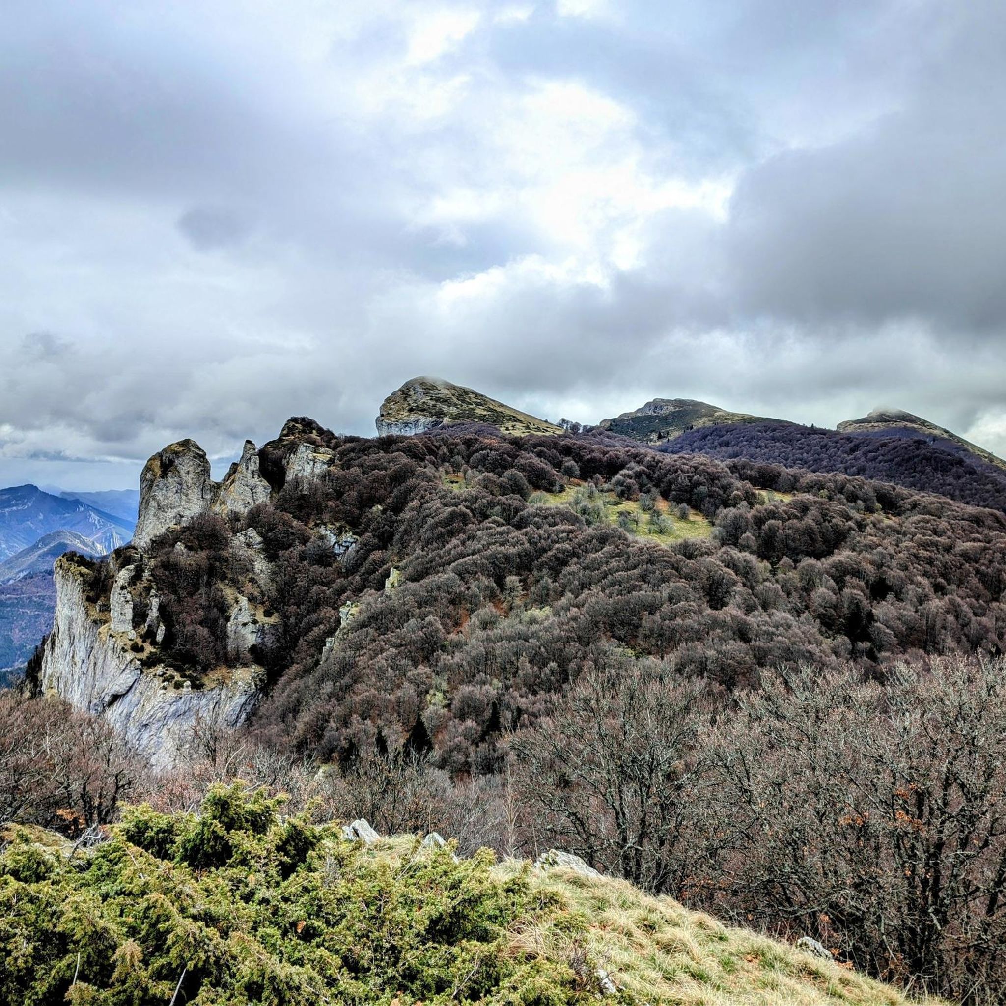
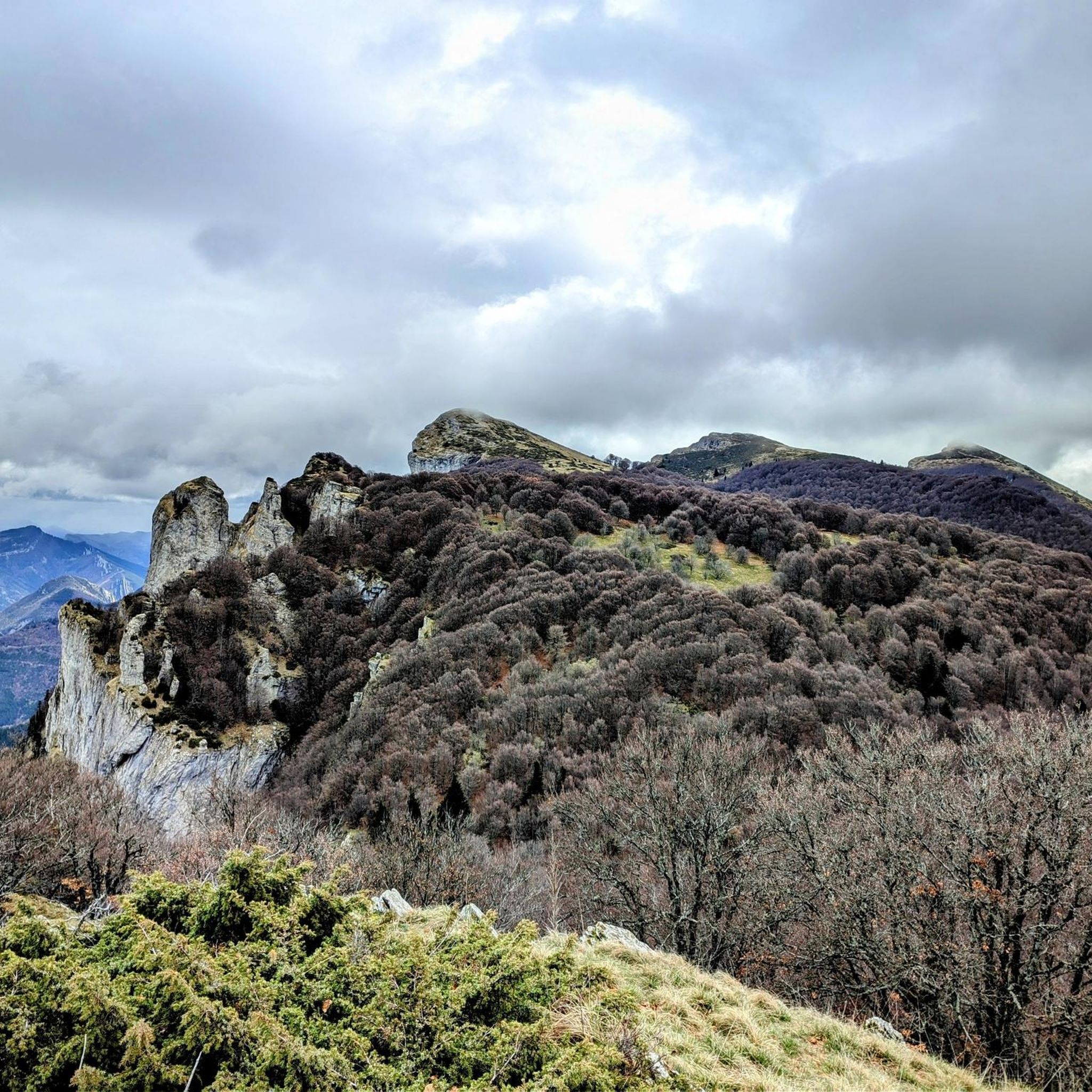
Beautiful tour over the 3 peaks. Not always very lonely on sunny weekends.
4
0
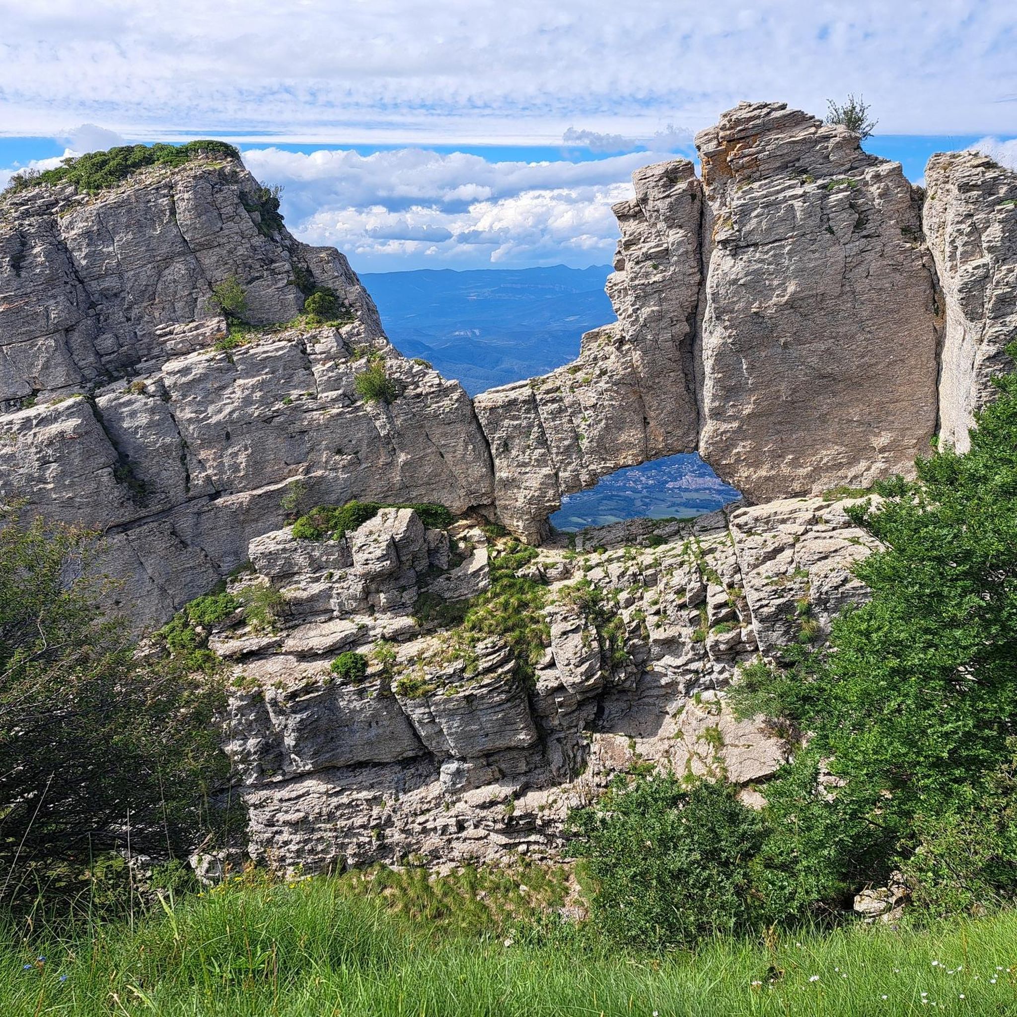
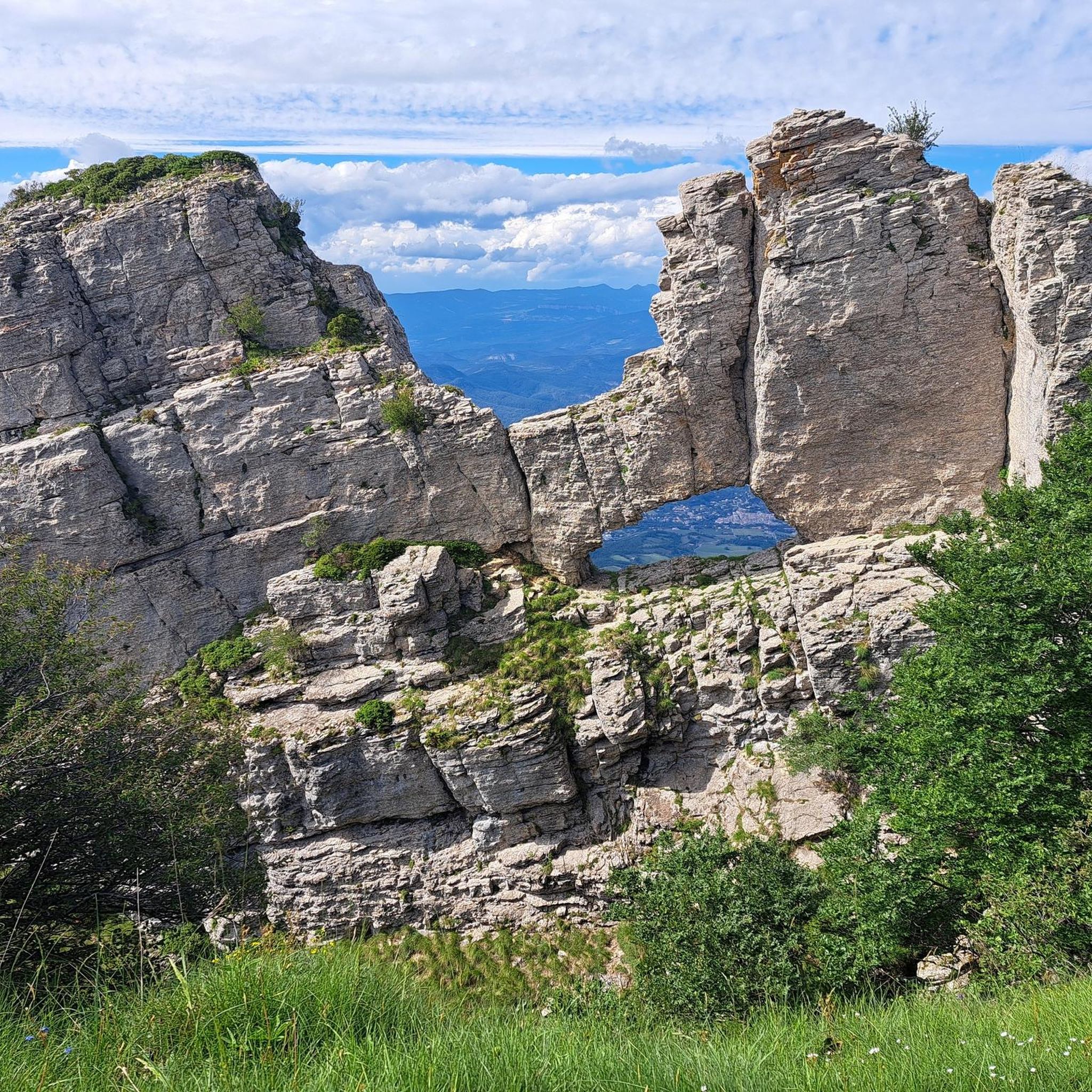
Beautiful rock formation near the Trois Becs
5
0

Siara's elephant on December 1st at 3:40 p.m.
0
0

Remember to take water because there is no source!!
0
0


Magnificent viewpoints for these unmissable peaks!
2
0

We call the Trois Becs, three summits with a similar profile, and perfectly aligned: the Veyou (1,589 meters), the Signal (1,559 meters), the Roche Courbe (1,545 meters).
2
0
Frequently Asked Questions
How many hiking trails are there in Chastel-Arnaud?
Chastel-Arnaud offers a wide variety of hiking experiences, with over 130 routes available. These trails cater to different skill levels, ranging from easy strolls to more challenging mountain ascents.
Are there easy hiking trails suitable for beginners in Chastel-Arnaud?
Yes, Chastel-Arnaud has a good selection of easy trails, with over 25 routes suitable for beginners. These paths often follow riverbeds or gentle slopes, providing a pleasant introduction to the region's natural beauty without significant elevation changes.
Can I find circular hiking routes around Chastel-Arnaud?
Yes, many of the trails in Chastel-Arnaud are designed as circular routes, allowing you to start and end at the same point. For example, the Les Trois Becs Loop Trail is a popular option, offering a challenging ascent with rewarding views. Another great choice is the Sadous Chapel loop from La Chaudière, which is a moderate route.
What are some notable viewpoints or landmarks to see while hiking in Chastel-Arnaud?
The region is rich in natural landmarks and scenic viewpoints. You can hike to prominent peaks like Le Veyou or Les Trois Becs for panoramic views. Mountain passes such as Col de Pennes and Col de la Chaudière also offer stunning vistas. The charming village of Saou and its surrounding forest are also worth exploring.
Is Chastel-Arnaud a good destination for family-friendly hikes?
Chastel-Arnaud offers various trails suitable for families, especially those looking for less strenuous options. The region's diverse terrain includes gentle paths along riverbeds and through woodlands, which are ideal for younger hikers or those preferring a leisurely pace. Look for routes marked as 'easy' to find the most family-friendly choices.
Are dogs allowed on the hiking trails in Chastel-Arnaud?
Generally, dogs are welcome on most hiking trails in Chastel-Arnaud, provided they are kept under control, especially in areas with livestock or wildlife. It's always advisable to keep your dog on a leash and to check local signage for any specific restrictions in certain nature reserves or protected areas.
What is the best time of year to go hiking in Chastel-Arnaud?
The best time for hiking in Chastel-Arnaud is typically from spring to autumn (April to October). During these months, the weather is generally mild and pleasant, with lush greenery in spring and vibrant colors in autumn. Summer offers longer daylight hours, but trails can be busier and temperatures higher.
What are the conditions like for winter hiking in Chastel-Arnaud?
Winter hiking in Chastel-Arnaud can be beautiful, especially after snowfall, but requires appropriate gear and caution. Higher elevation trails, particularly around the prominent peaks, may be covered in snow and ice, making them more challenging or inaccessible. Lower-lying paths might still be passable, but always check local weather conditions and trail reports before heading out.
Do I need a permit to hike in Chastel-Arnaud?
No, generally you do not need a permit for hiking on the established trails in Chastel-Arnaud. The region's trails are freely accessible to the public. However, always respect private property and any specific local regulations or temporary closures that might be in place for conservation or safety reasons.
Where can I find parking for hiking trailheads in Chastel-Arnaud?
Many popular trailheads in Chastel-Arnaud, especially those near villages or significant starting points like La Chaudière, offer designated parking areas. These are usually well-marked. For specific routes, it's recommended to check the tour details on komoot, as they often provide information about parking availability at the starting point.
What should I pack for a hike in Chastel-Arnaud?
For hiking in Chastel-Arnaud, essential items include sturdy hiking boots, layers of clothing suitable for changing weather, a waterproof jacket, sufficient water, snacks, a map or GPS device (like komoot's app), and sun protection. For more challenging routes or longer hikes, consider a first-aid kit and a headlamp.
Are there less crowded hiking options in Chastel-Arnaud?
While popular routes can see more visitors, Chastel-Arnaud's extensive network of over 130 trails means there are many opportunities to find quieter paths. Exploring some of the moderate or difficult trails, or venturing out during off-peak hours or seasons, can lead to a more secluded hiking experience away from the main crowds.
What do other hikers say about the trails in Chastel-Arnaud?
The hiking trails in Chastel-Arnaud are highly regarded by the komoot community, with an average rating of 4.5 stars from over 1,100 reviews. Hikers frequently praise the diverse landscapes, from limestone ridges to dense woodlands, and the well-maintained paths. Many appreciate the variety of routes catering to different fitness levels and the stunning views from the prominent peaks.
Most popular routes around Chastel-Arnaud
Most popular attractions around Chastel-Arnaud

Get inspired with the komoot mobile app


Explore more
Browse the best Hikes in other regions.
