The best road cycling routes around Marckolsheim
4.5
(262)
3,578
riders
12
rides
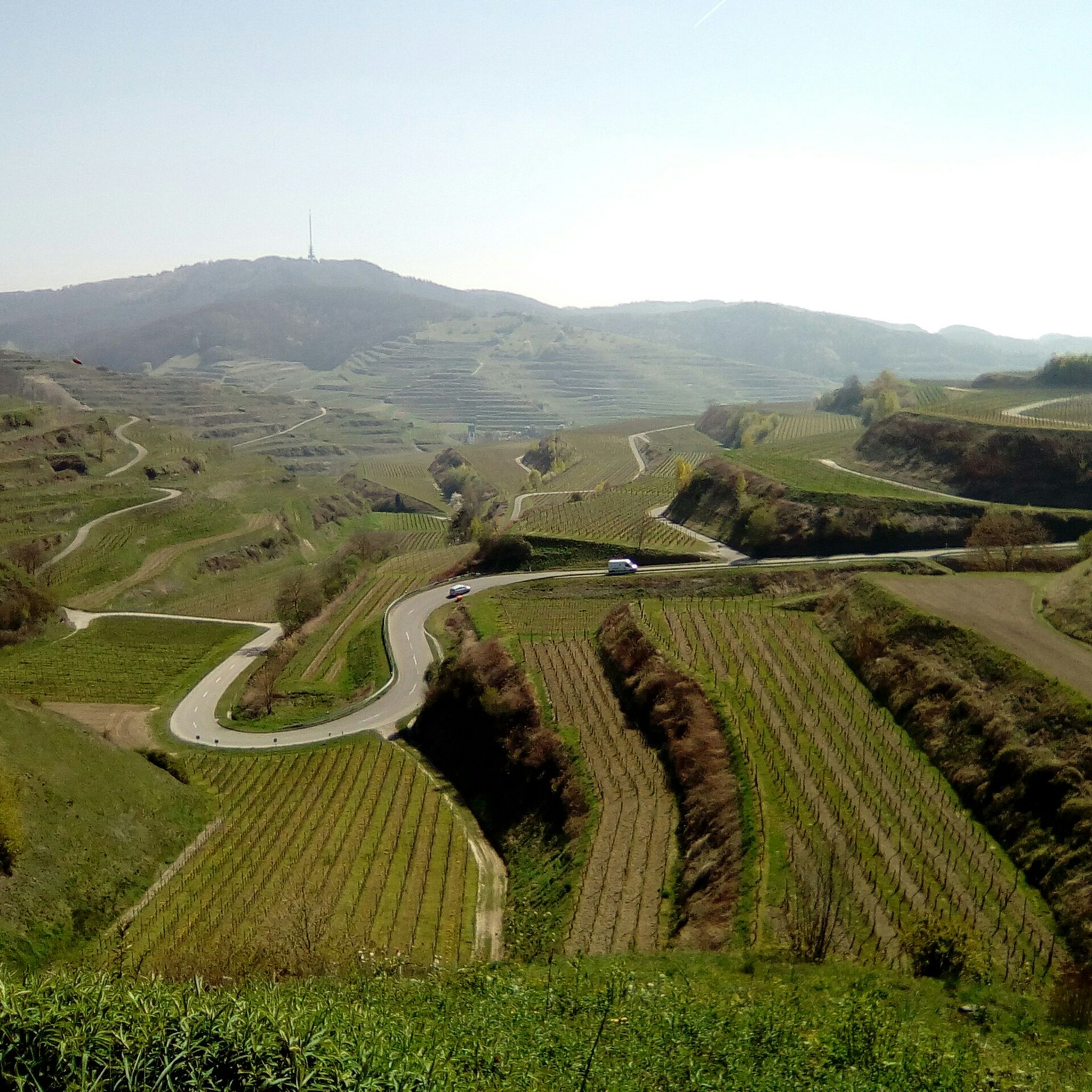
Road cycling around Marckolsheim is characterized by its location within the Grand Ried, an area of wet meadows, groves, and forests. The region is bordered by the Rhine River to the east and features the Rhenish Forest to the south, a classified Natura 2000 protection area. This landscape offers mostly flat to gently rolling terrain, with distant views of the Vosges mountains. The area is also a significant stop on the EuroVelo 15 Rhine Cycle Route, providing extensive cycling infrastructure.
Best road cycling routes around Marckolsheim
- The most popular road cycling route is Château du Haut-Koenigsbourg – Ascent to Haut-Koenigsbourg loop from Marckolsheim, a 41.1 miles (66.1 km) trail that takes 3 hours 2 minutes to complete. This route features a moderate ascent towards the historic Château du Haut-Koenigsbourg.
- Another top favourite among local road cyclists is Channel – Historic Centre of Sélestat loop from Marckolsheim, an easy 24.6 miles (39.6 km) path. This route leads through the historic center of Sélestat, offering views along the channel.
- Local road cyclists also love the Quiet Paved Path – Channel loop from Marckolsheim, a 31.5 miles (50.7 km) trail leading through quiet paved sections along the channel, often completed in about 1 hour 54 minutes.
- Road cycling around Marckolsheim is defined by the Rhine River, the Grand Ried's wet meadows, and the Rhenish Forest. The network offers options for various ability levels, from easy rides along canals to moderate routes with more elevation gain.
- The routes in Marckolsheim are highly rated by the komoot community with an average score of 4.4 stars from over 40 reviews. More than 700 road cyclists have used komoot to explore Marckolsheim's varied terrain.
Last updated: September 28, 2026
3.0
(1)
27
riders
39.4km
01:35
50m
50m
Easy road ride. Great for any fitness level. Mostly well-paved surfaces and easy to ride.
3.5
(2)
21
riders
50.9km
01:56
60m
60m
Easy road ride. Great for any fitness level. Mostly well-paved surfaces and easy to ride.

5.0
(3)
20
riders
58.2km
02:28
110m
110m
Moderate road ride. Good fitness required. Some segments of this route may be unpaved and difficult to ride.
10
riders
39.9km
01:31
40m
40m
Easy road ride. Great for any fitness level. Mostly well-paved surfaces and easy to ride.
11
riders
27.1km
01:08
150m
150m
Easy road ride. Great for any fitness level. Mostly well-paved surfaces and easy to ride.
Get access to more routes and recommendations from other explorers.
Already have an account?
Our route recommendations are based on thousands of hikes, rides, and runs completed by other people on komoot.
Start today with a free account
Your next adventure awaits.
Tips from the Community

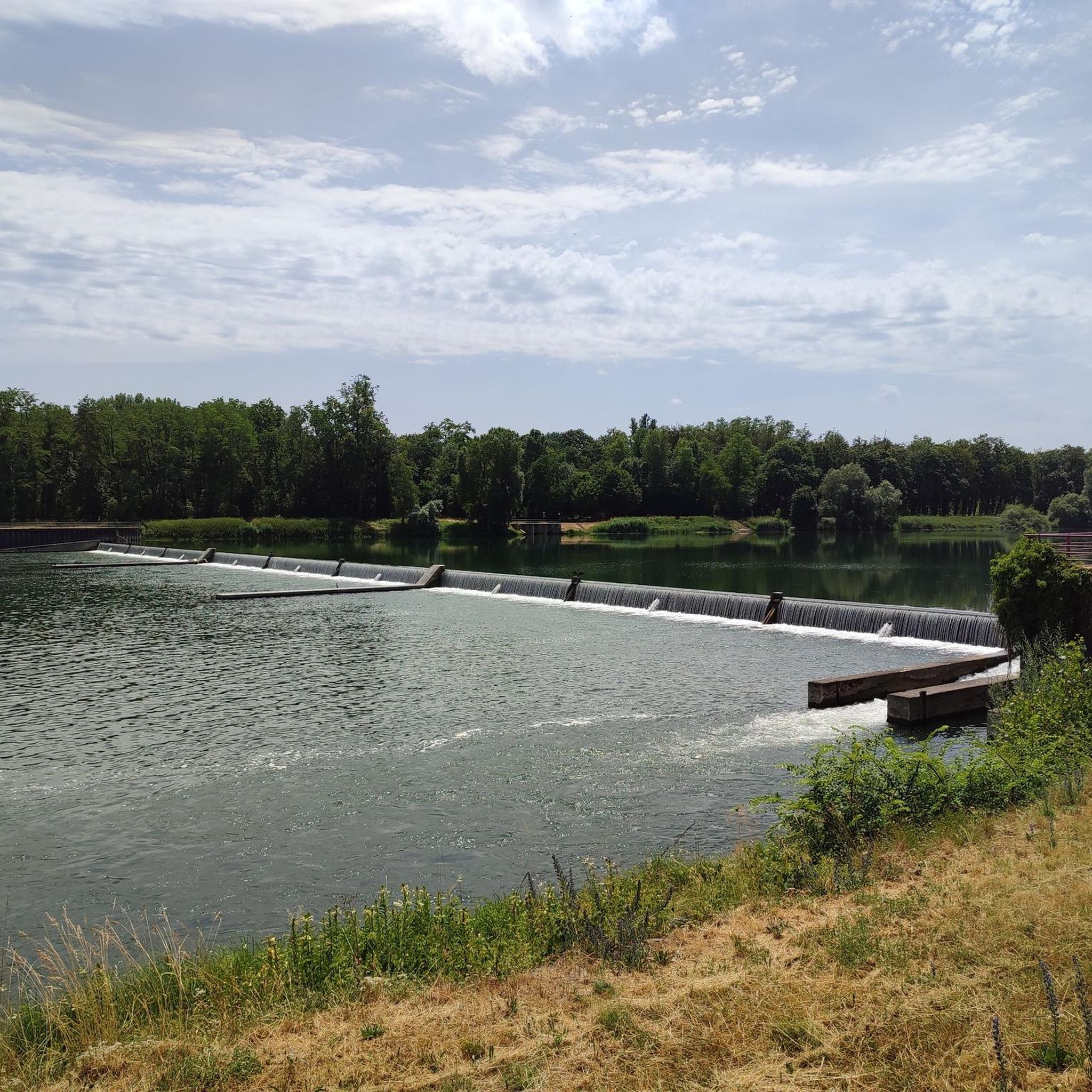
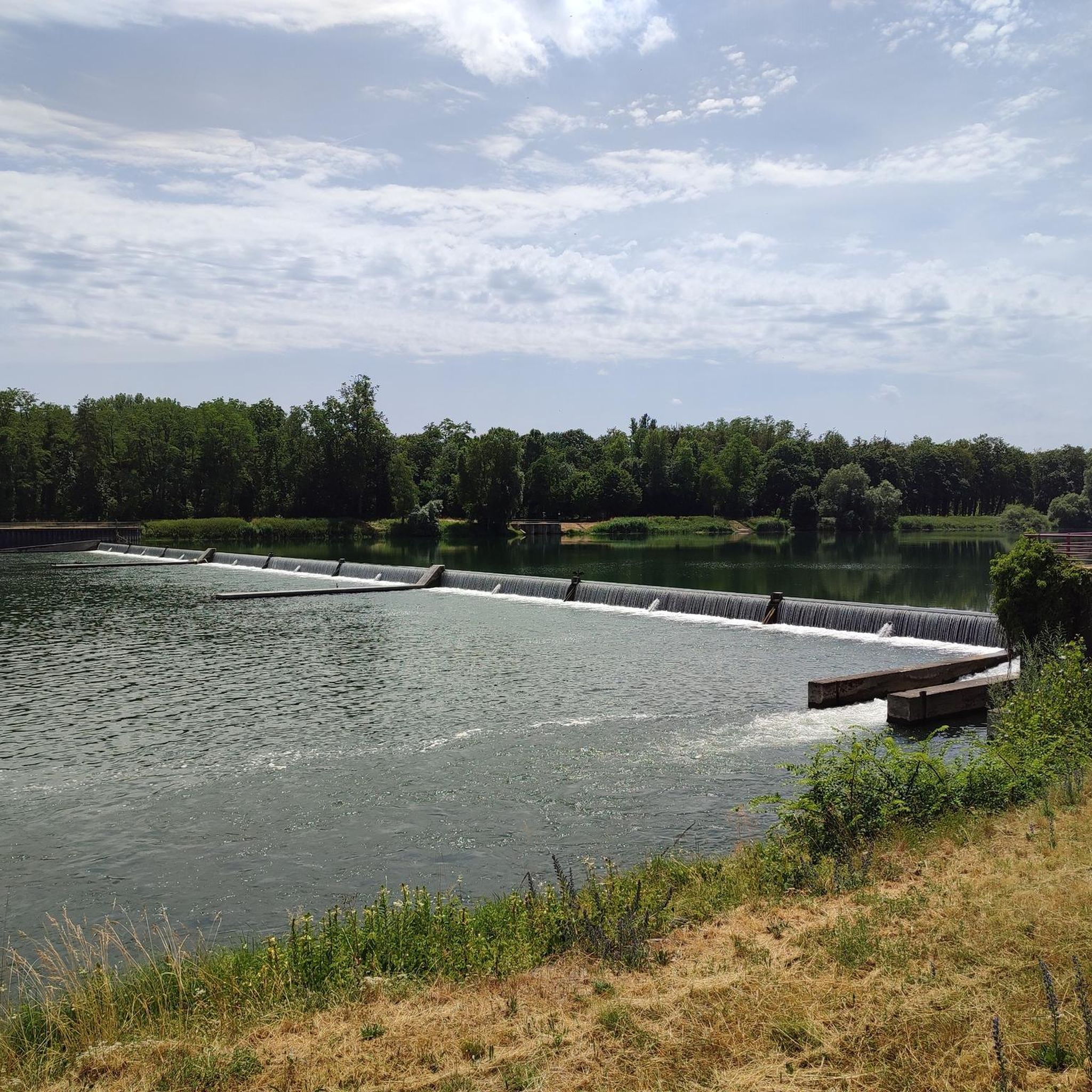
At first glance, the lock renovation works are ending. Today 7/04/26 no traffic problems.
0
0

From the bridge over the Ill River in Illhaeusern, you have an idyllic view of the gently flowing Ill and are well worth a short stop. The village of Illhaeusern has just over 700 inhabitants and lies in the Upper Rhine Plain in the Grand Ried region, between Colmar to the south and Sélestat (Schlettstadt) to the north, at the confluence of the Fecht and Ill rivers. The Ill is 217 km long, its source is in the Jura Mountains, and it flows into the North Sea.
0
0
These resting benches are mainly found in the Alsace region, in the Bas-Rhin department. They date back to the 19th century and are made of sandstone. On market days, farmers would carry their goods in baskets or panniers to the markets in the surrounding towns. To rest for a short while, they would sit on benches and place their goods down. The upper crossbar was particularly practical for the women farmers, as they often carried their baskets on their heads. Trees planted around the benches provided shade. There are two types of resting benches, "Bancs-reposoirs": - those erected in 1811/12, named after the "Roi de Rome" (King of Rome), to commemorate the birth of Napoléon-François-Joseph-Charles Bonaparte, son of Napoleon Bonaparte - those erected in 1854, named after the Empress "Impératrice Eugénie" to commemorate her first wedding anniversary, married to Napoleon III. More than 400 of these benches, made from the sandstone of the Vosges, were erected, and a few dozen still remain. Source: - https://fr.wikipedia.org/wiki/Banc-reposoir_d%27Alsace Location: - https://fr.wikipedia.org/wiki/Banc-reposoir_d%27Alsace#/maplink/122 - 48° 15′ 23″ N, 7° 31′ 40″ E - D605, 1 km south of Muttersholtz
0
0
This bicycle service station is located on the D468 coming from Mackenheim at the entrance to Artolsheim.
0
0

For a little snack between meals
0
0

Very pretty town with beautiful houses.
0
0

Absolutely stunning and charming historical village! The buildings are not only beautiful, but also so well preserved. There's also so many wonderful restaurants, bakeries, and cafes to enjoy - it's an absolutely fantastic place to stop for a break.
0
0

Long, after a while very boring
0
0
Frequently Asked Questions
What kind of terrain can I expect for road cycling around Marckolsheim?
Road cycling around Marckolsheim primarily features flat to gently rolling terrain, especially within the Grand Ried area, which is characterized by wet meadows, groves, and forests. You'll also find routes along the Rhine River and canals. While the distant Vosges mountains are visible, most local routes avoid significant climbs, offering a relaxed cycling experience. However, some routes, like the Château du Haut-Koenigsbourg – Ascent to Haut-Koenigsbourg loop from Marckolsheim, do include moderate ascents towards higher elevations.
Are there road cycling routes suitable for beginners in Marckolsheim?
Yes, Marckolsheim offers several easy road cycling routes perfect for beginners. These often follow quiet paved sections along canals or through the Grand Ried. An excellent option is the Channel – Historic Centre of Sélestat loop from Marckolsheim, which is an easy 24.6-mile (39.6 km) path with minimal elevation gain, leading through the historic center of Sélestat.
Are there challenging road cycling routes for experienced cyclists?
While much of the immediate Marckolsheim area is relatively flat, experienced cyclists can find routes with more significant elevation gain. For instance, the Riquewihr Old Town – Fréland Pass loop from Marckolsheim is a moderate 47.2-mile (75.9 km) route that includes a substantial climb towards Fréland Pass, offering a more demanding ride and scenic views.
What interesting sights or landmarks can I see while road cycling near Marckolsheim?
The region offers a mix of natural beauty and historical sites. You can cycle along the Rhine River, part of the EuroVelo 15, and pass the Marckolsheim Lock, which offers views of the Rhine and canal. Routes may also lead to historic towns like Sélestat, or offer distant views of the Vosges mountains. For specific historical landmarks, you might encounter structures like Sponeck Castle or the Schwendi Castle Ruins (Burkheim), depending on your chosen route.
Are there any scenic viewpoints along the road cycling routes?
Yes, the area provides several scenic spots. The dam of High Water and the Rhône-Rhine canal near Marckolsheim offer unique views of the Ried and the distant Vosges mountains. Additionally, some routes might pass by viewpoints such as the Mondhalde Pavilion and Viewpoint, providing panoramic vistas of the surrounding landscape.
Is parking available near the road cycling routes in Marckolsheim?
Marckolsheim is well-equipped for visitors, and parking is generally available within the town and at various starting points for cycling routes. Many routes are designed as loops starting from Marckolsheim, making it convenient to park your vehicle and begin your ride.
What is the best time of year for road cycling in Marckolsheim?
The best time for road cycling in Marckolsheim is typically from spring through autumn (April to October). During these months, the weather is generally mild and pleasant, making for comfortable riding conditions. The Grand Ried and Rhenish Forest are particularly beautiful in spring with blooming flora and in autumn with changing leaf colors.
Can I go road cycling in Marckolsheim during winter?
While possible, winter road cycling in Marckolsheim can be challenging due to colder temperatures, potential for ice or snow, and shorter daylight hours. It's advisable to check local weather forecasts and road conditions if planning a winter ride. Many cyclists prefer the warmer months for a more enjoyable experience.
Are there family-friendly road cycling routes in Marckolsheim?
Absolutely. The predominantly flat terrain and extensive network of paved cycle paths make Marckolsheim an excellent destination for family cycling. Routes along the canals and through the Grand Ried are often quiet and safe, perfect for families with children. The easy routes, such as the Quiet Paved Path – Channel loop from Marckolsheim, are ideal for a relaxed family outing.
Are there places to stop for refreshments or food along the road cycling routes?
Yes, many routes pass through or near charming towns and villages where you can find cafes, bakeries, and restaurants. The Channel – Historic Centre of Sélestat loop from Marckolsheim, for example, takes you directly into Sélestat, offering numerous options for a break. The region is known for its hospitality, and you'll often find welcoming establishments catering to cyclists.
What do other road cyclists enjoy the most about road cycling in Marckolsheim?
The road cycling routes around Marckolsheim are highly rated by the komoot community, with an average score of 4.4 stars from over 40 reviews. Cyclists often praise the peaceful, scenic rides through the Grand Ried's natural landscapes, the well-maintained paved paths, and the ease of access to the EuroVelo 15 Rhine Cycle Route. The variety of routes, from easy canal-side spins to more challenging loops with distant mountain views, is also frequently highlighted.
Are there any loop road cycling routes available from Marckolsheim?
Yes, many of the road cycling routes around Marckolsheim are designed as convenient loops, allowing you to start and finish in the same location. Examples include the Fortified town of Bergheim – Rest Area on the Ill River loop from Marckolsheim, which offers a moderate 36.5-mile (58.7 km) ride, and the Château du Haut-Koenigsbourg – Ascent to Haut-Koenigsbourg loop from Marckolsheim.
Most popular routes around Marckolsheim
Most popular attractions around Marckolsheim

Get inspired with the komoot mobile app


Explore more
Browse the best Road cycling routes in other regions.
