The best walks and hikes around Griesheim
4.5
(1158)
7,856
hikers
339
hikes
Hiking around Griesheim offers diverse terrain for outdoor enthusiasts, situated on the edge of the Odenwald and within the Hessian Ried. The region is characterized by mostly flat urban areas and intensive agricultural use, complemented by significant natural reserves like Kühkopf-Knoblochsaue. Hikers can explore gentle hills, dense forests, and idyllic river valleys, providing a variety of experiences. This varied topography ensures a wide array of hiking experiences for different preferences.
Best hiking trails in Griesheim
- The most popular hiking route…
Last updated: July 2, 2026
5.0
(7)
35
hikers
9.71km
02:34
90m
90m
Moderate hike. Good fitness required. Easily-accessible paths. Suitable for all skill levels.
19
hikers
6.45km
01:42
60m
60m
Easy hike. Great for any fitness level. Easily-accessible paths. Suitable for all skill levels.

Sign up for free
5.0
(1)
21
hikers
6.43km
01:44
80m
80m
Easy hike. Great for any fitness level. Easily-accessible paths. Suitable for all skill levels.
10
hikers
11.6km
03:02
80m
80m
Moderate hike. Good fitness required. Easily-accessible paths. Suitable for all skill levels.
4.0
(3)
53
hikers
4.76km
01:17
60m
60m
Easy hike. Great for any fitness level. Easily-accessible paths. Suitable for all skill levels.
Get access to more routes and recommendations from other explorers.
Sign up for free
Already have an account?
Our route recommendations are based on thousands of hikes, rides, and runs completed by other people on komoot.
Start today with a free account
Your next adventure awaits.
Login or Signup

Tips from the Community

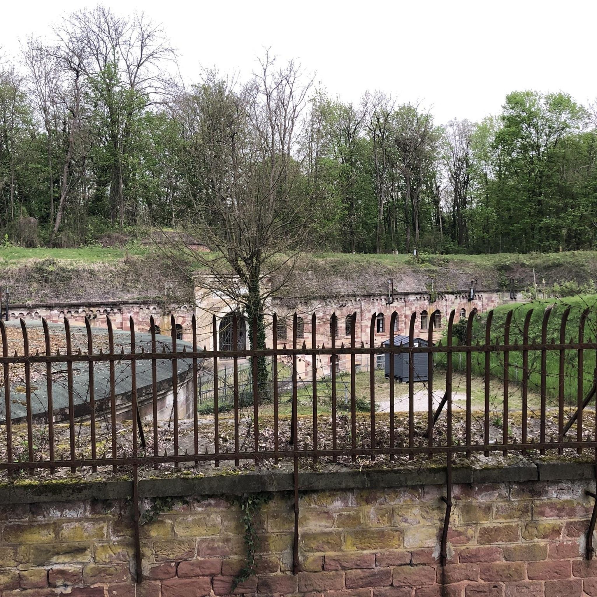
Fort currently being renovated, integrated into the Maginot Line, belonging to the fortified belt of Strasbourg
0
0

There are benches for a picnic
1
0

The site probably belongs to the University of Strasbourg and the site is under video surveillance.
4
0
One of several fortifications that line up here on the ridge. Unlike some others, this seems accessible here.
5
0
Former fort of Strasbourg city fortification. Although renamed into French, a white lettering still testifies to the German builders.
5
0

Built in the late 19th century as part of the fortification belt of Strasbourg. After 1945 renamed to a French resistance fighter. Limited opening hours, in summer, for example, every Sunday
6
0
Frequently Asked Questions
What types of landscapes can I expect to see while hiking around Griesheim?
Griesheim offers a diverse range of landscapes, from gentle hills and dense forests to idyllic river valleys. Situated on the edge of the Odenwald and within the Hessian Ried, you'll encounter a mix of agricultural areas and significant natural reserves, providing varied scenery for your hikes.
Are there any easy hiking trails suitable for beginners in Griesheim?
Yes, Griesheim has plenty of options for beginners. Out of nearly 300 routes, over 180 are classified as easy. An example is the Hiking loop from Mundolsheim, which is about 4 kilometers long and takes just over an hour to complete, offering a pleasant walk through local landscapes.
What is the best time of year to go hiking in Griesheim?
The best seasons for hiking in Griesheim are generally spring and autumn. During these times, temperatures are mild, and nature displays its most vibrant colors, making for a particularly scenic and comfortable hiking experience.
Are there any circular hiking routes available in Griesheim?
Yes, Griesheim features several circular routes. For instance, you could try the moderate Oberhausbergen hill – Fort Ducros loop from Mittelhausbergen, which covers about 9.8 kilometers. Another option is the easy Oberhausbergen hill – Fort Frère loop from Niederhausbergen, a 6.4-kilometer trail.
What natural features or attractions can I discover along the hiking trails?
The region around Griesheim is rich in natural attractions. You can find the Kalbsgiessen Waterfall, explore the Confluence of the Kinzig and Rhine, or visit the London Plane Tree. There are also beautiful lakes like Bel étang and the Beaver Habitat in the Réserve Naturelle Nationale du Massif Forestier de la Robertsau et de La Wantzenau.
Are there family-friendly hiking options in Griesheim?
Absolutely. The Gersprenztal Nature Trail is particularly suitable for families, offering an educational walk along the picturesque Gersprenz River. It features interactive elements, small waterfalls, and dense forests, making it an engaging experience for all ages.
Can I bring my dog on the hiking trails in Griesheim?
While specific dog-friendly regulations vary by nature reserve, many trails in the Griesheim area are suitable for dogs, especially those outside strict protected zones. Always keep your dog on a leash and be mindful of local wildlife and agricultural areas. The diverse landscapes, including forests and river valleys, offer pleasant walks for you and your canine companion.
What do other hikers say about the trails in Griesheim?
The hiking routes in Griesheim are highly rated by the komoot community, with an average score of 4.5 stars from over 900 reviews. Hikers often praise the varied terrain, the mix of agricultural landscapes and natural reserves, and the well-maintained paths that cater to different ability levels.
How can I reach the hiking trails around Griesheim using public transport?
Griesheim is connected to the wider region, and public transport options are available. While specific routes vary, the town's location near the Rhine-Main region means it's generally accessible. For detailed information on reaching specific trailheads, it's best to consult local public transport schedules for bus or train connections to Griesheim and surrounding areas.
Are there any historical sites or landmarks to see while hiking?
Yes, the region offers historical insights. The Kranichstein Nature Reserve, a popular starting point for hikes, features paths that extend along the Kuhkopfgraben, an 18th-century historic hydraulic structure. Trails there can lead to Heiligenberg Castle, which provides fascinating historical context and panoramic views.
How many hiking routes are available in total around Griesheim?
There are nearly 300 hiking routes available around Griesheim, offering a wide variety of choices for all skill levels, from easy strolls to more challenging treks.
Are there any trails that feature water bodies like lakes or rivers?
Yes, the region is characterized by idyllic river valleys and natural reserves with water features. The Gersprenztal Nature Trail follows the picturesque Gersprenz River, and the Kühkopf-Knoblochsaue Nature Reserve is a significant European bird reserve on the Rhine. You can also find highlights like the Bel étang lake.
Most popular routes around Griesheim
Most popular attractions around Griesheim

Get inspired with the komoot mobile app


Explore more
Browse the best Hikes in other regions.
